NEPAL
Everest Region Trekking
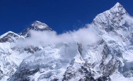
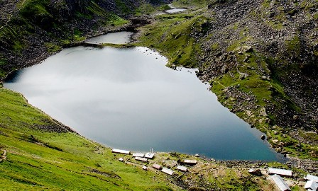
Everest Region Trekking Everest (8848m), the SAGARMATHA or CHOMOLUNGMA is magic in itself. The region is popular for trekking, expedition and peak climbing. The trekking route to the Everest Region penetrates through the highest wildlife reserve in the world, the Sagarmatha National Park (2845m – 8848m, World Heritage Site for its natural, cultural and geological characteristics). It is a nostalgic experience to trek in this region. Most of the trail follows the bank of the Dudh Kosi, traverses through the forests of rhododendron and pine, rivers, and Buddhist Monasteries to the foothills of the mightiest of the mountains in the world. Trekkers get a close view of the world's greatest mountains, Everest, Lhotse, Nuptse, Ama Dablam, Thamserku, Tawache and many other unnamed mountains and peaks. The region is dominated by the people of Sherpa community. The people of this exotic region are hard-working and laborious. They are enjoying their daily life in the high Himalayas playing with the seasons of feasts and festivals, marked by dancing and general merry-making. The festivals are spread out through the full moon days of May, June, July, August and November in different sections of the Himalayas. Cattle raring and tourism are the major occupations of the region.
RNK 01 EVEREST PANORAMA TREKKING (09 Nights / 10 Days)Best Season: Spring (September to December) Autumn (March to May).
Trekking Grade: Moderate Treks
RNK 02 AMADABLAM BASE CAMP TREK (11 nights / 12 Days)Best Season: Spring (September to December) Autumn (March to May).
Trekking Grade: Moderate Treks (M)
RNK 03 GOKYO VALLEY AND GOKYO RI TREK (13 Nights / 14 Days)Best Season: Spring (September to December) Autumn (March to May).
Trekking Grade: Moderate Treks (M)
RNK 04 EVEREST BASE CAMP & KALA PATHAR TREKKING (14 Nights / 15 Days)Best Season: Spring (September to December) autumn (March to May).
Trekking Grade: Moderate + fairly Strenuous
RNK 05 GOKYO RENJO LA PASS (15 Nights / 16 Days)Best Season: Spring (September to December) autumn (March to May).
Trekking Grade: Medium and fairly strenous
RNK 06 GOKYO CHO LA PASS TREKKING (18 Nights / 19 Days)Best Season: Spring (September to December) Autumn (March to May).
Trekking Grade: Strenuous treks
RNK 07 EVEREST HIGH PASS TREKKING (20 Nights / 21 Days)Best Season: Spring (September to December) autumn (March to May).
Trekking Grade: Strenuous
RNK 08 EVEREST TRANSVERSE TREK (THREE PASSES) (20 Nights / 21 Days)Best Season: March - June / September-November
Trekking Grade: Moderate
RNK 09 ARUN VALLEY (21 Nights / 22 Days)Best Season: Spring (September to December) autumn (March to May).
Trekking Grade: Moderate and farily streunous
RNK 01 EVEREST PANORAMA TREKKING (09 Nights / 10 Days)
 Everest Panorama Trekking is designed specially for those who have a short time to spend and special desire to see a world highest mountain. This trek is suitable for beginners who don’t want to climb more up and afraid of mountain sickness. The main objective of this trek is to see Mt. Everest 8848m and village of world famous mountaineers. This trek brings you the very great view of four 8000m peaks (Mt. Everest-8848m, Cho Oyu-8153m, Lhotse-8516m and Makalu-8463m). And you can have a great view of Nepal most beautiful mountain, Ama Dablam (6856m).
Best Season: Spring (September to December) Autumn (March to May).
Trekking Grade: Moderate Treks
Max Elevation: 3860 m
Total trekking days: 6 Days
Day 01: Arrive Kathmandu
Upon arrival in Kathmandu, meet & greet in the airport; transfer to Hotel. Overnight at Hotel in Kathmandu.
Day 02: Your full-day sightseeing includes visits to Bhaktapur Durbar Square, home of medieval art & architecture; Continue your tour to Kathmandu Durbar Square (Hanuman Dhoka), the old palace of the Royal Dynasty and hometown of living Goddess, Kumari. Final stop is at the Swayambhunath Stupa, the holiest shrine for the Buddhist and Hindus. Overnight at hotel in Kathmandu
Day 03: Fly from Kathmandu to Lukla (2,800m) -30 minutes, trek to Phakding (2,640m) -3 to 4 hours Take the morning flight to the dramatic airfield at Lukla (2,860m) with your trek guide.The views from the plane are amazing, providing dramatic views of terraced hills and the distant Himalayan giants. After landing in the village of Lukla (2840m) you will meet the rest of your staff/porters. The trail drops steeply for bit then descends to Chheplung (2660m) and Thado Khosi gaon where there is suspension bridge to cross to see the head of the valley Mt. Kusum Kanguru (6367m). After bridge climbs a bit to reach at Ghat (2590m) on banks of the Dudh Koshi River. Take a short visit to monastery then little easy walk before climbing again to reach at Phakding (2610m) The lodges on the first half of the trek are good and menus include all sorts of wholesome favorites: pasta, noodle and rice dishes with remarkably fresh vegetables, puddings and few varieties of hot drinks. The lodges have the same pattern all the way up, but understandably they become a bit more simple right at the top of the trek - though still remarkably good for the location. Overnight at.local lodge.
Day 04: Phakding trek to Namche Bazaar (3440m) 6hrs walk
The trail keeps close to the river valley and is lined with beautiful blue pine and rhododendron forest that is very spectacular in the spring months, when the flowers are in bloom with the beautiful waterfall. We will see the snow-capped peak of Thamserku (6623m) & Khumbi La (5765m) at Benkar. We cross the Dudh Kosi River at Benkar(2710m). From here it is a short walk to Monjo (2840m). Just beyond the Monjo trek enters the Sagarnatha (Everest) national park where your permits are checked. The trail thereafter is steep rocky descending to large farm aftermath cross bridge at Dudh Kosi and follow the west banks. Just short distance up the river is Jorsale (2830m). The trail follows the river for a while, then re-crosses the Dudh Koshi along the river bank and after short ups and downs, makes a steep climb near the confluence of the two rivers (Bhote Koshi & Dush Koshi). Crossing the bridge at Dudh Koshi, the trail follows steeply ascent towards the Namche Bazaar(3440m). One can see the beautiful mountains like the Mt. Everest (8848m), Lhotse (8516m) and Nuptse (7879m) before arriving Namche Bazaar which is a gate way to khumbu region. Namche is the main trading village and holds a busy Saturday market. It is a meeting place for the Hindu traders from the lowlands and the Tibetan yak caravans that have reached there by crossing the glaciated Nangpa La pass. Overnight at local lodge.
Day 05: Acclimatization day at Namche Bazaar (3440m)
Acclimatization is most important before heading higher. Today you may have excursion either to Thame village or viewpoint. If you prefer to Thame it takes approximately 7/8 hours walking both way go and return to Namche which is popular for visiting Thame monastery. Or simply just go to Viewpoint in the stand point for splendid view of the Himalayas including Mt. Everest (8848), Lhotse (8516m), Lhotse shar (8382m), Nuptse (7879m), Ama dablam (6856m), Thamserku (6623m), Kangtega (6783m), Kusum kangaru (6367), Cholaste (6335m), Tabuche peak (6495m), Khumbi La (5765m) and Kwangde Ri (6011m) etc. Overnight at local lodge.
Day 06: Namche Bazaar trek to Tengboche (3867m) 5 hrs walk
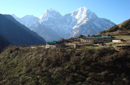
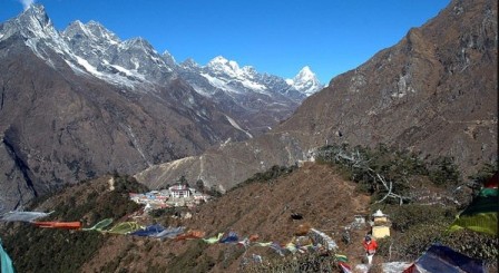
Today the trail is slightly up for a while up to the Chor camp at Namche Bazzar then continue easy level walk to Kyangjuma, 3550m. Along the way from chor camp at Namche bazaar to Kyangjuma you may enjoy incredible view of Mt. Everest (8848), Lhotse (8516m), Nuptse (7879m), Ama dablam (6856m), Thamserku (6623m) and many more beautiful mountains. From Kyangjuma the trail is bit easy walking through Rhododendron forest to Sansara. Here you can find two way; left hand side leads to the Gokyo valley trek and right hand side leads to the direct Everest base camp trek. From Sanasa the trail descends gradually through pine forest to Lausasa where there are a few teahouses. Then the trail drops steeply through the pine and Rhododendron forest to Phungi thanga, a small settlement on the river banks of the Dudh kosi 3250m. The trail climbs steeply at beginning then a gradual ascent through blue pine and Rhododendron forest at the hill top of Tengboche Monastery, 3867m. The splendid views of sunset, sunrise as well as magnificent view of the Mt. Everest including other Himalayas are your reward at Tengboche. Tengboche monastery is one of the beautiful monasteries in solu khumbu area as well as the religious center of the whole Sherpa land. Overnight at local lodge.
(Or we can shorten this trip by one night and Trek straight to Monjo: (2835m) 5 hours.
Overnight at local lodge.in Monjo.)
Day 07: Tengboche trek to Monjo (2835m) 07 hrs walk
Today we trek back along the Dudh Kosi River through a magnificent rhododendron forest with amazing waterfalls. Shortly before reaching Namche, the trek takes us through a pine forest, where musk deer often graze in the early morning. After arriving in town, Namche, the trail descend through the pine forests to Larja dobhan, confluence of two rivers where you can see Mt. Everest and Lhotse for the last time. After crossing the bridge at Larja Dobhan the trail descends for while and then walk along the Dudh Koshi River. Crossing Dudh Koshi continue level walk to Jorsale. Beyond the Jorsale the trail leads a bit ascend after that re-crosses the suspension bridge then short steep climb to Monjo (2835m) Overnight at local lodge.
Day 08: Monjo trek to Lukla (2840m) 5 hrs walk
From Monjo the trail descends for a while; crossing Dudh kosi over the suspension bridge brings short easy level till Benkar. Then the trail follows a bit up and down and level walk along the Dush kosi valley and re-crossing the suspension bridge again one arrives at Phakding (2610m). Beyond Phakding the trail follows a short descends and a level walk for a while then short steep climb up passes several Buddhist setups at Ghat village. After short steep climb up to Thado kosi; and a bit descends re-cross the small bridge then steep climb up for a short distance. Finally you re-crosses last long suspension bridge of your trek. The trail after the long suspension bridge follows the up wards route as far as Chablung, then turns off towards Lukla. The broad trail at Chablung leading uphill to the left hand side climbs steadily past a few local inn and houses. From there the trail follows through scrub forest above the school and houses of Chaurikharka village then final climb up of your trek about half and hour to reach to Lukla Overnight at local lodge
Day 09: Lukla flight to Kathmandu (1350m)
Flights to Kathmandu are generally early in the morning, so after an early breakfast, we make our way over to the Lukla airport and fly back to Kathmandu. After arrival in Kathmandu airport we drive you to hotel. Overnight at hotel in Kathmandu.
Day 10: Depart from Kathmandu
After breakfast, transfer to the Kathmandu airport (prior to three hours of your departure time) to board flight for your onward destination.
Have a wonderful flight back home with the treasures of your nostalgic memories.
RNK 02 AMADABLAM BASE CAMP TREK (11 nights / 12 Days)
 Ama Dablam mountain is situated in Mount Everest area in Khumbu region. Ama Dablam is a beautiful mountain and still call a technical mountain. Ama Dablam means "Mother and Pearl Necklace" and is an amazingly beautiful mountain that many consider the most stunning in the region. For several days, Ama Dablam will dominate the sky for anyone trekking to the Mount Everest region. The base camp below South West Face ranks among one of the most beautiful base camps in the Himalayas.
From Ama dablam base camp, one can have the spectacular view of Nuptse (7879m), Lhotse (8416m) Lhotse Shar(8400m), Ama Dablam (6812m), Island peak (6189m) Pumori (7165m), Thamserku (6618), Kongde Peak (4618m), Lobuche peak (6135), Tawochepeak (6542m) and Mt. Everest (8848m).
Best Season: Spring (September to December) Autumn (March to May).
Trekking Grade: Moderate Treks (M)
Max Elevation: 4600m
Total trekking days: 08 Days
Day 01: Arrive Kathmandu
Upon arrival in Kathmandu airport, please come right to the main arrival gate where our representative will be waiting with the company board or your name card.
Transfer to the hotel. Overnight at hotel in Kathmandu.
Day 02: Your full-day sightseeing includes visits to Bhaktapur Durbar Square, home of medieval art & architecture; Continue your tour to Kathmandu Durbar Square (Hanuman Dhoka), the old palace of the Royal Dynasty and hometown of living Goddess, Kumari. Final stop is at the Swayambhunath Stupa, the holiest shrine for the Buddhist and Hindus. Overnight at hotel in Kathmandu
Day 03: Fly from Kathmandu to Lukla (2,800m) -30 minutes, trek to Phakding (2,640m) -3 to 4 hours Take the morning flight to the dramatic airfield at Lukla (2,860m) with your trek guide.The views from the plane are amazing, providing dramatic views of terraced hills and the distant Himalayan giants. After landing in the village of Lukla (2840m) you will meet the rest of your staff/porters. The trail drops steeply for bit then descends to Chheplung (2660m) and Thado Khosi gaon where there is suspension bridge to cross to see the head of the valley Mt. Kusum Kanguru (6367m). After bridge climbs a bit to reach at Ghat (2590m) on banks of the Dudh Koshi River. Take a short visit to monastery then little easy walk before climbing again to reach at Phakding (2610m) The lodges on the first half of the trek are good and menus include all sorts of wholesome favorites: pasta, noodle and rice dishes with remarkably fresh vegetables, puddings and few varieties of hot drinks. The lodges have the same pattern all the way up, but understandably they become a bit more simple right at the top of the trek - though still remarkably good for the location. Overnight at.local lodge.
Day 04: Phakding trek to Namche Bazaar (3440m) 6hrs walk The trail keeps close to the river valley and is lined with beautiful blue pine and rhododendron forest that is very spectacular in the spring months, when the flowers are in bloom with the beautiful waterfall. We will see the snow-capped peak of Thamserku (6623m) & Khumbi La (5765m) at Benkar. We cross the Dudh Kosi River at Benkar(2710m). From here it is a short walk to Monjo (2840m). Just beyond the Monjo trek enters the Sagarnatha (Everest) national park where your permits are checked. The trail thereafter is steep rocky descending to large farm aftermath cross bridge at Dudh Kosi and follow the west banks. Just short distance up the river is Jorsale (2830m). The trail follows the river for a while, then re-crosses the Dudh Koshi along the river bank and after short ups and downs, makes a steep climb near the confluence of the two rivers (Bhote Koshi & Dush Koshi). Crossing the bridge at Dudh Koshi, the trail follows steeply ascent towards the Namche Bazaar(3440m). One can see the beautiful mountains like the Mt. Everest (8848m), Lhotse (8516m) and Nuptse (7879m) before arriving Namche Bazaar which is a gate way to khumbu region. Namche is the main trading village and holds a busy Saturday market. It is a meeting place for the Hindu traders from the lowlands and the Tibetan yak caravans that have reached there by crossing the glaciated Nangpa La pass. Overnight at local lodge.
Day 05: Acclimatization day at Namche Bazaar (3440m) Acclimatization is most important before heading higher. Today you may have excursion either to Thame village or viewpoint. If you prefer to Thame it takes approximately 7/8 hours walking both way go and return to Namche which is popular for visiting Thame monastery. Or simply just go to Viewpoint in the stand point for splendid view of the Himalayas including Mt. Everest (8848), Lhotse (8516m), Lhotse shar (8382m), Nuptse (7879m), Ama dablam (6856m), Thamserku (6623m), Kangtega (6783m), Kusum kangaru (6367), Cholaste (6335m), Tabuche peak (6495m), Khumbi La (5765m) and Kwangde Ri (6011m) etc. Overnight at local lodge.
Day 06: Namche Bazaar trek to Tengboche (3867m) 5 hrs walk Today the trail is slightly up for a while up to the Chor camp at Namche Bazzar then continue easy level walk to Kyangjuma, 3550m. Along the way from chor camp at Namche bazaar to Kyangjuma you may enjoy incredible view of Mt. Everest (8848), Lhotse (8516m), Nuptse (7879m), Ama dablam (6856m), Thamserku (6623m) and many more beautiful mountains. From Kyangjuma the trail is bit easy walking through Rhododendron forest to Sansara. Here you can find two way; left hand side leads to the Gokyo valley trek and right hand side leads to the direct Everest base camp trek. From Sanasa the trail descends gradually through pine forest to Lausasa where there are a few teahouses. Then the trail drops steeply through the pine and Rhododendron forest to Phungi thanga, a small settlement on the river banks of the Dudh kosi 3250m. The trail climbs steeply at beginning then a gradual ascent through blue pine and Rhododendron forest at the hill top of Tengboche Monastery, 3867m. The splendid views of sunset, sunrise as well as magnificent view of the Mt. Everest including other Himalayas are your reward at Tengboche. Tengboche monastery is one of the beautiful monasteries in solu khumbu area as well as the religious center of the whole Sherpa land. Overnight at local lodge.
Day 07: Trek from Tyangboche to Ama Dablam Base camp (4400m Approx 5 hrs walk)
Day 08: Walk uphill for about 2 hours for the fascinating view of many Mountains and trek back to Tengboche (3860M approx 7 hrs walk)
Day 09: Tengboche trek to Monjo (2835m) 07 hrs walk
Today we trek back along the Dudh Kosi River through a magnificent rhododendron forest with amazing waterfalls. Shortly before reaching Namche, the trek takes us through a pine forest, where musk deer often graze in the early morning. After arriving in town, Namche, the trail descend through the pine forests to Larja dobhan, confluence of two rivers where you can see Mt. Everest and Lhotse for the last time. After crossing the bridge at Larja Dobhan the trail descends for while and then walk along the Dudh Koshi River. Crossing Dudh Koshi continue level walk to Jorsale. Beyond the Jorsale the trail leads a bit ascend after that re-crosses the suspension bridge then short steep climb to Monjo (2835m) Overnight at local lodge.
Day 10: Monjo trek to Lukla (2840m) 5 hrs walk
From Monjo the trail descends for a while; crossing Dudh kosi over the suspension bridge brings short easy level till Benkar. Then the trail follows a bit up and down and level walk along the Dush kosi valley and re-crossing the suspension bridge again one arrives at Phakding (2610m). Beyond Phakding the trail follows a short descends and a level walk for a while then short steep climb up passes several Buddhist setups at Ghat village. After short steep climb up to Thado kosi; and a bit descends re-cross the small bridge then steep climb up for a short distance. Finally you re-crosses last long suspension bridge of your trek. The trail after the long suspension bridge follows the up wards route as far as Chablung, then turns off towards Lukla. The broad trail at Chablung leading uphill to the left hand side climbs steadily past a few local inn and houses. From there the trail follows through scrub forest above the school and houses of Chaurikharka village then final climb up of your trek about half and hour to reach to Lukla Overnight at local lodge.
Day 11: Lukla flight to Kathmandu (1350m)
Flights to Kathmandu are generally early in the morning, so after an early breakfast, we make our way over to the Lukla airport and fly back to Kathmandu. After arrival in Kathmandu airport we drive you to hotel. Overnight at hotel in Kathmandu.
Day 12: Depart from Kathmandu.
After breakfast, transfer to the Kathmandu airport (prior to three hours of your departure time) to board flight for your onward destination. Have a wonderful flight back home with the treasures of your nostalgic memories.
RNK 03 GOKYO VALLEY AND GOKYO RI TREK (13 Nights / 14 Days)
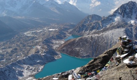 Gokyo Trekking is fewer travelled than the more typical Everest Base Camp Trek, but offers alike views and more seclusion along the trail. Normally we fly from Kathmandu to Lukla where you start walk through pine forests before a steep climb to Namche Bazaar and a more alpine type surroundings. This trek gives you bounty of stunning views of Everest and other close massive. Gokyo lake area is delimited by mountainous valleys, alpine lakes and various glaciers. Great view of ice point between Cho Oyo and Gyachung Kang is most theatrical panorama which you will see from Khumbu. Whole set in combination by our staff and alongside the trek will pass monasteries where monks go early in the morning for worship and pray with culturally god of Buddhist, the views of Everest and other snow high mountains and getting nearer by the day. We will have relaxed days in Namche village. There you will discover the area and adjust with elevation, which is very noteworthy. After trek to Gokyo Ri (5370m.) and same way back from Namche all the way to Lukla.
Gokyo Lake is crossing two others lake whic is close to lodge in Gokyo. Gokyo Ri increase beyond the northern beach of Dudh Pokari, which in the premature morning reflect the golden form of Cho Oyo and from its top afford supreme views of the Himalayan massive, Everest, Lotse and Makalu which are mainly remarkable in the period of sunset. The icon of this area is connected with the towering view of the mainly well-liked Himalaya in Nepal. We use the few days trekking and interact between the Himalayan people also recognized as Local community, we use local tea house lodges in this whole region. Astonishing Gokyo trekking is commendable in senses that proffer a sufficient prospect to discover the astonishing destination and its remarkable view, which is beyond being opinion. Himalaya is more stunning, the Cho Oyu Glacier (Ngozumpa) is the major in the Nepal Mountain and from an edge over Gokyo and 8000 meters of Himalaya peaks (Cho Oyu, Lhotse, Everest, and Makalu) are visible view from Gokyo Ri.
Best Season: Spring (September to December) Autumn (March to May).
Trekking Grade: Moderate Treks (M)
Max Elevation: 5360m
Total trekking days: 14 Days / 10 Days
Day 01: Arrive Kathmandu
Upon arrival in Kathmandu, meet & greet in the airport; transfer to Hotel. Overnight at Hotel in Kathmandu.
Day 02: Your full-day sightseeing includes visits to Bhaktapur Durbar Square, home of medieval art & architecture; Continue your tour to Kathmandu Durbar Square (Hanuman Dhoka), the old palace of the Royal Dynasty and hometown of living Goddess, Kumari. Final stop is at the Swayambhunath Stupa, the holiest shrine for the Buddhist and Hindus. Overnight at hotel in Kathmandu
Day 03: Fly from Kathmandu to Lukla (2,800m) -30 minutes, trek to Phakding (2,640m) -3 to 4 hours Take the morning flight to the dramatic airfield at Lukla (2,860m) with your trek guide.The views from the plane are amazing, providing dramatic views of terraced hills and the distant Himalayan giants. After landing in the village of Lukla (2840m) you will meet the rest of your staff/porters. The trail drops steeply for bit then descends to Chheplung (2660m) and Thado Khosi gaon where there is suspension bridge to cross to see the head of the valley Mt. Kusum Kanguru (6367m). After bridge climbs a bit to reach at Ghat (2590m) on banks of the Dudh Koshi River. Take a short visit to monastery then little easy walk before climbing again to reach at Phakding (2610m) The lodges on the first half of the trek are good and menus include all sorts of wholesome favorites: pasta, noodle and rice dishes with remarkably fresh vegetables, puddings and few varieties of hot drinks. The lodges have the same pattern all the way up, but understandably they become a bit more simple right at the top of the trek - though still remarkably good for the location. Overnight at.local lodge.
Day 04: Phakding trek to Namche Bazaar (3440m) 6hrs walk The trail keeps close to the river valley and is lined with beautiful blue pine and rhododendron forest that is very spectacular in the spring months, when the flowers are in bloom with the beautiful waterfall. We will see the snow-capped peak of Thamserku (6623m) & Khumbi La (5765m) at Benkar. We cross the Dudh Kosi River at Benkar(2710m). From here it is a short walk to Monjo (2840m). Just beyond the Monjo trek enters the Sagarnatha (Everest) national park where your permits are checked. The trail thereafter is steep rocky descending to large farm aftermath cross bridge at Dudh Kosi and follow the west banks. Just short distance up the river is Jorsale (2830m). The trail follows the river for a while, then re-crosses the Dudh Koshi along the river bank and after short ups and downs, makes a steep climb near the confluence of the two rivers (Bhote Koshi & Dush Koshi). Crossing the bridge at Dudh Koshi, the trail follows steeply ascent towards the Namche Bazaar(3440m). One can see the beautiful mountains like the Mt. Everest (8848m), Lhotse (8516m) and Nuptse (7879m) before arriving Namche Bazaar which is a gate way to khumbu region. Namche is the main trading village and holds a busy Saturday market. It is a meeting place for the Hindu traders from the lowlands and the Tibetan yak caravans that have reached there by crossing the glaciated Nangpa La pass. Overnight at local lodge.
Day 05: Acclimatization day at Namche Bazaar (3440m) Acclimatization is most important before heading higher. Today you may have excursion either to Thame village or viewpoint. If you prefer to Thame it takes approximately 7/8 hours walking both way go and return to Namche which is popular for visiting Thame monastery. Or simply just go to Viewpoint in the stand point for splendid view of the Himalayas including Mt. Everest (8848), Lhotse (8516m), Lhotse shar (8382m), Nuptse (7879m), Ama dablam (6856m), Thamserku (6623m), Kangtega (6783m), Kusum kangaru (6367), Cholaste (6335m), Tabuche peak (6495m), Khumbi La (5765m) and Kwangde Ri (6011m) etc. Overnight at local lodge.
Day 06: Namche Bazaar to Dole (4,200m) - 7 to 8 hours Today the trail is slightly up for a while up to the Chor camp at Namche Bazzar then continue easy level walk to Kyangjuma, 3550m. Along the way from chor camp at Namche bazaar to Kyangjuma you may enjoy incredible view of Mt. Everest (8848), Lhotse (8516m), Nuptse (7879m), Ama dablam (6856m), Thamserku (6623m) and many more beautiful mountains. From Kyangjuma the trail is bit easy walking through Rhododendron forest to Sansara. Here you can find two way; left hand side leads to the Gokyo valley trek and right hand side leads to the direct Everest base camp trek. From here the trail is steep climb up for about one and half hour to reach at Mongla danda (3978m) where there are a few teahouse and a chorten to enjoy magnificent view of Mt. Ama dablam including numerous mountains. The trail from Mongla danda descends in steep bends trail to Phortse thanga (3680m). From Phortse thanga you will meet two trails, one higher route left hand side lead to Gokyo valley trek and lower trail right hand side lead to Phortse village. From Phortse Thanga the trail climbs steeply through rhododendron and junipers forests then after level walks before to reach at Dole (4090m). Overnight at local lodge.
Day 07: Dole to Machhermo (4,410m) 4 to 5 hours We climb to the picturesque ridge above the Dole and the trail climbs via Lhabarma at 4220m to Luza at 4360m. Still the trail continues to climb along the side of the valley high above the river, crossing sandy spurs to reach Machharmo at 4410m. Overnight at local lodge.
Day 08: Machhermo to Gokyo (4,790m) 5 to 6 hours
We, first climb up to the ridge where one can see excellent view of both the valley to Khangtega and northern part to the Cho-Oyu (8153m). We descend to the river bank before beginning the climb up to the terminal moraine of the Ngazumpa glacier and start to climb until first lake. The trail follows the valley through enjoy the second lake view and after an hour walk will reaches at Gokyo at 4,750m, on the edge of third lake. Today’s course mostly gently ascent and kind of flat trail to Gokyo about 5 to 6 hrs. Overnight at local lodge.
Day 09: Day Hike to Gokyo Ri (5,360m) 2 to 3 hours
Early in the morning we have a steep climb up to the Gokyo Ri (5,360m). There are stunning views of the Gokyo valley, the massive Ngozumpa Glacier, one of the biggest glaciers in the world along with incredible panoramic view of the whole Khumbu mountains range, such giants as Mt. Cho Oyu (8201m) Mt. Everest (8848), Lhotse (8516m), Nuptse (7879m), Makalu (8481m), Cholaste (6335m), Tabuche peak (6495m) and Gychung Kang (7922m). This will be nostalgic memories for rest of the life. You can see the Cho-yu base camp and stroll back an hour to Gokyo; local lodge for a day rest. Overnight at local lodge.
Day 10: Gokyo to Dole (4,200m) 5 to 6 hours
After explore Gokyo Valley and Gokyo lakes, most of the trail goes down gently to Dole. People who like to take alternative route to Phorche Village; it turns east and climbs across the terminal moraine of the Ngozumpa Glacier to Na (4,400m) nearby Phanga. On the way, you have still chance to see a numbers of mountains scenery. Overnight at local lodge.Dole.
Day 11: Dole to Namche Bazar (3,430m) 4 to 6 hours
After breakfast again all the same way trek down to Phorche Thanga through rhododendron and pine forest. The trail led you up to Mongla hill and gradual descent to the Sanasa the main trail for the Everest Base Camp and follow way to Namche Bazaar for overnight.
Day 12: Namche Bazaar to Lukla (2,800m) 6 to 7 hours
After a long walk we'll trek back to Lukla today. We descend the long way before crossing the bridge and further walk to Monju and then to Phakding enjoying the lush green scenery around and passing through the incredible mountain scenery and local Sherpa village. We will have the lunch on the way. Overnight at local lodge.
Day 13: Lukla flight to Kathmandu (1350m)
Flights to Kathmandu are generally early in the morning, so after an early breakfast, we make our way over to the Lukla airport and fly back to Kathmandu. After arrival in Kathmandu airport we drive you to hotel. Overnight at hotel in Kathmandu.
Day 14: Depart from Kathmandu.
After breakfast, transfer to the Kathmandu airport (prior to three hours of your departure time) to board flight for your onward destination.
Have a wonderful flight back home with the treasures of your nostalgic memories.
RNK 04 EVEREST BASE CAMP & KALA PATHAR TREKKING (14 Nights / 15 Days)
 Trekking to base camp of the world’s tallest peak, the Mt. Everest (8,848m) is a thrilling experience in itself. Starting from Kathmandu with a short flight to Lukla, the aerial views of some of the highest mountains Langtang, Jugal Himal, Gaurishankar, Melungtse are spectacular before the flight enters the Khumbu region. The trekking course follows through the Khumbu region from Namche Bazaar and it passes through forest of rhododendron, pine juniper and many monasteries and Chortens and mani walls, prayer walls of stone. The Thyangboche monastery, where Mani Rimdu festival is held every October or November is the great cultural and religious center for the people of Solu Khumbu.
This is a classic trekking which follows in the footsteps of Hillary and Tenzing and ends with an ascent of Kalapattar for magnificient views of Everest.
Best Season: Spring (September to December) autumn (March to May).
Trekking Grade: Moderate + fairly Strenuous
Max Elevation: 5545m
Total trekking days: 15 Days / 11 Days
Day 01: Arrive Kathmandu
Upon arrival in Kathmandu, meet & greet in the airport; transfer to Hotel. Overnight at Hotel in Kathmandu.
Day 02: Your full-day sightseeing includes visits to Bhaktapur Durbar Square, home of medieval art & architecture; Continue your tour to Kathmandu Durbar Square (Hanuman Dhoka), the old palace of the Royal Dynasty and hometown of living Goddess, Kumari. Final stop is at the Swayambhunath Stupa, the holiest shrine for the Buddhist and Hindus. Overnight at hotel in Kathmandu
Day 03: Fly from Kathmandu to Lukla (2,800m) -30 minutes, trek to Phakding (2,640m) -3 to 4 hours Take the morning flight to the dramatic airfield at Lukla (2,860m) with your trek guide.The views from the plane are amazing, providing dramatic views of terraced hills and the distant Himalayan giants. After landing in the village of Lukla (2840m) you will meet the rest of your staff/porters. The trail drops steeply for bit then descends to Chheplung (2660m) and Thado Khosi gaon where there is suspension bridge to cross to see the head of the valley Mt. Kusum Kanguru (6367m). After bridge climbs a bit to reach at Ghat (2590m) on banks of the Dudh Koshi River. Take a short visit to monastery then little easy walk before climbing again to reach at Phakding (2610m) The lodges on the first half of the trek are good and menus include all sorts of wholesome favorites: pasta, noodle and rice dishes with remarkably fresh vegetables, puddings and few varieties of hot drinks. The lodges have the same pattern all the way up, but understandably they become a bit more simple right at the top of the trek - though still remarkably good for the location. Overnight at.local lodge.
Day 04: Phakding trek to Namche Bazaar (3440m) 6hrs walk The trail keeps close to the river valley and is lined with beautiful blue pine and rhododendron forest that is very spectacular in the spring months, when the flowers are in bloom with the beautiful waterfall. We will see the snow-capped peak of Thamserku (6623m) & Khumbi La (5765m) at Benkar. We cross the Dudh Kosi River at Benkar(2710m). From here it is a short walk to Monjo (2840m). Just beyond the Monjo trek enters the Sagarnatha (Everest) national park where your permits are checked. The trail thereafter is steep rocky descending to large farm aftermath cross bridge at Dudh Kosi and follow the west banks. Just short distance up the river is Jorsale (2830m). The trail follows the river for a while, then re-crosses the Dudh Koshi along the river bank and after short ups and downs, makes a steep climb near the confluence of the two rivers (Bhote Koshi & Dush Koshi). Crossing the bridge at Dudh Koshi, the trail follows steeply ascent towards the Namche Bazaar(3440m). One can see the beautiful mountains like the Mt. Everest (8848m), Lhotse (8516m) and Nuptse (7879m) before arriving Namche Bazaar which is a gate way to khumbu region. Namche is the main trading village and holds a busy Saturday market. It is a meeting place for the Hindu traders from the lowlands and the Tibetan yak caravans that have reached there by crossing the glaciated Nangpa La pass. Overnight at local lodge.
Day 05: Acclimatization day at Namche Bazaar (3440m) Acclimatization is most important before heading higher. Today you may have excursion either to Thame village or viewpoint. If you prefer to Thame it takes approximately 7/8 hours walking both way go and return to Namche which is popular for visiting Thame monastery. Or simply just go to Viewpoint in the stand point for splendid view of the Himalayas including Mt. Everest (8848), Lhotse (8516m), Lhotse shar (8382m), Nuptse (7879m), Ama dablam (6856m), Thamserku (6623m), Kangtega (6783m), Kusum kangaru (6367), Cholaste (6335m), Tabuche peak (6495m), Khumbi La (5765m) and Kwangde Ri (6011m) etc. Overnight at local lodge.
Day 06: Namche Bazaar trek to Tengboche (3867m) 5 hrs walk Today the trail is slightly up for a while up to the Chor camp at Namche Bazzar then continue easy level walk to Kyangjuma, 3550m. Along the way from chor camp at Namche bazaar to Kyangjuma you may enjoy incredible view of Mt. Everest (8848), Lhotse (8516m), Nuptse (7879m), Ama dablam (6856m), Thamserku (6623m) and many more beautiful mountains. From Kyangjuma the trail is bit easy walking through Rhododendron forest to Sansara. Here you can find two way; left hand side leads to the Gokyo valley trek and right hand side leads to the direct Everest base camp trek. From Sansara the trail descends gradually through pine forest to Lausasa where there are a few teahouses. Then the trail drops steeply through the pine and Rhododendron forest to Phungi thanga, a small settlement on the river banks of the Dudh kosi 3250m. The trail climbs steeply at beginning then a gradual ascent through blue pine and Rhododendron forest at the hill top of Tengboche Monastery, 3867m. The splendid views of sunset, sunrise as well as magnificent view of the Mt. Everest including other Himalayas are your reward at Tengboche. Tengboche monastery is one of the beautiful monasteries in solu khumbu area as well as the religious center of the whole Sherpa land. Overnight at local lodge.
Day 07: Tengboche trek to Dingboche (4410m) 6 Hours The trail at first descent to Deboche (3820m) through a forest of birches, juniper, conifers and rhododendrons. There is a small village as well as monastery at Deboche. The level trail further ahead from Deboche to Imja khola passes through deep rhododendron forest. Along the way from Tengboche before crossing Imja khola you can often see the musk deer, pheasant and blue sheep etc. After crossing the Imja khola the trail climbs past some magnificently carved Mani stones to lower pangboche (3930m). Beyond pangboche the trail lead level and gradually up to Sansara (4010m) then level walk to orsho (4190m). There are two trails further ahead from orsho whereas one trail higher up left hand side leads to Pheriche and lower trail right hand side above Imja khola leads gradually ascend to Dingboche (4410m). During the day you can see amazing views of Mt. Everest (8848), Lhotse (8516m), Lhotse shar (8382m), Nuptse (7879m), Ama dablam (6856m), Thamserku (6623m), Kangtega (6783m), Kusum kangaru (6367), Cholaste (6335m) and Island (6189m) Overnight at local lodge.
Day 08: Dingboche trek to Lobuche (4910m) 5 Hours From Dingbouche the trail follows through farmlands and meadows before continuing along the lateral moraine of the Khumbu Glacier then you will reach at Dughla (4620m) after that continues rocky steeply climb uphill to Dughla Pass (4830m) from whereas you can see the lots of stone memorials of climbers who have perished on nearby summits. You can see magnificent views including Mt. Ama dablam (6856m), Thamserku (6623m), Kangtega (6783m), Cholaste (6335m), Lobuche east (6090m), Pumori (7165m), Lingtren (6713m), Khumbutse (6639m)and Nuptse (7879m) etc. Beyond the Dughla Pass the trail gently climb up and drops a bit then continue level walk to Loboche (4910m). Overnight at local lodge.
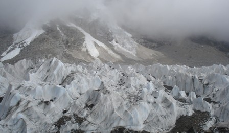
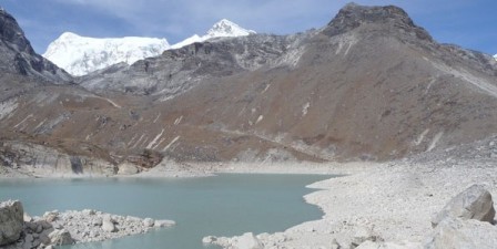
Day 09: Lobuche trek to Gorak Shep (5140m) & Everest base camp (5364m) 7 to 8 hours Today, the trail follows western side of khumbu valley ascends gently through meadows nearby the glacial moraine after that ascends and descends in the rocky path with some rounding the bands. Along the way you can enjoy incredible views of Pumori (7167m) Lingtren (6713m), Khumbutse (6639m), Nuptse (7879m), Lobuche east (6090m) as well as Khumbu glacier and icefall. After finishing several bands you will a bit descends to Gorak Shep (5140m). After reaching Gorak Shep you could have your lunch and leaving bag pack at teahouse where we stay for overnight later on, then proceed to Everest base camp (5364m). You will spend about 4 and half hours trek up to Everest Base Camp and back to Gorak shep. The trek trail is on glacier and snow capped rocks. You can also see many small frozen lakes around the Everest Base Camp. There are several mountains including Pumori (7165m), Lingtren (6713m), Khumbutse (6639m), Nuptse (7879m) and Lhotse (8516m) but you can’t see the mount Everest (8848m) from Everest base camp although you will see it along the trail. The most impressive view from Everest base camp is the Khumbu icefall. After enjoying beautiful moment at the Everest base camp then return back to Gorak Shep. Overnight at local lodge.
Day 10: Gorak Shep Hike to Kala Pattar (5545m) then trek to Pheriche (4260m) 7 Hours Today early in the morning from Gorak shep hike up to Kala patter for magnificent view of the numerous Himalayas as well as marvelous view of sunrise. The trail from Gorak sheep to Kala patter at the beginning is steep climb up approximately for half an hour then reaches the flat land. Afterthat the trail is steep climb with lots of bends till you finally reach Kala patter. 50 meters steeply with rocky climbing begins to summit the main Kala pattar (5545m). Today you may catch the excellent view of sunrise on the Mt. Everest (8848), Lhotse (8516m), Nuptse (7879m), Ama dablam (6856m), Thamserku (6623m), Kangtega (6783m), Kusum kangaru (6367), Cholaste (6335m), Tabuche peak(6495m) Lobuche peak (6090m) , Lingtren (6713m), Khumbutse (6639m), Lho La, south col, changste as well as Everest base camp, Khumbu Icefall and few lakes. Being at the kala pattar is like touching Mt. pumori and to have the closeup view Mt. Everest. Return back to Gorak shep continuing trek heading down through Lobuche and Dughla. Little further from Dughla you will cross the river comes from Everest base camp and khumbu icefall then you will meet two trail where one way left hand side goes to Dingboche and lower one right hand side goes to Pheriche . From here easy walk in the valley to pheriche (4260m). Overnight at local lodge.
Day 11: Pheriche trek to Tengboche (3867m) The first trail leads level walk in the valley for a while; descent to Imja Khola and cross a bridge then ascend to the hill to find few stones memorials of climbers. The trail then leads slightly to Orhso, level walk continuing to Sansara then slightly descents and a bit ascend for a while then level walk to two way junction of right hand side going to Phortse village via upper Pangboche and another lower trail left going to Tengboche through lower Pangboche. Beyond pangboche the trail descends past some magnificently carved Mani stones to the Imja Khola, which we cross via a steel suspension bridge high above the river at a spot where it rushes through a narrow cleft then to Debache and a short steep climb to Tengboche through a forest of birches conifers and rhododendrons. Finally you reach at Tengboche (3867m). You may enjoy the breathtaking view of sunset and sunrise as well as magnificent view of the Mt. Everest including other Himalayas from Tengboche. Tengboche monastery is one of the beautiful monasteries in solu khumbu area as well as the religious center of the whole ‘Sherpa land ‘entire solu khumbu area. Overnight at local lodge.
Day 12: Tengboche trek to Monjo (2835m) 07 hrs walk Today we trek back along the Dudh Kosi River through a magnificent rhododendron forest with amazing waterfalls. Shortly before reaching Namche, the trek takes us through a pine forest, where musk deer often graze in the early morning. After arriving in town, Namche, the trail descend through the pine forests to Larja dobhan, confluence of two rivers where you can see Mt. Everest and Lhotse for the last time. After crossing the bridge at Larja Dobhan the trail descends for while and then walk along the Dudh Koshi River. Crossing Dudh Koshi continue level walk to Jorsale. Beyond the Jorsale the trail leads a bit ascend after that re-crosses the suspension bridge then short steep climb to Monjo (2835m) Overnight at local lodge.
Day 13: Monjo trek to Lukla (2840m) 5 hrs walk From Monjo the trail descends for a while; crossing Dudh kosi over the suspension bridge brings short easy level till Benkar. Then the trail follows a bit up and down and level walk along the Dush kosi valley and re-crossing the suspension bridge again one arrives at Phakding (2610m). Beyond Phakding the trail follows a short descends and a level walk for a while then short steep climb up passes several Buddhist setups at Ghat village. After short steep climb up to Thado kosi; and a bit descends re-cross the small bridge then steep climb up for a short distance. Finally you re-crosses last long suspension bridge of your trek. The trail after the long suspension bridge follows the up wards route as far as Chablung, then turns off towards Lukla. The broad trail at Chablung leading uphill to the left hand side climbs steadily past a few local inn and houses. From there the trail follows through scrub forest above the school and houses of Chaurikharka village then final climb up of your trek about half and hour to reach to Lukla. Overnight at local lodge.
Day 14: Lukla flight to Kathmandu (1350m)
Flights to Kathmandu are generally early in the morning, so after an early breakfast, we make our way over to the Lukla airport and fly back to Kathmandu. After arrival in Kathmandu airport we drive you to hotel. Overnight at hotel in Kathmandu.
Day 15: Depart from Kathmandu.
After breakfast, transfer to the Kathmandu airport (prior to three hours of your departure time) to board flight for your onward destination.
Have a wonderful flight back home with the treasures of your nostalgic memories.
Gokyo and Everest Base Camp Trek
The most magnificent and picturesque of the eastern mountain ranges rise above the well known town of Namche Bazaar, from whence trekkers travel toward the top of the world, Mt EVEREST. It towers over numerous panoramic peaks. The trek up to the summit of Kalapatthar, which means "black rock", is a memorable up to 5545m of elevation. The trek includes a visit to Gokyo lake and over Cho La (La means "pass") and leads you near Cho-Oyu base camp. These excursions will become some of the most memorable of your exotic experiences. During this trip, you will watch festivals and Sherpa customs, including the biggest and holiest worship celebrated at Tyangboche gompa.
With eight of the world's ten highest peaks, Nepal is loaded with spectacular mountains vistas. Everest trek is justifiably famous, not only for its proximity to the world's highest mountain ( 8848m ) but also for its friendly Sherpa people, picturesque villages, great variety of cultures and traditions, colorful festivals and monasteries. The flora and fauna are other ornaments of the Sagarmatha National Park. The story of the yeti is still a mystery to the world from the Khumbu region.
RNK 05 GOKYO RENJO LA PASS (15 Nights / 16 Days)
 The Gokyo-Renjo La Pass trail is considered as an alternative trekking route to the traditional Everest Base Camp trek. Renjo la pass gives an alternative way to the Gokyo trek making a circuit. This is a less crowded popular adventure trek in the Everest region.
The Picturesque less trodden trek to the high alpine Gokyo Ri and a traverse of Renjo La pass links the stunning Gokyo valley to the remote Bhote Koshi valley makes this Gokyo Renjo la pass trek a different experience of trekking in Everest region.
Best Season: Spring (September to December) autumn (March to May).
Trekking Grade: Medium and fairly strenous
Max Elevation: 5550m
Total trekking days: 15 Days
Day 01: Arrive Kathmandu
Upon arrival in Kathmandu, meet & greet in the airport; transfer to Hotel. Overnight at Hotel in Kathmandu.
Day 02: Your full-day sightseeing includes visits to Bhaktapur Durbar Square, home of medieval art & architecture; Continue your tour to Kathmandu Durbar Square (Hanuman Dhoka), the old palace of the Royal Dynasty and hometown of living Goddess, Kumari. Final stop is at the Swayambhunath Stupa, the holiest shrine for the Buddhist and Hindus. Overnight at hotel in Kathmandu
Day 03: Fly from Kathmandu to Lukla (2,800m) -30 minutes, trek to Phakding (2,640m) -3 to 4 hours Take the morning flight to the dramatic airfield at Lukla (2,860m) with your trek guide.The views from the plane are amazing, providing dramatic views of terraced hills and the distant Himalayan giants. After landing in the village of Lukla (2840m) you will meet the rest of your staff/porters. The trail drops steeply for bit then descends to Chheplung (2660m) and Thado Khosi gaon where there is suspension bridge to cross to see the head of the valley Mt. Kusum Kanguru (6367m). After bridge climbs a bit to reach at Ghat (2590m) on banks of the Dudh Koshi River. Take a short visit to monastery then little easy walk before climbing again to reach at Phakding (2610m) The lodges on the first half of the trek are good and menus include all sorts of wholesome favorites: pasta, noodle and rice dishes with remarkably fresh vegetables, puddings and few varieties of hot drinks. The lodges have the same pattern all the way up, but understandably they become a bit more simple right at the top of the trek - though still remarkably good for the location. Overnight at.local lodge. Day 04: Phakding trek to Namche Bazaar (3440m) 6hrs walk The trail keeps close to the river valley and is lined with beautiful blue pine and rhododendron forest that is very spectacular in the spring months, when the flowers are in bloom with the beautiful waterfall. We will see the snow-capped peak of Thamserku (6623m) & Khumbi La (5765m) at Benkar. We cross the Dudh Kosi River at Benkar(2710m). From here it is a short walk to Monjo (2840m). Just beyond the Monjo trek enters the Sagarnatha (Everest) national park where your permits are checked. The trail thereafter is steep rocky descending to large farm aftermath cross bridge at Dudh Kosi and follow the west banks. Just short distance up the river is Jorsale (2830m). The trail follows the river for a while, then re-crosses the Dudh Koshi along the river bank and after short ups and downs, makes a steep climb near the confluence of the two rivers (Bhote Koshi & Dush Koshi). Crossing the bridge at Dudh Koshi, the trail follows steeply ascent towards the Namche Bazaar(3440m). One can see the beautiful mountains like the Mt. Everest (8848m), Lhotse (8516m) and Nuptse (7879m) before arriving Namche Bazaar which is a gate way to khumbu region. Namche is the main trading village and holds a busy Saturday market. It is a meeting place for the Hindu traders from the lowlands and the Tibetan yak caravans that have reached there by crossing the glaciated Nangpa La pass. Overnight at local lodge.
Day 04: Phakding trek to Namche Bazaar (3440m) 6hrs walk The trail keeps close to the river valley and is lined with beautiful blue pine and rhododendron forest that is very spectacular in the spring months, when the flowers are in bloom with the beautiful waterfall. We will see the snow-capped peak of Thamserku (6623m) & Khumbi La (5765m) at Benkar. We cross the Dudh Kosi River at Benkar(2710m). From here it is a short walk to Monjo (2840m). Just beyond the Monjo trek enters the Sagarnatha (Everest) national park where your permits are checked. The trail thereafter is steep rocky descending to large farm aftermath cross bridge at Dudh Kosi and follow the west banks. Just short distance up the river is Jorsale (2830m). The trail follows the river for a while, then re-crosses the Dudh Koshi along the river bank and after short ups and downs, makes a steep climb near the confluence of the two rivers (Bhote Koshi & Dush Koshi). Crossing the bridge at Dudh Koshi, the trail follows steeply ascent towards the Namche Bazaar(3440m). One can see the beautiful mountains like the Mt. Everest (8848m), Lhotse (8516m) and Nuptse (7879m) before arriving Namche Bazaar which is a gate way to khumbu region. Namche is the main trading village and holds a busy Saturday market. It is a meeting place for the Hindu traders from the lowlands and the Tibetan yak caravans that have reached there by crossing the glaciated Nangpa La pass. Overnight at local lodge.
Day 05: Acclimatization day at Namche Bazaar (3440m) Acclimatization is most important before heading higher. Today you may have excursion either to Thame village or viewpoint. If you prefer to Thame it takes approximately 7/8 hours walking both way go and return to Namche which is popular for visiting Thame monastery. Or simply just go to Viewpoint in the stand point for splendid view of the Himalayas including Mt. Everest (8848), Lhotse (8516m), Lhotse shar (8382m), Nuptse (7879m), Ama dablam (6856m), Thamserku (6623m), Kangtega (6783m), Kusum kangaru (6367), Cholaste (6335m), Tabuche peak (6495m), Khumbi La (5765m) and Kwangde Ri (6011m) etc. Overnight at local lodge.
Day 06: Namche Bazaar to Dole (4,200m) - 7 to 8 hours Today the trail is slightly up for a while up to the Chor camp at Namche Bazzar then continue easy level walk to Kyangjuma, 3550m. Along the way from chor camp at Namche bazaar to Kyangjuma you may enjoy incredible view of Mt. Everest (8848), Lhotse (8516m), Nuptse (7879m), Ama dablam (6856m), Thamserku (6623m) and many more beautiful mountains. From Kyangjuma the trail is bit easy walking through Rhododendron forest to Sansara. Here you can find two way; left hand side leads to the Gokyo valley trek and right hand side leads to the direct Everest base camp trek. From here the trail is steep climb up for about one and half hour to reach at Mongla danda (3978m) where there are a few teahouse and a chorten to enjoy magnificent view of Mt. Ama dablam including numerous mountains. The trail from Mongla danda descends in steep bends trail to Phortse thanga (3680m). From Phortse thanga you will meet two trails, one higher route left hand side lead to Gokyo valley trek and lower trail right hand side lead to Phortse village. From Phortse Thanga the trail climbs steeply through rhododendron and junipers forests then after level walks before to reach at Dole (4090m). Overnight at local lodge.
Day 07: Dole to Machhermo (4,410m) 4 to 5 hours We climb to the picturesque ridge above the Dole and the trail climbs via Lhabarma at 4220m to Luza at 4360m. Still the trail continues to climb along the side of the valley high above the river, crossing sandy spurs to reach Machharmo at 4410m. Overnight at local lodge.
Day 08: Machhermo to Gokyo Lake (4750m)Walk approximately 5-6 hours
Day 09: Machhermo to Gokyo (4,790m) 5 to 6 hours
We, first climb up to the ridge where one can see excellent view of both the valley to Khangtega and northern part to the Cho-Oyu (8153m). We descend to the river bank before beginning the climb up to the terminal moraine of the Ngazumpa glacier and start to climb until first lake. The trail follows the valley through enjoy the second lake view and after an hour walk will reaches at Gokyo at 4,750m, on the edge of third lake. Today’s course mostly gently ascent and kind of flat trail to Gokyo about 5 to 6 hrs. Overnight at local lodge.
Day 10: Gokyo lake to Lungdeng (4600m) walk approximately 6-7 hours
Day 11: Lungdeng via Renju La pass to Sumna Phugwalk approximately 6-7 hours
Day 12: Sumna Phug to Thame (3800m)walk approximately 4-5 hours
Day 13: Thame to Namche Bazaar walk approximately 5-6 hours
Day 14: Namche Bazaar to Lukla (2,800m) 6 to 7 hours After a long walk we'll trek back to Lukla today. We descend the long way before crossing the bridge and further walk to Monju and then to Phakding enjoying the lush green scenery around and passing through the incredible mountain scenery and local Sherpa village. We will have the lunch on the way. Overnight at local lodge.
Day 15: Lukla flight to Kathmandu (1350m)
Flights to Kathmandu are generally early in the morning, so after an early breakfast, we make our way over to the Lukla airport and fly back to Kathmandu. After arrival in Kathmandu airport we drive you to hotel. Overnight at hotel in Kathmandu.
Day 16 : Depart from Kathmandu.
After breakfast, transfer to the Kathmandu airport (prior to three hours of your departure time) to board flight for your onward destination.
Have a wonderful flight back home with the treasures of your nostalgic memories.
RNK 06 GOKYO CHO LA PASS TREKKING (18 Nights / 19 Days)
 Gokyo Chola La Pass is one of the most popular and adventurous treks in the Everest region. This trek is the combination of classic tradition, culture and top class of adventures as it combines entire upper Khumbu, crystal Gokyo Lake, renowned viewpoint Gokyor-Ri and the base of world's tallest mountain, Everest. After the flight from Kathmandu to Lukla, the trail twisting ups and down through the trekking hub like Namche, Thame, Khumjung, Phortse and Dhole to Gokyo Lake at 4790m and finally to Gokyo Ri (5483 m.) where Mt. Everest, Lotse Nuptse and far away Makalu are seen magnificiently. Crossing over Cho La Pass (5667 m.), trail heads up to Kalapattar at 5545 m which demands lots of strength and walking over the pass in to the himalayas, takes you into the heart of the mountains and the culture of the Everest region to the foot of the great peaks itself.
Best Season: Spring (September to December) Autumn (March to May).
Trekking Grade: Strenuous treks
Max Elevation: 5545m
Total trekking days: 15 Days
Day 01: Arrive Kathmandu 1338 m
Upon arrival in Kathmandu, meet & greet in the airport; transfer to Hotel. Overnight at Hotel in Kathmandu.
Day 02: Your full-day sightseeing includes visits to Bhaktapur Durbar Square, home of medieval art & architecture; Continue your tour to Kathmandu Durbar Square (Hanuman Dhoka), the old palace of the Royal Dynasty and hometown of living Goddess, Kumari. Final stop is at the Swayambhunath Stupa, the holiest shrine for the Buddhist and Hindus. Overnight at hotel in Kathmandu
Day 03: Fly from Kathmandu to Lukla (2,800m) -30 minutes, trek to Phakding (2,640m) -3 to 4 hours Take the morning flight to the dramatic airfield at Lukla (2,860m) with your trek guide.The views from the plane are amazing, providing dramatic views of terraced hills and the distant Himalayan giants. After landing in the village of Lukla (2840m) you will meet the rest of your staff/porters. The trail drops steeply for bit then descends to Chheplung (2660m) and Thado Khosi gaon where there is suspension bridge to cross to see the head of the valley Mt. Kusum Kanguru (6367m). After bridge climbs a bit to reach at Ghat (2590m) on banks of the Dudh Koshi River. Take a short visit to monastery then little easy walk before climbing again to reach at Phakding (2610m) The lodges on the first half of the trek are good and menus include all sorts of wholesome favorites: pasta, noodle and rice dishes with remarkably fresh vegetables, puddings and few varieties of hot drinks. The lodges have the same pattern all the way up, but understandably they become a bit more simple right at the top of the trek - though still remarkably good for the location. Overnight at.local lodge.
Day 04: Phakding trek to Namche Bazaar (3440m) 6hrs walk The trail keeps close to the river valley and is lined with beautiful blue pine and rhododendron forest that is very spectacular in the spring months, when the flowers are in bloom with the beautiful waterfall. We will see the snow-capped peak of Thamserku (6623m) & Khumbi La (5765m) at Benkar. We cross the Dudh Kosi River at Benkar(2710m). From here it is a short walk to Monjo (2840m). Just beyond the Monjo trek enters the Sagarnatha (Everest) national park where your permits are checked. The trail thereafter is steep rocky descending to large farm aftermath cross bridge at Dudh Kosi and follow the west banks. Just short distance up the river is Jorsale (2830m). The trail follows the river for a while, then re-crosses the Dudh Koshi along the river bank and after short ups and downs, makes a steep climb near the confluence of the two rivers (Bhote Koshi & Dush Koshi). Crossing the bridge at Dudh Koshi, the trail follows steeply ascent towards the Namche Bazaar(3440m). One can see the beautiful mountains like the Mt. Everest (8848m), Lhotse (8516m) and Nuptse (7879m) before arriving Namche Bazaar which is a gate way to khumbu region. Namche is the main trading village and holds a busy Saturday market. It is a meeting place for the Hindu traders from the lowlands and the Tibetan yak caravans that have reached there by crossing the glaciated Nangpa La pass. Overnight at local lodge.
Day 05: Acclimatization day at Namche Bazaar (3440m)
Acclimatization is most important before heading higher. Today you may have excursion either to Thame village or viewpoint. If you prefer to Thame it takes approximately 7/8 hours walking both way go and return to Namche which is popular for visiting Thame monastery. Or simply just go to Viewpoint in the stand point for splendid view of the Himalayas including Mt. Everest (8848), Lhotse (8516m), Lhotse shar (8382m), Nuptse (7879m), Ama dablam (6856m), Thamserku (6623m), Kangtega (6783m), Kusum kangaru (6367), Cholaste (6335m), Tabuche peak (6495m), Khumbi La (5765m) and Kwangde Ri (6011m) etc. Overnight at local lodge.
Day 06: Namche Bazaar to Dole (4,200m) - 7 to 8 hours
Today the trail is slightly up for a while up to the Chor camp at Namche Bazzar then continue easy level walk to Kyangjuma, 3550m. Along the way from chor camp at Namche bazaar to Kyangjuma you may enjoy incredible view of Mt. Everest (8848), Lhotse (8516m), Nuptse (7879m), Ama dablam (6856m), Thamserku (6623m) and many more beautiful mountains. From Kyangjuma the trail is bit easy walking through Rhododendron forest to Sansara. Here you can find two way; left hand side leads to the Gokyo valley trek and right hand side leads to the direct Everest base camp trek. From here the trail is steep climb up for about one and half hour to reach at Mongla danda (3978m) where there are a few teahouse and a chorten to enjoy magnificent view of Mt. Ama dablam including numerous mountains. The trail from Mongla danda descends in steep bends trail to Phortse thanga (3680m). From Phortse thanga you will meet two trails, one higher route left hand side lead to Gokyo valley trek and lower trail right hand side lead to Phortse village. From Phortse Thanga the trail climbs steeply through rhododendron and junipers forests then after level walks before to reach at Dole (4090m). Overnight at local lodge.
Day 07: Dole to Machhermo (4,410m) 4 to 5 hours
We climb to the picturesque ridge above the Dole and the trail climbs via Lhabarma at 4220m to Luza at 4360m. Still the trail continues to climb along the side of the valley high above the river, crossing sandy spurs to reach Machharmo at 4410m. Overnight at local lodge.
Day 08: Machhermo to Gokyo (4,790m) 5 to 6 hours
We, first climb up to the ridge where one can see excellent view of both the valley to Khangtega and northern part to the Cho-Oyu (8153m). We descend to the river bank before beginning the climb up to the terminal moraine of the Ngazumpa glacier and start to climb until first lake. The trail follows the valley through enjoy the second lake view and after an hour walk will reaches at Gokyo at 4,750m, on the edge of third lake. Today’s course mostly gently ascent and kind of flat trail to Gokyo about 5 to 6 hrs. Overnight at local lodge.
Day 09: Day Hike to Gokyo Ri (5,360m) 2 to 3 hours
Early in the morning we have a steep climb up to the Gokyo Ri (5,360m). There are stunning views of the Gokyo valley, the massive Ngozumpa Glacier, one of the biggest glaciers in the world along with incredible panoramic view of the whole Khumbu mountains range, such giants as Mt. Cho Oyu (8201m) Mt. Everest (8848), Lhotse (8516m), Nuptse (7879m), Makalu (8481m), Cholaste (6335m), Tabuche peak (6495m) and Gychung Kang (7922m). This will be nostalgic memories for rest of the life. You can see the Cho-yu base camp and stroll back an hour to Gokyo; local lodge for a day rest. Overnight at local lodge.
Day 10: Gokyo trek to Thangna/Dragnag (4700m) 4 Hours
The trail is bit ascending till smoothly up and down in glacier and finally about an hour smoothly descends along the valley to reach at Thangana (4700m) known as base camp of Cho La Pass. Overnight at local lodge.
Day 11: Thagna trek to Dzongla (4830m) over the Cho La Pass (5368m) 7 to 8 Hours
This is the tough days which is because of steep and involves a glacier traverse on the eastern side. Being cautious we follow the trail vertically through the rocks glazed by ice avoiding slippery. Climbing through a narrow valley and a rocky trail through the side of a frozen lake we come to the top of the Cho La pass (5368m) decorated with prayer flags. The secenery is captivating on the way; the pyramidal Ama Dablam presiding over a range of mountains on the south, Cholatse soar on the west and Lobuche East and Baruntse rises sharply to our right. After the Cho La pass, the trail descends steeply towards the Dzonglha (4,830 m) passing through some crevasses and pine forests, the another marvelous site with a complete view of Mt. Cholatse, Mt. Ama Dablam, Lobuche and the Pheriche village at the end. There are few basic lodges at Dzongla (4830m) here are few basic teahouse facilities. Overnight at local lodge.
Day 12: Dzongla to Lobuche (4910m) 5 – 6 hours
The trail is quite easy from Dzongla to Lobuche which has gentle descends and ascends and at the end easy walk to reach at Lobuche (4910m). This path brings astounding views of Ama Dablam, the Nuptse-Lhotse, Everest, Pumori, Lobuche peak etc. Lobuche is a small village situated nearby the stream and viewing the sunset on Nuptse is often regarded as the fortunate sight. Overnight at local lodge.
Day 13: Lobuche trek to Gorak Shep (5140m) & Everest base camp (5364m) 7 to 8 hours
Today, the trail follows western side of khumbu valley ascends gently through meadows nearby the glacial moraine after that ascends and descends in the rocky path with some rounding the bands. Along the way you can enjoy incredible views of Pumori (7167m) Lingtren (6713m), Khumbutse (6639m), Nuptse (7879m), Lobuche east (6090m) as well as Khumbu glacier and icefall. After finishing several bands you will a bit descends to Gorak Shep (5140m). After reaching Gorak Shep you could have your lunch and leaving bag pack at teahouse where we stay for overnight later on, then proceed to Everest base camp (5364m). You will spend about 4 and half hours trek up to Everest Base Camp and back to Gorak shep. The trek trail is on glacier and snow capped rocks. You can also see many small frozen lakes around the Everest Base Camp. There are several mountains including Pumori (7165m), Lingtren (6713m), Khumbutse (6639m), Nuptse (7879m) and Lhotse (8516m) but you can’t see the mount Everest (8848m) from Everest base camp although you will see it along the trail. The most impressive view from Everest base camp is the Khumbu icefall. After enjoying beautiful moment at the Everest base camp then return back to Gorak Shep. Overnight at local lodge.
Day 14: Gorak Shep Hike to Kala Pattar (5545m) then trek to Dingpoche 7 Hours
Today early in the morning from Gorak shep hike up to Kala patter for magnificent view of the numerous Himalayas as well as marvelous view of sunrise. The trail from Gorak sheep to Kala patter at the beginning is steep climb up approximately for half an hour then reaches the flat land. Afterthat the trail is steep climb with lots of bends till you finally reach Kala patter. 50 meters steeply with rocky climbing begins to summit the main Kala pattar (5545m). Today you may catch the excellent view of sunrise on the Mt. Everest (8848), Lhotse (8516m), Nuptse (7879m), Ama dablam (6856m), Thamserku (6623m), Kangtega (6783m), Kusum kangaru (6367), Cholaste (6335m), Tabuche peak(6495m) Lobuche peak (6090m) , Lingtren (6713m), Khumbutse (6639m), Lho La, south col, changste as well as Everest base camp, Khumbu Icefall and few lakes. Being at the kala pattar is like touching Mt. pumori and to have the closeup view Mt. Everest. Return back to Gorak shep continuing trek heading down through Lobuche and Dughla. Little further from Dughla you will cross the river comes from Everest base camp and khumbu icefall then you will meet two trail where one way left hand side goes to Dingboche and lower one right hand side goes to Pheriche. Overnight at local lodge.
Day 15: Dingboche trek to Tengboche (3867m)
The trail begins with descending the valley and crossing the Khumbu Khola bridge and climbing again upward near Orsho and finally slightly descending to Orhso continue level walk to Sansara The path keeps slightly descending and ascending for a while then level walk to two way junction where higher right goes to Phortse village via upper Pangboche and another lower at left goes to Tengboche through lower Pangboche. Beyond pangboche the trail descends past some magnificently carved Mani stones to the Imja Khola, which we cross via a steel suspension bridge high above the river at a spot where it rushes through a narrow cleft then to Debache and a short steep climb to Tengboche through a forest of birches conifers and rhododendrons. Finally you reach at Tengboche (3867m). You may enjoy the breathtaking view of sunset and sunrise as well as magnificent view of the Mt. Everest including other Himalayas from Tengboche. Tengboche monastery is one of the beautiful monasteries in solu khumbu area as well as the religious center of the whole ‘Sherpa land ‘entire solu khumbu area. Overnight at local lodge.
Day 16: Tengboche trek to Monjo (2835m) 07 hrs walk
Today we trek back along the Dudh Kosi River through a magnificent rhododendron forest with amazing waterfalls. Shortly before reaching Namche, the trek takes us through a pine forest, where musk deer often graze in the early morning. After arriving in town, Namche, the trail descend through the pine forests to Larja dobhan, confluence of two rivers where you can see Mt. Everest and Lhotse for the last time. After crossing the bridge at Larja Dobhan the trail descends for while and then walk along the Dudh Koshi River. Crossing Dudh Koshi continue level walk to Jorsale. Beyond the Jorsale the trail leads a bit ascend after that re-crosses the suspension bridge then short steep climb to Monjo (2835m) Overnight at local lodge.
Day 17: Monjo trek to Lukla (2840m) 5 hrs walk
From Monjo the trail descends for a while; crossing Dudh kosi over the suspension bridge brings short easy level till Benkar. Then the trail follows a bit up and down and level walk along the Dush kosi valley and re-crossing the suspension bridge again one arrives at Phakding (2610m). Beyond Phakding the trail follows a short descends and a level walk for a while then short steep climb up passes several Buddhist setups at Ghat village. After short steep climb up to Thado kosi; and a bit descends re-cross the small bridge then steep climb up for a short distance. Finally you re-crosses last long suspension bridge of your trek. The trail after the long suspension bridge follows the up wards route as far as Chablung, then turns off towards Lukla. The broad trail at Chablung leading uphill to the left hand side climbs steadily past a few local inn and houses. From there the trail follows through scrub forest above the school and houses of Chaurikharka village then final climb up of your trek about half and hour to reach to Lukla Overnight at local lodge.
Day 18: Lukla flight to Kathmandu (1350m)
Flights to Kathmandu are generally early in the morning, so after an early breakfast, we make our way over to the Lukla airport and fly back to Kathmandu. After arrival in Kathmandu airport we drive you to hotel. Overnight at hotel in Kathmandu.
Day 19: Depart from Kathmandu.
After breakfast, transfer to the Kathmandu airport (prior to three hours of your departure time) to board flight for your onward destination.
Have a wonderful flight back home with the treasures of your nostalgic memories.
RNK 07 EVEREST HIGH PASS TREKKING (20 Nights / 21 Days)
 Everest High Passes Trek is a fantastic trek, visiting all of the high passes of the Khumbu with extra time at Gokyo to explore the upper valley. This trek explores the breath-taking Gokyo valley, Renjo la pass, Chola pass and other high passes. Being at Tengboche Monastry, one of the popular monastery in the khumbu valley rewards us with breathtaking view of many high Himalayas. Heading towards Everest we cross the Kangma La, Cho La and Renjola pass with the alpine pastures and lakes of Gokyo. From Gokyo Ri we can see the outstanding views of Mt. Everest , Nuptse, Pumori, Amadablam, Lobuche and many more mountains.
Best Season: Spring (September to December) autumn (March to May).
Trekking Grade: Strenuous
Max Elevation: 5555 m
Total trekking days: 17 Days
Day 01: Arrive Kathmandu1338 m
Upon arrival in Kathmandu, meet & greet in the airport; transfer to Hotel. Overnight at Hotel in Kathmandu.
Day 02: Your full-day sightseeing includes visits to Bhaktapur Durbar Square, home of medieval art & architecture; Continue your tour to Kathmandu Durbar Square (Hanuman Dhoka), the old palace of the Royal Dynasty and hometown of living Goddess, Kumari. Final stop is at the Swayambhunath Stupa, the holiest shrine for the Buddhist and Hindus. Overnight at hotel in Kathmandu
Day 03: Fly from Kathmandu to Lukla (2,800m) -30 minutes, trek to Phakding (2,640m) -3 to 4 hours Take the morning flight to the dramatic airfield at Lukla (2,860m) with your trek guide.The views from the plane are amazing, providing dramatic views of terraced hills and the distant Himalayan giants. After landing in the village of Lukla (2840m) you will meet the rest of your staff/porters. The trail drops steeply for bit then descends to Chheplung (2660m) and Thado Khosi gaon where there is suspension bridge to cross to see the head of the valley Mt. Kusum Kanguru (6367m). After bridge climbs a bit to reach at Ghat (2590m) on banks of the Dudh Koshi River. Take a short visit to monastery then little easy walk before climbing again to reach at Phakding (2610m) The lodges on the first half of the trek are good and menus include all sorts of wholesome favorites: pasta, noodle and rice dishes with remarkably fresh vegetables, puddings and few varieties of hot drinks. The lodges have the same pattern all the way up, but understandably they become a bit more simple right at the top of the trek - though still remarkably good for the location. Overnight at.local lodge.
Day 04: Phakding trek to Namche Bazaar (3440m) 6hrs walk The trail keeps close to the river valley and is lined with beautiful blue pine and rhododendron forest that is very spectacular in the spring months, when the flowers are in bloom with the beautiful waterfall. We will see the snow-capped peak of Thamserku (6623m) & Khumbi La (5765m) at Benkar. We cross the Dudh Kosi River at Benkar(2710m). From here it is a short walk to Monjo (2840m). Just beyond the Monjo trek enters the Sagarnatha (Everest) national park where your permits are checked. The trail thereafter is steep rocky descending to large farm aftermath cross bridge at Dudh Kosi and follow the west banks. Just short distance up the river is Jorsale (2830m). The trail follows the river for a while, then re-crosses the Dudh Koshi along the river bank and after short ups and downs, makes a steep climb near the confluence of the two rivers (Bhote Koshi & Dush Koshi). Crossing the bridge at Dudh Koshi, the trail follows steeply ascent towards the Namche Bazaar(3440m). One can see the beautiful mountains like the Mt. Everest (8848m), Lhotse (8516m) and Nuptse (7879m) before arriving Namche Bazaar which is a gate way to khumbu region. Namche is the main trading village and holds a busy Saturday market. It is a meeting place for the Hindu traders from the lowlands and the Tibetan yak caravans that have reached there by crossing the glaciated Nangpa La pass. Overnight at local lodge.
Day 05: Acclimatization day at Namche Bazaar (3440m)
Acclimatization is most important before heading higher. Today you may have excursion either to Thame village or viewpoint. If you prefer to Thame it takes approximately 7/8 hours walking both way go and return to Namche which is popular for visiting Thame monastery. Or simply just go to Viewpoint in the stand point for splendid view of the Himalayas including Mt. Everest (8848), Lhotse (8516m), Lhotse shar (8382m), Nuptse (7879m), Ama dablam (6856m), Thamserku (6623m), Kangtega (6783m), Kusum kangaru (6367), Cholaste (6335m), Tabuche peak (6495m), Khumbi La (5765m) and Kwangde Ri (6011m) etc. Overnight at local lodge.
Day 06: Namche Bazzar to Thame (3820m). 5 Hours
The route trail turns west and is almost level as you head up to the Bhote Koshi Valley, once a popular trading route into Tibet. After descending to the Bhote Koshi the trail climbs steeply to Thame. The peaks likef Teng Kangpoche and Kwangde and to the north is the Nangpa La, the pass leading to Tibet can be picturized from here. Thame Gompa is situated above the village overlooking the valley and is the site for the spring celebrations of the Mani Rimdu festival. Overnight at local lodge.
Day 07: Thame to Lungdeng (4500m) 6 Hours
Day 08: Rest day and explore around:
Today we can go for visit at Nakpa Valley, which falls on the old trade route to Tibet. We can also hik to Darkyachhulung Peak, Marlung sacred site of Warfield or hik to Lake Cho Relmo, Back to stay in Lungden. Overnight at local lodge.
Day 09: Lungden – Renjola Pass (5415m) – Gokyo Lake : 6 Hours
The trail often follow steeply ups and down with sandy ridge. We will crosses frozen stream, and walking through dramatic rock, we will past several yak kharkas and twin Renjo Lakes, the view from the top is incredible, you can have studding view of 7000 to 8000 metes peaks all around including Kalapathar, Tengboche Monastery, chola glaciers and many more. Overnight at local lodge.
Days 10: Gokyo Ri /Peak (5,360m) 2 to 3 hours Early in the morning hike up to the Gokyo Ri (5,360m) for the breathtaking view of splash a sunrise top of the mountain four highest mountains including Mt. Everest and many more snow caped scenery. This will be nostalgic memories for rest of the life. You can see the Cho-yu base camp and Ngazumpa glacier; one of the biggest glacier in the world and stroll back an hour to Gokyo to local lodge a rest and relax all the day.
Days 11: Gokyo Lake to Thangnak: (4700m) 4 HoursDays 12: Cho-La crossing- Dzongla: 7 Hours The trek through Cho La Pass (5,330m) is a rather difficult route, requires some mountaineering experience and well equipped. We suggest bringing warm clothing and some extra food. The pass is not difficult but it is steep and involves a glacier crossing. Though there are no technical problems, there area trail in the rocks besides the icefall.
Days 12: Cho-La crossing- Dzongla: 7 Hours
The trek through Cho La Pass (5,330m) is a rather difficult route, requires some mountaineering experience and well equipped. We suggest bringing warm clothing and some extra food. The pass is not difficult but it is steep and involves a glacier crossing. Though there are no technical problems, there area trail in the rocks besides the icefall.
Days 13: Dzongla to Lobuche: 5 Hours
Days 14: Lobuche to Gorakshep (5,140m) – 2 to 3 Hours (Excursion to Kala Pathar – 4 to 5 hours )
The trail from Lobuche follows the grassy ablation valley with great views of Pumori then crosses tributary glaciers to reach the dry lake bed of Gokrakchep.
The trail from Gorak sheep to Kala patter at the beginning is steep climb up approximately for half an hour then reaches the flat land. Afterthat the trail is steep climb with lots of bends till you finally reach Kala patter. 50 meters steeply with rocky climbing begins to summit the main Kala pattar (5545m). Today you may catch the excellent view of sunrise on the Mt. Everest (8848), Lhotse (8516m), Nuptse (7879m), Ama dablam (6856m), Thamserku (6623m), Kangtega (6783m), Kusum kangaru (6367), Cholaste (6335m), Tabuche peak(6495m) Lobuche peak (6090m) , Lingtren (6713m), Khumbutse (6639m), Lho La, south col, changste as well as Everest base camp, Khumbu Icefall and few lakes. Being at the kala pattar is like touching Mt. pumori and to have the closeup view Mt. Everest. Return back to Gorak shep for overnight stay at simple lodge.
Days 15: Lobuche trek to Gorak Shep (5140m) & Everest base camp (5364m) 7 to 8 hours
Days 16: Lobuche to - Khongma La Pass (5535m) – Chhukung (4900m) 8/9 hrs Today will be the longest and difficult day.
Days 17: Chhukung to Tengboche : 5 to 6 Hours From Chhukung we descend the valley of the Imja Khola, trek through the village of Dingboche with its stone walled potatoe fields, down alpine pastures through the kharkas of Tsura, Orsho and Samsara the village of Pangboche.
Days 18: Tengboche trek to Monjo (2835m) 07 hrs walk
Today we trek back along the Dudh Kosi River through a magnificent rhododendron forest with amazing waterfalls. Shortly before reaching Namche, the trek takes us through a pine forest, where musk deer often graze in the early morning. After arriving in town, Namche, the trail descend through the pine forests to Larja dobhan, confluence of two rivers where you can see Mt. Everest and Lhotse for the last time. After crossing the bridge at Larja Dobhan the trail descends for while and then walk along the Dudh Koshi River. Crossing Dudh Koshi continue level walk to Jorsale. Beyond the Jorsale the trail leads a bit ascend after that re-crosses the suspension bridge then short steep climb to Monjo (2835m) Overnight at local lodge.
Days 19: Monjo trek to Lukla (2840m) 5 hrs walk
From Monjo the trail descends for a while; crossing Dudh kosi over the suspension bridge brings short easy level till Benkar. Then the trail follows a bit up and down and level walk along the Dush kosi valley and re-crossing the suspension bridge again one arrives at Phakding (2610m). Beyond Phakding the trail follows a short descends and a level walk for a while then short steep climb up passes several Buddhist setups at Ghat village. After short steep climb up to Thado kosi; and a bit descends re-cross the small bridge then steep climb up for a short distance. Finally you re-crosses last long suspension bridge of your trek. The trail after the long suspension bridge follows the up wards route as far as Chablung, then turns off towards Lukla. The broad trail at Chablung leading uphill to the left hand side climbs steadily past a few local inn and houses. From there the trail follows through scrub forest above the school and houses of Chaurikharka village then final climb up of your trek about half and hour to reach to Lukla Overnight at local lodge.
Days 20: Lukla flight to Kathmandu (1350m)
Flights to Kathmandu are generally early in the morning, so after an early breakfast, we make our way over to the Lukla airport and fly back to Kathmandu. After arrival in Kathmandu airport we drive you to hotel. Overnight at hotel in Kathmandu.
Day 21: Depart from Kathmandu.
After breakfast, transfer to the Kathmandu airport (prior to three hours of your departure time) to board flight for your onward destination.
Have a wonderful flight back home with the treasures of your nostalgic memories.
 RNK 08 EVEREST TRANSVERSE TREK (THREE PASSES) (20 Nights / 21 Days)
Everest three high pass trekking is combination of Kongmba La, Chola and Renjola which is demanding and exhausting trekking well-known in Khumbu, Everest area. This trip has diversity of amazing Himalaya which can be seen incredibly from top of three pass. The trail completes the desires of every trekker who seeks to explore the treasures in Himalayas as this brings most of exhilarating, charming landscape of Himalayas. The scenery is diverse and stunning, the accommodation and trail variety from the time-worn path of the Khumbu area, to the remote and less recurrent three pass region.
Tourist attractions of 3 high pass trekking are generally extensive the Chhukhung valley and walking to Ama Dablam base camp, Everest base camp and morning walk up to the Kalapattar for sunrise view on top of Everest which is spectacular as well as several Himalaya, Gokyo lakes and exciting views from Gokyo Ri and cross Renjo La to appear in the perfect Thame valley which is leading trail to the Nangpa La and Tibet China side.
Best Season: March - June / September-November
Trekking Grade: Moderate
Max Elevation: 5545m
Total trekking days: 17 Days
Day 01: Arrive Kathmandu 1338 m
Upon arrival in Kathmandu, meet & greet in the airport; transfer to Hotel. Overnight at Hotel in Kathmandu.
Day 01: Arrive Kathmandu 1338 m Upon arrival in Kathmandu, meet & greet in the airport; transfer to Hotel. Overnight at Hotel in Kathmandu.
Day 03: Fly from Kathmandu to Lukla (2,800m) -30 minutes, trek to Phakding (2,640m) -3 to 4 hours Take the morning flight to the dramatic airfield at Lukla (2,860m) with your trek guide.The views from the plane are amazing, providing dramatic views of terraced hills and the distant Himalayan giants. After landing in the village of Lukla (2840m) you will meet the rest of your staff/porters. The trail drops steeply for bit then descends to Chheplung (2660m) and Thado Khosi gaon where there is suspension bridge to cross to see the head of the valley Mt. Kusum Kanguru (6367m). After bridge climbs a bit to reach at Ghat (2590m) on banks of the Dudh Koshi River. Take a short visit to monastery then little easy walk before climbing again to reach at Phakding (2610m) The lodges on the first half of the trek are good and menus include all sorts of wholesome favorites: pasta, noodle and rice dishes with remarkably fresh vegetables, puddings and few varieties of hot drinks. The lodges have the same pattern all the way up, but understandably they become a bit more simple right at the top of the trek - though still remarkably good for the location. Overnight at.local lodge.
Day 04: Phakding trek to Namche Bazaar (3440m) 6hrs walk The trail keeps close to the river valley and is lined with beautiful blue pine and rhododendron forest that is very spectacular in the spring months, when the flowers are in bloom with the beautiful waterfall. We will see the snow-capped peak of Thamserku (6623m) & Khumbi La (5765m) at Benkar. We cross the Dudh Kosi River at Benkar(2710m). From here it is a short walk to Monjo (2840m). Just beyond the Monjo trek enters the Sagarnatha (Everest) national park where your permits are checked. The trail thereafter is steep rocky descending to large farm aftermath cross bridge at Dudh Kosi and follow the west banks. Just short distance up the river is Jorsale (2830m). The trail follows the river for a while, then re-crosses the Dudh Koshi along the river bank and after short ups and downs, makes a steep climb near the confluence of the two rivers (Bhote Koshi & Dush Koshi). Crossing the bridge at Dudh Koshi, the trail follows steeply ascent towards the Namche Bazaar(3440m). One can see the beautiful mountains like the Mt. Everest (8848m), Lhotse (8516m) and Nuptse (7879m) before arriving Namche Bazaar which is a gate way to khumbu region. Namche is the main trading village and holds a busy Saturday market. It is a meeting place for the Hindu traders from the lowlands and the Tibetan yak caravans that have reached there by crossing the glaciated Nangpa La pass. Overnight at local lodge.
Day 05: Acclimatization day at Namche Bazaar (3440m)
Acclimatization is most important before heading higher. Today you may have excursion either to Thame village or viewpoint. If you prefer to Thame it takes approximately 7/8 hours walking both way go and return to Namche which is popular for visiting Thame monastery. Or simply just go to Viewpoint in the stand point for splendid view of the Himalayas including Mt. Everest (8848), Lhotse (8516m), Lhotse shar (8382m), Nuptse (7879m), Ama dablam (6856m), Thamserku (6623m), Kangtega (6783m), Kusum kangaru (6367), Cholaste (6335m), Tabuche peak (6495m), Khumbi La (5765m) and Kwangde Ri (6011m) etc. Overnight at local lodge.
Day 06: Namche Bazaar trek to Tengboche (3867m) 5 hrs walk
Today the trail is slightly up for a while up to the Chor camp at Namche Bazzar then continue easy level walk to Kyangjuma, 3550m. Along the way from chor camp at Namche bazaar to Kyangjuma you may enjoy incredible view of Mt. Everest (8848), Lhotse (8516m), Nuptse (7879m), Ama dablam (6856m), Thamserku (6623m) and many more beautiful mountains. From Kyangjuma the trail is bit easy walking through Rhododendron forest to Sansara. Here you can find two way; left hand side leads to the Gokyo valley trek and right hand side leads to the direct Everest base camp trek. From Sansara the trail descends gradually through pine forest to Lausasa where there are a few teahouses. Then the trail drops steeply through the pine and Rhododendron forest to Phungi thanga, a small settlement on the river banks of the Dudh kosi 3250m. The trail climbs steeply at beginning then a gradual ascent through blue pine and Rhododendron forest at the hill top of Tengboche Monastery, 3867m. The splendid views of sunset, sunrise as well as magnificent view of the Mt. Everest including other Himalayas are your reward at Tengboche. Tengboche monastery is one of the beautiful monasteries in solu khumbu area as well as the religious center of the whole Sherpa land. Overnight at local lodge.
Day 07: Trek to Dingboche (4410m) 5 hrs
Descend through a beautiful forest and crossing the Imja Khola, trek through the village of Pangboche (3900m); perhaps today is the most interesting trekking because you will not lose altitude like on other days and you will enjoy views of Mt. Amadablam, Mt. Lhotse & other peaks; the route continues through pastures to Dingboche. Overnight at local lodge.
Day 08: Trek to Chhukung (4700m) 3 hrs
Short hike to Chhukung which is easy compared to other days. You can have the view of marvelous mountains around. Overnight at local lodge.
Day 09: Hiking to Chhukung RI and back to Chhukung 5 hrs
This is more like an acclimatization day. Excursion to Chhukung Ri (5546m) if one wants. The views from Chukkhung are wonderful; special the fifth-highest mountain, Makalu. Overnight at local lodge.
Day 10: Trek to Lobuche (4,940m) Via Kongma La pass (5,535m.) 6-7 hours trek.
As we have to conquer the highest pass today, we start at break of dawn from Chhukung.
Our rail is via any of these- either taking a climb over the hill northwest of Chhukung over the moraine of he Nuptse Glacier or we might walk back down the valley to Bibre and follow a high trail above the Niyang Khola. Island peak valley and jagged ridge of Amphu Lapcha can be seen during the trip. Ascending along the east side of Niyang Khola valley, we turn west and walk through the sloppy stony trail through wide basin dotted with small frozen lakes. The trail rises over loose screen gaining the Kongma La after about five hours. On the top, we see cairns wrapped in prayer flags,-marks of the pass and the landscape of icy lakes, Khumbu Glacier. The final descent is the most difficult stage of the trek today, upon climbing the moraine on the far side, the trail turns north through Khumbu Glacier which takes us to Lobuche. Overnight at local lodge.
Day 11: Lobuche trek to Gorak Shep (5140m) & Everest base camp (5364m) 7 to 8 hours
Today, the trail follows western side of khumbu valley ascends gently through meadows nearby the glacial moraine after that ascends and descends in the rocky path with some rounding the bands. Along the way you can enjoy incredible views of Pumori (7167m) Lingtren (6713m), Khumbutse (6639m), Nuptse (7879m), Lobuche east (6090m) as well as Khumbu glacier and icefall. After finishing several bands you will a bit descends to Gorak Shep (5140m). After reaching Gorak Shep you could have your lunch and leaving bag pack at teahouse where we stay for overnight later on, then proceed to Everest base camp (5364m). You will spend about 4 and half hours trek up to Everest Base Camp and back to Gorak shep. The trek trail is on glacier and snow capped rocks. You can also see many small frozen lakes around the Everest Base Camp. There are several mountains including Pumori (7165m), Lingtren (6713m), Khumbutse (6639m), Nuptse (7879m) and Lhotse (8516m) but you can’t see the mount Everest (8848m) from Everest base camp although you will see it along the trail. The most impressive view from Everest base camp is the Khumbu icefall. After enjoying beautiful moment at the Everest base camp then return back to Gorak Shep. Overnight at local lodge.
Day 12: Hiking to Kalapattar (5545m) - Gorekshep - Dzongla (4710 meters) 7 hrs
The day starts with a hike up to Kalapattar (5545m), the best viewpoint to witness Mt. Everest and the spectacular Himalayan range. Then trek back to Gorekshep and proceed descending to Dzongla. Overnight at local lodge.
Day 13: Trek to Dragnak/Thangna(4500m) via crossing Cho La pass (5370m) 7 hrs
This is the tough days which is because of steep and involves a glacier traverse on the eastern side. Being cautious we follow the trail vertically through the rocks glazed by ice avoiding slippery. Climbing through a narrow valley and a rocky trail through the side of a frozen lake we come to the top of the Cho La pass (5368m) decorated with prayer flags. The secenery is captivating on the way; the pyramidal Ama Dablam presiding over a range of mountains on the south, Cholatse soar on the west and Lobuche East and Baruntse rises sharply to our right. Scenery of majestic peaks in all directions is breathtaking. Although long, the path leading down to Thagnak can be easily made out from the pass because it is just decent but can be hazardous if rocks are glazed by ice. We reach Thagna, a rather more substantial hamlet with a small village. Overnight at local lodge.
Day 14: Trek to Gokyo lakes (4790m) 4 hrs
After a short walk we come across the Ngozumpa glacier edge, which is longest glacier in Nepal. Reaching the other side of the glacier, we get view of the second of the Gokyo lakes on the series of six lakes. A short distance away is the third Gokyo Lake. On the edge of this lake stands the Gokyo Village where we finally stay for the overnight.
Day 15: Hiking to Gokyo RI and back to Gokyo Lake, 2/3 hours
Early in the morning hike up to the Gokyo Ri (5,360m) for the breathtaking view of splash a sunrise top of the mountain four highest mountains including Mt. Everest and many more snow caped scenery. This will be nostalgic memories for rest of the life. You can see the Cho-yu base camp and Ngazumpa glacier; one of the biggest glacier in the world and stroll back an hour to Gokyo to stay overnight at local lodge. Rest day for free.
Day 16: Trek to Lunden (4300m) via crossing Renjo La pass (5340m) and. 7 hrs
The crossing of the Renjo La Pass will be exciting and challenging as we descend into remote northern Valley where access is restricted, and the landscape is progressively that of the Tibetan; valleys beyond the border. There is a chance we will meet Tibetan Traders descending from the Nangpa La pass that leads through the Himalayas from Tibet with their caravans of woolly yaks laden with goods. Overnight at local lodge.
Day 17: Trek to Thame (3800m) 4 hours
We could meet Tibetan trader encampments along and experience their rare lifestyle. About 150 meters above Thame, there is a Thame Monastery, a picturesque monastery set among the many homes of monks.. It's perched on the side of a hill overlooking the valley. This is the site for the spring celebration of the Mani Rimdu festival, held about the middle of May each year. Overnight at local lodge.
Day 18: Trek to Namche Bazaar (3440m) 4 hrs
We continue our trekking following the flat and descending to first resting place Thamo after heading towards to Namche bazaar. Overnight at local lodge.
Day 19: Namche Bazaar to Lukla (2,800m) 6 to 7 hours
After a long walk we'll trek back to Lukla today. We descend the long way before crossing the bridge and further walk to Monju and then to Phakding enjoying the lush green scenery around and passing through the incredible mountain scenery and local Sherpa village. We will have the lunch on the way. Overnight at local lodge.
Day 20: Lukla flight to Kathmandu (1350m)
Flights to Kathmandu are generally early in the morning, so after an early breakfast, we make our way over to the Lukla airport and fly back to Kathmandu. After arrival in Kathmandu airport we drive you to hotel. Overnight at hotel in Kathmandu.
Day 21: Depart from Kathmandu.
After breakfast, transfer to the Kathmandu airport (prior to three hours of your departure time) to board flight for your onward destination.
Have a wonderful flight back home with the treasures of your nostalgic memories.
RNK 09 ARUN VALLEY (21 Nights / 22 Days)
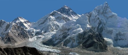 Arun Valley Trek is blessed with an incredible diversity of natural beauty and culture. Situated between the two highest mountains Everest and Makalu, it is really a superb area for nature lovers and botanical researchers. It is regarded as nature paradise as it holds many precious and rare plants, animals and birds.
Significant views of Mt.Everest, Makalu, and dozens of other mountains can be observed in this trek. Sherpas, Rais, Limbus, Tamangs, Newars, Magars, Gurungs, Brahmins and Chhetris are the main inhabitants of this region. They depend on agriculture farming, animal farming, cattle rearing and small business. Culturally, the Arun Trek is very interesting. We would be moving from Sherpa settlements to Rai villages, then down to Chhetri and Brahmin villages. We would lodge in traditional teahouses with traditional hospitality of the local people throughout Eastern Nepal. On can usually find helpful and generous people throughout the trek. They are ready to serve when in need.
Our trek can be finished at the Tumlingtar Airstrip, or further south at the road-head near Hille. The route can be strenuous at times of crossing three sizable passes up to 3350m. Trekking in places like this can be as much psychologically difficult as physically demanding. However, the trek is not difficult if taken at a sensible pace. As the region remains off the main tourist map, it is sparsely populated and free of pollution. The region lacks general development so the inhabitants retain certain innocence to the Western eye.
Best Season: Spring (September to December) autumn (March to May).
Trekking Grade: Moderate and farily streunous
Max Elevation: 5550m
Total trekking days: 18 Days
Day 01: Arrive Kathmandu 1338 m
Upon arrival in Kathmandu, meet & greet in the airport; transfer to Hotel. Overnight at Hotel in Kathmandu.
Day 02: Your full-day sightseeing includes visits to Bhaktapur Durbar Square, home of medieval art & architecture; Continue your tour to Kathmandu Durbar Square (Hanuman Dhoka), the old palace of the Royal Dynasty and hometown of living Goddess, Kumari. Final stop is at the Swayambhunath Stupa, the holiest shrine for the Buddhist and Hindus. Overnight at hotel in Kathmandu.
Day 03: Fly Kathmandu to Tumlingtar (400m) -30 to 35 minutes, & Trek to Chewabesi (450m) – 2 to 3 hours After scenic flight to Tumlingtar, we follow the Arun river bank towards north through the sub tropical forest around Chiwabasi crossing Brahman, Chettri and Rai villages.
Day 04: Trek Chewabesi to Gothe bazaar (800m) – 5 to 6 hours
After breakfast, we follow the upstream trail of Arun river towards north through the sub tropical forest around Baluwabesi, crossing Brahman, Chettri and Rai villages. Stay Overnight at local lodge.Gothe Bazzar either camp/ simple tea house. This area is popular for Rudrakchhhaya (Hindu’s holey brined).
Day 05: Trek Gothe bazaar to Dobhane (1800m) – 5 to 6 hours
The trail for today is through terrace land with rice paddies, Citrus fruits, Banana groves etc. sparsely populated by Rai and Sherpa people. We also can see Nepali paper production by local plants Lokta.
Day 06: Trek Dobhane to Salpa Phedi (3000m) – 5to 6 hours
The trail leads upwards, almost imperceptibly gaining in elevation, through the rice fields. Numerous bamboo bridges, flimsy and substantial – all picturesque – cross and re-cross the river and there are many pools large enough for swimming. From here an enjoyable day preparation for our further destination ups and downs to come. Set camp at Salpha Phadi.
Day 07: Trek Salpa Phedi to Gudel (2400m) via Salpa Pass (3350m) -6 to 7 hours
Ascend through bamboo then rhododendron, from the steamy Arun valley to the Salpa Bhanjyung Pass (3349m) where a large chorten marks the pass and the beginning of Sherpa influence. This is long descent to the Hongu Khola, through hemlock and fir forest that abounds with bird and animal life including Himalayan bear, barking deer and lesser panda.
Day 08: Trek Gudel to Gai Kharka (2450m) via Surkie La (pass) (3100m) -5½ to 6 hours
This is followed by an equally long, although steeper, ascent to Bung. This rice growing area is one of the most fertile regions of Nepal and is almost exclusively Rai, although you begin to find some Sherpa villages at higher elevations.
Day 09: Trek Gai Kharka to Kharte (2600m) via Pangmum La (pass) (3350m) – 6 to 7 hours
Day 10: Trek Kharte to Phakding (2600m) -5 to 6 hours
At first we start to walk through the bamboo bushes and climb down to Surke. Then the trail climbs to north to Chaurikharka a large scattered village with monastery and high school. It is known as the bread basket of the Khumbu area because the land is very fertile for barley, wheat and enough green vegetables. Today we can see many trekkers from Lukla and coming back from Everest Base Camp. From here the path makes quite busy with more trekkers, porters and pack animals and few hours of good scenic walk brings you at Phakding and stay overnight.
After breakfast, the trail ascents and descents continue across the Hinku Khola towards the Dudh Kosi, which leads north to the Kharte.
Day 10: Trek Kharte to Phakding (2600m) -5 to 6 hours
At first we start to walk through the bamboo bushes and climb down to Surke. Then the trail climbs to north to Chaurikharka a large scattered village with monastery and high school. It is known as the bread basket of the Khumbu area because the land is very fertile for barley, wheat and enough green vegetables. Today we can see many trekkers from Lukla and coming back from Everest Base Camp. From here the path makes quite busy with more trekkers, porters and pack animals and few hours of good scenic walk brings you at Phakding and stay overnight.
Day 11: Phakding trek to Namche Bazaar (3440m) 6hrs walk
Today, the trail we cross the Dudh Koshi river and climb gently the valley to Toktak (2760m) and Benkar (2710m) The trail keeps close to the river valley and is lined with beautiful blue pine and rhododendron forest that is very spectacular in the spring months, when the flowers are in bloom and also you will see the beautiful waterfall. We will see the snow-capped peak of Thamserku (6623m) & Khumbi La (5765m) at Benkar. We cross the Dudh Kosi River at Benkar. From here it is only a short walk to Monjo (2840m). Just beyond the Monjo trek enters the Sagarnatha (Everest) national park where you need to check your permits. After checking the permits the trail steep rocky descend to large farm aftermath cross bridge at Dudh Kosi and follow the west banks. Just short distance up the river is Jorsale (2830m). The trail follows the river for a while, then re-crosses the Dudh Koshi along the river bank and after short ups and downs, makes a steep climb near the confluence of the two rivers (Bhote Koshi & Dush Koshi) then little climb and re-crosses bridge at Dudh Koshi after that the trail follows steeply ascent towards the Namche Bazaar(3440m). One hour before arrive Namche Bazaar from where we may see the Mt. Everest (8848m), Lhotse (8516m) and Nuptse (7879m) first time in your life. Namache bazaar is gate way to khumbu. Namche is the main trading village in the Khumbu region and holds a busy Saturday market. There is set a meeting place for the Hindu traders from the lowlands and the Tibetan yak caravans that have reached there by crossing the glaciated Nangpa La pass. Overnight at local lodge.
Day 12: Acclimatization day at Namche Bazaar (3440m)
Acclimatization is most important before heading higher. Today you may excursion either Thame village or viewpoint. If you prefer to Thame it takes approximately 7/8 hours walking both way go and return to Namche. it is popular for visiting Thame monastery or simply just go to Viewpoint in the stand point of splendid view of the Himalayas including Mt. Everest (8848), Lhotse (8516m), Lhotse shar (8382m), Nuptse (7879m), peak- 38(7591m), Ama dablam (6856m), Thamserku (6623m), Kangtega
(6783m), Kusum kangaru (6367), Cholaste (6335m), Tabuche peak (6495m), Khumbi La (5765m) and Kwangde Ri (6011m) etc. Overnight at local lodge.
Day 13: Namche Bazaar trek to Tengboche (3867m) 5 hrs walk
Today the trail at first slightly climb up for a while up to the Chor camp at Namche Bazzar then continue easy level walk to kyangjuma 3550m. Along the way from chor camp at Namche bazaar to kyangjuma you may enjoy incredible view of Mt. Everest (8848), Lhotse (8516m), Lhotse shar (8382m), Nuptse (7879m), peak- 38(7591m), Ama dablam (6856m), Thamserku (6623m), Kangtega (6783m), Kusum kangaru (6367), Cholaste (6335m), Tabuche peak (6495m), Khumbi La (5765m) and Kwangde Ri (6011m). From kyangjuma the trail follows for a while easy level walk through Rhododendron forest to sanasa .There is two way from where one way left hand side leads to the Gokyo valley trek and another way right hand side leads to the direct Everest base camp trek. From sanasa the trail descends gradually through pine forest to lausasa where there are a few teahouses aftermath the trail drops steeply through the pine and Rhododendron forest to Phungi thanga, a small settlement on the river banks of the Dudh kosi at 3250m. The trail climbs steeply at beginning then a gradual ascent through blue pine and Rhododendron forest at the hill top of Tengboche Monastery at 3867m. The view of sunset and sunrise as well as magnificent view of the Mt. Everest including other Himalayas form Tengboche probably most amazing during your treks. Tengboche monastery is one of the beautiful monasteries in solu khumbu area as well as the religious center of the whole ‘Sherpa land ‘entire solu khumbu area. Overnight at local lodge.
Day 14: Tengboche trek to Dingboche (4410m) 6 Hours
From Tengboche the trail at first descent to Deboche (3820m) through a forest of birches, juniper, conifers and rhododendrons. There is a small settlement as well as monastery at Deboche. The level trail further ahead from Deboche to Imja khola passes many mani walls in a deep rhododendron forest. Along the way from Tengboche before crossing Imja khola you can often see the musk deer,
pheasant (national birds of Nepal) and blue sheep etc. After crossing the Imja khola the trail climbs past some magnificently carved mani stones to lower pangboche (3930m). Beyond pangboche the trail lead level and gradually up to Sansara (4010m) then level walk to orsho (4190m). There are two trails further ahead from orsho whereas one trail higher up left hand side leads to Pheriche and lower trail right hand side above Imja khola leads gradually ascend to Dingboche (4410m).during the day you can see amazing views of Mt. Everest (8848), Lhotse (8516m), Lhotse shar (8382m), Nuptse (7879m), peak- 38(7591m), Ama dablam (6856m), Thamserku (6623m), Kangtega (6783m), Kusum kangaru (6367), Cholaste (6335m) and Island (6189m) Overnight at local lodge.
Day 15: Dingboche trek to Lobuche (4910m) 5 Hours
From Dingbouche the trail follows through farmlands and meadows before continuing along the lateral moraine of the Khumbu Glacier then you will reach at Dughla (4620m) after that continues rocky steeply climb uphill to Dughla Pass (4830m) from whereas you can see the lots of stone memorials of climbers who have perished on nearby summits. You can see magnificent views including Mt. Ama dablam (6856m), Thamserku (6623m), Kangtega (6783m), Cholaste (6335m), Lobuche east (6090m), Pumori (7165m), Lingtren (6713m), Khumbutse (6639m)and Nuptse (7879m) etc. Beyond the Dughla Pass the trail gently climb up and drops a bit then continue level walk to Loboche (4910m). Overnight at local lodge.
Day 16 Lobuche trek to Gorak Shep (5140m) & Everest base camp (5364m) 7 to 8 hours
Today, the trail follows western side of khumbu valley ascends gently through meadows nearby the glacial moraine after that ascends and descends in the rocky path with some rounding the bands. Along the way you can enjoy incredible views of Pumori (7167m) Lingtren (6713m), Khumbutse (6639m), Nuptse (7879m), Lobuche east (6090m) as well as Khumbu glacier and icefall. After finishing several bands you will a bit descends to Gorak Shep (5140m). After reaching Gorak Shep
you may have your lunch and leave your bag pack at teahouse then start your journey to Everest base camp (5364m). You will spend about 4 and half hours trek up to Everest Base Camp and back to Gorak shep. The trek trail is on glacier and snow capped rocks. You can also see many small frozen lakes around the Everest Base Camp. There are several mountains including Pumori (7165m), Lingtren (6713m), Khumbutse (6639m), Nuptse (7879m) and Lhotse (8516m) but you can’t see the mount Everest (8848m) from Everest base camp although you will see it along the trail. The most impressive view from Everest base camp is the Khumbu icefall. After enjoying beautiful moment at the Everest base camp then return back to Gorak Shep. Overnight at local lodge.
Day 17: Gorak Shep Hike to Kala Pattar (5545m) then trek to Pheriche (4260m) 7 Hours
Today early in the morning from Gorak shep hike up to Kala patter for magnificent view of the numerous Himalaya as well as breathtaking view of sunrise. The trail from Gorak sheep to Kala patter at the beginning steep climb up approximately half an hour reach the flat land where have been attending Nepal government cabinet meeting regarding the issue of the global warming in 2009.it was first cabinet meeting in such a high place in the world. Aftermath the trail steep climb with lots of bends finally you reach at kala patter after that about 50 meters steeply with rocky climbing to summit the main Kala pattar (5545m). Today you may see excellent view of sunrise on the Mt. Everest (8848), Lhotse (8516m), Nuptse (7879m), Ama dablam (6856m), Thamserku (6623m), Kangtega (6783m), Kusum kangaru (6367), Cholaste (6335m), Tabuche peak(6495m) Lobuche peak (6090m) , Lingtren (6713m), Khumbutse (6639m), Lho La ,south col, changste as well as Everest base camp, Khumbu Icefall and few lake. Once you are at the kala pattar you may feel you are touching Mt. pumori and close-up view Mt. Everest. Finally the dream comes in true then will return back to Gorak shep have a breakfast continue trek heading down through Lobuche and Dughla. Little further from Dughla you will cross the river comes from Everest base camp and khumbu icefall then you will meet two trail where one way left hand side goes to Dingboche and lower one right hand side goes to Pheriche . From here easy walk in the valley to pheriche (4260m). Overnight at local lodge.
Day 18: Pheriche trek to Tengboche (3867m)
From Pheriche at first the trail leads level walk in the valley for a while then descent to Imja Khola and cross a bridge then ascend to the hill where is a few stone memorials of climbers. After that the trail leads slightly descends to Orhso continue level walk to Sansara then slightly descents and a bit ascend for a while then level walk to two way junction where one trail higher right hand side goes to Phortse village via upper Pangboche and another lower trail left hand side goes to Tengboche through lower Pangboche. Beyond pangboche the trail descends past some magnificently carved mani stones to the Imja Khola, which we cross via a steel suspension bridge high above the river at a spot where it rushes through a narrow cleft then to Debache and a short steep climb to Tengboche through a forest of birches conifers and rhododendrons. Finally you reach at Tengboche(3867m). You may enjoy the breathtaking view of sunset and sunrise as well as magnificent view of the Mt. Everest including other Himalayas from Tengboche. Tengboche monastery is one of the beautiful monasteries in solu khumbu area as well as the religious center of the whole ‘Sherpa land ‘entire solu khumbu area. Overnight at local lodge.
Day 19: Tengboche trek to Monjo (2835m) 07 hrs walk
Today we trek back along the Dudh Kosi River through a magnificent rhododendron forest and past brilliant waterfalls. Shortly before reaching Namche, the trek takes us through a pine forest, where musk deer often graze in the early morning. Arriving in town, we may see lowland porters, highland Sherpas, and Tibetan people and again you reach in Namche bazaar. After Namche the trail descend to Larja dobhan (confluence of two rivers) though the pine forests before you reach at Larja Dobhan you may get last opportunity to see Mt. Everest and Lhotse. After cross the bridge at Larja Dobhan the trail descends for while and then walk along the Dudh Koshi River. Re-cross the Dudh Koshi continue level walk to Jorsale. Beyond the Jorsale the trail leads a bit ascend after that re-crosses the suspension bridge then short steep climb to Monjo (2835m) Overnight at local lodge.
Day 20: Monjo trek to Lukla (2840m) 5 hrs walk
From Monjo the trail leads descends for a while and cross Dudh kosi over the suspension bridge then short easy level walk to Benkar. After Benker the trail follows a bit up and down and level walk along the Dush kosi valley then after re-crossing the suspension bridge you reach at Phakding (2610m). Beyond Phakding the trail follows a short descends continue level walk for a while then short steep climb up passes several Buddhist setups at Ghat village. Aftermath short steep climb up to Thado kosi and a bit descends re-cross the small bridge then climb up a short distance after that finally you re-crosses last long suspension bridge of your trek. The trail after the long suspension bridge follows the up wards route as far as Chablung, then turns off towards Lukla. The broad trail at Chablung leading uphill to the left hand side climbs steadily past a few (bhattis) local inn and houses. From there the trail follows through scrub forest above the school and houses of Chaurikharka village then final climb up of your trek about half and hour reach lukla Tamang tole where a new settlement with houses and Bhattis then short distance walk to approach to Hotel close by Lukla airport. Overnight at local lodge.
Day 21: Lukla flight to Kathmandu (1350m)
In the morning, we take the tiny aircraft to flight from Lukla to Kathmandu which is very interesting scenery flight journey on the earth. After arrival in Kathmandu airport we drive you to hotel. Overnight at local lodge.
Day 22: Depart Kathmandu
After breakfast, transfer to the Kathmandu airport (prior to three hours of your departure time) to board flight for your onward destination. Have a wonderful flight back home with the treasures of your nostalgic memories.
ANNAPURNA TREKKING REGION
This region of Nepal enjoy with splendid view close to highest and impressive mountain range in the world. The treks mostly start after the rest day at Pokhara. Generally highest point of whole Annapurna is 5416m. There are three main trek routes in the Annapurna region. Annapurna itself is most popularlar trekking paradise in the world, situated in the mid west of Nepal surrounded in the west by the Marshyangdi and Kali Gandaki rivers. The mountains are central of Nepal and subjugated by the Dhaulagiri, 8167m. and Annapurna, 8091 m Himalayas. Trekking in this region is the opportunity to discover throughout rhododendron Jungle over the foot hills of the Annapurna and Dhaulagiri and throughout the deepest village, the Kali Gandaki valley. The major Himalayan range run south of the boundary with Tibet means that the northern part of the area are in the rain shade and are significantly drier than the south slope of the Himalaya which lead to extraordinarily varied scenery. Thorangla la is situated in Buddhist Monastery, an eternal flame, and Hindus Vishnu Tempe of Juwala Mai making it a pilgrimage site for both Hindus and Buddhists and Muktinath, another pilgrimages site of Hinduism, is on the way down, where all will be fascinated by incredible view in Annapurna region. Whenever possible we try to arrive at destination by mid-afternoon, giving us plenty of time for exploring the local villages, enjoying the hot springs at the Tatopani and to watch magnificient sunset over the Himalayas. We wouldn’t miss to hike to Poon Hill for spectacular views of Dhaulagiri, Fishtail, Nilgiri and the Annapurna Himalaya range.
RNK 10 GHANDRUK TREK (8 Nights/9 Days)
Best Season: Spring (September to December) autumn (March to May).
Trekking Grade: Easy
RNK 11 PANCHASE HILL TREKKING (09 Nights / 10 Days)
Best Season: Spring (September to December) autumn (March to May).
Trekking Grade: Easy
RNK 12 THE ROYAL TREK (08 Nights / 09 Days)
Best Season: Spring (September to December) autumn (March to May).
Trekking Grade: Easy
RNK 13 GHOREPANI POONHILL TREK (10 Nights / 11 Days)
Best Season: Spring (September to December) autumn (March to May).
Trekking Grade: Easy and fairlyMedium
RNK 14 THE SIKLES TREKKING (11 Nights / 12 Days)
Best Season: Spring (September to December) autumn (March to May). Trekking Grade: Easy and fairly moderate
RNK 15 JOMSOM MUKTINATH TREK (14 Nights / 15 Days)
Best Season: Spring (September to December) autumn (March to May).
Trekking Grade: Easy and fairly moderate
RNK 16 ANNAPURNA DHAULAGIRI TREK (14 Nights / 15 Days)
Best Season: Spring (September to December) autumn (March to May).
Trekking Grade: Moderate
RNK 17 ANNAPURNA SANCTUARY TREK (14 Nights / 15 Days)
Best Season: Spring (September to December) autumn (March to May).
Trekking Grade: Moderate
RNK 18 TILICHO PASS TREKKING (15 Nights / 16 Days)
Best Season: Spring (September to December) autumn (March to May).
Trekking Grade: Strenuous
RNK 19 ANNAPURNA BASE CAMP TREKKING (16 Nights / 17 Days)
Best Season: Spring (September to December) autumn (March to May).
Trekking Grade: Moderate
RNK 20 ANNAPURNA CIRCUIT TREK (22 Nights/23 Days)
Best Season: Spring (September to December) autumn (March to May).
Trekking Grade: Moderate and fairly strenuous
RNK 10 GHANDRUK TREK (8 Nights/9 Days)
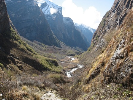 Ghandruk Trek is a short trek that takes you to the Gurung Village, a huge Gurung village at 1940 meters is the second largest Gurung village in Nepal and is a confusing cluster of closely-spaced, slate-roofed houses. There are neatly terraced fields situated both above and below the town. It is wonderfully easy to get lost in the network of narrow alleyways while trying to trek through the village. There is a larger handicraft factory at the top of Ghandruk. The views of Annapurna South from here are magnificient. Machapuchere, from here in its fish tail aspect, peeps over a forested ridge. Clanging bells announce the brightly coloured mule and yak caravans that regularly use the well-trodden paths on their way to and from Tibet. We climb with them through oak and rhododendron forest and across sparkling streams to Ghorepani Pass. Descending through giant primary rhododendron forest, troops of monkeys and exotic birds set a vivid and colourful scene.
Best Season: Spring (September to December) autumn (March to May).
Trekking Grade: Easy
Max Elevation: 3200m
Total trekking days: 05 Days
Day 01: Arrive Kathmandu (1,350m)
Upon arrival in Kathmandu, meet & greet in the airport; transfer to Hotel. Overnight at Hotel in Kathmandu.
Day 02: Drive/Flight (30 Min.) - Kathmandu to Pokhara (950m/200 kms) - 6 to 7 hours.
Early in the morning you will departs for Pokhara in private transport with our trekking guide which is a nostalgic scenic journey itself. Along the journey you will witness some stunning scenery of snow capped Mountains, green hills, rivers for rafting, and villages. Pokhara is a beautiful tourist hub, with panoramic views of Annapurna, Machapuchare (shape of fish tail), Dhaulagiri in the west, Lamjung Himal and Manaslu in the east. The town of Pokhara is set on the banks of the Phewa Lake. It is smaller and much less hectic than Kathmandu providing the perfect starting point for one’s trek. You will be introduced with rest of the trekking assistances. Overnight at hotel in Pokhara.
Day 03: Transfer from Pokhara to Nayapul (about 2 hours) & commence trek to Tikedhunga (1,540m) – 4 to 5 hours walk.
This morning we will drive for about 45 Km. This drive offers you the best view of Annapurna Himalayan range with terraced landscapes and villages and then descends to the Nayapul. From there our trek begins in this warm sub tropical region. The walk follows the Modi River upstream to Birethanti & follows the east bank of Bhurungdi Khola with magnificent scenery of waterfalls, high green forest and follows the picturesque trails and finally reaches to Tikhedhunga. Lunch will be eaten en route. Walking distance is four hours and we will stay overnight at local lodge in Tikhedhunga where you can enjoy the cool splash of the cascading waterfalls. Overnight at local lodge.
Day 04: Tikhe Dhunga trek to Ghorepani (2775m) – 4 to 5 hours walk.
From Tikhedhunga the trail ascend to Ulleri village through a stone staircase. Ulleri is a large Magar villages situate at 2070m. From Ulleri the trail gently climb through pasture and cultivated fields as you climb up you walk up besides the cascading river through refreshingly cool oak and rhododendron forest. We will have a lunch en route. The trail again ascent to Ghorepani. The place provides a majestic views of Dhaulagiri I (8167m), Tukuche Peak Nilgiri (6940m), Annapurna South, Annapurna I (8091m), Hiunchuli (6441m) and Tarke Kang (7193m) and other mountains. Overnight at local lodge.
Day 05: Early morning ascent of Poon Hill (3,210m), then descend for breakfast. Trek onto Tadapani (2,640m) – 6 hours walk.
Today your guide will wake you early in the morning for a 40 minute hike up to Poonhill with the help of flash-light or moon light offering morning glimpse of stars and walking through the Rhododendron forest.
Poonhill is named after the hill tribe Pun, inhabitants of Ghorepani and the surrounding area. It is also an ideal spot for the most panoramic scenery from the far western Himalaya of Dolpo, Mt. Dhaulagiri, Annapurna including Mt. Machhapuchare (Fish Tail) Manaslu all the way to Ganesh Himalayan range. Nearly 600 km range of mountains can be seen from this great spot with the spectacular sunrise on the mid western Himalaya range. After an unforgettable time here return back to Ghorepani for breakfast and continue trek to Tadapani, the walk passes through the Rhododendron, Pine, fur & bamboo forest with few short up and downs and finally you reach Tadapani. This is a wonderful place with close views of the Annapurna and Fishtail mountains, situated in the midst of the rain and alpine mixed forest. This takes around six hours walking up & down with a lunch break en route. Overnight at local lodge.
Day 06: Tadapani trek to Ghandruk (1940m): – 3 hours walk. Optional afternoon excursions.
Today trekking trails steeply goes through forests where you can encounter with monkeys and different birds. Ghandruk is the second largest Gurung village in Nepal and explores the maze like streets of this thriving Gurung settlement you can have a good mountain view of Annapurna south and Fishtail. Overnight at local lodge.
Day 07: Ghandruk Trek to Birethanti (1065m) – Nayapul approximately 4 hour trek and drive 2 hours to Pokhara:
Today the trail gradually decline down to the valley, passes through small hamlets, terraced rice fields and subtropical forests with giving the glimpse of mountains. At the last part we will mostly follow the Modi khola valley with an easy and pleasant walk along the river bank to Birethanti, continues walk to Nayapul. Our vehicle will be waiting for us to drive to Pokhara for next 2 hours. Overnight at hotel in Pokhara.
Day 08: Pokhara to Kathmandu
After breakfast drive back to Kathmandu through the road passing terraces, streams, rivers, local settlements, high hills and along the river side for about 7 hours.
Rest day at leisure. Overnight at hotel in Kathmandu.
Day 09: Depart Kathmandu
After breakfast, transfer to the Kathmandu airport (prior to three hours of your departure time) to board flight for your onward destination.
Have a wonderful flight back home with the treasures of your nostalgic memories.
OPTION 2 Ghandruk Trek (07 Nights/08 Days)
Day 01: Arrive Kathmandu (1338 m)
Upon arrival in Kathmandu, meet & greet in the airport; transfer to Hotel. Overnight at Hotel in Kathmandu.
Day 02: Drive/Flight (30 Min.) - Kathmandu to Pokhara (950m/200 kms) - 6 to 7 hours.
Early in the morning you will departs for Pokhara in private transport with our trekking guide which is a nostalgic scenic journey itself. Along the journey you will witness some stunning scenery of snow capped Mountains, green hills, rivers for rafting, and villages. Pokhara is a beautiful tourist hub, with panoramic views of Annapurna, Machapuchare (shape of fish tail), Dhaulagiri in the west, Lamjung Himal and Manaslu in the east. The town of Pokhara is set on the banks of the Phewa Lake. It is smaller and much less hectic than Kathmandu providing the perfect starting point for one’s trek. You will be introduced with rest of the trekking assistances. Overnight at hotel in Pokhara.
Day 03: Pokhara/Damphus. (40 Minutes drive and 1.5 hours of walk.)
Leave Pokhara and travel by road to Phedi, 40 minutes away. From here, the trail ascends steeply through forest and later through paddy fields to the village of Damphus. Overnight at local lodges/tea houses.
Day 04: Dhamphus/Landrung.
(5100 feet and 5/6 hours walking) Today the trail goes along the ridge to Deurali. Descend through forest again for some time to the small villages of Tolka and Beri Kharka. The trail then descends through scattered forests and villages to reach Landrung. Overnight at local lodges/tea houses.
Day 05: Landrung/Ghandrung. (6400 feet and 3 to 4 hours walking) The trail goes steeply down towards the river for an hour then there is a steep ascent for about 2-3 hours through scattered villages with beautiful views of the Himalayas. Eventually, reach Ghandrung, one of the largest Gurung settlements in Western Nepal. You can have good views of Gangapura, Machapuchhre (Fishtail), Mount Annapurna and other snow-capped mountains. Overnight at local lodges/tea houses.
Day 06: Ghandruk Trek to Birethanti (1065m) – Nayapul approximately 4 hour trek and drive 2 hours to Pokhara: Today the trail gradually decline down to the valley, passes through small hamlets, terraced rice fields and subtropical forests with giving the glimpse of mountains. At the last part we will mostly follow the Modi khola valley with an easy and pleasant walk along the river bank to Birethanti, continues walk to Nayapul. Our vehicle will be waiting for us to drive to Pokhara for next 2 hours. Overnight at hotel in Pokhara.
Day 07: After breakfast, half day sightseeing around Pokhara valley. Refreshments at your hotel and then drive back to Kathmandu through the scenic journey again of terraces, streams, rivers, local settlements, high hills for about 7 hours. Overnight at hotel in Kathmandu.
Day 08: Depart Kathmandu After breakfast, transfer to the Kathmandu airport (prior to three hours of your departure time) to board flight for your onward destination. Have a wonderful flight back home with the treasures of your nostalgic memories.
RNK 11 PANCHASE HILL TREKKING (09 Nights / 10 Days)
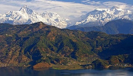 Panchase Hill trek is a panoramic short trek for magnificient mountain views. The trail includes some larger Gurung villages as well as rhododendron flower forest with majestic Mountain View. Panchase route is abundant with array of bird and wildlife, excellent views from the more frequented trails and wealth of culture, From Panchase you will see the great Himalayan peaks of Macchapuchare, Dhaulagiri, Annapurna, Lamjung and Manaslu. The terrain varies from subtropical valleys of banana trees and rice paddies to high ridges covered in rhododendron forest. Along the way you will see many ethnic mixes, such as Brahmin, Magar and Gurung. This trek is off the beaten path so it is unlikely to meet other trekkers. Panchase trek is easy trekking suitable for all ages and fitness levels.
Best Season: Spring (September to December) autumn (March to May).
Trekking Grade: Easy
Max Elevation: 2000m
Total trekking days: 05 Days
Day 01: Arrive Kathmandu (1338 m)
Upon arrival in Kathmandu, meet & greet in the airport; transfer to Hotel. Overnight at Hotel in Kathmandu.
Day 02: Your full-day sightseeing includes visits to Bhaktapur Durbar Square, home of medieval art & architecture; Continue your tour to Kathmandu Durbar Square (Hanuman Dhoka), the old palace of the Royal Dynasty and hometown of living Goddess, Kumari. Final stop is at the Swayambhunath Stupa, the holiest shrine for the Buddhist and Hindus. Overnight at hotel in Kathmandu.
Day 03: Drive/Flight (30 Min.) - Kathmandu to Pokhara (950m/200 kms) - 6 to 7 hours. Early in the morning you will departs for Pokhara in private transport with our trekking guide which is a nostalgic scenic journey itself. Along the journey you will witness some stunning scenery of snow capped Mountains, green hills, rivers for rafting, and villages. Pokhara is a beautiful tourist hub, with panoramic views of Annapurna, Machapuchare (shape of fish tail), Dhaulagiri in the west, Lamjung Himal and Manaslu in the east. The town of Pokhara is set on the banks of the Phewa Lake. It is smaller and much less hectic than Kathmandu providing the perfect starting point for one’s trek. You will be introduced with rest of the trekking assistances. Overnight at hotel in Pokhara.
Day 04: Drive Pokhara to Thado Khola -30 Minutes, and trek Thado Khola to Bhumdi (1600m) -3 to 4 hours After breakfast, we start our journey driving for 30 minutes in the morning to Thado Khola through the way of David Falls. Your trekking crew will arrange all our trekking gears in Thado Khola. The trail ascends towards Bhumdi village, which takes about 3 hours. We stay overnight in traditional Bhumdi Gurung village under the beautiful views of Ganesh Himal, Himalchuli, Manaslu, Annapurna range and Fishtail Mountain touching skyline. Overnight at local lodges/tea houses.
Day 05: Trek Bhumdi to Panchase Bhanjang (2000m) -5 to 6 hours
The trail ascends westward through bushes forest for an hour and if the weather allows us see the entire mountains vista to the north. It will be and pleasant day for those who are interested on birds. After 3 hours walking, we take the lunch en route. Proceed for a gentle trail for two hours through the forest again. Finally, the trail ascends to Bhanjyang for one and half with more incomparable mountains vista, Pokhara valley and Phewa Lake. Overnight at local lodges/tea houses.
Day 06: Trek Panchase to Bhadaure (1700m) -4 to 5 hours
After breakfast, the trail goes to through the beautiful forest to the highest view point Panchase Ridge at 2500m, offering view of Pokhara and the Kusma Valley. All the Annapurna range and the giant peak of Dhaulagari are remarkable for the picture. Then desend through pastures and scattered forest to Bhadaure. Overnight at local lodges/tea houses.
Day 07: Trek Bhadure to Dhampus (1580) via Kade
We can finish our journey at Naudanda or trek via Naudada to uphill of Kade and descend to Dhampus; unique cultural Gurung village with astonishing mountains scereny of Annapurna, Fishtail. The sun rise and sun set is awesome for anyone. Overnight at local lodges/tea houses.
Days 08: Ghandrung/Pothana. (1900m./5600 feet and 5 to 6 hours walking)
We decent down following stone staircase to Kimbu (Bee hive) that is located at the elevation of 1315 meters on the bank of Modi Khola and start climb up to Landruk village (1545m) a pretty big village inhabited by mixed community of Gurung, Magar and Brahmin as well. The trail ascends gently for early two hours and again ascends steeply for an hour to Deurali (2100m.) passing through Tolkha (1700m.) and Bherikharka. You can enjoy the magnificient views of various mountain peaks of Dhaulagiri I (8167m.), Annapurna South (7219m.), Hiunchuli (6441m.), Fishtail (6997m.), Annapurna III (7755m.), Annapurna IV (7525m.), Annapurna II (7937m.) and Lamjung Himal (6930m.). Now the trail gradually descends to Pothana passing through different oak forests. Pothana is a small town resided by Gurung, an ethnic community of Nepal. Overnight at hotel in Pokhara.
Day 09: After breakfast drive back to Kathmandu through the road passing terraces, streams, rivers, local settlements, high hills and along the river side for about 7 hours. Rest day at leisure. Overnight at hotel in Kathmandu.
Day 10: Depart from Kathmandu
After breakfast, transfer to the Kathmandu airport (prior to three hours of your departure time) to board flight for your onward destination.
Have a wonderful flight back home with the treasures of your nostalgic memories.
RNK 12 THE ROYAL TREK (08 Nights / 09 Days)
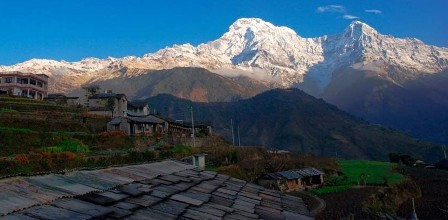 Royal Trek is one of the effortless trekking in Nepal but there are no tea house facilities. It’s an exceptional trek to do as it doesn't require any regularly long walk days and there is constantly abundance time to see what Prince Charles, the Prince from Wales had saw in 1980 and hence the name remain same. This is most excellent trekking for those who desire to skill local Nepalese village life and outstanding Himalaya views in a comparatively short period. Royal trekking generally covers extremely normal altitude about 1500m but offers exciting panoramic views of snow in Annapurna Himalaya peaks. Those who have diverse option and looking for the real natural knowledge about mountain views with royal trekking is extremely suggested for short hiking tour in Nepalese countryside. Walk alongside the nonviolent farmer terraced hills and you will see multicolored flora and fauna, gorgeous scenery, good mountain views of Annapurna and Fishtail.
Best Season: Spring (September to December) autumn (March to May).
Trekking Grade: Easy
Max Elevation: 1550m
Total trekking days: 04 Days
Day 01: Arrive Kathmandu (1338 m)
Upon arrival in Kathmandu, meet & greet in the airport; transfer to Hotel. Overnight at Hotel in Kathmandu.
Day 02: Your full-day sightseeing includes visits to Bhaktapur Durbar Square, home of medieval art & architecture; Continue your tour to Kathmandu Durbar Square (Hanuman Dhoka), the old palace of the Royal Dynasty and hometown of living Goddess, Kumari. Final stop is at the Swayambhunath Stupa, the holiest shrine for the Buddhist and Hindus. Overnight at hotel in Kathmandu.
Day 03: Drive/Flight (30 Min.) - Kathmandu to Pokhara (950m/200 kms) - 6 to 7 hours. Early in the morning you will departs for Pokhara in private transport with our trekking guide which is a nostalgic scenic journey itself. Along the journey you will witness some stunning scenery of snow capped Mountains, green hills, rivers for rafting, and villages. Pokhara is a beautiful tourist hub, with panoramic views of Annapurna, Machapuchare (shape of fish tail), Dhaulagiri in the west, Lamjung Himal and Manaslu in the east. The town of Pokhara is set on the banks of the Phewa Lake. It is smaller and much less hectic than Kathmandu providing the perfect starting point for one’s trek. You will be introduced with rest of the trekking assistances. Overnight at hotel in Pokhara.
Day 04: Drive Pokhara to bijayapur -30 minutes, and Trek to Kalikasthan (1370m) -3 to 4 hours Our journey starts in the morning, 30 minutes drive that takes you to the Bijayapur Khola and then walks for about an hour through flat paddy fields and cross the river trek uphill for about 2/3 hours through Braminh and Chettri villages to Kalikasthan, the Skyline camp will be set up around Kalikasthan area. Rest of the day, we explore the surrounding areas and stay overnight at camp.
Day 05: Trek Kalikasthan to Syaklung (1,730m) -3 to 4 hours After breakfast the trail leads us along the rhododendron forested ridge top through Thulokot to Mati Thana, where there are a few tea shop, there is a short climb, offers mountain with good views of Annapurna and Lamjung Himal. Then the trek reached Naudanda (not to be confuse with the Naudanda west of Pokhara) continue along the ridge to a school at Lipini village, there we make a steep but short climb through forest to the Gurung village of Syaklung at 1730 meters and stay overnight overnight at camp.
Day 06: Trek Syaklung to Chisapani (1550m) - 4 to 5 hours Today the trail steeply drops through the Gurung village, rhododendron and Sal forest south side of the hill to a large tree, a Chautaara (Resting Place) with several tea shops and a police check post. The junction trail leads from here west to Begnas Tal and east to the Madi Khola. The Royal Trek route climbs Chisopani winding around back of the hill to the village. A short distance above Chisopani village is a high knoll where there is a small temple. The camp offers the Himalayan Panoramic splendid views of Dhaulagiri and Annapurna range. Stay overnight at overnight at camp.
Day 07: Trek Chisapani to Begnas Lake – 1 hours, and Drive to Pokhara (950m) – 1 hour.
The trail descends along the field for an hour or so, and goes steeply on the stone step into a small valley near Rupa Tal and climb about 200 meters to arrive at Sundare Danda. Continue for a short distance through the rice field and Walk 15 minutes down to Begnas Tal. Drive back to Pokhara for about an hour. Overnight at lodge/hotel in Pokhara.
Day 08: Pokhara to Kathmandu After breakfast drive back to Kathmandu through the road passing terraces, streams, rivers, local settlements, high hills and along the river side for about 7 hours. Rest day at leisure. Overnight at hotel in Kathmandu.
Day 09: Depart from Kathmandu
After breakfast, transfer to the Kathmandu airport (prior to three hours of your departure time) to board flight for your onward destination.
Have a wonderful flight back home with the treasures of your nostalgic memories
RNK 13 GHOREPANI POONHILL TREK (10 Nights / 11 Days)
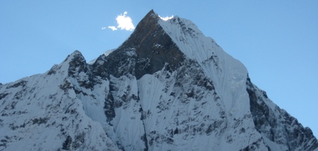 Ghorepani trek with viewpoint on Poon Hill gifts all the best of trekking in Nepal. Enjoy trekking in the amazing mountain view through charming villages settled by Gurungs, Magars dense rhododendron forests full of birds and deep sub tropical valleys, all set below the Annapurna area with the charming peak of Fishtail dominating the skyline. Very few places in Earth can brings the mountain so close as this trekking route does! At the climax, you will hike Poon Hill at dawn to enjoy one of the most spectacular mountain ranges on Earth. None can briefed about his experiences when the sun touches the snow capped summits the Himalayan giants, Dhaulagiri (8167m.) and Annapurna (8091m.) along with a maze of other peaks. The lover of nature and hunger of magnificient landscape must go through this route! Rhododendron flower, the national flower of Nepal, is abundant found during this trek and you feel like you are in different part of the world when gorgeous mountain landscape, immaculate forests, multiplicity of flora and fauna and warm family atmosphere from local communities of simple people of Magar, Gurung and Magar heartily welcomes you.
Best Season: Spring (September to December) autumn (March to May).
Trekking Grade: Easy and fairlyMedium
Max Elevation: 3210m
Total trekking days: 06 Days
Day 01: Arrive Kathmandu (1338 m)
Upon arrival in Kathmandu, meet & greet in the airport; transfer to Hotel. Overnight at Hotel in Kathmandu.
Day 02: Your full-day sightseeing includes visits to Bhaktapur Durbar Square, home of medieval art & architecture; Continue your tour to Kathmandu Durbar Square (Hanuman Dhoka), the old palace of the Royal Dynasty and hometown of living Goddess, Kumari. Final stop is at the Swayambhunath Stupa, the holiest shrine for the Buddhist and Hindus. Overnight at hotel in Kathmandu.
Day 03: Drive/Flight (30 Min.) - Kathmandu to Pokhara (950m/200 kms) - 6 to 7 hours. Early in the morning you will departs for Pokhara in private transport with our trekking guide which is a nostalgic scenic journey itself. Along the journey you will witness some stunning scenery of snow capped Mountains, green hills, rivers for rafting, and villages. Pokhara is a beautiful tourist hub, with panoramic views of Annapurna, Machapuchare (shape of fish tail), Dhaulagiri in the west, Lamjung Himal and Manaslu in the east. The town of Pokhara is set on the banks of the Phewa Lake. It is smaller and much less hectic than Kathmandu providing the perfect starting point for one’s trek. You will be introduced with rest of the trekking assistances. Overnight at hotel in Pokhara.
Day 04: Transfer from Pokhara to Naya Pul (about 2 hours) & commence trek to Tikedhunga (1,540m) – 4 to 5 hours walk. This morning we will drive for about 45 Km. This drive offers you the best view of Annapurna Himalayan range with terraced landscapes and villages and then descends to the Nayapul. From there our trek begins in this warm sub tropical region. The walk follows the Modi River upstream to Birethanti & follows the east bank of Bhurungdi Khola with magnificent scenery of waterfalls, high green forest and follows the picturesque trails and finally reaches to Tikhedhunga. Lunch will be eaten en route. Walking distance is four hours and we will stay overnight at local lodge in Tikhedhunga where you can enjoy the cool splash of the cascading waterfalls. Overnight at local lodge.
Day 05: Tikhe Dhunga trek to Ghorepani (2775m) – 4 to 5 hours walk.
From Tikhedhunga the trail ascend to Ulleri village through a stone staircase. Ulleri is a large Magar villages situate at 2070m. From Ulleri the trail gently climb through pasture and cultivated fields as you climb up you walk up besides the cascading river through refreshingly cool oak and rhododendron forest. We will have a lunch en route. The trail again ascent to Ghorepani. The place provides a majestic views of Dhaulagiri I (8167m), Tukuche Peak Nilgiri (6940m), Annapurna South, Annapurna I (8091m), Hiunchuli (6441m) and Tarke Kang (7193m) and other mountains. Overnight at local lodge.
Day 06: Early morning ascent of Poon Hill (3,210m), then descend for breakfast. Trek onto Tadapani (2,640m) – 6 hours walk. Today your guide will wake you early in the morning for a 40 minute hike up to Poonhill with the help of flash-light or moon light offering morning glimpse of stars and walking through the Rhododendron forest. Poonhill is named after the hill tribe Pun, inhabitants of Ghorepani and the surrounding area. It is also an ideal spot for the most panoramic scenery from the far western Himalaya of Dolpo, Mt. Dhaulagiri, Annapurna including Mt. Machhapuchare (Fish Tail) Manaslu all the way to Ganesh Himalayan range. Nearly 600 km range of mountains can be seen from this great spot with the spectacular sunrise on the mid western Himalaya range. After an unforgettable time here return back to Ghorepani for breakfast and continue trek to Tadapani, the walk passes through the Rhododendron, Pine, fur & bamboo forest with few short up and downs and finally you reach Tadapani. This is a wonderful place with close views of the Annapurna and Fishtail mountains, situated in the midst of the rain and alpine mixed forest. This takes around six hours walking up & down with a lunch break en route. Overnight at local lodge.
Day 07: Tadapani trek to Ghandruk (1940m): – 3 hours walk. Optional afternoon excursions.
Today trekking trails steeply goes through forests where you can encounter with monkeys and different birds. Ghandruk is the second largest Gurung village in Nepal and explores the maze like streets of this thriving Gurung settlement you can have a good mountain view of Annapurna south and Fishtail. Overnight at local lodge.
Day 08: Ghandrung/Pothana. (1900m./5600 feet and 5 to 6 hours walking)
We decent down following stone staircase to Kimbu (Bee hive). Kimbu or Bee hive is located at the elevation of 1315 meters on the bank of Modi Khola and start climb up to Landruk village (1545m) a pretty big village inhabited by mixed community of Gurung, Magar and Brahmin as well. The trail ascends gently for early two hours and again ascends steeply for an hour to Deurali (2100m.) passing through Tolkha (1700m.) and Bherikharka. You can enjoy the splendid views of various mountain peaks of Dhaulagiri I (8167m.), Annapurna South (7219m.), Hiunchuli (6441m.), Fishtail (6997m.), Annapurna III (7755m.), Annapurna IV (7525m.), Annapurna II (7937m.) and Lamjung Himal (6930m.). Now the trail gradually descends to Pothana passing through different oak forests. Pothana is a small town resided by Gurung, an ethnic community of Nepal. From here too, you can. Overnight at local lodges/tea houses.
Day 09: Pothana/Dhampus /Phedi/Pokhara.
After breakfast a one hour walk to Damphus, then an easy one and half hours walk along the ridge passing villages and paddy fields to Phedi. From here, you will drive for 45 minutes hour back to Pokhara. Overnight at hotel in Pokhara.
Day 10: Pokhara to Kathmandu
After breakfast drive back to Kathmandu through the road passing terraces, streams, rivers, local settlements, high hills and along the river side for about 7 hours.Rest day at leisure. Overnight at hotel in Kathmandu.
Day 11: Depart from Kathmandu
After breakfast, transfer to the Kathmandu airport (prior to three hours of your departure time) to board flight for your onward destination.
Have a wonderful flight back home with the treasures of your nostalgic memories.
RNK 14 THE SIKLES TREKKING (11 Nights / 12 Days)
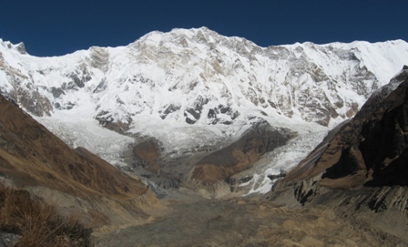 The Gurung village of Sikles has been established by the ACA project as a model trekking village and is an internal part of their eco-route. It is located to the north east of Pokhara, at about 2000 meters elevation, in the shadow of Annapurna II and Lamjung Himal. It is a large village, possibly the second largest Gurung village in Nepal, and is a well-preserved example of traditional Gurung culture. While here, the trekker can easily spend several days experiencing local life-style, handicraft production and sight-seeing. Of particular interest are the local cloth weaving and the ancient water driven flourmills.
Above the village is Rishing Danda, from where a marvelous panoramic view of the peaks of Annapurna II and Lamjung can be seen. This place is also famous as a point from which to see avalanches thundering down off the mountain sides. Folk songs and dances are an important part of Gurung life and cultural performances are common occurrences in Sikles. Of particular interest here is the Ghantu dance, traditionally performed by three young girls.
Best Season: Spring (September to December) autumn (March to May).
Trekking Grade: Easy and fairly moderate
Max Elevation: 2000m
Total trekking days: 07 Days
Day 01: Arrive Kathmandu (1338 m)
Upon arrival in Kathmandu, meet & greet in the airport; transfer to Hotel. Overnight at Hotel in Kathmandu.
Day 02: Your full-day sightseeing includes visits to Bhaktapur Durbar Square, home of medieval art & architecture; Continue your tour to Kathmandu Durbar Square (Hanuman Dhoka), the old palace of the Royal Dynasty and hometown of living Goddess, Kumari. Final stop is at the Swayambhunath Stupa, the holiest shrine for the Buddhist and Hindus. Overnight at hotel in Kathmandu.
Day 03: Drive/Flight (30 Min.) - Kathmandu to Pokhara (950m/200 kms) - 6 to 7 hours. Early in the morning you will departs for Pokhara in private transport with our trekking guide which is a nostalgic scenic journey itself. Along the journey you will witness some stunning scenery of snow capped Mountains, green hills, rivers for rafting, and villages. Pokhara is a beautiful tourist hub, with panoramic views of Annapurna, Machapuchare (shape of fish tail), Dhaulagiri in the west, Lamjung Himal and Manaslu in the east. The town of Pokhara is set on the banks of the Phewa Lake. It is smaller and much less hectic than Kathmandu providing the perfect starting point for one’s trek. You will be introduced with rest of the trekking assistances. Overnight at hotel in Pokhara.
Day 04: Drive Pokhara to Mardipul - hours and Trek Mardipul to Kharpani (1370m) -4 to 5 hours Today is first day of our journey, after breakfast we drive to Mardipul and start the trek to Karpani. We follow a less frequented path in the direction of Ghachok passing through the settlement of Lhachock (975m) then through village fields to descend gently through a natural rock tunnel to reach our campsite at Karpani. Overnight at local lodges/tea houses.
Day 05: Trek Kharpani to Ghale Kharka (1669m) -4 to 5 hours The trail leads us along the west bank of the Seti Khola (river) and through several scattered small Gurung settlements, paved with large stones path and several of the ascents are stepped in the same way. Then we cross the Sardi Khola and make a steep ascent to our campsite on a ridge high above the river with wonderful views of Annapurna South (7219m), Hiunchuli (6336m) and Machhapuchare (6999m). Overnight at local lodges/tea houses.
Day 06: Trek Ghale Kharka to Sikles /Parche (1760m) -6 to 7 hours After breakfast, we start with a steep ascent from the campsite through oak and rhododendron forest toward the ridge which separates the Seti and Madi Kholas. In spring the forest is full of Primula, orchids and rhododendrons charming. We come to an open meadow with fabulous views of Machhapuchare, and then continue up to the top of the ridge (2621m). We make a short descent to reach an open meadow used by the local people as a buffalo pastures (2400m). Then, again the trail follows descent through the forest, emerging into open grassy meadows above Sikklis (2000m). Overnight at local lodges/tea houses.
Day 07: Excursion around Sikles Gurung Village (2000m)
Today, you have great opportunity to make an optional excursion north from Sikklis along a ridge with stunning views of Lamjung Himal and the Annapurnas range. Overnight at local lodges/tea houses.
Day 08: Trek Sikkles to Laamokhet (920m) -4 to 5 hours
After hot breakfast with stunting mountains panorama, we steep descent from our campsite above Sikkles through the small settlement of Khitang down to the Madi Khola. Then we walk more gradual along the west bank of the river with great opportunities for bird watching – watch out for kingfishers, blue throated beaters and white capped river chats. After long steep descent trek we get in Laamokhet for staying overnight at local lodges/tea houses.
Day 09: Trek Laamokhet to Kalikasthan (1080m) -5 to 6 hours
From Laamokhet, easy walking brings us gradually down the west bank of the river through forest and fields terrace with settlement. Then the trail ascends steeply through the forest and gradually continues to Kalikastan (1150m). We stop in the village before continuing along a broad trail and ascending to the top of an open grassy ridge with panoramic views of the Annapurna range, Dhaulagiri, Lamjung and Manaslu Himal in the east and Begnas and Rupa lakes are below the ridge to the south. Overnight at local lodges/tea houses.
Day 10: Trek Kalikasthan to Beganas Tal -3 to 4 hours, and Drive to Pokhara (950m) -30 minutes
In the morning the trail retrace from the camp to the top of the ridge to watch sunrise over the mountains and then return to the campsite for breakfast. Then descend quite steeply from the ridge to the major trail junction take the trail to the east. The last day trekking of our journey, goes through the rice terrace and mixed ethnic group inhabitance with breathtaking mountains panoramic vista. After an hour drive from Bagnas Tal we get in hotel in Pokhara
Day 11: After breakfast drive back to Kathmandu.through the road passing terraces, streams, rivers, local settlements, high hills and along the river side for about 7 hours. Rest day at leisure. Overnight at hotel in Kathmandu.
Day 12: Depart from Kathmandu
After breakfast, transfer to the Kathmandu airport (prior to three hours of your departure time) to board flight for your onward destination.
Have a wonderful flight back home with the treasures of your nostalgic memories.
RNK 15 JOMSOM MUKTINATH TREK (14 Nights / 15 Days)
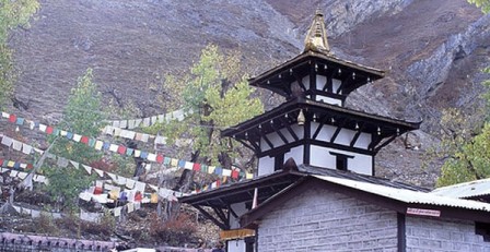 Jomsom Muktinath trek through the Kali Gandaki Valley, passing through the deepest gorge in the world the trek finally emerges into wide valley of Jomsom, Himalayan Shangrila. Similarly if you don't have enough time to do whole Annapurna circuit, this trek provides almost as much cultural variety. Jomsom Muktinath trek route are typical Mustang village such as a Tukuche, Marpha and Jharkot with its medieval king Palace and Bonpo gompa. Finally, it emerge to north of main Himalayan range, dry and desert like Tibetan plateau. Cultural skill holy Shiva pilgrimage site, Buddhist society, scenery, best mountain view, down mid-hill mixed cultural trail, hot spring. Beginning trekking from Nayapul after one and half hours drive from Pokhara, the trail passes over the Ghorepani pass and descends down to Kali Gandaki valley. Thist trek is indeed a classical trek, essentially the final third of Annapurna Circuit, follow Kali Gandaki valley between two big mountain Annapurna and Dhaulagiri.
Jomsom Muktinath trekking way is known as Kaligandaki valley and popular of Lower Mustang trekking. Holy Hindus temple has 108 water taps and all pilgrimage went take shower from every water tape from 108 that look like water graceful from taps it is naturally from Hindus and others. Kaligandaki valley offer you knowledge with variety of change in Flora and fauna in theatrical way than in anyplace else in Nepal in one day. Muktinath is a holy and a pilgrimage site for both Hindu and Buddhists. Charming of nature scenery of conservative Nepalese Life expect you in Ghorepani, Shikha and Tatopani. Hiking up gradually throughout rhododendron jungle, magnificent Annapurna Himalaya range make known it as you appear from the jungle Ulleri and Ghorepani. Enjoy with mountain scenery and skill of variety in many factor in one day such as varied in scenery and society. Hiking distance similarly windy Jomsom valley from Lete Kalopani to Kagbeni. Beginning part of this trek ascend through Tikhedhunga, Ghorepani, Shikha and Tatopani (hot water), rice terraces and villages settled by the intrepid Gorkha people, well-known for their force as support of both the Indian and British military. Magnificence of the Dhaulagiri ice fall is on show a small additional up beside with the first sight of the windy Tibetan highland on the way to the holy Hindu pilgrimage place of Muktinath (3800m). Trek back to Jomsom from Muktinath we use plane fly back Pokhara.
Best Season: Spring (September to December) autumn (March to May).
Trekking Grade: Easy and fairly moderate
Max Elevation: 3800m
Total trekking days: 10 Days
Day 01: Arrive Kathmandu
Upon arrival in Kathmandu airport, please come right to the main arrival gate where our representative will be waiting with the company board or your name card.Transfer to the hotel. Overnight at hotel in Kathmandu.
Day 02: Your full-day sightseeing includes visits to Bhaktapur Durbar Square, home of medieval art & architecture; Continue your tour to Kathmandu Durbar Square (Hanuman Dhoka), the old palace of the Royal Dynasty and hometown of living Goddess, Kumari. Final stop is at the Swayambhunath Stupa, the holiest shrine for the Buddhist and Hindus. Overnight at hotel in Kathmandu.
Day 03: Drive/Flight (30 Min.) - Kathmandu to Pokhara (950m/200 kms) - 6 to 7 hours. Early in the morning you will departs for Pokhara in private transport with our trekking guide which is a nostalgic scenic journey itself. Along the journey you will witness some stunning scenery of snow capped Mountains, green hills, rivers for rafting, and villages. Pokhara is a beautiful tourist hub, with panoramic views of Annapurna, Machapuchare (shape of fish tail), Dhaulagiri in the west, Lamjung Himal and Manaslu in the east. The town of Pokhara is set on the banks of the Phewa Lake. It is smaller and much less hectic than Kathmandu providing the perfect starting point for one’s trek. You will be introduced with rest of the trekking assistances. Overnight at hotel in Pokhara.
Day 04: Pokhara flight to Jomsom (2713m) then trek to Kagbeni (2800m) – 3 hours Early morning transfer to Pokhara airport, fly to Jomsom. This is one of the world's exciting flights to see mountain closely through the tiny aircraft, Annapurna I 8091 meters, Dhaulagiri 8167 meters, fishtail 6997 meter and other numerous peaks. You begin your trek to Kagbeni following along the bank of Kali Gandaki River. En- route, you pass through arid part of Kali Gandaki River with beautiful Ekle Bhatti. Kagbeni people are influence with more Tibetan and also Kagbeni is gateway for Upper Mustang and Damodar Kunda trekking. After reaching at Kagbeni (2800m) there is oldest monastery so better to visit this monastery and look around Kagbeni village. Overnight at local lodges/tea houses.
Day 05: Kagbeni trek to Muktinath (3800m)
The Trail steeply ascends for couple of hundred meters. While gradually walking you can enjoy beautiful deserted landscape, caves, old Tibetan Style villages, apple garden, yaks herds, sheep herds and so on. You can look at Thorong La valley straight up to the Muktinath. You can take a small rest or take a break for delicious lunch at Jharkot and visit Monastery believed to be built in 15 century. Now you head towards Muktinath following steep ascent path about half an hour. Muktinath temple is situated in 3800m but you are staying little down where available teahouse facilities so you can visit the temple and monastery as your suitable time but pilgrimages are going there in morning time. It takes about 15 minutes walk to reach at Muktinath temple from your teahouse / hotel, where you can enjoy a holy bath of 108 taps. You can see splendid view of Dhaulagiri (8165m), Nilgiri (7061m.) and others from Muktinath and people of Kagbeni, Jharkot and Muktinath are close to the life style, culture, religion and idea of Tibetan people. Overnight at local lodges/tea houses.
Day 06: Muktinath trek to Marpha (2680m)
Today, trek is begin with the descent down hill to dramatic Kali Gandaki Gorge, initially through arid country in the same geographical and climatic zone as Tibet. After passing through Jharkot (3500m) and Khingar (3280m), villages with typical Tibetan architecture, you follow the valley floor most of the way to Jomsom through Ekle Bhatti (2740m) which is sprawled along both banks of the
Kali Gandaki .From here there are fine views of the Nilgiri peaks. You continue down to Marpha (2680m), a delightful Thakali village, complete with a drainage system beneath the flagstone streets. Its narrow alleys and passageways provide welcome shelter from the strong winds of the Kali Gandaki Gorge and Marpha is particularly well known for its apples, apple cider and apple, apricot and peach rakshi (wine) Overnight at local lodges/tea houses.
Day 07: Marpha trek to Ghasa (2010m)
The trekking trail descends steeply through forests to Ghasa, the last Thakali village and the southern-most limit of Tibetan Buddhism. The beginning part of the trail is stretched at almost flat level up to Kalopani and then your trail begins descending steeply to Ghasa. The first part of the trek passes through the windy area covered with pine forests, rhododendron forests and birches are seen. The surrounding area of Ghasa is famous destination for bird watching. Here you are quite amazed at the panoramic view of Mount Nilgiri North (7061m.), Nilgiri Central (6940m.), and Nilgiri South (6839m.), Annapurna I (8091m.), Dhaulagiri I (8167m.) and Tukuche peak (6920m.) Overnight at local lodges/tea houses.
Day 08: Ghasa trek to Tatopani (1190m)
The trekking trail descends steeply up to Rupse Chhahara (Rupse Waterfall) which is amazing to look and enjoying with beauty. There is situated the deepest gorge of the world between two mountains Annapurna I (8091m.) and Dhaulagiri I (8167m.) facing each other near Rupse Waterfall. Now the trail ascends slightly to Tatopani (1190m) through different human settlements. You can enjoy the hot spring at Tatopani as the word Tatopani is termed after the natural hot spring situated at the bank of the Kali Gandaki River. It is popularly believed that taking bath in Hot Spring helps you to get rid of skin diseases. Overnight at local lodges/tea houses.
Day 09: Tatopani trek to Ghorepani (2855m)
The trekking trail passes through flat level of the land at some distance. Then the trail begins ascending steeply for at least one hour. Now path goes up through different villages inhabited by the people of different caste and agricultural land. While on trekking you will see the best panoramic view of Dhaulagiri and Annapurna ranges. The trail ascends gently all the way to Ghorepani passing through small villages like Ghara (1780m), Shikha (1950m), Phalate (2390m), Chitre (2420m) and so on. While trekking you pass through rhododendron forests and come across the wildlife such as monkeys and birds of various species. You are accompanied by more panoramic views of different
mountains. Ghorepani (Watering to Horse) are a small pass known as Ghorepani Deurali (2855m) so more tourists stay here than down hill situated Ghorepani for better views. Overnight at local lodges/tea houses.
Day 10: Early morning ascent of Poon Hill (3,210m), then descend for breakfast. Trek onto Tadapani (2,640m) – 6 hours walk.
Today your guide will wake you early in the morning for a 40 minute hike up to Poonhill with the help of flash-light or moon light offering morning glimpse of stars and walking through the Rhododendron forest.
Poonhill is named after the hill tribe Pun, inhabitants of Ghorepani and the surrounding area. It is also an ideal spot for the most panoramic scenery from the far western Himalaya of Dolpo, Mt. Dhaulagiri, Annapurna including Mt. Machhapuchare (Fish Tail) Manaslu all the way to Ganesh Himalayan range. Nearly 600 km range of mountains can be seen from this great spot with the spectacular sunrise on the mid western Himalaya range. After an unforgettable time here return back to Ghorepani for breakfast and continue trek to Tadapani, the walk passes through the Rhododendron, Pine, fur & bamboo forest with few short up and downs and finally you reach Tadapani. This is a wonderful place with close views of the Annapurna and Fishtail mountains, situated in the midst of the rain and alpine mixed forest. This takes around six hours walking up & down with a lunch break en route. Overnight at local lodge.
Day 11: Tadapani trek to Ghandruk (1940m)
It is very easy short trek by descending gently all the way through rhododendron, oak and other kinds of dense forests. You could hear different kinds of birds chirping on the way. This is one of the popular destinations for the birds' lovers. Ghandruk is a big Gurung village (1940m). There is a Gurung museum so afternoon you can visit museum and Ghandruk village then relax in From this village you could see good views of Annapurna South, Hiunchuli, Gangapurna (7455m.), Annapurna III (7755m.) and Fishtail. Overnight at local lodges/tea houses.
Day 12: Ghandrung/Pothana. (1900m./5600 feet and 5 to 6 hours walking)
We decent down following stone staircase to Kimbu (Bee hive). Kimbu or Bee hive is located at the elevation of 1315 meters on the bank of Modi Khola and start climb up to Landruk village (1545m) a pretty big village inhabited by mixed community of Gurung, Magar and Brahmin as well. The trail ascends gently for early two hours and again ascends steeply for an hour to Deurali (2100m.) passing through Tolkha (1700m.) and Bherikharka. You can enjoy the splendid views of various mountain peaks of Dhaulagiri I (8167m.), Annapurna South (7219m.), Hiunchuli (6441m.), Fishtail (6997m.), Annapurna III (7755m.), Annapurna IV (7525m.), Annapurna II (7937m.) and Lamjung Himal (6930m.). Now the trail gradually descends to Pothana passing through different oak forests. Pothana is a small town resided by Gurung, an ethnic community of Nepal. From here too, you can. Overnight at local lodges/tea houses.
Day 13: Pothana/Dhampus /Phedi/Pokhara.
After breakfast a one hour walk to Damphus, then an easy one and half hours walk along the ridge passing villages and paddy fields to Phedi. From here, you will drive for 45 minutes hour back to Pokhara. Overnight at hotel in Pokhara.
Day 14: After breakfast, half day sightseeing around Pokhara valley. Refreshments at your hotel and then drive back to Kathmandu through the scenic journey again of terraces, streams, rivers, local settlements, high hills for about 7 hours. Overnight at hotel in Kathmandu.
Day 15: Depart Kathmandu
After breakfast, transfer to the Kathmandu airport (prior to three hours of your departure time) to board flight for your onward destination.
RNK 16 ANNAPURNA DHAULAGIRI TREK (14 Nights / 15 Days)
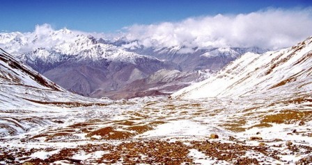 Annapurna Dhaulagiri trek is one of the best short treks away from the main trekking routes, with magnificent views of the two giants, Annapurna and Dhaulagiri. The scenery on the Annapurna Dhaulagiri trek ranges from the fertile splendour of the Pokhara Valley with its panoramic views of the Annapurnas, through splendid rhododendron, hemlock and fir forests to the high alpine ridges and meadows that lead towards the greater Himalayan peaks. From Pokhara the trail of Annapurna Dhaulagiri trek passes through traditional Gurung and Magar villages with ever-changing views of the stunning Annapurnas before leaving habitation behind us. Our journey to Annapurna Dhaulagiri trek continues through a wilderness of rhododendron forest to an open ridge at Khopra, one of the most spectacular vantage points in Nepal. Here some of the giants like Nilgiri, Annapurna South (7237m), Annapurna I (8091m) and the Dhaulagiri massif rise above the Kali Gandaki Valley. Our return route descends through villages, on a different trail, to Pokhara.
Best Season: Spring (September to December) autumn (March to May).
Trekking Grade: Moderate
Max Elevation: 4240 m
Total trekking days: 12 Days
Day 01: Arrive Kathmandu 1338m
Upon arrival in Kathmandu airport, please come right to the main arrival gate where our representative will be waiting with the company board or your name card.
Transfer to the hotel. Overnight at hotel in Kathmandu.
Day 02: Your full-day sightseeing includes visits to Bhaktapur Durbar Square, home of medieval art & architecture; Continue your tour to Kathmandu Durbar Square (Hanuman Dhoka), the old palace of the Royal Dynasty and hometown of living Goddess, Kumari. Final stop is at the Swayambhunath Stupa, the holiest shrine for the Buddhist and Hindus. Overnight at hotel in Kathmandu.
Day 03: Fly to Pokhara & drive to Phedi, trek to Dhampus [1700m]
Your trip starts with your 30-minute flight from Kathmandu to Pokhara. During your flight, you will have the sightseeing of the most magnificent and sensational view of Himalayan range. As your flight lands on Pokhara, you will be mesmerized by the irresistible visual treat of Manaslu and the Annapurna mountain range.
Then you will be escort in the private transport for about 40 minutes to trek starting point, Phedi. We shall commence our trek in Annapurna mountain range. As you climb uphill, you will bask in the splendor of nature and your trails become more adventurous. Finally, after walking for 3 hours, you encounter several roadside teashops and at last your trail leads to the Gurung village of Dhampus. Here concludes your trip of the day. Overnight at the local lodges/tea houses.
Day 04: Trek to Landrung
After a glorious mountain sunrise we follow the trail through rhododendron forest. Your path narrows as it skirts round a ridge snout. On proceeding further you pass through Pothana and reach Deurali. As we walk along we will pass through a series of Gurung villages where lifestyles have not changed substantially over the centuries. After lunch we will follow a well-marked trail untill we reach picturesque Gurung settlement of Landrung. Our Lodge affords spectacular views of Annapurna South and Hinchuli. Overnight stay at local lodges/tea houses.
Day 05: Trek to Ghandruk 1945 m
Our destination today is easily seen across the valley, the attractive Gurung village of Ghandruk. Unfortunately we have to descend to the valley bottom to get there. Slowly descending through the terraced land we reach the valley bottom where we will cross the Modi Khola (river) in a steel suspension bridge and commence our ascent. As we trek up the many staircases, we enjoy the beauty of the Himalaya at a relatively close range and observe the glaciers flowing from them to form the rivers below us. It really is a magnificent location and a photographer's delight. After a good climb we enter the beautiful village of Ghandruk. Here you get an opportunity to witness unique culture, tradition and customs of Gurung community. Ghandruk is a nicely located village where you get and excellent views of Annapurna South, Gangapurna, Annapurna III and Machapuchare. Overnight stay at local lodges/tea houses.
Day 06: Trek to Tadapani – 2,630m/4 Hours
Leaving the terraced fields of Ghandruk, our trail meanders along the zigzag path on a steep slope. We walk in the canopy under the age old rhododendron and magnolia trees. We pass by water falls that cascade down narrow gullies that provide a perfect home for many small ferns and delicate plants. We finally reach Tadapani which is an ideal vantage point to glimpse the stunning Annapurna South, Hiunchuli and Machapuchare. Overnight stay at local lodges/tea houses.
Day 07: Trek to Bhaisi Kharka – 3460m/ 6 Hours
Leaving the main trail that leads to Ghorepani we follow a rarely used trail through a thick rhododendron forest. The climb is gradual and we soon emerge above the tree line to superb views of the Annapurna range. We take lunch by a small stream and, in the afternoon, continue to climb gradually through open countryside to reach a small pass, where our trail descends through rhododendron to an open clearing, know as Bhaisi Kharka where we will camp for the overnight stay.
Day 08: Trek to Chistibung – 3100m/ 5 Hours
Our destination for today could be seen from our campsite. The first bit of walking we descend through open ground and pristine Himalayan forest to reach the pastures of lower Chistibung. In the afternoon our trek ascends through dwarf rhododendron to our camp at Chistibung.
Day 09: Trek to Khopra Ridge – 3650m/ 4 Hours
The ridge above our camp is today's destination. The first bit of walking is through the forest and slowly with the gain in altitude landscape changes to alpine with less trees. We climb steadily to Khopra ridge. This area is noted for wildlife and we should keep our eyes open for Himalayan thar and Daphe pheasant. Occasionally we might also see the yaks grazing in the field. Once atop this ridge we contour around the grass alpine meadows to our campsite at Khopra ridge in time for lunch. The views from here is just stunning. The mountains you could see from here are Dhaulagiri, Annapurnas, Annpurna Fang, Annapurna South, Tukuche Peak, Nilgiri and several other mountains.
Day 10: Excursion to Khair Lake 4240m
If you are feeling fit and enthusiastic, then a hike up to the Khair Lake should not be missed. We make a gradual climb up to the High Camp which is a flat piece of land and then the trail climbs steeply to the holy lake of Khair and several holy shrines where thousands of Hindu pilgrims visit annually to pay homage during the Bhadau Purnima Festival which happens in August and September. For those wishing for an easier option, a walk high on the ridge will provide fantastic views. After visiting the lake we come back down to our campsite at Khopra Ridge.
Day 11: Trek to Swatha – 2390m/ 5.5 Hours We descend downhill to Chistibung and a little bit further down just by the side of a stream we will stop for lunch. Today's walk is mostly through the rhododendron and oak forest. Occasionally we will meet villagers and the shepherds going through their daily chores. We finally reach Swatha, a village settled in an open flat ground. The views of Dhaulagiri from here are just fantastic.
Day 12: Trek to Ulleri (2070m): 6 Hours
Descend through the village and cross the suspension bridge followed by upwards trail to the village of Chittre; Walk through rhododendron forest and reach at Nangethanti; Trek through the forest enjoying the full blosoms of hododendron; Arrive at Ulleri in the mid afternoon; Rest of the Time explore the picturesque village. Overnight at the local lodge.
Day 13: Trek to Pokhara (950m): 5 Hours
Start sharp descend over 500 metres on a stone staircase to the Bhurungdi River and arrive at Tikhedhunga; Walk along a gentle descend to the village of Birethanti, on the banks of the Modi Khola; Walk further and arrive at Naya Phul which is in total 5 hours trekking. Drive for about 1 and half hours by road to Pokhara. Overnight at hotel in Pokhara.
Day 14: After breakfast, half day sightseeing around Pokhara valley. Refreshments at your hotel and then drive back to Kathmandu through the scenic journey again of terraces, streams, rivers, local settlements, high hills for about 7 hours. Overnight at hotel in Kathmandu.
Day 15: Depart Kathmandu
After breakfast, transfer to the Kathmandu airport (prior to three hours of your departure time) to board flight for your onward destination.
RNK 17 ANNAPURNA SANCTUARY TREK (14 Nights / 15 Days)
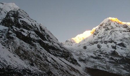 This is an unique trek on the foothill of the Annapurna south specially designed for those who love to enjoy the flora and fauna, panoramic view of the Himalayan range in a comfortable way including Annapurna, Dhaulagiri, Fishtail and other Himalayan ranges.
This is an ideal trek best called as a classic walk right into the heart of the mountains and our gentle walk start from lowland to the outstanding high mountains with breathtaking view of the Annapurna range. The walk ends at a point where you are virtually surrounded by soaring Himalayan peaks. Once this trek was a real expedition into an uninhabited wilderness area.
The trek involves several ascents and descents but not so hard to attempt as there are several alternative routes to the sanctuary, all meeting at Chomrong.
This trek provides an excellent opportunity to experience the fasinating glimpse of rich culture, typical Nepalese lifestyle and ultimate thrill of trekking in the Himalayas at the high elevation.
Best Season: Spring (September to December) autumn (March to May).
Trekking Grade: Moderate
Max Elevation: 4130m
Total trekking days: 10 Days
Day 01: Arrive Kathmandu
Upon arrival in Kathmandu airport, please come right to the main arrival gate where our representative will be waiting with the company board or your name card.
Transfer to the hotel. Overnight at hotel in Kathmandu.
Day 02: Your full-day sightseeing includes visits to Bhaktapur Durbar Square, home of medieval art & architecture; Continue your tour to Kathmandu Durbar Square (Hanuman Dhoka), the old palace of the Royal Dynasty and hometown of living Goddess, Kumari. Final stop is at the Swayambhunath Stupa, the holiest shrine for the Buddhist and Hindus.
Overnight at hotel in Kathmandu.
Day 03: Drive Kathmandu to Pokhara (950m/200 kms) - 6 to 7 hours.
Early in the morning you will leave will for Pokhara in private transport with our trekking guide which is a nostalgic scenic journey. Along the journey you will witness some stunning scenery of snow capped Mountains, green hills, rivers for rafting, and villages. Pokhara is a beautiful tourist hub, with panoramic views of Annapurna, Machapuchare (shape of fish tail), Dhaulagiri in the west, Lamjung Himal and Manaslu in the east. The town of Pokhara is set on the banks of the Phewa Lake. It is smaller and much less hectic than Kathmandu providing the perfect starting point for one;s trek.
You will be introduced with rest of the trekking assistances. Overnight at hotel in Pokhara.
Day 04: Drive to Nayapul (1010m) – 1: 45 hours and trek to Tikhedunga (1570meters) - 3 hours
The first day trek start at Nayapul after 1 and half hour driving by private vehicle from Pokhara. After 20 minutes short walk along the banks of the Modi Khola, we reach Birethanti (1015m) a large village that has many shops and teahouses inhabitance of Gurung, Magar and Thakali. Then, the trail continues following the north bank of the Bhurungdi Khola through villages and climbs steadily up the side of the valley to Hille (1495m) and after the short climb, we reach Tikhedhunga (1570m). Today’s walk offers a short and comparatively easy day, during the journey allowing getting use to the experience of trekking in Nepal. Overnight at local lodges/tea houses.
Day 05: Trek Thikdhunga to Ghorepani (2840m) – 5 to 6 hours
After breakfast, we begin our journey with a steep climb to large Magar village at Ulleri (2070m) after crossed bridge. Then the trail leads us continue to ascend more gently, through dense forests of oak and rhododendrons towards Banthanti (2250m). Occasionally, we can see Lonmgur (long tail black mouth Monkey) jumping on the tree. Then we trek towards Nangethanti (2460m), after an hour walk we arrive at Ghorepani (2840m). Overnight at local lodges/tea houses..
Day 06: Hike up Ghorepani to Poon Hill (3210m) - 45 munites, to Tadapani (2520m) – 4 to 5 hours
We will hike about 45 minutes to Poon Hill (3210m) earlyin the morning; this viewpoint provides an unobstructed beautiful sunrise over the high Himalayas with panoramic view giants Dhaulagiri (8,167m), Annapurna (8,091m),Machhapuchere, Nilgiri, Hiuchuli, South Annapurna etc. along with a network of other peaks, slowly begin to appear like magic before our eyes.We come back to Ghorepani for a hot breakfast, and start walking to Tadapani, the trail climbs along ridges with pine and rhododendron forests to the Deurali and then descent it through the beautiful waterfall, stream, and dense forest to the Banthati. The stream has some clear pools alongside the trail and finally climb up to the final destination Tadapani, meaning ‘far water’ and the water supply for this village is a long distance below. Overnight at local lodges/tea houses.
Day 07: Trek Tadapani to Chommrong (2140m) - 4 to 5 hours
After breakfast the trail starts with steep downhill through rhododendron forests and terrace field to Kimrong Khola offers good views of the upper Modi valley. Then, after crossing suspension bridge, ascend to the Gurjung Village, you can donate some money for the school kids and school welfare. From here the trail goes gradual ascend through the forest and huge land slide ridge with an easy walk to Chommrong (2140 m). Where we have view of mighty peak of Annapurna South, Hiuchuli, Gangapurna and Fishtail touch to the sky-line. Overnight at local lodges/tea houses.
Day 08: Trek Chommrong to Dovan (2500m) - 5 to 6 hours
The trail descends on the stone staircase to the Chhomrong Khola and again we continue climbing to small village Sinuwa (2340m). The trail leads us through the dense forest further on, then the route travels very steeply down a rock bank through thick bamboo at the bottom of the gorge to the Bamboo, and after lunch we follow up along the Modi Khola forest to the Dovan. Overnight at local lodges/tea houses.
Day 09: Trek Dovan to Deurali (3200m) - 4 to 5 hours
Today is short walking day trek due to altitude and risk of snow avalanches in the area that we need to cross in the next morning. All the way climb through bamboo and rhododendron mixed forests and small Ditties serene nearby Himalayan Hotel, known as Hinko cave; used to potters shelter in previous time. Then continue to the Deurali, on the ridge above Hinko is the stretch of trail that is most subject to avalanche. Overnight at local lodges/tea houses.
Day 10: Trek Deurali to Annapurna Base Camp (4130m) - 4 to 5 hours, via Machhapuchre Base Camp (3700m)
After breakfast the trail lead us in the heart of the Sanctuary at the Annapurna Base Camp for overnight stay. The trail follows uphill for few hours passing some roofless shepherds huts along the side of a moraine and this area is windy and often snowbound. The trail climbs on past the Machhapuchre Base Camp (3700m), which isn’t really a base camp since climbing the mountain is not permitted. From here to Annapurna Base Camp 2 hours trail offering superb Himalaya scenery and can be seen rarely this amazing panoramic view of snow capped mountains surrounding you. Rest of day you have time to explore and relax at the base camp as per your interest. Overnight at local lodges/tea houses.
Day 11: Trek back Annapurna Base Camp to Bamboo (2345m) -5 to 6 hours
After breakfast we drop down to Bamboo, collecting boundless experience this morning glimpse of sunrise and last evening sun set over Mt. Annapurna I, Annapurna fangs. The unobstructed views of mountain scenery, which is very spectacular totally surrounded by mountains, that’s why this area is known as the Annapurna Sanctuary. After a great time retrace the journey back to Bamboo for the overnight stay at local lodges/tea houses.
Day 12: Trek Bamboo to Jhinu Danda (hot spring) (1780m) - 4 to 5 hours
The trail follows the same trail until Chommrong. Once we have passed Khuldighar there is an experimental sheep farm, the trail continues through rhododendron and bamboo forest with majestic mountains scenery, especially Mt. Machhapuchhre. From ancient Gurung village Chomrong, trail descends very steeply to the Jhinu hot spring, where you can bathe in natural hot springs. Overnight stay at local lodges/tea houses.
Day 13: Jhinu Danda to Syawali Bazaar (1100m) - 4 to 5 hours, Drive to Pokhara - 1:30 hour.
Walk to the Syawali Bazaar and drive to Pokhara by road. Overnight at hotel in Pokhara.
Day 14: After breakfast, half day sightseeing around Pokhara valley. Refreshments at your hotel and then drive back to Kathmandu through the scenic journey again of terraces, streams, rivers, local settlements, high hills for about 7 hours. Overnight at hotel in Kathmandu.
Day 15: Depart Kathmandu After breakfast, transfer to the Kathmandu airport (prior to three hours of your departure time) to board flight for your onward destination.
RNK 18 TILICHO PASS TREKKING (15 Nights / 16 Days)
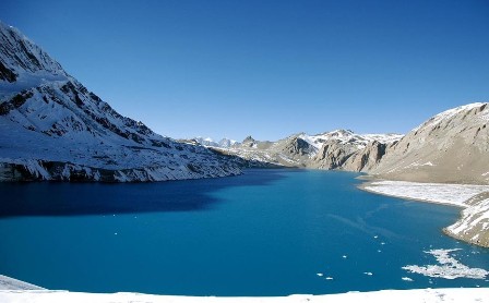 Tilicho Lake 4920m is World highest lake, situated In the Annapurna range of the Central Nepal Himalaya. This is a splendid summer trek, as rewarding as it is challenging. The Tilicho lake trek is among the finest serious Nepal treks best experienced in the Monsoon but we run this treks at anytime of year except snowing season.
The Tilicho Lake is a famous lake from natural beauty as well as religious point of view. For the lovers of nature it a magnificent view and real opportunity to see a lake at this altitude at 4920m. For religious minded people it is a Godly blessed place best suited for devotees, it is also an area of rough and wild beauty. This trek is visited by very few people though it is recommended for trekking and travel for all type of tourists. . On the way we would have passed (Mesokanto La 5121m) through every type of vegetation zone from lush sub-tropical to harsh semi-desert and passed over one of the highest trekking passes in the world. We will have entered a world without roads or cars and witnessed the way people have worked, played and survived for hundreds and hundreds of years. We would have essentially walked through a time warp coming out the other side with a deeper understanding of ourselves and the world we live in.
Best Season: Spring (September to December) autumn (March to May).
Trekking Grade: Strenuous
Max Elevation: 5121m
Total trekking days: 11 Days
Day 01: Arrive Kathmandu
Upon arrival in Kathmandu airport, please come right to the main arrival gate where our representative will be waiting with the company board or your name card.
Transfer to the hotel. Overnight at hotel in Kathmandu.
Day 02: Your full-day sightseeing includes visits to Bhaktapur Durbar Square, home of medieval art & architecture; Continue your tour to Kathmandu Durbar Square (Hanuman Dhoka), the old palace of the Royal Dynasty and hometown of living Goddess, Kumari. Final stop is at the Swayambhunath Stupa, the holiest shrine for the Buddhist and Hindus. Overnight at hotel in Kathmandu.
Day 03: Kathmandu drive to Beshi Sahar (820m) & Bhulbhule (840m)
Early morning drive from Kathmandu to Bhulbhule via Besisahar. It takes about seven to eight hours to reach the Bhulbhule by surface. After long beautiful drive you will reach at Bhulbhule (840m). Overnight at local lodges Overnight at local lodges/tea houses.
Day 04: Bhulbhule trek to Jagat (1330m)
Today, we cross the Marshyangdi River and continue along its right fork. We soon pass some tropical trees and terraced fields. Soon we glimpse of first sights of one of the 8000 peaks, Mount Manaslu (8161m), as well as Himalchuli and Ngadi Chuli. From Ngadi, our path climbs steadily to Bhaudanda-a small Hindu village (1300m) with shops and tea houses. From Bhaundanda our trail abruptly dips to Syange (1080m). We'll cross the Marsyangdi River on a suspension bridge and continue trek along the peaceful river and climb to the stone village of Jagat (1330). Overnight at local lodge/Camp.
Day 05: Jagat trek to Dharapani (1960m)
From Jagat our trail descends, crossing Ghatte Khola Stream and climbs again through forest-finally reaching Chamje (1410m). From Chamje our path crosses to the east fork of Marsyangdi River. Soon we climb steep stone steps past the village of Sattale (1680m), past fields and rhododendrons along the river bank and later climb to the open plateau of Tal (1700m). We continue gradually
uphill, passing the villages of Khorte and Karte to finally you are reaching at Dharapani (1960m). Overnight at local lodge/Camp
Day 06: Dharapani to Chame (2670m.)
Today, we pass a village school and also you can see the way of coming down from Larkya Pass (Manaslu trekking) and continue climb gradually through a forest to the typical Tibetan-style village of Bagarchhap (2160). Remaining along the left bank of the river, we gradually climb to Danaque (2210m). After Danaque cross suspension bridge and climb up to Temang village (2600m) and continue trek koto (2640m). It is the gate way for Nar Phu valley trekking. After koto easy walk to
Chame (2670m) the largest village and headquarters of Manang District. Overnight at local lodge./Camp
Day 07: Chame trek to Pisang (3200m.)
Today, trek west from the bridge but if you wish to see the small hot spring you can walk 2 minutes east side of bridge after cross the bridge in Marsyangdi River at Chame but sometime it will be closed by overflow by Marsyangdi River water. After you follow west trail from the bridge now continues trek along the river banks through Telekhu (2840m) to Bharatang which is surrounded by apple orchards. Continue on the trail for about 30 minutes taking you through the banks of the Marshyangdi River, cross the bridge and proceed with the gradual ascent about 30 minutes to reach at Dhukure Pokhari (3200m). The trail now gradually turns planar and you would reach Pisang in about an hour. Pisang offers magnificent views of the Annapurna II and Pisang Peak. Overnight at local lodge/Camp
Day 08: Pisang trek to Manang (3540m.)
Trek from Pisang to Manang (3440m.) and it takes about five and half hours. Beyond Pisang, the trail climbs a steep ridge which affords good views of the Manang valley and Tilicho peak (7134m.). Descending past Manang's airstrip at Hongde (3420m), you come to a level area from where the north-east face of Annapurna III rises majestically above you. From the wide plains of the Sabje Khola Valley, Annapurna IV (7525m) also becomes visible. Just beyond this point you cross the considerably reduced flow of the Marsyangdi Khola via a wooden bridge to the tiny village of Mungji. Cultivated fields appear on both sides of the path and off to the right, below a craggy mountain, you can see the village of Bryaga (3500m) with its splendid monastery. Large chortens and mani walls abound and the tall peaks of the Himalaya spread out before us - Annapurna II, Annapurna III, Annapurna IV, Gangapurna (7454m) and, to the rear, Tilicho Peak (7134m). Overnight at local lodge/Camp
Day 09: Acclimatization in Manang (3540m.)
Today is our like a rest day to acclimatization for trekking in higher elevation so you can make short visit to Gangapurna Lake, monastery and Manang village but if you wish to make day hiking trip such as visiting Milarepa cave, Ice Lake you need to extend your rest day in Manang because Ice Lake it is hard full day trip from Manang and also Milarepa cave not suggest in one day rest in Manang because you need some rest at Manang for acclimatization. Overnight at local lodge/Camp
Day 10: Manang trek to Khangsar (3734m)
Today, we will trek to the village of Khangsar, about 3-hrs from Manang at (3734m). On the way, we can make a detour to small lake at the Gangapurna glacier. The trail Manang to Khangsar is very narrow and this village is small village with beautiful monastery. You are enjoying with splendid views of Khangsar Khola to Tilicho Peak and the grand barrier. Overnight at local lodge/Camp
Day 11: Khangsar to Tilicho Base camp (4150m)
In between Tore Gompa and Tilicho Lake, there is a big, grassy field where Blue Sheep are often seen. About one kilometer from the field, we reach a hill. You have to Climb this hill (4200m) affords us a view of the entire valley. A steep descent will bring us to Tilicho Base Camp (4150m), where we will find trekking seasonable lodging at Tilicho Base Camp. Overnight at local lodge/Camp
Day 12: Base Camp trek to Nama Phu (3510m) over the Masokanto La (5121m)
Early morning climb to Tilicho Lake (4920m) and take a look and enjoy with beautiful Lake situated at such high elevation. The Lake is 4 kilometers long and 2.5 kilometers wide. It is the main source for the Marsyangdi River. After enjoying with lake view then continue climb to Mesokanto La Pass (5121m) known as Tilicho Pass then descends to rocky trail to Nama Phu (3510m). Still there is a not available teahouse facility so you need to stay overnight in Tented Camp.
Day 13: Nama Phu trek to Jomsom (2713m)
Today, the trail also lead the descending path to Jomsom and not hard walking today just you with beautiful panoramic views of Nilgiri, Dhaulagiri, Tukuche Peak and so on. Afternoon you are in Jomsom then you can look around Jomsom it is big town in Mustang district and guide will reconfirm your flight tickets for Jomsom to Pokhara for next morning. Overnight at local lodge/Camp.
Day 14: Jomsom Flight to Pokhara (850m)
Today, you will take the early morning flight which again will give close-up views of the Annapurna range, Dhaulagiri, Nilgiri and Annapurna range and you are flying about 25 minutes flight in a small aircraft. After arrival in Pokhara airport drive to hotel and rest day at leisure. Overnight at hotel in Pokhara.
Day 15: After breakfast, half day sightseeing around Pokhara valley. Refreshments at your hotel and then drive back to Kathmandu through the scenic journey again of terraces, streams, rivers, local settlements, high hills for about 7 hours. Overnight at hotel in Kathmandu.
Day 16: Depart Kathmandu
After breakfast, transfer to the Kathmandu airport (prior to three hours of your departure time) to board flight for your onward destination.
RNK 19 ANNAPURNA BASE CAMP TREKKING (16 Nights / 17 Days)
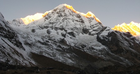 Annapurna Base Camp Trek offer quickest to meet high Himalayan altitude where glacier replace rivers. We start the foothills from Pokhara, appreciating the slate roofed tropical village of magnificent rhododendron forest before entering the narrow Modi Khola gorge. We climb higher we get to the hidden world of the Annapurna Sanctuary. Huge south face of Annapurna one (8091m.) provide impressive backdrop while closeness of ten peaks over 6000 meters including Hiunchuli, Fang, Annapurna III and Fishtail, inspire a delicious joy as a fitting highlight of this spectacular trek. On the return journey we will have a chance to visit the beautiful village and the Gurungs of Gandruk village before heading back to Pokhara. Wonderful journey to the heart of the Annapurnas. Moderate to difficult trekking from 900m to 4130m. Comfortable hotel/lodges run by local families atmosphere in Annapurna Himalaya.
Trekking to Annapurna base camp passes through opaque stand of rhododendron and bamboo forest. Look the logic of whole pleasure face of our customers when they leave back to their own country. We hike through the village on the way to Annapurna base camp and green forest before arrive more unprofitable and rocky scenery. You reach the large rock over execution, known as Hinku Cave after Himalaya hotel, you will have observed that the flora and fauna has watery, ravine tapering to only few 100m wide. Annapurna sanctuary valley trek increasingly offer snow-white, screen landscape and reach in snow fields. No villages after Sinuwa and back until same place. Steep snow clad ridges retreating from Hiunchuli on the left from Machhapuchhre on the exact from the entry to the Sanctuary. This trekking is more divide than others treks by its diversity of people, their rich culture, beautiful view and natural scenery. This trekking is also the introduce to greater altitude without creature too tricky.
Best Season: Spring (September to December) autumn (March to May).
Trekking Grade: Moderate
Max Elevation: 4130m
Total trekking days: 12 Days
Day 01: Arrive Kathmandu
Upon arrival in Kathmandu airport, please come right to the main arrival gate where our representative will be waiting with the company board or your name card.
Transfer to the hotel. Overnight at hotel in Kathmandu.
Day 02: Your full-day sightseeing includes visits to Bhaktapur Durbar Square, home of medieval art & architecture; Continue your tour to Kathmandu Durbar Square (Hanuman Dhoka), the old palace of the Royal Dynasty and hometown of living Goddess, Kumari. Final stop is at the Swayambhunath Stupa, the holiest shrine for the Buddhist and Hindus.
Overnight at hotel in Kathmandu.
Day 03: Drive Kathmandu to Pokhara (950m/200 kms) - 6 to 7 hours.
Early in the morning you will leave will for Pokhara in private transport with our trekking guide which is a nostalgic scenic journey. Along the journey you will witness some stunning scenery of snow capped Mountains, green hills, rivers for rafting, and villages. Pokhara is a beautiful tourist hub, with panoramic views of Annapurna, Machapuchare (shape of fish tail), Dhaulagiri in the west, Lamjung Himal and Manaslu in the east. The town of Pokhara is set on the banks of the Phewa Lake. It is smaller and much less hectic than Kathmandu providing the perfect starting point for one;s trek.
You will be introduced with rest of the trekking assistances. Overnight at local lodge/hotel in Pokhara
Day 04: Drive to Nayapull (1010m) – 1: 45 hours and trek to Thikhedhunga (1570meters) - 3 hours The first day trek start at Nayapull after 1 and half hour driving by private vehicle from Pokhara. After 20 minutes short walk along the banks of the Modi Khola, we reach Birethanti (1015m) a large village that has many shops and teahouses inhabitance of Gurung, Magar and Thakali. Then, the trail continues following the north bank of the Bhurungdi Khola through villages and climbs steadily up the side of the valley to Hille (1495m) and after the short climb, we reach Tikhedhunga (1570m). Today’s walk offers a short and comparatively easy day, during the journey allowing getting use to the experience of trekking in Nepal. Overnight at local lodges/tea houses.
Day 05: Trek Thikhedhunga to Ghorepani (2840m) – 5 to 6 hours
After breakfast, we begin our journey with a steep climb to large Magar village at Ulleri (2070m) after crossed bridge. Then the trail leads us continue to ascend more gently, through dense forests of oak and rhododendrons towards Banthanti (2250m). Occasionally, we can see Lonmgur (long tail black mouth Monkey) jumping on the tree. Then we trek towards Nangethanti (2460m), after an hour walk we arrive at Ghorepani (2840m). Stay Overnight at local lodges/tea houses.
Day 06: Hike up Ghorepani to Poon Hill (3210m) - 45 munites, to Tadapani (2520m) – 4 to 5 hours
We will hike about 45 minutes to Poon Hill (3210m) earlyin the morning; this viewpoint provides an unobstructed beautiful sunrise over the high Himalayas with panoramic view giants Dhaulagiri (8,167m), Annapurna (8,091m),Machhapuchhre, Nilgiri, Hiuchuli, South Annapurna etc. along with a network of other peaks, slowly begin to appear like magic before our eyes.We come back to Ghorepani for a hot breakfast, and start walking to Tadapani, the trail climbs along ridges with pine and rhododendron forests to the Deurali and then descent it through the beautiful waterfall, stream, and dense forest to the Banthati. The stream has some clear pools alongside the trail and finally climb up to the final destination Tadapani, meaning ‘far water’ and the water supply for this village is a long distance below. Overnight at local lodges/tea houses.
Day 07: Trek Tadapani to Chommrong (2140m) - 4 to 5 hours
After breakfast the trail starts with steep downhill through rhododendron forests and terrace field to Kimrong Khola offers good views of the upper Modi valley. Then, after crossing suspension bridge, ascend to the Gurjung Village, you can donate some money for the school kids and school welfare. From here the trail goes gradual ascend through the forest and huge land slide ridge with an easy walk to Chommrong (2140 m). Where we have view of mighty peak of Annapurna South, Hiuchuli, Gangapurna and Fishtail touch to the sky-line. Overnight at local lodges/tea houses.
Day 08: Trek Chommrong to Dovan (2500m) - 5 to 6 hours
The trail descends on the stone staircase to the Chhomrong Khola and again we continue climbing to small village Sinuwa (2340m). The trail leads us through the dense forest further on, then the route travels very steeply down a rock bank through thick bamboo at the bottom of the gorge to the Bamboo, and after lunch we follow up along the Modi Khola forest to the Dovan. Overnight at local lodges/tea houses.
Day 09: Trek Dovan to Deurali (3200m) - 4 to 5 hours
Today is short walking day trek due to altitude and risk of snow avalanches in the area that we need to cross in the next morning. All the way climb through bamboo and rhododendron mixed forests and small Ditties serene nearby Himalayan Hotel, known as Hinko cave; used to potters shelter in previous time. Then continue to the Deurali, on the ridge above Hinko is the stretch of trail that is most subject to avalanche. Overnight at local lodges/tea houses.
Day 10: Trek Deurali to Annapurna Base Camp (4130m) - 4 to 5 hours, via Machhapuchhre Base Camp (3700m)
After breakfast the trail lead us in the heart of the Sanctuary at the Annapurna Base Camp for overnight stay. The trail follows uphill for few hours passing some roofless shepherds huts along the side of a moraine and this area is windy and often snowbound. The trail climbs on past the Machhapuchhre Base Camp (3700m), which isn’t really a base camp since climbing the mountain is not permitted. From here to Annapurna Base Camp 2 hours trail offering superb Himalaya scenery and can be seen rarely this amazing panoramic view of snow capped mountains surrounding you. Rest of day you have time to explore and relax at the base camp as per your interest. Overnight at local lodges/camp.
Day 11: Trek back Annapurna Base Camp to Bamboo (2345m) -5 to 6 hours
After breakfast we drop down to Bamboo, collecting boundless experience this morning glimpse of sunrise and last evening sun set over Mt. Annapurna I, Annapurna fangs. The unobstructed views of mountain scenery, which is very spectacular totally surrounded by mountains, that’s why this area is known as the Annapurna Sanctuary. After a great time retrace the journey back to Bamboo for the overnight stay. You can rest and relax at the evening with a good unforgettable view of the many snow capped peaks, Annapurna Glacier and enjoy the dinner. Overnight at local lodges/camp.
Day 12: Trek Bamboo to Jhinu Danda (hot spring) (1780m) - 4 to 5 hours
The trail follows the same trail until Chommrong. Once we have passed Khuldighar there is an experimental sheep farm, the trail continues through rhododendron and bamboo forest with majestic mountains scenery, especially Mt. Machhapuchhre. From ancient Gurung village Chomrong, trail descends very steeply to the Jhinu hot spring, where you can bathe in natural hot springs,which 20 munites from our hotel. Rest of the day enjoy around. Overnight at local lodges/camp.
Day 13: Jhinu Danda to Tolka (1790m) - 4 to 5 hours
The trail for today, first descend to the Komrong Khola and get in new bridge through the forest nearby river side, here we see many trekkers, who are going to finest trekking in Nayapull. After we cross new suspension bridge nearby Himalpani with beautiful water fall. Then the trail leads us gently up to horizontal to the Gurung village Landruk. We will get in Tolka for lunch after an hour easy walk. We explore around the Magar village Tolka rest of day. Overnight at local lodges/tea houses.
Day 14: Trek Tolka to Dhampus (1580m) - 3 to 4 hours
The trails climb through forests alive with birds, fern and orchids in to the dense forest. After crossing a stream on a suspension bridge the trails climb to the Bheri Kharka, often hear sound of sheep. Then the trail climbs through forests to a clearing on the top of the hill at Deurali (2010m) where there are views of mountains can be seen and Pokhara valley. After breakfast all the way lead us downhill to Dhampus (1580m) through the Pothana village pass a tourist cheek post. You are rewards with great views of the mountains and people culture. Overnight at local lodges/tea houses.
Days 15: Trek Dhampus to Phedi (1080m) -1: 45 hours, Drive to Pokhara - 40 minutes
Today is last day trekking, the goes to downhill through the village to Phedi through the forests that is so overgrazed that is look like a manicured municipal park, the trail down steeply to the ridge at Phedi at (1080m). Then catch our vehicles and drive to Pokhara for lunch. After Lunch you are free as your own in Pokhara. Overnight at hotel in Pokhara.
Day 16: After breakfast, half day sightseeing around Pokhara valley. Refreshments at your hotel and then drive back to Kathmandu through the scenic journey again of terraces, streams, rivers, local settlements, high hills for about 7 hours. Overnight at hotel in Kathmandu.
Day 17: Depart Kathmandu
After breakfast, transfer to the Kathmandu airport (prior to three hours of your departure time) to board flight for your onward destination.
RNK 20 ANNAPURNA CIRCUIT TREK (22 Nights/23 Days)
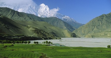 Annapurna Circuit Trekking is the popular name for 300 kilometer trek in Nepal around the Annapurna Himalaya range in the Himalayas. The trek reaches an 5416 meters altitude of on the Thorong La pass 5416 meters, touching the edge of the fabled Tibetan plateau. These paths have long facilitated the flow of cultures and religions in this remote and formerly inaccessible region. The magnificent mountain scenery, seen at close quarters includes Annapurna 8091m, which was the first 8000 meters peak to climbed, magnificent ice pyramid Dhauligiri 8167 meters once the home of the legendary Buddhist priest & Fishtail 6993m, considered by many to be the most beautiful mountain in the world. The trek follows ancient paths used as trade routes between Nepal and Tibet. Tibetan Mahayana Buddhism, Hinduism and the mysterious religion still coexist and interpenetrate one another in this region which contains many pilgrimage sites. The unusually wide range of climatic zones in such a small area as the path ascends from 900m to 5416m provides a chance to see many different plants and animals, and the different ways of life of the many peoples who live there. This trek provides you dramatic changes in landscape, culture and climate. The changes in climate from warm to cold take you to the sacred shrine of Muktinath in Mustang district. From Pokhara to Mustang, you can enjoy the through terraced hills, forests and alpine pastures and also through the village of different cultures during whole the trekking it takes 18 to 21 days. Annapurna round (circuit) trekking begin from Besisahar and ending in Pokhara and walk via Kaligandaki river valley after Thorongla. Trekking route goes through Buddhist villages and Hindu holy pilgrimage sites, mostly markedly the village of Muktinath which call Ranipauwa too, a holy site together with Hindus and Buddhists, one of oldest monasteries in this region. The uppermost point of trekking is Thorongla (5416m.) pass at top of the valley. Owing to the difficulty of journey pass. We arrive at Besisahar after eight hours continuous drive from Kathmandu . Besisahar is in Marsyangdi Valley River. At the signify time, you will also observe gorgeous scene of Himalaya, many waterfall and precipice of course. You will also come to examine the effortless yet charming village of nature life. The well-known Mt. fishtail that dominate the skyline over Pokhara. In adding of area enjoy the Kali Gandaki, valley the world's deepest gorge Dana village. Annapurna region is delimited by many Himalayan ranges which comprise the Annapurna, Dhaulagiri, Machhapuchhre and Manaslu. The Manang people are Gurung are very arrogant of their perfect society legacy and amalgamation of lower land Gurung and Tibetan edifying authority. The whole trekking is exciting that you never forget your life. Manang and Mustang are of the higher elevation and predominantly Tibetan Buddhist.
Best Season: Spring (September to December) autumn (March to May).
Trekking Grade: Moderate and fairly strenuous
Max Elevation: 5416 m
Total trekking days: 19 Days
Day 01: Arrive Kathmandu
Upon arrival in Kathmandu airport, please come right to the main arrival gate where our representative will be waiting with the company board or your name card.
Transfer to the hotel. Overnight at hotel in Kathmandu.
Day 02: Your full-day sightseeing includes visits to Bhaktapur Durbar Square, home of medieval art & architecture; Continue your tour to Kathmandu Durbar Square (Hanuman Dhoka), the old palace of the Royal Dynasty and hometown of living Goddess, Kumari. Final stop is at the Swayambhunath Stupa, the holiest shrine for the Buddhist and Hindus.
Overnight at hotel in Kathmandu.
Day 03: Kathmandu to Khudi (792m) It is around 6:30 AM in the morning that you start your trip from Kathmandu to Khudi after having breakfast. You drive from Kathmandu (1300m) down the hill thru the high way. A long chain of green hill in both sides and beautiful river on right side follow you during the 6-7 hours drive to Khudi. Scattered beautiful hamlets throughout the hills are seen on the way. You pass thru Marsyangdi river valley to Besisahar and finally reach to Khudi. Overnight at local lodges/tea houses.
Day 04: Khundi - Bahundanda (1314meter)
It takes you around 6-7 hours normal walk to reach Bahundanda. On the way you cross the bridge and continue your journey to the north above the Marsyangdi Khola. The changes in the valley’s ecosystem and its physical characteristics become evident now.
This trek fetches you the knowledge of cultural diversity of Nepal while you passes thru many typical local houses and the faces of varied ethnic tribes exchanging gr eetings (Namaste). You share the trail with mule caravans that transport supplies to the remote villages. The trek further becomes romantic when you pass thru subtropical forests and see the rice terraces of Sera of Khundi village. Overnight at local lodges/tea houses.
Day 05: Bahundanda - Chamje (1400m)
Today you have exciting walk for 6 hours to reach Chyamje. You descend to the valley floor and then, crossing the river, climb steeply out of it to follow a trail beautifully carved out to the rock wall of the valley with beautiful waterfalls. As you near the village of Jagat you have to climb a steep 200m trail that has been blasted out of the rock face. You now again climb down the hill where you get a small hot spring and then again you c limb up to Chamje.
Day 06: Chamje - Dharapani (1943m)
As you head up the way through stream , bamboo and rhododendron (national flower)forest , you begin to notice the changes in the people as well as the landscapes, culture and architecture. You notice that there is a concentration of people of Tibetan origin; Rock built houses, less tropical vegetation and the predominantly Tibetan Culture. The trail from Tal crosses the Marshyangdi River to its west bank after Karte Village and continuous towards the village of Dharapani. You complete this trek in just 6 hours normal walk.Overnight at local lodges/tea houses.
Day 07: Dharapani - Chame (2713m)
Today morning at 0700 hours you pack up and start trek to Chame. You continue up the River valley and pass the Gurung Village Thonje to Bagarchhap. You continue walk along the left bank of the river , climb up the heavily wooded Manang valley and small settlements with outstanding views of Mt. Manaslu (8163meter) and the peaks above Larkya La. As Chame is administration town of Manang district has facility of bank. Throughout the day there are nice views of Lamjung Himal, Annapurna II and Anna purna IV (7525m). The treks end after continuous walk for 6 hours. Overnight at local lodges/tea houses.
Day 08: Chame - Pisang (3185m)
Today you do trek for almost 5 hours to Pisang.You first pass the older part of Chame and climb up to Telekhu at 2840 meter and continue with a long pleasant and mostly level walk through the forest to Brathang, which lies at 2950 meter. After the trail rounds a bend here you see the first view of the dramatic Paungda Danda rock face, a tremendous curved slab of rock rising more then 1500 meter from the river. Overnight at local lodges/tea houses.
Further you cross back to the south bank of the Marsyangdi River on a suspension bridge at 3080 meter and then make a long gentle climb over a ridge through blue pine forests. After this, the trek reasonably level as it heads to the upper part of Manang valley to Pisang. This town marks the beginning of the region known as Nyesyang, the upper portion of the Manang district. An excellent view of Annapurna II can be seen to south as you are now behind the main Himalayan peaks in their rain shadow area. Overnight at local lodges/tea houses.
Day 09: Pisang - Manang (3540m)
Today you have to trek slowly climbed up to the Tibetan-style village of Bryaga at 3500 meter following the valley floor. At Braga you see houses stacked one atop the other, each with an open veranda formed by a neighbor’s rooftop. The gompa perched on a high crag overlooking the village, is the largest in the district and has an outstanding display of statues.
Then you continue through a very arid countryside, dominated by weird cliffs of yellow rock, eroded into dramatic pillars alongside the trail to reach today’s destination, the village of Manang, where the shops are surprisingly well stocked with all the things you might want to refuel on.
This astonishing trek ends after 5 hours continuous walk. You stop at Manang today. Overnight at local lodges/tea houses.
Day 10: Acclimatization at Manang
After many days continuous trekking, today you stay one day at Manang. It is important for you to acclimatize at this point furthering your trip because the altitude is going to rise up to 4700m in coming treks. You may hike to Chonkor View Point 3800m and to the monastery. The day can be utilized preparing by you for further trekking. Overnight at local lodges/tea houses.
Day 11: Manang - Yak Kharka (4000m)
Trekking slowly upwards to Thrung La you leave the large trees behind and see vegetation consisting mainly of scrub juniper and alpine grass and you pass a few meadows where horses and yaks graze. You get an opportunity to see herds of blue sheep grazing on the steep slopes at Yak Kharka. You do not feel crossing all the way in 4 hours.
Overnight at local lodges/tea houses. Tomorrow morning you prepare yourself for the highest altitude trek you have ever done before.
Day 12: Yak Kharka - Thrung Phedi/high camp (4500m/4700m)
This day you reach to the highest point of the trek, possibly the highest point you have ever been on in your life. From Yak kharka you will continue to climb along the east bank of the Jarang Khola to Thorung Phedi, a rock-strewn meadow surrounded by vertical cliffs at 4420 meter. Blue sheep and even snow leopards can be seen sometimes in this valley. High in the skies above, you can see lammergeyers and Himalayan griffons circling around.
The total walking time is 3-4 hours for this day. Overnight at local lodges/tea houses.
Day 13 Thorang Phedi -Muktinath (3800m) via Thorang La Pass (5416m)
Today, we have start early in the morning to reach Thorang La pass by 1000 hrs at the latest, otherwise weather conditions will greatly affect the journey. You cross over at an altitude of 5416m, so can be effected by strong winds if you do late.
Local people have been using this trail for hundreds of years to bring herds of sheep and yaks in and out of Manang. Thus the trail, while often steep, is well defined and easy to follow. Snow can block the pass at any time of the year if there comes an unseasonable storm. It takes 4-6 hours from Thorung Phedi to La Pass.
At the Thorung La pass, with its traditional prayer flags and stone cairn you have outstanding views. You can see the Annapunas, Gangapurna and Khatung Kang, peaks with heavy glacier. Amazingly there is a teashop here on top of the pass at 5416 meter. From here you start a long descend of about 1600 meter with outstanding views of Dhaulagiri mountain standing alone in the distance across the valley.
After the trail becomes less steep you enter grassy fields and cross meadows to your final destination of Muktinath, which means place of Nirvana and is home to the Muktinath temple as well as several monasteries. It is said that all sorrows you feel are relieved when visiting the Temple, which is a scared pilgrimage site to both Hindus and Buddhists. The main pilgrimage normally takes place in September. The Temple is dedicated to Lord Vishnu and has 108 taps around it from which Holy water pours. Another attraction nearby is the Jwala Mai Temple and this contains a spring and an eternal flame fed by natural underground gas. You reach Muktinath from La Pass in 9 hours. Overnight at local lodges/tea houses.
Day 14 Muktinath - Marpha via Jomsom (2700m)
Today you follow the “Jomsom trek” in reverse order. You first go down to Kagbeni, which is a 990 meter descend through meadows, streams and fruit trees like peach orchards. Then you continue going down to Jomson (more correctly Dzongsam, or “new fort”). You descend continues through the Kali Gandaki Valley to Marpha. Marpha isa home to many apple orchids as well as all the various food products made from the fruit. Apple Brandy is a local specialty of Marphs that you can taste en route. It takes around 6 hours to complete this route. Overnight at local lodges/tea houses.
Day 15 Marpha - Ghasa (2073m)
You further trek down the Kali Gandaki valley alongside the Kali Gandaki river to Ghasa. You pass the villages of Tukuche at 2580m and Larjung at 2560 meter. Then you cross the Kali Gandaki river by a high suspension bridge and continue through an area covered with fir, juniper and cypress trees. Towards the village of Kalopani (2530m) you have splendid 360° views of Dhaulagiri, Tukuche Peak, the three Nilgiris, Fang and Annapurna I. After crossing another very long suspension bridge (107 meter long) you reach Ghasa, last point for this night. This trek demands around 6 hours walk. Overnight at local lodges/tea houses.
Day 16 Ghasa - Tatopani (1190m)
Today the trek leads you through the most steep and narrow part of the Kali Gandaki valley; much of the way is cut through solid rock and subject to frequent landslides. Before you reach the village of Dana (1450m) you pass the Rupse Chhahara (‘beautiful waterfall’). Descending further down passthere will be several landslides then you reach Tatopani, meaning hot water, which is situated on the riverbanks where you can stop and take a natural hot water bath. It is 6 hours walk from Ghasa to Tatopani. Overnight at local lodges/tea houses.
Day 17 Tatopani -Ghorepani (2856m)
Leaving the hot springs behind you have a day of climbing Ghorepani. You leave the Kali Gandaki valley and follow the Ghar Khola river and cross this river through old swing bridge. You continue ascending to Ghara (1780m) and Shika (1935m) where there is British army training centre. The last part of the trail today is climbing through rhododendron and magnolia forests to Ghorepani, where you arrive in the mid afternoon. Seven hours is enough to reach this place. Overnight at local lodges/tea houses.
Day 18 Ghorepani (2834m) - Poon Hill (3210m) - Tadapani (2625m)
Early morning an hour’s hiking to Poon Hill to enjoy the sunrise view over Mt. Dhaulagiri, Tukuche Peak, Nilgiri, Varaha Shikhar, Mt. Annapurna I, Annapurna South, Annapurna III, Machapuchere, Annapurna IV, Annapurna II, Lamjung Himal and other numerous snowcapped mountain peaks. Spending about an hour, we come back to Ghorepani for a breakfast, and start walking to Tadapani.
From Ghorepani the trail climbs along ridges and through pine and rhododendron forests and on the favorable weather one can see panoramic view all the way south to the plains of India. The trail follows a stream bed which becomes larger as you continue. The stream has some clear pools alongside the trail and finally becomes a series of waterfalls. Today’s final destiny is the village of Tadapani, meaning ‘far water’. Unfortunately, the water supply for this village is a long distance below. You reach here after 5 hours walk. Overnight at local lodges/tea houses.
Day 19 Tadapani - Ghandrung (1950m/3 hours)
Trek from Tadapani (2675m.) to Ghandruk (1950m.) and it takes about three hours. It is very easy trek by descending gently all the way through rhododendron, oak and other kinds of dense forests. Overnight at local lodges/tea houses.
Day 20: Ghandrung/Pothana. (1900m./5600 feet and 5 to 6 hours walking)
We decent down following stone staircase to Kimbu (Bee hive). Kimbu or Bee hive is located at the elevation of 1315 meters on the bank of Modi Khola and start climb up to Landruk village (1545m) a pretty big village inhabited by mixed community of Gurung, Magar and Brahmin as well. The trail ascends gently for early two hours and again ascends steeply for an hour to Deurali (2100m.) passing through Tolkha (1700m.) and Bherikharka. You can enjoy the splendid views of various mountain peaks of Dhaulagiri I (8167m.), Annapurna South (7219m.), Hiunchuli (6441m.), Fishtail (6997m.), Annapurna III (7755m.), Annapurna IV (7525m.), Annapurna II (7937m.) and Lamjung Himal (6930m.). Now the trail gradually descends to Pothana passing through different oak forests. Pothana is a small town resided by Gurung, an ethnic community of Nepal. From here too, you can. Overnight at local lodges/tea houses.
Day 21: Pothana/Dhampus /Phedi/Pokhara.
After breakfast a one hour walk to Damphus, then an easy one and half hours walk along the ridge passing villages and paddy fields to Phedi. From here, you will drive for 45 minutes hour back to Pokhara. Overnight at hotel in Pokhara.
Day 22: After breakfast, half day sightseeing around Pokhara valley. Refreshments at your hotel and then drive back to Kathmandu through the scenic journey again of terraces, streams, rivers, local settlements, high hills for about 7 hours. Overnight at hotel in Kathmandu.
Day 23: Depart Kathmandu
After breakfast, transfer to the Kathmandu airport (prior to three hours of your departure time) to board flight for your onward destination
LANGTANG REGION TREKKING
The Langtang region trekking to north of Katmandu offers a multitude of trekking destinations, all accessible without flights. This region is easily accessible from Kathmandu. Straight north from Kathmandu is the Langtang- Helambu region which enjoys snow-covered peaks, a mild climate, and friendly hospitable inhabitants which makes it the ideal trek destination that go years round. The major areas in this region are Langtang, Gosainkunda, Helambu, Panch Pokhari and Tamang heritage trail which can be combined in many different ways to make trekking lasting from seven to 16 days.
Langtang region offers splendid varieties of natural and cultural diversity with spectacular Himalayan views. The region is popular for its bio diversity. Trekking in this region offers pine forest, swift mountain streams, rugged rock and snow-caped peaks, grassy down and meadows strewn with daises and wild animals. In the upper part of the Langtang region are snow ridges and high passes enveloped in mist tiny lakes of crystalline brightness and glaciated mountain giants.
Langtang region trek route goes through traditional/ ethnic villages. It also comprises rich Tamang art and culture at Gutlang and Goljung, ancient Buddhist monasteries such as kyangin and Sing-gumpa, Tatopani (natural hot springs) and the historic fort of Rasuwa-gadi in the china-Nepal border. The highlights of this region, in addition, includes a visit to Langtang valley, Helambu region, Kyanjing gompa and the Langtang lirung Glacier. One can also visit Gosainkunda Lake which is one of the holiest Lake in Nepal. Here in Langtang, one can taste different verities of cheese which is one of the central attractions of this region. As most of the people around Langtang are of Tamang and Tibetan origin their culture around this region reflects their norms and values. The craftsmanship, dress, traditionally built stone houses and the beautifully carved wooden porches reflect the solitude and the serenity of the Himalayan scenery.
In short, Langtang Region Trekking is one of the best trekking destinations for all those who enjoy natural landscape and distinct cultural practices along with bio diversity.
RNK 21 HELAMBU VALLEY TREK (09 Nights / 10 Days)
Best Season: Spring (September to December) autumn (March to May).
Trekking Grade: Moderate
RNK 22 LANGTANG VALLEY TREK (10 Nights / 11 Days)
Best Season: Spring (September to December) autumn (March to May).
Trekking Grade: Moderate
RNK 23 GOSAIKUNDA TREK (10 Nights / 11 Days)
Best Season: Spring (September to December) autumn (March to May).
Trekking Grade: Moderate and fairly strenuous
RNK 24 LANGTANG - HELAMBU - GANJALA TREKS (15 Nights / 16 Days)
Best Season: Spring (September to December) autumn (March to May).
Trekking Grade: Strenuous
RNK 25 LANGTANG HELAMBU GOSAINKUNDA TREKKING (18 Nights / 19 Days)
Best Season: Spring (September to December) autumn (March to May).
Trekking Grade: Moderate
RNK 26 LANGTANG GANJALA PASS TREK (21 Nights / 22 Days)
Best Season: Spring (September to December) autumn (March to May).
Trekking Grade: Moderate
RNK 21 HELAMBU VALLEY TREK (09 Nights / 10 Days)
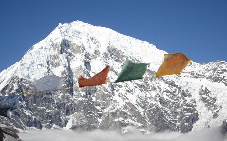 Helambu trekking via Sherpa villages north of Kathmandu valley there are natural escape. Low elevation of this trekking area its make exciting eight days loop. Drive from Kathmandu to Sundarijal the trail to Helambu climbs on Shivapuri ridge from wide views of the central Himalaya. Following the trekking top north of Tharepati before turning east down to Melemchi Gaon and Tarkegyang the typical villages of this area. Visit Shermathang after Tarkeghyang before downward to Melamchi river to end trek and drive from Melamchi Bazaar back to Kathmandu. Moderate trek between altitudes of 1370 to 3510m. hotel, lodge Comfortable run by local people. Valley offers pine forest, swift mountain stream, rugged rock and snow capped peaks, green downs and meadow scattered with daisies and wild primal. A variety of sights including Buddhist monasteries, cheese factory, yaks, glaciers and Himalaya scenery make trek an exciting. This Trek offers the experience of being in typical Sherpa village and many old monastery golden chance to learn about life in villages.
Helambu valley well-known for its picturesque magnificence and enjoyable atmosphere. Trekking continue to Kutumsang, Tharepati, Tarkegyang, Sermanthang and finally arrive in Melamchi Bazaar and next day drive back to Kathmandu. Cross throughout wide-ranging scenery ranging from evergreen jungle, cascade waterfalls and tumultuous stream pretty Langtang Himalaya range especially from Chisapani and Tharepati. Moderately effortless one due to the information that the elevation is inferior between 800 meters to 3600 meters contribution less climb as well as warmer temperature. Trekking starting from Sundarijal one and half hour drive from Kathmandu, we hike up to the directly up hill and move down roughly 30 minute then you reach in Chisapani where we expend first night just exterior of Kathmandu valley, impressive peaks scenery and wide mountain range. It is very gorgeous and beautiful village. Most significant advantage of this trek is the area is fewer packed and free from noise in similarity others parts of trekking region in Nepal. Furthermore on this trek offer an extensive Himalayan range, local society as well as stunning scenery. This is most beautiful place to see from there panoramic views of Langtang range with Ganesh Himal and Manaslu
Best Season: Spring (September to December) autumn (March to May).
Trekking Grade: Moderate
Max Elevation: 3640 m
Total trekking days: 07Days
Day 01: Arrive Kathmandu
Upon arrival in Kathmandu airport, please come right to the main arrival gate where our representative will be waiting with the company board or your name card.
Transfer to the hotel. Overnight at hotel in Kathmandu.
Day 02: Your full-day sightseeing includes visits to Bhaktapur Durbar Square, home of medieval art & architecture; Continue your tour to Kathmandu Durbar Square (Hanuman Dhoka), the old palace of the Royal Dynasty and hometown of living Goddess, Kumari. Final stop is at the Swayambhunath Stupa, the holiest shrine for the Buddhist and Hindus. Overnight at hotel in Kathmandu.
Day 03: Drive Kathmandu to Sundarijal (1350m) -1 hour & trek to Chisapani (2300m) -3 to 4 hours We drive from Kathmandu to the Sundarijal northern edge of the Kathmandu valley for about an hour by private transport and start to hike through the Shivpuri Watershed and Wildlife Reserve. The first settlement we will come across to sprawling Tamang settlement Mulkharka. The trail continues on a gentle climb through the forests ridges before it drops down to Chisopani (cold water) (2300m) situated on the ridge from where you can see countless snow peaks. The sunrise on the Himalaya, from Annapurna to Everest, is particularly outstanding from here. Stay overnight there.
Day 04: Trek Chisopani to Gul Bhanjyang (2140m) -5 to 6 hours
After breakfast the trail continues to drop down on a good, sometimes level and crosses meadows and fields to Pati Bhanjyang. Here is Brahman and Chhetri village on a saddle at the bottom of the ridge at 1860 meter. Then the trail begins climbing up again on a series of steep switchbacks to Chipling (2170m) where we can stop for lunch. At the upper end of this village the trail leads us another steep, 200 meter, climb on a stone staircase to the top of the Jhogin Danda ridge. From this ridge the trail descends through forest to a large Chorten (round Buddhist monument) overlooking the Tamang village of Gul Bhanjyang, which is a delightfull, classic hill village with a pleasant main street.
Day 05: Trek Gul Bhanjyang to Tharepati (3640m) -5 to 6 hours
Today the first part of the trail climbs up a steep, eroded trail through rhododendron forest passing only a few shepherds’ huts to a pass at 2580 meter. The trail proceeds north up the Yurin Danda ridge and affords views of Langtang and Gosaikund Peaks. Then we will cross the pass at 3510 meter before we descent to Magen Goth where we stop for lunch. Afterwards, the trail goes ascending / descending again, passing through forests, across flower-strewn meadows and crossing streams till we reach Tharepati (3640m). We stay Overnight at local lodge.
Day 06: Trek Tharepati to Melamchigaon (2530m) -4 to 5 hours
After breakfast the trail turns east and drops steeply into a narrow valley from the northern end of the village. The vegetation changes to large firs, then oaks and rhododendrons, as we rapidly low altitude. Thearepati and then the trail goes in descending order from Tharepati to Melamchi Gaun through the pine and rhododendron forest with good views down into the Helambu valley. The ridge directly above the village gives you a marvelous view of the Jugal Himal and Numbur in the Solu Khumbu. Cross the village and enter a forested area, again descending to Melamchi River followed to the Malemchigaon for overnight. Melamchi Gaon is surrounded by beautiful forests, which is mainly inhabited by Sherpa people with their distinctive culture and some Buddhist monasteries.
Day 07: Trek Malemchigaon to Tarke Gyang (2,590m) -5 to 6 hours
The early part of the trek descends until you cross the stream named as Melamchi. Now you enter a cultural destination it call Helambu Region. Then the trail goes gently up to beautiful Sherpa village Tarkeghyang passing through Sherpa old settlements and biggest monasteries. The stone houses are close together with narrow alleyways separating them. Stay Overnight at local lodge.guesthouse.
Day 08: Trek Tarke Gyang to Sermathang (2,610m) -4 to 5 hours
Today the trail is quite easy through flat land with beautiful forests. The trail leads us cross small forest with the view of beautiful village of Helembu region. The trail makes a sweep around the wide valley end between Parachin and the pretty Sharpa village of Gangyul. The people of this village practice Drukpa Kagyu Buddhism, the same as the national religion of Bhutan. This is another pretty Sherpa village where you can visit many ancient monasteries and view of Jugal Himal range at the north face of Shermathang village.
Day 09: Trek Sermathang to Malemchi Pul Bazaar (880m) -3 to4 hours and Drive to Katmandu - 2 to 3 hours bus After breakfast the trail gradually descends all the way to Melamchi Pul Bazaar through meadows and cultivated fields. Along the way, you come across several old villages with their own particular traditions. Walking today is quite pleasant with mountain views and the possibility of interacting with friendly local people. After having lunch we will drive back to Kathmandu through the road passing terraces, streams, rivers, local settlements and high hills. It takes about 3/4 hours (conditional) to reach your hotel in Kathmandu. Overnight at local lodge.Kathmandu.
Day 10: Depart Kathmandu
After breakfast, transfer to the Kathmandu airport (prior to three hours of your departure time) to board flight for your onward destination.
RNK 22 LANGTANG VALLEY TREK (10 Nights / 11 Days)
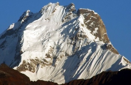 Langtang valley Trekking unite the distant and stunning valley of Langtang with high mountain lakes in Gosainkund, attractive Helambu valley. Visit lovely Langtang National park and then trekking to end of the valley excellent ice view. Langtang valley is properly called valley of glaciers. Here mountains raise high towards the sky. The valley offers pine forest, swift mountain river, rock and snow-capped peaks, grassy downs and meadow scattered with daisies and wild premolars. In the upper part of valley there are snow ridges spanning angry torrents, high passes enveloped in mist, tiny lakes of crystal brilliance and glaciated mountain giants. The region is one of the most pretty Himalayan destinations in terms of picturesque beauty and easy accessibility from Kathmandu. We commence our trek from Dhunche, on the well defined trail up the Langtang valley. The view of the Langtang Himal crowned by Langtang Lirung (7545m) is rewarding. Trek highlights are Kyanjin Gompa, Yala Peak & Gosainkund lake. Trekkers get the opportunity to travel through pristine forests to the village of Ghoda Tabela, where the valley of Langtang opens. Langtang has riverside meadows that provide stunning camping sites, spectacular peaks and wide glaciers. Trekkers, if they wish, can explore glacier filled side canyons at the head of the valley.
Langtang trekking proffer abundance of range for astonishing landscape of unharmed woodlands, massive glaciers, lakes and snow-white Himalaya peaks. Trek throughout the immaculate jungle to the village of Ghodatabela where you stop for lunch, where you see Langtang valley openly. Valley offer pine jungle, quick mountain stream, rocky snowcapped Himalaya peaks, green down and pasture strewn with daisies and wild primitive. Kyanjing Gompa and Tserko Ri are some of the well-liked places in this area. This high and remote area is settled by Tamangs whose spiritual practice, language and dress are much more similar with Tibet than to the society of their cousins in the Middle Hills. Those hiking Kyannjing Gompa make day tour to Tserko Ri from where your eyes will apprehend the surprising view of the gorgeous Himalaya. Trails will lead throughout evergreen jungle cross Rivers, lakes, and waterfall and even a glacier. Travelers with limited time border can delight this trekking, experience the wonderful intermingle of society, natural loveliness and escapade. Variety of sights counting Buddhist monasteries, cheese factory, yaks, glaciers and mountain Himalaya lakes make this trek an thrilling one.
Best Season: Spring (September to December) autumn (March to May).
Trekking Grade: Moderate
Max Elevation: 4130m
Total trekking days: 06 Days
Day 01: Arrive Kathmandu
Upon arrival in Kathmandu airport, please come right to the main arrival gate where our representative will be waiting with the company board or your name card.
Transfer to the hotel. Overnight at hotel in Kathmandu.
Day 02: Your full-day sightseeing includes visits to Bhaktapur Durbar Square, home of medieval art & architecture; Continue your tour to Kathmandu Durbar Square (Hanuman Dhoka), the old palace of the Royal Dynasty and hometown of living Goddess, Kumari. Final stop is at the Swayambhunath Stupa, the holiest shrine for the Buddhist and Hindus. Overnight at hotel in Kathmandu.
Day 03: Kathmandu- Syabrubesi – 7 hours drive
After breakfast drive to Syabrubensi – 118km. Overnight at local lodge.lodge.
Day 04: Syabrubesi- lama Hotel - 5 hours walk
Today’s journey starts after breakfast. We go to Lama Hotel through Bamboo and Ramche. We have to cross Bhotekoshi River from Syabrubesi and then by walking down the bank of Langtang River we reach Bamboo. After having lunch we start steep up journey till Ramche and then to Lama Hotel. Today we will get chance to have Jungle walk and can see Honey bee en route.
Day 05: Lama Hotel- Langtang - 5 hours walk
Today we start journey from lama Hotel and lunch break at Ghodatabela. After lunch we walk straight up route to reach Langtang. We find many shops en route to eat and drink. Langtang is a Buddhist Village so we see many Chortens, Mani wall and praying flag on the way.
Day 06: Langtang- Kanjing Gomba - 4 hours walk
The way from Langtang to Kanjing is straight and easy. We can see many beautiful mountains from Kanjing Gomba. This place is really beautiful. At Kanjing Gumba there is also one Cheese factory donated by Swiss Government. Kanjing Gumba is famous for Snow Leopard Protected Area. Some of the foreigners only come here to see and research Snow leopard. We can go to Kanjing Ri for a day hiking from where we can see beautiful Mountains from very close.
Day 07: Kanjing- Langshisha Kharka –Kanjing
Today is the day for extra hiking so you can hike as your wish. By having breakfast at Kanjing Gomba you should take packed lunch with you because there are no any shops available in-between. Langshisha Kharka is the best spot for panoramic view of Himalayas.
Day 08: Kanjing Gomba - Lama Hotel - 6 hours walking
We trek down to Lama Hotel and stay in the hotel.
Day 09: Lama Hotel – Syabrubesi - 4 hours walking
The journey from Lama Hotel – Syabrubesi is straight down and easy.
Day 10 Syabrubensi - Kathmandu - 7 hours drive
After breakfast drive back to Kathmandu.through the road passing terraces, streams, rivers, local settlements, high hills and along the river side for about 7 hours.
Rest day at leisure. Overnight at hotel in Kathmandu.
Day 11: Depart Kathmandu
After breakfast, transfer to the Kathmandu airport (prior to three hours of your departure time) to board flight for your onward destination.
RNK 23 GOSAIKUNDA TREK (10 Nights / 11 Days)
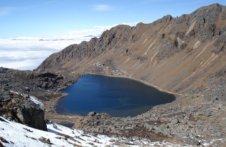 Gosainkunda Trekking many 100 of years pilgrims world wide have trek to this region to pay religious respect at many of the 100 icy fed lakes of Lord Shiva and other Deities. The lakes are situated at about 4300m. It is said that Lord Shiva, after drinking the poisons of the world, drove his Trisuli (three pronged fork) into the earth to drink pure water to quench his thirst. We follow a rugged trail with vivid views of Himal chuli (7893m) Manaslu (8163m) and Ganesh Himal (7406m). Clear day, the Annapurna Himalaya Range can be seen rising up behind to the north across valley is Langtang Lirung. Pass a few huts in high meadow of Laurebina, cross a small edge and first views of holy lakes call also frozen lakes and Gosainkunda sink, Main three being Saraswatikunda, Bhairabkunda and Gosainkunda, the lake Shiva created when he pierce a glacier with his trident to get water to satisfy his thirsty.
Gosaikunda Trekking provide a possibility to watch one of a holy site of Hindu and Buddhist the sacred Gosainkunda. We cross Laurebina pass (4610m.). Gosainkunda is located north of Kathmandu valley and the cultural group, known as Tamangs, Gurung typically settled this region. Route to Gosainkunda cross through diverse scenery range from evergreen jungle to sub alpine grasslands where flow waterfall and lovely Himalaya make an extra to loveliness. According to the Hindu tradition, when the God churn the primeval sea to create elixir of endless life, the poison was also shaped all together. Save the world from this poison, Lord Shiva drank it scare his gullet blue in the procedure. To cool downhill his ablaze gullet, Shiva wallop his trident into the rock make three spring which eventually resulted in the creation of lovely Gosainkunda and others lakes. Goshaikund trekking is one of the most incredible treks in Nepal. The society language and their culture are really alike to the Tibetans. There are 108 kund (pond) is in this area and mostly visible from Hindus where thousands of Hindus reach there during summer to pray and worship to Shiva. There are some others well-liked lakes near Gosainkunda as Nagkunda, Suryakunda, Saraswatikunda and Bhairabkunda.
Best Season: Spring (September to December) autumn (March to May).
Trekking Grade: Moderate and fairly strenuous
Max Elevation: 4610m
Total trekking days: 06 Days
Day 01: Arrive Kathmandu
Upon arrival in Kathmandu airport, please come right to the main arrival gate where our representative will be waiting with the company board or your name card.
Transfer to the hotel. Overnight at hotel in Kathmandu.
Day 02: Your full-day sightseeing includes visits to Bhaktapur Durbar Square, home of medieval art & architecture; Continue your tour to Kathmandu Durbar Square (Hanuman Dhoka), the old palace of the Royal Dynasty and hometown of living Goddess, Kumari. Final stop is at the Swayambhunath Stupa, the holiest shrine for the Buddhist and Hindus. Overnight at hotel in Kathmandu.
Day 03: Drive Kathmandu to Dhunche (1950m) -6 to 7 hours
Our Guide and Potter come to in your hotel at 6:00 am. Then we head north out of Kathmandu to Dhunche about 6/7 hours scenic driving by bus or Land cruiser (depending on group size). The scenery of foothills and ridgeline vistas to Dhunche goes through the Trishuli Bazaar, Betrawati and Dhunche you feel as if you are heading towards deep land. While passing along the road at the bank of Trishuli River you catch a glimpse of Ganesh Himal, terraces and green hills. Behind Trisuli Bazaar the road is tricky because of the grubby road. Stay Overnight at local lodge.
Day 04: Trek Dhunche to Chandanbari (3330m) -3 to 4 hours
This is our first day of trekking. After breakfast we will head through the trail of mineral water factory observing local traditional roof topped houses and some modern building. Far horizing we can see some snow capped mountains too. The trail climbs all the way through the jungle to Chandanbari. This is small town with few lodges and most significant of Sing Gumba (Monastery). The one of the oldest Cheese factory in Nepal is best quality cheese manufactures. We stay Overnight at local lodge.
Day 05: Trek Chandanbari to Laurebina Yak (3920m) -2 to 3 hours
After breakfast the trail climbs steeply up the ridge, which creates a transition zone between rich, moist forests on the northern slopes and dry scrub vegetation on the slope facing south. The northern slope is a sanctuary for the red panda, an endangered species that the Nepali calls cat bear. The trail leads us cross behind the ridge and stays in the deep forest for a while before emerging onto a saddle at Chalang Pati. Now we enter the Goisakund protected area where the killing of animals, lighting of wood fires and grazing of goats is prohibited. As the trail ascends there are outstanding views across Langtang valley and skey dominating view of Langtang Lirung. We can continue to Goisakund on the same day, but for acclimatization reasons it is wiser to stay in Lauberina Yak. During the morning we can see excellent view of Annapurnas, Manaslu, Ganesh Himal and Langtang lirung.
Day 06: Trek Lauberina Yak to Goisakund (4460m) -2 to 3 hours
We start by climbing further along the ridge till we see the first lakes at around 4100 meter. From here rest of trail today’s ascent steeply all the way to Gosaikunda. Then we follow a rugged trail with dramatic views to the west; Manaslu range, Ganesh Himal range, Tibetan peaks and to the north also across the valley is Langtang Lirung. Even the Annapurna range can be seen rising up behind during the clear day. Afterwards we pass a few huts in the high pasture of Laurebinayak, cross a small ridge and can see first views of the holy lake of Gosaikunda. There are about a dozen lakes around Gosainkunda Basin, the main three being Saraswatikunda, Bhairabkunda and Gosainkunda. According to legend Gosainkunda was created by Shiva when he pierced a glacier with his trident to obtain water to quench his thirst after having swallowed a poison that threatened to destroy the world. Hundreds of pilgrims come here to worship and bathe during the full-moon festival each August. It takes about 45 minutes to walk around the lake.
Day 07: Trek Gosainkunda Lake to Chandanbari (3330m) -4 to 5 hours
We will visit some picturesque site to catch in our camera. Then after breakfast we will retrace trekking route. It is downhill all the way to Chandambari (Singgumba) offering excellent view surrounded you. May you have chance to see some missing scenery of yesterday. We stay Overnight at local lodge. The local well managed cheese factory and a Buddhist Monastery’s place Singgompa provides panoramic views, exhilarating nature. The cheese manufactured here is considered the best in Nepal.
Day 08: Trek Chandanbari to Thulo Syabru (2,230m) - 2 to 3 hours
The trail gently descents through with rhododendron, oak, hemlock, pine and Junipers forests steeply to the Thulo Syabru. During today trail you could see red pandas, boar, monkeys and various species of birds. The Tamang Cultural Heritage “Thulo Syabru Gaun” is offers wonderful ethnic custom, culture and their traditional has not been followed from century. Here, you can enjoy the amazing landscape and the magnificent nature with splendid views of Ganesh Himal (7110m), Langtang Himal and its ranges. Rest of the day explore around village and Overnight at local lodge.guesthouse.
Day 09: Trek Thulo Syabru to Syabrubesi (1440m) -2 to 3 hours
After breakfast, we will walk through the village to the syabrubesi. The trail apart from end of the queue houses to the lefe ridge. Then it steeply descends until syabrubesi. Rest of the day we will wonder around city observing people culture and day to day life style. Stay Overnight at local lodge.
Day 10: Drive Syabrubesi to Kathmandu -7 to 8 hours
We will be ready at 6:00 morning in hotel lobby with having your breakfast or advice as your trekking guide or you’re wise. We will drive back to Kathmandu through the road passing terraces, streams, rivers, local settlements, high hills and along the Trishuli river side. It takes about 7 to 8 hours (conditional) to reach your hotel in Kathmandu. Overnight at local lodge.
Day 11: Depart Kathmandu
After breakfast, transfer to the Kathmandu airport (prior to three hours of your departure time) to board flight for your onward destination.
RNK 24 LANGTANG - HELAMBU - GANJALA TREKS (15 Nights / 16 Days)
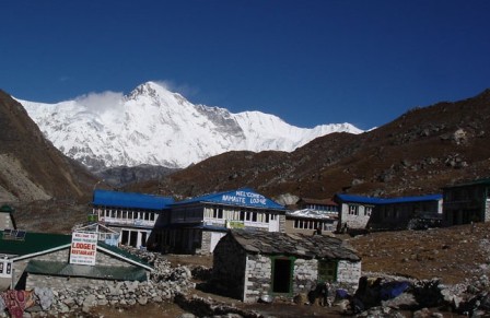 Ganja La pass trekking (5130m.) is most critical challenging treks in Nepal. The pass is often blocked by snow, discovery about local status, good equipment and climbing skill are required for safe cross to Ganja La and located in Langtang region. Adventure Ganja La trekking is altering most tricky treks in Nepal. Dialect spoken are also diverse but they also follow the Buddhist religion and we find many old Buddhist monasteries in the villages. View from the Ganja La pass of langtang Gyenyin Lhudup the peak in the Tibet and Shisha pangma (8013m.) which is last biggest mountain above 8000m. Over the pass as you make your way south from the Langtang village (3200m.), which lies at and is the headquarters of Langtang National Park. Three nights Ganja La high pass trekking you must be sleep in tent between Langtang valley to Tarkeghyang and day four after cross Ganja La than you are Tarkeghyang where you sleep in tea house normal like in Langtang side. Trek passes through some lovely forests and very pretty villages on route. Few meters of ascent to the prayer flags on the pass necessitate an unassuming amount of scramble.
Magnificent views of the Ganesh and Jugal Himal peaks welcome you as you cross to the pleasant Helambu region. After Ganjala pass all the way takes you to Tarkeghyang in Helambu trekking region. Sherpas culture in Tarkeghyang and Sermanthang but their link with Sherpa from Solukhumbu is far-away. Ganjala La pass trekking region people from Tibetan origin are living from long time in Langtang side, but they introduce them self as Gurung and Tamang. Ganja La create the trekking from Langtang one of the demanding trek in Nepal with adverse weather status. Good gear as well as experience of climbing is condition for the trekking in Ganja La. There are no lodges after Kyangjing Gompa until Tarkeghyang and no defrayal for three days next to the trail, the group must be well ready with enough food. Only camping camping treks are likely for this area. While Ganjala La pass is regularly used by cross to Helambu side after cross Ganja La has always been concern of travelers from Langtang side. We meet Sherpa people and society in Tarkeghyang which is diverse way to lifestyle than Solukhumbu. Spoken are also different way between Sherpa from Solukhumbu and this region. People here follow the Buddhist religion and you will find several old Buddhist monasteries in the villages equally of Solukhumbu. Tarkeghyang and further down to Sermanthang, Melamchi Bazar and we drive back to Kathmandu.
Best Season: Spring (September to December) autumn (March to May).
Trekking Grade: Strenuous
Max Elevation: 5130m
Total trekking days: 11 Days
Day 01: Arrive Kathmandu
Upon arrival in Kathmandu airport, please come right to the main arrival gate where our representative will be waiting with the company board or your name card.
Transfer to the hotel. Overnight at hotel in Kathmandu.
Day 02: Your full-day sightseeing includes visits to Bhaktapur Durbar Square, home of medieval art & architecture; Continue your tour to Kathmandu Durbar Square (Hanuman Dhoka), the old palace of the Royal Dynasty and hometown of living Goddess, Kumari. Final stop is at the Swayambhunath Stupa, the holiest shrine for the Buddhist and Hindus. Overnight at hotel in Kathmandu.
Day 03: Drive from Kathmandu to Syabru Besi (1503m)
Today your guide will pick you up from your hotel early in morning to go for new bus park to catch the public bus to Syabru Besi but if you prefer to hire private vehicle then private vehicle (Jeep/Land cruiser or bus depend on group size) will pick up from hotel and directly drive to Syabru besi. You head north of Kathmandu driving through scenic foothills and ridgeline vistas to Syabru Besi (1503m) through the famous places Kakani (2145m), Ranipauwa, Trisuli Bazaar (548m), Betrawati (620m), Kalikhastan (1390m), Dhunche (1960m) Thulo Bharkhu (1860m) and finally you reach at Syabru Besi. It takes about 8/9 hours drive from Kathmandu. Overnight at local lodge.Camp / teahouse
Day 04: Syabru Besi trek to Lama Hotel (2400m)
Today the trek we cross the Bhote Kosi river by a suspension bridge towards ‘old’ Syabrubesi, a cluster of houses and a school opposite the river. Another suspension bridge carries us over the south side of the Langtang Khola, this river we will be following upwards for the next couple of days. We climb slowly to Doman (1680m) and continue over a rocky ridge to Landslide Lodge and Hot Spring restaurant; named after a small hot spring on the opposite river bank at 1810 meter. The trail now climbs gently up to Bamboo. Opposite the river we will see near vertical cliffs covered with cactuses. After Bamboo we cross the Langtang Khola on a new suspension bridge to the north bank. The forest becomes sparser and drier on this side of the river, consisting mainly of scrub nettles and oaks. We climb steeply on a good trail to Rimche (2400m) continue to Upper Rimche (2510m). Beyond the trail descend slowly to Changtang known as Lama Hotel (2470m) Overnight at local lodge.Camp / teahouse
Day 05: Lama Hotel trek to Langtang village (3430m)
Today the trek starts with a gentle climb, but it soon becomes steeper, climbing through a forest of oaks, hemlocks, maples and rhododendron. From the trail you will see the beautiful views of Langtang Lirung (7246m). After little more then an hour we pass two lodges in the forest at Gumanchok (2800m), from where we climb to a Nepal army post and a national park checkpoint at Ghoda Tabela (2970m). The trail ascends gradually, as the valley becomes wider. We will pass a few teashops at Thangshyap (3140m). The route is now in open country, and passes many mani stones, water-driven prayer wheels and a few scattered Tamang villages before arriving in Langtang. This is a small village consisting of guesthouses and yak farms. The surrounding fields containing buckwheat, wheat, turnips, potatoes, and barley have typical stone fencing walls. Overnight at local lodge.Camp/ teahouse
Day 06: Langtang village trek to Kyangjin Gompa (3870M)
Today the trek through the village of Langtang we will pass many stone mani walls, covered with Tibetan inscriptions to please the gods. It then climbs up gradually past the small villages of Mumdu and Sindum. The trail continues through yak pastures. After crossing the Langtang Khola to its south bank we climb up through a landscape scattered with large boulders to a moraine where we will have the first views of Kyanjin Gompa ahead of us, and the dramatic icefall flowing from Langtang Lirung and Kinshung (6781m) north of us. Beyond the trail lead through some rocks and climb towards the gompa, then make a short descend to Kyanjin Gompa (3870m). Afternoon looks around the Kyanjin Gompa. Overnight at local lodge.Camp /
Day 07: Excursion around Kyanjin Gompa
Today, we have day excursion trip from Kyanjin Gompa either Kyanjin Ri (4773m) or Tsergo Ri (4984m) or another option is hike to Langshisa Kharka (4080m) but not recommended one because it is very hard and long day trip so if you don’t have camping arrangement with one more day for stay overnight in Langshisa Kharka better not to go there. North of Kyanjin Gompa is about two hours climb you reach at Kyanjin Ri from where you will see the beautiful views of Langtang Lirung (7246m), Kinshung (6781m), Yansa Tsenji (6567m) and Straddling the Tibetan border are Dorje Lhakpa (6966m), Ganchempo (6387m), Langshisa Ri (6427m) and a whole host of 6,000+m peaks whilst across the valley are Naya Kang and the Ganja La pass. If you are interested to little gain in altitude there is the chance to climb Tsergo Ri (often written Cherko Ri) - at 4,984m. It takes about five hours climb from Kyanjin Gompa to reach at Tsergo Ri. Follow the trail north and take a left fork about 10 minutes then step climb to Tsergo Ri for spectacular mountains view and back to Kyanjin Gompa. Overnight at local lodge.Camp / teahouse
Day 08: Kyanjin Gompa trek to Ngegang (4000m)
Today trek trail is very short, Cross the Langtang Khola below the kyanjin Gompa then makes steep climb along the ridge on the south side of the valley through a forest of juniper and rhododendron. Finally becoming more gentle, the trek trail reaches the Yak pasture at Ngegang (4000m) where available good place to camp before climb to the Ganja La Pass. Overnight at local lodge.Camp
Day 09: Ngegang trek to Keldang over the Ganja La Pass (5130m)
Today we are follows the trail south of our camp. The trek continues climbing steeply towards the Pass. As the trail climbs higher and comes under the shadow of the above 5800m peaks to the south. The trail normally covered by snow. Turning south-west, the trail makes the final steep climbs to the Ganja La Pass at 5130m. The view to north from the pass of Langtang Lirung and snow peaks in Tibet including Shisha Pangma (8013m). Clear day there are also views of many ranges to the south. West of Pass is Naya Kanga (5844m), previously named Ganja La Chuli. After the pass we are descend steeply to Yangri Khola (4400m) then drops quickly down rough slope to the stream. Follow the stream for some distance through grassy meadows, the trail reaches a few Goths at Keldang (4270m). Overnight at local lodge.Camp
Day 10: Keldang trek to Dukpu (4080m)
Today is long and strenuous day as the descends along a ridge. The trail many ups and downs to Dukpu. In Winner, there is no water from Keldang to bottom of the ridge so better to take packed food for the trail but monsoon and usually October and November no problem with water. The trail heads down the valley, but stay high above the river, finally meet the ridge itself then follow the ridge line to Dukpu (4080m). Overnight at local lodge.camp
Day 11: Dukpu trek to Tarke Gyang (2590m)
Today the trek trail descends further along the ridge then makes a 180m climb to a pass at 4020m. From the top of Pass offers magnificent views of Dorje Lakpa and scenery some part of Everest range, as far as the peak of Numbur in Khumbu. After pass you trek through pine and rhododendron forest past tiny herders settlements to a ridge high above Tarke Gyang. Then descend steeply to Gekye Gompa (3020m) through Ama Yangri Danda (3771m) which is the best view point in Helambu region. The trail continues to the large Sherpa village Tarke Gyang (2590m) Overnight at local lodge.Camp / teahouse
Day 12: Melamchigaon trek to Tarke Gyang (2590m)
Today the trek from Melamchigaon gompa, the trail descends through jungle to a bamboo teashop at 2360 meter, then drops steeply through fields to the Malemchi Khola river. After crossing the suspension bridge at 1920m the trail begins its long climb towards Tarke Gyang, which is the largest village in the Helambu region. The stone house here are build close together with narrow alleyways
separating them. The gompa of this village has a large brass prayer wheel. Afternoon is better to visit around Tarke Gyang and see their life style and culture. Overnight at local lodge.
Day 13: Tarke Gyang trek to Sermathang (2610m)
The trail leaves the village and makes a sweep around the wide valley to the pretty Sherpa village of Ganyul at 2520 meter. The people in this village practice Drukpa Kagyu Buddhism, the same as the national religion of Buthan. From here the trail drops over a ridge but soon starts climbing up again through deep forests, crossing a number of streams to a crest at 2620 meter. We continue our way passing the large gompa at Chumnik, before another gentle climb leads to the village of Sermathang (2610m). Afternoon is better to visit Gompa and village to see their life style and culture. Overnight at local lodge.
Day 14: Sermathang trek to Melamchi Pul Bazaar (880m)
Today trek trail from Sermathang the trail follows the ridge all the way down to Malemchi Pul Bazaar, making a drop of 1730 meter. The trail passes chorten after chorten in the settlements of Nigale, Gyalsha and Raithani Gyang. From here we descent through chir pine forest to yet another chorten at Kakani, which is the last Sherpa village on the trek, and we now enter the lowlands inhabited by Brahmans and Chhetris. From Kakani the trail drops steeply to the attractive village of Dubhachaur in a saddle at 1610 meter. Continuing further down the ridge our trail will eventually bring us to a large suspension bridge which crosses the Indrawati river and brings us into Malemchi Pul Bazaar (880m) Overnight at local lodge.
Day 15: Melamchi Pul drive to Kathmandu (1350m)
From Melamchi Pul we can take local transportation, or have our private transport to bring us back to Kathmandu.Drive from Melamchi Pul Bazaar to Kathmandu which takes about five hours. You travel through gravel and bumpy path up to Lamidanda and then you follow the pitched road up to Kathmandu though Banepa & Dhulikhel highway. Overnight at local lodge.Hotel
Day 16: Depart Kathmandu
After breakfast, transfer to the Kathmandu airport (prior to three hours of your departure time) to board flight for your onward destination.
RNK 25 LANGTANG HELAMBU GOSAINKUNDA TREKKING (18 Nights / 19 Days)
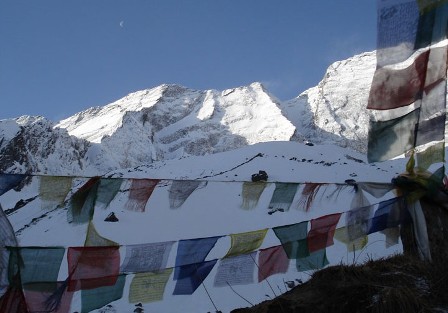 Langtang Gosainkund Helambu Trekking chance to travel through pure forest and village of Ghoda Tabela, where the valley of Langtang opens. Langtang provide lodging this area, which provide lovely camping sites, spectacular peaks and wide glaciers. Trekkers, if they wish, can explore glacier filled side canyons by hiking to the head of the valley also Hindus holy place. Thousands of Hindus make a pilgrimage there during the summer to pay homage Lord Shiva. Lake call Gosainkunda its-elf is situated here at 4380m. Gosainkunda passes through varied scenery ranging from evergreen forest to sub alpine grasslands where cascade waterfalls and beautiful mountains make an adding to its splendor. There are other popular lakes nearby including Nagkunda, Suryakunda, Saraswatikunda and Bhairabkunda. It lies to north of Kathmandu where dominantly Sherpa and Tamang peoples have their homes. Trekkers come in contact with temperate forests and alpine meadow, glaciers lakes, snowy peaks can give sometime feeling of being in heaven.
Trekking in this region can be reach by a bus drive to the little trail head of Syaprubesi. Trekking up to Sing Gompa and then to Gosaikunda (4380m.), a holy lake where thousands of Hindu and Buddhist pilgrimage hiking during a full moon festival it call holy thread almost in August every year. Along with this, Helambu, Sherpa villages are also enclosed in this trek. It is likely to trekking in diverse walking track. One of the best options is ongoing trekking by crossing Lauribina pass 4610m. Lovely surrounded by mountain peaks. The water fall from lake to lake will create your trek more pretty and wonderful. Trekking in this area is extremely lovely and well-known for its natural beauty with magnificent climate in mountain for the spectacular views of Himalaya and brilliant snowy mountains. Cross Lauribina, Gosainkunda and you will arrive in Helambu trek region. Helambu gives the travelers a great option to discover the life culture of Sherpa. Many of monasteries in central of village take you in world of Tibetain painting art culture. Trekking ending at Sundarijal and drive back to Kathmandu.
Best Season: Spring (September to December) autumn (March to May).
Trekking Grade: Moderate
Max Elevation: 4460m
Total trekking days: 14 Days
Day 01: Arrive Kathmandu
Upon arrival in Kathmandu airport, please come right to the main arrival gate where our representative will be waiting with the company board or your name card.
Transfer to the hotel. Overnight at hotel in Kathmandu.
/p>
Day 02: Your full-day sightseeing includes visits to Bhaktapur Durbar Square, home of medieval art & architecture; Continue your tour to Kathmandu Durbar Square (Hanuman Dhoka), the old palace of the Royal Dynasty and hometown of living Goddess, Kumari. Final stop is at the Swayambhunath Stupa, the holiest shrine for the Buddhist and Hindus. Overnight at hotel in Kathmandu.
Day 03: Kathmandu to Syabru Bensi (2581m)
We take early drive from Kathmandu to Syabru Bensi via. Dhunche (1966m.). We drive through scenic foothills and ridgeline vistas to Dhunche. The first part of our drive up to Trishuli Bazaar is quite smooth. Syabru Bensi is the starting point of our trek. It is a beautiful village stretched out along the ridgeline. Overnight stay at Syabru Bensi.
Day 04: Syabru Bensi to Lama Hotel (2470m.)
Today we trek from Syabru Bensi to Lama Hotel (2470m.). The trail goes along the ridge of Syabru's main street and then drop to the Ghopche Khola (2050 m.) and then to Pairo (1810m.). From this point, the trail goes to Rimche (2400m.) through Bamboo (1960m.) and finally end at Lama Hotel. En route one can see red pandas, monkey and bear.
Day 05: Lama Hotel to Langtang Village (3430m.)
Having lunch at Lama Hotel, we trek to Langtang village (3430m.) via Ghore Tabela (3000m.) which takes about six hours. We would find some grazing grounds of Yak on the way. The local people bring their livestock for grazing in the high pastures during the summer months. We find a monastery before we reach Langtang Village. We pay our short visit to the monastery and arrive at our destination.
Day 06: Langtang Village to Kyangjin Gompa (3870m.)
It is our turn to trek from Langtang Village to Kyangjin (3870m.). It takes about three hours to reach there. Our trail climbs gradually through small villages and yak pastures as the valley opens further and the views become more extensive. Kyangjin Gompa is reached after crossing several small streams and moraines. We would visit the cheese factory at Kyangjin Gompa. We would enjoy the panoramic view of Dorje Larpa (6990m.), Langtang Ri (6370m.), Langtang Lirung (7245m.) and many more.
Day 07:Kyangjin Gompa
We would acclimatize at Kyangjin Gompa and go for excursion to utilize our time. We would visit the monastery and the cheese factory, walk up the moraine to see the spectacular ice falls and tumbling glaciers of Langtang Lirung or ascend Kyangjin Ri (4350m).
Day 08: Kyangjin Gompa to Lama Hotel (2740m.)
Trek from Kyangjin Gompa to Lama Hotel. From Kyangjin, we retrace our route following the Langtang Khola to Langtang village and on to Ghora Tabela. Having lunch at Ghora Tabela, we trek steep descent to Lama Hotel.
Day 09: Lama Hotel to Thulo Syabru (2260m.)
We trek from Lama Hotel to Thulo Syabru (2260m.). The beginning of the trek is gently descending till Pairo and then goes steep up to Thulo Syabru. En route, one could see red pandas, monkey and various species of birds.
Day 10:Thulo Syabru to Sing Gompa (3330m.)
It is our turn to trek from Thulo Syabru to Sing Gompa (3330m.). Our trail from Thulo Syabru goes to Foprang Danda (3200m.) passing through Dursagang (2660m.). We would be lucky enough to view Langtang Himal, Ganesh Himal, Tibetan Mountain and forests of Oak, Hemlock and Firs. After a while, we reach Sing Gompa. We would find a well-managed local cheese factory and a Buddhist Monastery at Sing Gompa too.
Day 11: Sing Gompa to Gosaikunda (4460m.)
Today we trek from Sing Gompa to Gosaikunda (4460m.) via Lauribinayak La (3920m.). We would follow a rugged trail with dramatic views of Himal Chuli (7893m.,) Manaslu (8156m,) and Ganesh Himal (7406m.). On a clear day, even the Annapurna range can be seen rising up gently behind. To the north, we would see Langtang Lirung. At Gosainkunda, we would see a dozen of lakes. Among them, the major three are Saraswatikund, Bharab Kunda and Gosainkunda. According to a legend, Gosainkunda was created by Shiva when he pierced a glacier with his trident to obtain water to quench his thirst after having swallowed poison.
Day 12: Gosaikunda
We would acclimatize at Gosainkunda and go for excursion at our leisure.
Day 13: Gosainkunda to Ghopte (3430m.)
Trek from Gosainkunda to Lauribinayak Pass (4610m.) to Ghopte (3430m.). The trail leaves Gosainkund and climbs through rugged country, past four more small lakes to the Laurebina La (4610m), the highest point of this trek. Keep looking back for spectacular views of Manaslu and the mountains of the Ganesh Himal, as well as the now familiar Langtang Lirung. You then descend steeply to camp near Gopte.
Day 14: Ghopte to Melamchi Gaon (2650m.)
Today we trek from Ghopte to Melamchi Gaon (2650m.) via Tharepati Pass (3490m.) The first part of our trail is slightly descending and then starts ascending through the rhododendron forests until Thearepati. From Tharepati, the trail gradually descends through pine and rhododendron forests down to Helambu valley. We would see Jugal Himal and Numbur of Solu Khumbu from here. Melamchi Gaon is mainly inhabited by Sherpa people. We would visit the monasteries at our leisure at Melamchi.
Day 15: Melamchi Gaon to Tarkeghyang (2743m.)
We trek from Melamchi Gaon to Tarkeghyang (2743m.) The early part of the trek descends until we cross the stream named as Melamchi. From here, our trail goes to Tarkeghyang. It is a beautiful Sherpa village with one of the oldest and biggest monasteries.
Day 16: Tarkeghyang to Shermathang (2621m.)
Trek from Tarkeghyang to Shermathang (2621m.) Trekking today is comparatively easier than the previous days as the trail goes through flat land with beautiful forests. On the way, we would penetrate the village called Shermathang where we would visit some ancient monasteries.
Day 17: Shermathang to Melamchi Pul Bazaar (846m.)
Today we trek from Shermathang to Melamchi Pul Bazaar (846m.) The trail gradually descends all the way to Melamchi Pul Bazaar through meadows ad cultivated fields. On the way, we come across several villages. En route, we would interact with the local people and know their culture and way of life.
Day 18: Melamchi Pul Bazaar to Kathmandu (1320m.)
From Melamchi Pul Bazaar, we drive to Kathmandu. The road is graveled and bumpy till Lamidanda and then we will have pitched road up to Kathmandu. Overnight at local lodge.Kathmandu.
Day 19: Depart Kathmandu
After breakfast, transfer to the Kathmandu airport (prior to three hours of your departure time) to board flight for your onward destination.
RNK 26 LANGTANG GANJALA PASS TREK (21 Nights / 22 Days)
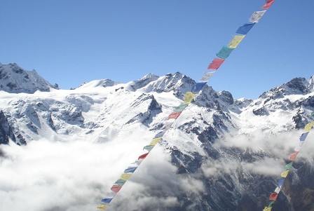 Regarded as one of the difficult passes in Nepal, Gonja-La Pass (5106m) is to be attempted with the local advice, adequate acclimatization, good equipments and some experience. The pass is usually blocked by snow from December to the last week of February and at any time a bad weather change can make crossing the pass decidedly challenging. It takes about four days to cross the distance between Kyanjin and Gekye and we find no permanent settlement between them. It is very wise idea to have some altitude acclimatization around Kyanjin Gompa before commencing the crossing. We would camp before the pass that would facilitate us to increase our acclimatization.
We commence our overland journey to Syabrubesi by bus. From Syabrubensi, we ascend to the beautiful alpine valley of Kyangjin Gompa. We would stay two days for acclimatization in Kyanjin Gompa. From Ngegang the trail climbs steeply and crosses a snow slope to the pass, marked by rock cairns and prayer flags and with a spectacular view of the peaks to the north and the hills to the south. A steep and dangerous descent flows to Kaldang at 4270m. Coming the other way over the pass the long ascent from Keldang means we must spend an additional night on the southern side of the pass. From Keldang it is a long day’s walk to Dukpu at 4080m. and another day from there to Tarke Gyang at 2743m. The last day’s walk offers tremendous views of the Himalaya as you cross a 4020m. pass soon after leaving Dukpu.
To the north of the pass, we would see the Hilalayas like- Langtang Lirung, Shisa Pangma (8013m.) and some Tibetan Himalayas. To the west, there is Naya Kangri (5846m.) previously named as Gunja-La Chuli. A base camp in this region makes a good starting point for this trek.
Best Season: Spring (September to December) autumn (March to May).
Trekking Grade: Moderate
Max Elevation: 5106m
Total trekking days: 17 Days
Day 01: Arrive Kathmandu
Upon arrival in Kathmandu airport, please come right to the main arrival gate where our representative will be waiting with the company board or your name card.
Transfer to the hotel. Overnight at hotel in Kathmandu.
Day 02: Your full-day sightseeing includes visits to Bhaktapur Durbar Square, home of medieval art & architecture; Continue your tour to Kathmandu Durbar Square (Hanuman Dhoka), the old palace of the Royal Dynasty and hometown of living Goddess, Kumari. Final stop is at the Swayambhunath Stupa, the holiest shrine for the Buddhist and Hindus. Overnight at hotel in Kathmandu.
Day 03: Kathmandu to Chisopani (2300m.)
We drive from Kathmandu to Sundarijal (1350m.). The rough road from Kathmandu turns into a trail near a small hydroelectric plant. The trail will take us through the Shivpuri Watershed and Wildlife Reserve. We will come across a Tamang settlement called Mulkharka. The route heads down the ridge through a forest of oaks and rhododendron to Chisopani (2300m.)
Day 04: Chisopani to Kutumsang (2446m.)
Today we trek from Chisopani to Kutumsang (2446m.). The trail continues to drop from Chisopani and crosses meadow and fields. We would descend through Pathi Bhanjyang to Gul Bhanjyang. The trail climbs a ridge from Gul Bhanjyang to another pass at 2620m. The meadow at Kutumsang at 2470m makes a good camping spot.
Day 05: Kutumsang to Magen Goth (3220m.)
Having lunch at Kutumsang, we trek to Magen Goth (3220m.). The trek continues due north to Yurin Danda ridge. The trail climbs above Kutumsang on a steep, eroded trail mostly through fir and rhododendron forest and descends to Magen Goth.
Day 06: Magen Goth to Ghopte (3430m.)
Today we trek from Magen Goth to Ghopte (3430m.) Via Tharepati Pass (3650m.) We will reach Tharepati and the trail ascends through the forest, climbing in and out of ravines across the valley.
Day 07: Ghopte to Gosainknda (4361m.)
Trek from Ghopte to Gosaikunda (4361m.). The trail ascends through the meadow of bushes and some rhododendron trees and ascends to Phedi (3500m.). Finally, we come to Gosainkunda.
Day 08: Gosainkunda
We would take rest at Gosaikunda for pilgrimage. The large lake Gosainkunda at an elevation of 4361m., attracts hundreds of Hindu and Buddhist pilgrims from different corners of the world during the full moon festival each August. One can witness some black and white stones in the lake with an individual story about Lord Shiva and his creation.
Day 09:Gosainkunda to Chandanbari (2350m.)
It is our turn to trek from Gosainkunda to Chandanbari (2350m.) Our trail gently ascends for a short period and goes through different chortens and small Shiva temples. The trail then descends to Laure Binayak to Singh Gompa and then goes to Chandanbari. Singh Gompa houses a statue of the Green Tara. We would also witness small cheese factories on the way.
Day 10: Chandanbari to Syabru Gaon (2210m.)
It is our turn to trek from Chandanbari to Syabru Gaon (2210m.). Our trail descends through the forest and come across the Chortens en route. Finally, we will arrive at Syabru Gaon which is densely populated by Buddhists.
Day 11:Syabru Gaon to Lama Hotel (2380m.)
Trek Syabru Gaon to Lama Hotel (2380m.). Our trail crosses the Bhote Kosi and then climbs through forest of oak and rhododendron. We would also have a glance of languor monkeys jumping from one tree to another.
Day 12: Lama Hotel to Langtang Village (3430m.)
Having lunch at Lama Hotel, we trek to Langtang village (3430m.) via Ghore Tabela (3000m.) which takes about six hours. We would find some grazing grounds of Yak on the way. The local people bring their livestock for grazing in the high pastures during the summer months. We find a monastery before we reach Langtang Village. We pay our short visit to the monastery and arrive at our destination.
Day 13: Langtang Village to Kyangjin Gompa (3870m.)
It is our turn to trek from Langtang Village to Kyangjin (3870m.). It takes about three hours to reach there. Our trail climbs gradually through small villages and yak pastures as the valley opens further and the views become more extensive. Kyangjin Gompa is reached after crossing several small streams and moraines. We would visit the cheese factory at Kyangjin Gompa. We would enjoy the panoramic view of Dorje Larpa (6990m.), Langtang Ri (6370m.), Langtang Lirung (7245m.) and many more.
Day 14: Kyangjin Gompa
We would acclimatize at Kyangjin Gompa and go for excursion to utilize our time. We would visit the monastery and the cheese factory, walk up the moraine to see the spectacular ice falls and tumbling glaciers of Langtang Lirung or ascend Kyangjin Ri (4350m).
Day 15: Kyanjing Gompa to Ngegang(4000m.)
Today we trek from Kyanjing Gompa to Ngegang(4000m.) which takes about 5 hours. We don’t find villages along the trail. We would enjoy varieties of flora and fauna on the way. In the evening, we would take rest in our camp.
Day 16: Ngegang to Keldang (5106m.)
Having breakfast at Ngegang, we trek to Keldang (5106m.) via Ganja La (5130m.). Ganja La Pass is to be attempted with the local advice, adequate acclimatization, good equipments and some experience. The pass is usually blocked by snow from December to the last week of February and at any time a bad weather change can make crossing the pass decidedly challenging.
Day 17: Keldang to Dukpu (4080m.)
We trek from Keldang to Dukpu (4080m.) which takes about five and half hours. Our camping site will be arranged in the forest. We would be walking along ridge, grassland experiencing pin-drop silence and enjoying the panoramic views of Himalayas.
Day 18: Dukpu to Tarkeghyang (2740m.)
From Dukpu, we trek to Tarkeghyang( 2740m.). We would descend about 200m. and climb the 4100m pass. From the pass, we would view spectacular mountain ranges- Annapurna and Everest. Now the trail descends through pine forest, rhododendron forest and pass through the settlement to Tarkeghyang. On the way, we would also visit one of the oldest Buddhist monasteries and Sherpa villages. The people of the villages are well cultured, friendly and cheerful.
Day 19: Tarkeghyang to Shermathang (2621m.)
Trek from Tarkeghyang to Shermathang (2621m.) Trekking today is comparatively easier than the previous days as the trail goes through flat land with beautiful forests. On the way, we would penetrate the village called Shermathang where we would visit some ancient monasteries.
Day 20: Shermathang to Melamchi Pul Bazaar (846m.)
Today we trek from Shermathang to Melamchi Pul Bazaar (846m.) The trail gradually descends all the way to Melamchi Pul Bazaar through meadows ad cultivated fields. On the way, we come across several villages. En route, we would interact with the local people and know their culture and way of life.
Day 21: Melamchi Pul Bazaar to Kathmandu
From Melamchi Pul Bazaar, we drive to Kathmandu. The road is graveled and bumpy till Lamidanda and then we will have pitched road up to Kathmandu. Overnight at local lodge.
Day 22: Depart Kathmandu
After breakfast, transfer to the Kathmandu airport (prior to three hours of your departure time) to board flight for your onward destination.
EASTERN NEPAL TREKKING
Trekking in Eastern Nepal is very isolated but it has some of the besttrekking in Nepal. The most popular areas for trekkers are the Makalu Barun National park on the border of Tibet and the Kanchenjunga massif on the border to Sikkim . Trekking to the very remote Makalu (8475 m) and Kanchenjunga (8598 m) base camps are two of the finest treks in eastern Nepal .
The foothills of these Himalayan regions offers one of the most exciting trekking in Nepal , trekking, trekking trails on this regions follow a series of melt water rivers and streams passing through a fascinating variety of landscape. This area is rarely visited by trekkers and is rich in wildlife. The area has hot rice-growing districts and also encompasses the cooler tea-growing region of Ilam. The heavily populated Middle Hills are gouged by the mighty Arun Kosi, which is flanked by the massifs of Kanchenjunga and Makalu . Inhabitants of this part of Nepal have not seen many Westerners in their villages.
Trekking in Eastern Nepal regions are not popular like other parts of Nepal but this regions has endless variety of places to explore around. The diverse landscapes includes terraced fields and plan lands which are covered by different types of vegetation, the mixed pastures, hills of colorful rhododendron and jasmine, beautiful sunrise and sunset, magnificent view of Makalu, Everest, Lhotse, Kanchenjunga, Baruntes and other mountains. Eastern Regions has the ethnic gropes of Rai Tamang, Sherpa and Limbu. The places like Basantapur, Dhankuta, Hile, Khandbari and Bhojpur are prosperous and clean.
Because of the long access to eastern Nepal by bus, we recommend to fly in to the tiny airstrips at Tumlingtar and Suketar. Most of the trek in Eastern Nepal is camping style trek. Because of the flight transports and camping trekking the costs are quite expensive and trekking duration are long for these regions
RNK 27 MAKALU BASE CAMP TREKKING (21 Nights / 22 Days)
Best Season: Spring (September to December) autumn (March to May).
Trekking Grade: Moderate
RNK 28 KANCHENJUNGHA TREKKING (24 Nights / 25 Days)
Best Season: Spring (September to December) autumn (March to May).
Trekking Grade: Moderate and fairly strenuous
RNK 27 MAKALU BASE CAMP TREKKING (21 Nights / 22 Days)
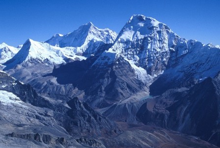 Pyramid shaped Mt. Makalu (8463m.) is the fifth highest mountain in the world and is located 22 km east of Mt. Everest on the border between Nepal and Tibet. The first attempt to the peak was made by an American team led by W. Siri in the spring of 1954. They attempted the southeast ridge but were turned back at 7,100 m due to a constant barrage of storms. A New Zealand team lead by Sir Edmund Hillary had also made the attempt in the spring but could not ascend the summit due to injury and illness. In the fall of 1954, a French reconnaissance expedition made the first ascent of the subsidiary summits Kangchungtse on May 15, 1955 by Lionel Terray and Jean Couzy of a French expedition led by Jean Franco. Franco, G. Magnone and Sirdar Gyaltsen Norbu summitted the next day, followed by Bouvier, S. Coupe, Leroux and A. Vialatte on the 17th.
This beautiful and impressive massive is one of the harder eight-thousanders, and is considered one of the most difficult mountains in the world to climb. The mountain has steep pitches and knife-edged ridges. An ascent to the summit pyramid involves technical rock climbing. The world’s fifth highest peak is the only Nepalese 8,000m peak which has yet to be climbed in true winter conditions. Mt. Makalu is situated just 14 miles east of Everest in the Khumbu region. Its impressive size makes this mountain all the more spectacular. The name Makalu is derived from the Sanskrit word Maha-Kala, meaning ‘Big Black’. The mountain is also called ‘Kumba Karna’, which means ‘The Giant’.
Climbing to Makalu is a challenging task. Only five of its first sixteen attempts were successful. There have been a total of 206 successful ascents of Makalu and a total of 22 fatalities to the date. A winter ascent to the peak is not yet known.
One can make this outstanding trek either from Hile or Tumlingtar by walking north up the Arun Kosi to Num and Sedua, then crossing Shipton La (4216m.) into the upper Barun valley for a close look at Makalu and Chhamlang. The trek to Makalu Base Camp (MBC) visits one of the most remote and unfrequented areas of Nepal. It is advised to trek to Makalu during both the spring and autumn seasons.
Best Season: Spring (September to December) autumn (March to May).
Trekking Grade: Moderate
Max Elevation: 4600m
Total trekking days: 18 Days
Day 01: Arrive Kathmandu (1338 m)
Upon arrival in Kathmandu, meet & greet in the airport; transfer to Hotel. Overnight at Hotel in Kathmandu.
Day 02: Your full-day sightseeing includes visits to Bhaktapur Durbar Square, home of medieval art & architecture; Continue your tour to Kathmandu Durbar Square (Hanuman Dhoka), the old palace of the Royal Dynasty and hometown of living Goddess, Kumari. Final stop is at the Swayambhunath Stupa, the holiest shrine for the Buddhist and Hindus. Overnight at hotel in Kathmandu.
Day 03: Fly to Tumlingtar (400m), 40 minutes flight and Trek to Khadbari (1025m)-2 to 3 hours
This is your trip begging day. In the morning you'll be transferred to domestic airport fly to Tumlingtar observing range of snow capped peaks from Ganesh Himal to Mt. Everest, Makalu & Mt. Kanchenjunga. We will arrive at Tumlingtar after 40 minutes. Then we start our adventurous journey with our crew heading upward through the Kumal village to the Khadbari in the midst of the sub-tropical forest of Sal tree (Sorea-Robusta) and more farm fields along the way, as we come to a town of Khadbari a major town of the Makalu region and from Khadbari with up and down walk lead to the camp at Mani Bhanjyang. Rest of the day we explores the town and Overnight at local lodge.tented camp or Hotel.
Day 04: Trek Khadbari to Chichila (1,800m) -5 to 6 hours
After breakfast, we start our adventure with few flat then ascending to the ridge on a wide and well-used trail, reaching our lunch stop at Bhotebas. Then the trail goes to through fertile land and forested path brings you to the top of the small ridge at Chichila village for the Overnight at local lodge.tent. Where is settled few local houses with superb scenic mountains of Mt. Makalu and Khumbakarna range.
Day 05: Trek Chichile to Num (1,500m) -5 to 6 hours
Totay, our journey leads us through the cool and serene forest of rhododendron, oaks and hemlocks as we climb to the top of the ridge. Then it is almost downhill for two hours to the Num- is a small village with about fifteen houses and a primary school on the large flat ground, where we have good view of our route for the next couple of days from our camp site.
Day 06: Trek Num to Seduwa (1,493m) -5 to 6 hours
At first, we extremely steep head down and terraced slopes towards the Arun River, nearly 800 meters below. The lower slopes of this narrow valley are densely forested and the paths are quite slippery, after reaching the bottom we cross the suspension bridge across the torrential Arun River. Then we climb back out of the rain forest, reaching our lunch place and further steep climb takes us up to Seduwa a village with a small health post and a primary school. Our camp will set nearby.
Day 07: Trek Seduwa to Tashi Gaun (2,200m) - 3 to 4 hours
After breakfast, we have pleasant easy short walk takes you to country side farm villages, again it is gradual trail and an uphill climb for an hour through the millet and rice fields takes you the to the Tashi Gaon. We'll Overnight at local lodge.camp and rest of the time walk around the village.
Day 08: Trek Tashi Gaun to Kahuma Danda (3,500m) - 5 to 6 hours
Today, we leave the human settlement for our destination. After Tashi Gaun we walk through the refreshing beautiful shade of the rhododendron and oaks forest, then leaving the dense forest coming to a summer pastures with traces of temporary made shepherd huts. From here onwards to Kahuma ridge is strenuous uphill climb, where tree lines also declines for the bushes of rhododendron and juniper. We'll stay Overnight at local lodge.tented camp with scenic mountain ranges during the moon light.
Day 09: Trek Kahuma Danda to Mumbuk (3,400m) -5 to 6 hours
This is superb view of snow capped mountains and the surrounding landscapes. Our trek follows a gradual trail with few ups and down pass through the Thulo Pokhari (big pond) and Sano Pokhari (small pond). In the heavy snow fall, the path from here can be quite misleading and it will be difficult to find the trail sometime. We walk further cross the pass of Keke La pass (4230m) Tutu-la (4,200m) where there is a chorten. Then we walk all downhill back to vegetation, a small clearing place for camping in the middle of the woods of pines, hemlock, birch and rhododendrons to reach at Mumbuk for the overnight.
Day 10: Trek Mumbuk to Nehe Kharka (3,750m) -6 to 7 hours
The day begins with a sharp descent down a wooden narrow valley and continues on to cross the Barun Khola just beyond Tamatan Kharka. Then the trial goes unclear along much of the route. It can also be slippery with numerous and rock falls often, so you have to walk carefully. After this you follow the Barn Khola along its northern bank. Trial goes through the seasonal settlement of Yangri Kharka and a little aead is the Nehe Kharka for overnight stay.
Day 11: Trek Nehe Kharka to Sherson (4,600m) -6 to 7 hours
Today, our trek begins crossing the wooden bridge on the Barun River and walk on the boulders, where a large prayer wall is can be seen. After 2-3 hours walk the vegetation gets thin, although the rhododendron, barberries, cotoneaster and juniper bushes keep on for some time. With a pleasant walk we get nearer to Sherson, where we have sight of the lower Barun glacier and the towering majestic Mt. Makalu. This is also the lower base camp of Mt. Makalu. There are number of stone enclosures at this high grazing ground with outstanding view of host of peaks, including the upper part of Makalu south face, and Mt. Baruntse (7,220m) and at Sherson we make camp for the night.
Day 12: Free day at Sherson for a day excursion
This is rest day; you have full day rest at the camp or visit around some interesting hike and view points to explore. The most scenic walk would be taking a hike on the right side of the camp above for the closer view of Mt. Makalu, Barun Pokhari and the view of the rare face of Everest the Kanshung face with Lhotse. A one hour steep up brings you to the large meadow you can walk farther up to have a greater view of the mentioned peaks and more other peaks of this area and beyond. After exploring that stroll back to the camp.
Day 13: Trek Sherson to Yangri Kharka (3,645m) -6 to 7 hours
After a wonderful exploration in the surrounding valley, we trek back to end of the Barun valley named Yak Kharkha for the overnight camp.
Day 14: Trek Yangri Kharka to Mumbuk (3,400m) -5 to 6 hours
After breakfast, we continuing journey trek back to Mumbuk, after leaving the Barun Valley it is all uphill to the overnight camp in the midst of the alpine forest at Mumbuk and enjoy the day stroll back from trek.
Day 15: Trek Mumbuk to Kahuma Danda (3,500m) -5 to 6 hours
We retrace the journey back to Kohuma danda (ridge) via Shipton-la and Thulo Pokhari for the overnight camp. Enjoy the scenic picturesque spot and evening rest at the camp.
Day 16: Trek Kahuma Danda to Navagaun (2,500m) via Tashi Gaun – 6 to 7 hours
Today, we trek back to Tashi Gaon and continue walk towards Navagaun on the upper trail for another 2/3 hours through the cool shade of the forest after leaving the forest area, coming towards the farm terraces and eventually to the village of Navagaun, another Sherpa village which is much larger than Tashigaun, situated right above the Seduwa village.
Day 17: Trek Navagaun to Num via Seduwa – 6 to 7 hours
After breakfast, we fallow downhill track through the farm fields for an hour or two to Seduwa village. From Seduwa retrace the journey to Num, with 2-3 hours downhill and after the bridge another 2/3 hours brings you back to Num for the overnight camp. Enjoy the walk during the re-track to Num village.
Day 18: Trek to Chichila (1,800m/5,904ft) -5-6 hrs walk
Today, we trek back to Chichele, the first 2/3 hours is all uphill and reach at the top of ridge, from here onwards it is almost downhill all the way to the overnight camp at Chichela. Enjoy exploring the village.
Day 19: Trek Seduwa to Khadbari – 6 to 7 hours
This is pleasant walk through this route back to Khadbari, the forest, farm lands and small villages passing and further walk to gradual path, leading you to the large village town of Khadbari, where nearby we'll overnight stop at our camp.
Day 20: Trek Khadbari to Tumlingtar (400m) -2 to 2 ½ hours
This is our last day walk leads an easy 3/4 hours downhill walk brings you back to Tumlingtar for lunch and the last overnight camp of this great memorable adventure journey and this will be your last night with the trekking staffs and porters as well. We celebrate evening after completion of the long trek and Overnight at local lodge.camp
Day 21: Fly Tumlingtar to Kathmandu
We fly to Kathmandu via Biratnagar or direct flight depends on the flight schedule and season. We will come to Kathmandu and transfer to hotel and remaining time simply rest and relax at the hotel. Overnight at local lodge.Kathmandu.
Day 22: Depart from Kathmandu
After breakfast, transfer to the Kathmandu airport (prior to three hours of your departure time) to board flight for your onward destination.
Have a wonderful flight back home with the treasures of your nostalgic memories.
RNK 28 KANCHENJUNGHA TREKKING (24 Nights / 25 Days)
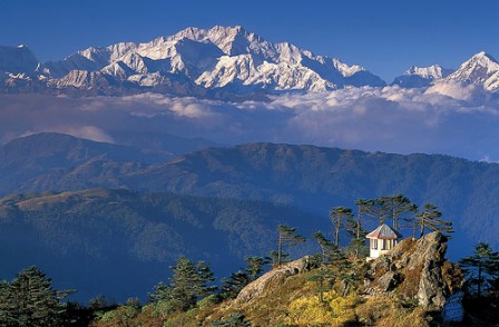 Of all the world's great peaks, Kanchenjunga is perhaps the least known; the third highest in the world at 8,598m. It sits astride the Nepal / Sikkim border only a few miles from Tibet. This route was opened to the trekkers in 1988, though people have trekked in the area in connection with mountaineering expedition since the turn of the century. Kanchenjunga is along way from Kathmandu and the nearest road and airports are along way from the mountains. Our long trek here climbs from the intensively cultivated hillsides of the Nepal Midlands, populated by the Rai and Limbu tribes, towards the peaks of Jannu and Khabru and the great wall of Kumbakarna, Kanchenjunga and Rathong, passing on the way through some of the finest high mountain scenery anywhere. Until very recently this was a restricted area, so this is an ideal trek for those who already know Nepal and want to get away from the better known areas and visit a remoter part where few foreigners have penetrated. We fly from Kathmandu to Biratnagar and transfer to Basantapur on the same day. The treks begins with our first camp at Chauki then trek through Gyabla, and ascend to the higher camp at Pang Pema (5120m) and camp at Lhonak. The trek concludes at Suketar via the descent from Omje Khola, from where we fly back to Kathmandu.
Best Season: Spring (September to December) autumn (March to May).
Trekking Grade: Moderate and fairly strenuous
Max Elevation: 5100m
Total trekking days: 20 Days
Day 01: Arrive Kathmandu (1338 m)
Upon arrival in Kathmandu, meet & greet in the airport; transfer to Hotel. Overnight at Hotel in Kathmandu.
Day 02: Your full-day sightseeing includes visits to Bhaktapur Durbar Square, home of medieval art & architecture; Continue your tour to Kathmandu Durbar Square (Hanuman Dhoka), the old palace of the Royal Dynasty and hometown of living Goddess, Kumari. Final stop is at the Swayambhunath Stupa, the holiest shrine for the Buddhist and Hindus. Overnight at hotel in Kathmandu.
Day 03: Fly to Taplejung (2320meters) trek to Lali Kharka (2276meters) 3 hours.
Half hour flight to Taplejung at Suketar Airport. The porters and crew will be waiting for our arrival. After landing we take an early lunch, while the crew arranges our gear. In the afternoon we start with an easy 2 to 3 hours walk along the ridge line to Lali Kharka, a grazing area. Overnight at local lodge.tented camp.
Day 04: Trek to Khesewa (2120meters). 5 hours
After traversing the hillside a short way, we descend to the village of Pakora along the Phawa Khola, crossing a suspension bridge before beginning the steep climb up towards Kunjuri. Lunch will be taken somewhere below Kunjuri. The afternoon's walk takes us on a short distance over the crest of the ridge to our campsite at Khesewa. We get our first views of Kanchenjunga, and should be able to clearly make out the south and main summit along with Yalung Kang. Overnight at local lodge.tented camp.
Day 05: Trek to Mamanke (1920meters). 5 hours.
Today the path covers steep hillside through terraced fields high above the Kabbeli Khola. There are some ups and downs crossing side valleys but there are many shady spots to rest. After lunch, we pass the village of Anpan, before descending to cross the Kashawa Khola and finally, we climb again through terraced fields to the village of Mamankhe. O/N at camp.
Day 06: Trek to Yamphudin (2080meters) 6 hours.
Today the walks start with an easy climb to Yamphudin along a track which contours the hillside above the Kabeli Khola. The path has several ups and downs as we cross the ridges and stream beds that make up the valley sides. Generally the route is flat and the river eventually becomes level with the trail, a couple of hours before Yamphudin. At last we can stop to bathe in one of the clear pools within this beautiful river. It is truly an idyllic spot. After lunch by the river we complete the day's walk to Yamphudin. Yamphudin is the most remote settlement in this area and the last village we will see until we reach Ghunsa. It is a charming place tucked away beneath the ridge of Deurali Danda that we must cross next. Overnight at local lodge.tented camp.
Day 08: Trek to Tortongn (3010meters) 6 hours.
Starting the day with 3 hours of steep ascent to the crest of the Deurali Danda in dense forest most of the way. From the 3230meters pass we see Jannu, definitely closer! We descend across some steep and exposed areas before entering the forest again. The sharp descent through beautiful forest continues down into the valley of the Simjua Khola. Across the 'interesting' wooden bridge is Tortongn, a camping place with numerous rock shelters amid towering conifers. Overnight at local lodge.tented camp.
Day 09: Trek to Tseram (3870meters) 6 hours.
Today we follow the river through more beautiful forest, the conifers giving way to the rhododendron forest. The valley climbs fairly steeply, with the day progressing the trees become more stunted and scattered, giving us glimpses of the snow: capped giants ahead and the massive snout of Yalung Glacier. Just before Tseram the towering heights of Kabru and Rathong peak start to peep over the moraine. Camping at Tseram, a grazing area, the night temperatures will remind us that we are really gaining height. Overnight at local lodge.tented camp.
Day 10: Trek to Ramche (4580meters) 4 hours.
A shorter day's walk up the final 600 meters to Ramche where the trail to Kanchenjunga South turns dangerous. The scenery is magnificent as we ascend past the snout of Yalung Glaciers into a series of ablation valleys, which gives easy walking and good camping. A frozen lake, clear streams and views of Koktang, Rathong and Kabru are the highlights of this stroll. Expect to feel the altitude today. Overnight at local lodge.tented camp.
Day 11: Explore around Ramche (4580m) and trek to Oktang (4730meters) 5 hours.
Our first close encounter with Kanchenjunga. Following the valley round to see the stunning south face of Kanchanjunga and Jannu. We get across the Yalung Ri Glacier and continue by a sweeping curve, at Oktang, 4730meters, suddenly we are confronted with the southern wall of the mountain. This vast ridge forms a cirque over 15 kms long, nowhere less than 7500meters high and with three main summits of Kanchenjunga at 8420meters, 8586meters, and 8474meters! It is a breathtaking mountain panorama and especially impressive is Jannu while observing the glaciers flowing from its east face. Overnight at local lodge.tented camp.
Day 12: Trek to Sallerle over the Mirgin La (4480meters) 6 hours.
We trek down the valley, passing the turn off to the high and challenging Labsang La route to Ghunsa and the north side of Kanchenjunga. This pass is rough and dangerous, especially for porters so we take the more southern set of passes, beginning with the Mirgin La. After an initial steep climb and several false summits we reach Mirgin La. Apart from the magnificent Jannu, on the horizon are Makalu, Gyakung Kang, Everest, Lhotse and Chamalang. To the south it is possible to see down to the Terai, a panorama worth the effort. Our campsite will be beyond the pass, after 6 to 7 hours tough walking. Overnight at local lodge.tented camp.
Day 13: Trek to Ghunsa (3475meters) 5 hours.
Although there four more passes, there is little descent between them, so in effect it is a high scenic area. After lunch the descent brings us to Lamba Sumba Kharka, where there are more views of the awesome Southwest Face of Jannu. From Kharka the going is easy again down a pleasant forested trail to the village of Ghunsa, where we camp in the village. Ghunsa is a picturesque Tibetan village; prayer flags flutter from the wooden houses and there are two monasteries, a welcome sight after the many days of wilderness. One of the local specialties’ is 'Tongba', a curious alcoholic drink. A jug or large bamboo cup is filled with fermented millet seed and boiling water pored over. The flavour and alcohol seep though and you drink it with a special straw. You might need a drink after the tough 4 to 6 hour walk. O/N at camp.
Day 14: Trek to Kampuchean (4040meters) 6 hours.
Gradually the trail ascends to south of the Ghunsa Khola and crossing flood plains while emerging on a pasture situated at the north side of the river. A steep climb to a slope from where it crosses a slide and then descends to Lakepo. A short climb from here to the village of Kampuchean 4040meters. Overnight at local lodge.tented camp.
Day 15: Trek to Lhonak (4790meters) 6 hours.
The main Kanchenjunga peak is only visible from Pang Pema, which is the base camp for expeditions on Kanchenjunga. From Lhonak, the trail gradually ascends across the plain but soon gets steeper as it follows the moraine. Pang Pema is at a height of 5140 meters. Overnight at local lodge.tented camp.
Day 16: Explore around Kanchenjunga Base Camp (5100 meters) 5 hours.
Today those who would like to take a morning hike up a ridge, north of Pang Pema. A climb of 200 or 300 meters providing a great vantage point with views of Kanchenjunga, Wedge Peak, the Twins and Tent Peak. As usual the descent goes faster and you can reach Kampuchean the same day. Overnight at local lodge.tented camp.
Day 17: Trek to Ghunsa 6 hours.
More descents thru magnificent sections of forest as long as we make Amjilosa tomorrow. From Ghunsa an hour down we pass through Phole, a village in two parts. The upper section houses Tibetan refugees who are well established, the second is the winter village of Ghunsa. Further down is Yangswa, a great and warm camp. Overnight at local lodge.tented camp.
Day 18: Trek to Amjilosa (2460meters) 4 hours. Overnight at local lodge.tented camp.
Day 19: Trek to Sakathum (1600meters) 5 hours. Overnight at local lodge.tented camp. Down, down and down! After a short climb we begin the steep descent that will take most of the day. We reach the joining of the Tamur and Ghunsa Kholas. Overnight at local lodge.tented camp.
Day 20: Trek to Chhiruwa (1200 meters) 5 hours.
We cross the Simbu Khola, which originates from Kanchenjunga's south base camp, the Khola that we followed up from Torontan. It is pleasantly warm at these low altitudes and cardamom grows freely in the moist shaded forest. Crossing numerous small tributary streams we reach Chhirwa, a village set among large boulders. We camp in a field out of the village. This is an easier day. Overnight at local lodge.tented camp.
Day 21: Trek to Furumbu (1700m), 6 hrs. Overnight at local lodge.tented camp.
Day 22: Trek to Suketar (2420meters) 5 hours. Overnight at local lodge.tented camp. Traversing in an out of minor valleys, we pass thru a succession of picturesque villages on our way to Suketar, reaching around late afternoon. Overnight at local lodge.tented camp.
Day 23: Fly back to Kathmandu.
Enjoying your last glimpse of the mountains you have recently visited one last time on the 35 minute Scenic flight back to Kathmandu. Overnight at local lodge.
Day 24: Leisure day, in case of bad weather in the mountain. Overnight at local lodge.
Day 25: Depart from Kathmandu
After breakfast, transfer to the Kathmandu airport (prior to three hours of your departure time) to board flight for your onward destination.
Have a wonderful flight back home with the treasures of your nostalgic memories.
DHAULAGIRI TREK
Dhaulagiri Trek, separated from the Annapurna region by Kali Gandaki deepest Gorge includes some fifteen peaks above 7000mt. A trek in this area is relatively strenuous and needs some high altitude trekking experiences, this region is new destination for trekkers. Geographically, it is a land of dramatic contrast. Trek around the giant Himalayan Peak Dhaulagiri (8th highest Himalayan Peaks of the world) is one of the most challenging treks. The trek goes through big challenging mountain passes, crossing over French pass (5360 meter) and Thapa Pass (5200 meter); It is a challenging walk on an icy track. The massive mountains range of Dhaulagiri consisting of fifteen 7000 meter peaks is magnificent. Trekking of the main paths is not only possible, but can be immensely rewarding, though you do need a sense of adventure and an increased ability to deal with unexpected. Geographically, it is a land of dramatic contrast.
The vast massive screens the hidden land of Dolpo to its north west. Following the rivers upstream, ferns and forests of oak and other deciduous trees and juniper are interesting. Mountain sides of rhododendron blaze with color in the spring, and other flowers are abundant on the trail. Even on high mountain passes above the tree line, tiny alpine flowers can be found dotting the windswept ground.
RNK 29 DHAULAGIRI CIRCUIT TREKKING (20 Nights / 21 Days)
Best Season: Spring (September to December) autumn (March to May).
Trekking Grade: Moderate and fairly strenuous
RNK 29 DHAULAGIRI CIRCUIT TREKKING (20 Nights / 21 Days)
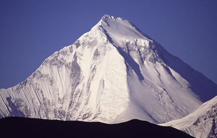 Best Season: Spring (September to December) autumn (March to May).
Trekking Grade: Moderate and fairly strenuous
Max Elevation: 5240m
Total trekking days: 14 Days
Day 01: Arrive Kathmandu (1338 m)
Upon arrival in Kathmandu, meet & greet in the airport; transfer to Hotel. Overnight at Hotel in Kathmandu.
Day 02: Your full-day sightseeing includes visits to Bhaktapur Durbar Square, home of medieval art & architecture; Continue your tour to Kathmandu Durbar Square (Hanuman Dhoka), the old palace of the Royal Dynasty and hometown of living Goddess, Kumari. Final stop is at the Swayambhunath Stupa, the holiest shrine for the Buddhist and Hindus. Overnight at hotel in Kathmandu.
Day 03: Drive Kathmandu to Beni (850m) - 8 to 9 hours by bus
Our trekking guide will come to the hotel in the morning at 6: 00 to pick you with private transport for Beni and will take us about 8 to 9 hours scenic journey. Along the journey you will witness some stunning scenery of snow capped Mountains, green hills, rivers in rafting, and villages. Pokhara is a beautiful valley, with panoramic views of Annapurna, Machapuchare (shape of fish tail), Dhaulagiri, Lamjung Himal and Manaslu. The road leads us next three hours to the Beni Bazaar (850m). Stay overnight in Hotel.
Day 04: Trek Beni to Babiachor (950 meters) -5 to 6 hours
This is first our day trekking, so you are exacting to leaving Beni, the trail heads west along the north bank of the Myagdi Khola through the village of Beni Mangalghat to Singa and Tatopani (hot springs). Then the trail lead us to the bridge beyond the village to the south bank of the river, the trail makes a little half loop before crossing another bridge, near the village of Simalchour, then back to the north bank from where it continues to the Babichor village. Overnight at local lodge.camp in tent.
Day 05: Trekbabiachor to Dharapani (1400m) -5:30 to 6:30 hours
After breakfast, the trail follow valley broadens and terraced hills develop on both sides of the river and you pass the village of Shahashradhara, cross the Duk Khola and walk through fields arriving at Ratorunga. From here the path goes to the narrow valley again and terraces disappear on the river side. And then the trail leads us continue to the Dharapani village for Overnight at local lodge.tented.
Day 06: Trek Dharapani to Muri (1850m) -5 to 6 hour
After crossing river the trail goes to west Bank as you leaves Phedi then starts to climb many switch-backs until you arrive at the ridge viewpoint of ascent eases. Then again the trail climbs steeply to the Muri village and continue to Sibang and Mattim. From here the trail lead you continue up an incline to the snout of the ridge, descend to the Gatti Khola and reach Phalai Gaon (1810m. After cross Dhara Khola to once again emerge on the west bank of the Myagdi Khola and then climb ridge to the large Magar village of Muri. Overnight at local lodge.tented camp.
Day 07: Trek Muri to Boghara (2080m) -5:30 to 6:30 hours
Today, at begging we descend to the stream and continue through terraced fields before climbing a ridge to reach the pass from where you can see Mt. Ghustung South (6465 m) and view of astonishing landscape. Then descend to the Myagdi Khola and trek along the west Bank to the Naura village, from where you will climb a little before traversing a grassy hill and climbing a steep slope with switch -backs, then descend through the forest and terraced fields to Boghara (2080 m) for the overnight.
Day 08: Trek Boghara to Dobang (2520m) -5 to 6 hours
At first, the trail descends through terraced fields to the small ridge, then through forest to Jyardan which is the most remote permanent settlement in this area. Then the trail leads us to high winding path crosses a rocky area and descends before climbing again to Lipshe. The trail continues through a forest to Lapche Kharka and then climbs to the Dobang for today destination.
Day 09: Trek Dobang to Choriban Khola (3110m) -5 to 6 hours
After crossing a wooden bridge the trail us gradual ascend forest with chirping melody of birds and some wildlife, which full joy of our life. And soon the west face of Dhaulagiri I (8167 m) becomes visible through breaks in the trees. Then we descend to the Myagdi Khola and cross wooden bridge then continue to the east bank for Chartare. The trail lead us through forests again, rocky area and cross a stream to Choriban Khola. We will Overnight at local lodge.tented camp.
Day 10: Trek Choriban Khola to Italian Base Camp (3660m) -6 to 7 hours
We have to walk slowly in our won pest in order to acclimatize of body. The trail follows to the terminal moraine of the Chhonbarban Glacier and enters the glacier from the right side. From here, Tukche Peak (6837 m) becomes visible straight on; at the far end while the impressive north flank of Dhaulagiri I (8167 m) dominates the skyline to the right. After for while you will get Italian Base Camp (3660 m), which is also the site of your camp for the night. It offers you breathtaking scenery of mountains; Dhaulagiri II (7751m), Dhaulagiri III (7715 m) and Dhaulagiri V (7618 m).
Day 11: Acclimatization and rest day in Italian Base Camp (3660m)
This is our first rest day after many days walking, we will spend a day here in order to acclimatize and adjust to the thinning of the air. It is recommended that your body acclimatizes to the high altitude and be "tuned" for the even higher altitudes. You can hiking around with mighty mountains charming and landscape.
Day 12: Trek Italian Base Camp to Glacier Camp (4210m) -5 to 6 hours
After breakfast we set up all gears early in the morning, the weather is expected to be clear for our adventures journey. The trail goes to through the prone to stone fall, which passes through a narrow gorge. It is not that much easy trail but the great view of mountains charming give you enough increase for rest of the trekking. Here, we stay overnight near at glacier.
Day 13: Trek Glacier Camp to Dhaulagiri Base Camp (4740m) -6 to 7 hours
Today is one of the most adventure days to Dhaulagiri base camp. The view of impressive Dhaulagiri I (8167 m) north faces dominating the skyline to your right and Dhaulagiri II (7751m), Dhaulagiri III (7715 m) and Dhaulagiri V (7618 m) to the west offering you true nature beauties. The impressive icefall that descends from the north east col in front of us is another magnet for us. We are Overnight at local lodge.tented camp.
Day 14: Acclimatization and Rest Day in Dhaulagiri Base Camp (4740m), go to see Dhaulagiri Icefall
Today is another rest day for acclimatization and refill energy for next adventures trip. The mountains skyline view from this place is superb and Dhoulagiri icefall is plenty to explore. Rest of the day you can enjoying to the true nature beauty seeping hot tea in the camp.
Day 15: Trek Dhaulagiri Base Camp via French Pass (5240 m) then trek to Hidden Valley (5000m) -6 to 7 hours
After along the glacier walk the trail climb two terraced hills; the first of which runs along the glacier, then cuts across the mountain flank and the moraine you enter a gentle bring round on the left from an ablation valley often requires a rope, but once over the steep moraine walls we are in safer and more gentle country.Then climb this gentle slope to the French Pass (5360 m); a great vista opens up from the French Pass and offers you Mukut Himal (6328 m), Tashi Kang (6386 meters) and Sita Chuchura (6611 meters), all of which surround the Hidden Valley. To the south is Tukche Peak (6920 m) and massive peak of Dhaulagiri I beyond. Again the trail continues along the right edge of the Hidden valley losing a little altitude to Thapa Pass (5250m) between Tukche Peak and Thapa Peak (6,012 m); offering slender Himalayan beauty and mountains scenery. We descending from Thapa Pass and make camp at 5200 meters.
Day 16: Trek Hidden Valley via Dhampus Pass (5210 m), and trek to Yak Kharka (3,680m) -6 to 7 hours
The trek for Hidden Valley to Yak Kharka via climbing over the 5200m Dhampus Pass, we traverse avalanche prone slopes and then descends steep rocky small adventures trail. But the view of mountains and nature beauty are still unbelievable to the Yak Kharka. There is a perfect camp site to enjoy the surroundings.
Day 17: Trek Yak Kharka to Jomsom (2710m) 5 to 5:30 hours.
Today we descend all the way to the Marpha village; famous traditional salt traders Thakali inhabitant, on the west bank of the Kali Gandaki River. Marpha is home to many apple orchards and as well as all the various food and brandy products made from fruit. Apple Brandy is local specialty that offers you to test some in the distillery and can buy. We continue north, up to the Kali Gandaki valley to the Jomsom town for the overnight stay.
Day 18: Fly Jomsom to Pokhara (950m) -25 munites, relaxing Day
Early in the morning fly to Pokhara by small air craft with majestic mountains view above the World deepest Gorge. And relax whole day in Pokhara Hotel. Or wander around Lake side city with fascinating mountains panorama view and nature charming.
Day 19: Explore day around Pokhara Valley
After late breakfast, we will start sight scene around Pokhara Valliy. The worth able places; Fewa Lake, Bagnes Lake, Devi’s water fall, Bisw Shanti Stupa (Worlde Peace stupa ), International Mountaineering Museum, Tibetan refugee settlement and Gupteshower cave. We will relax rest of the day in Hotel or Shopping around. Overnight at local lodge.hotel Day
Day 20: Drive back to Kathmandu early in the morning by Tourist Bus - 6 to 7 hours
We will be ready at 6:00 morning in hotel lobby with having your breakfast or advice as your trekking guide or you’re wise. We will drive back to Kathmandu through the road passing terraces, streams, rivers, local settlements, high hills and along the river side. It takes about 7 hours (conditional) to reach your hotel in Kathmandu. If you are interested to fly from Pokhara to Kathmandu with extra cost of fly ticket, please request Nepal Mother House Trekking to book your flight ticket. It takes about 30 minutes with having spectacular Himalayas, high hills, terraces, local settlements, and forests ... view from the plane. Overnight at local lodge.Kathmandu.
Day 21: Depart from Kathmandu
After breakfast, transfer to the Kathmandu airport (prior to three hours of your departure time) to board flight for your onward destination.
Have a wonderful flight back home with the treasures of your nostalgic memories.
UPPER MUSTANG TREK
Nepal Upper Mustang trekking is one of the unique and culturally trek which is linked by religion, culture and history to Tibet where one of the truly pure Tibetan influence cultures are existing yet. This is best trekking holidays for the culture lover, people who are interested in history and fascinated by Buddhism and wanted to know the Tibetan culture, untouched temples, colorful festivals and red-robed lamas.
Mustang was only opened to trekkers in 1991 and remains a restricted area with only a small number of special permits issued each year. The permits restrict the visitor to a 10 or 13 day group visit (2 minimum to 14 people maximum). Keeping the cost of the permit high, and the amount of time spent in the area restricted is an attempt by the Nepalese Government to protect the local Tibetan traditions from outside influence as well as to protect the fragile environment. Your journey will take you back nearly 400 years in the cultural history of this isolated region of Nepal. Mustang is situated in the trans-Himalayan area of Nepal. The district of Mustang is where the Nepalese mountains yield to the Southern Tibetan Plateau, a transition zone between these two extreme environments.
Mustang caves, forts, monasteries and temples, which date to past millennia and carry echoes of a rich history. Mustang's history, as well as it’s natural and cultural treasures have made it one of the most mysterious and intriguing trekking destination’s in Nepal. The people who live in this area continue to live their daily lives in much the same way as their forefathers, with very little intrusion from the modern world, which makes this regions is Nepal natural and cultural treasures.
RNK 30 UPPER MUSTANG TREK (15 Nights / 16 Days)
Best Season: March to October.
Trekking Grade: Moderate and fairly strenuous
RNK 31 MUSTANG TIJI FESTIVAL TREKKING (17 Nights / 18 Days)
Best Season: March to October. Trekking Grade: Moderate and Fairly Strenuous
RNK 30 UPPER MUSTANG TREK (15 Nights / 16 Days)
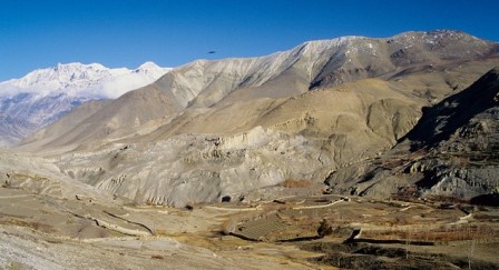 Long and isolated kingdom once made prosperous by the salt trade in to Tibet. Mustang is an adventure paradise. In 1992 this remote and mystical region on north of Jomsom was opened to foreign trekkers. The 10 day camping based trek to Lomanthang is Mustang is one of the great treks of Annapurna ’s. It takes you in to a fair tale land of strangely bitsy quaint Tibetan style villages surrounded by picturesque stupas and chortens. Mustang trek lying in the rain shadow of the Himalayas is perhaps the last enclave of pristine Tibetan culture. Forbidden & isolated from the rest of the World it was able to evolve its own distinctive culture and traditional which is so rich & unique. Lo-Mustang, the capital is walled city ruled by religious king. Untouched by modern civilization, life in Mustang goes on as it has for centuries in unhurried pace. A trek into the kingdom of Mustang is an unforgettable experience.
Best Season: March to October.
Trekking Grade: Moderate and fairly strenuous
Max Elevation: 3920m
Total trekking days: 10 Days
Day 01: Arrive Kathmandu (1338 m)
Upon arrival in Kathmandu, meet & greet in the airport; transfer to Hotel. Overnight at Hotel in Kathmandu.
Day 02: Your full-day sightseeing includes visits to Bhaktapur Durbar Square, home of medieval art & architecture; Continue your tour to Kathmandu Durbar Square (Hanuman Dhoka), the old palace of the Royal Dynasty and hometown of living Goddess, Kumari. Final stop is at the Swayambhunath Stupa, the holiest shrine for the Buddhist and Hindus.
Overnight at hotel in Kathmandu.
Day 03: Drive Kathmandu to Pokhara (950m/200 kms) - 6 to 7 hours.
Early in the morning you will leave will for Pokhara in private transport with our trekking guide which is a nostalgic scenic journey. Along the journey you will witness some stunning scenery of snow capped Mountains, green hills, rivers for rafting, and villages. Pokhara is a beautiful tourist hub, with panoramic views of Annapurna, Machapuchare (shape of fish tail), Dhaulagiri in the west, Lamjung Himal and Manaslu in the east. The town of Pokhara is set on the banks of the Phewa Lake. It is smaller and much less hectic than Kathmandu providing the perfect starting point for one;s trek.
You will be introduced with rest of the trekking assistances.Overnight at hotel in Pokhara.
Day 04: Pokhara flight to Jomsom (2713m) then trek to Kagbeni (2800m) – 3 hours
Early morning transfer to Pokhara airport, fly to Jomsom. This is one of the world's exciting flights to see mountain closely through the tiny aircraft, Annapurna I 8091 meters, Dhaulagiri 8167 meters, fishtail 6997 meter and other numerous peaks. You begin your trek to Kagbeni following along the bank of Kali Gandaki River. En- route, you pass through arid part of Kali Gandaki River with beautiful Ekle Bhatti. Kagbeni people are influence with more Tibetan and also Kagbeni is gateway for Upper Mustang and Damodar Kunda trekking. After reaching at Kagbeni (2800m) there is oldest monastery so better to visit this monastery and look around Kagbeni village. Overnight at local lodges/tea houses.
Day 05: Trek to Chele (3110 Meter.) 5 - 6 hrs.
The trail leads up toward the east bank of the Kaligandaki climbing over many ridges as it heads north and reaches Tangbe village. The town is a labyrinth of narrow alleys amongst white washed houses, fields of buckwheat, barley, wheat and apple orchards. The Nilgiri peak, dominates the southern skyline of Kagbeni, will be enjoyed all the way by different shapes. Beyond Tangbe we reach Chhusang village in about 1-½-hrs trek and crosses the river and continues north climbing up to a huge red chunk of conglomerate that has fallen from the cliff above, forming a tunnel through which the Kaligandaki follows. The trek now leaves the Kali Gandaki valley and climbs steeply up a rocky gully to Chaile. Overnight at local lodge.tented camp, inclusive of full board meals
Day 06: Trek to Geling (3500 Meters) 5 - 6 hrs
The trail climb continues along steep, treeless, waterless terrain, along the side of the spectacular steep canyon to a pass and cairn of rock at (3540m) then the trail makes a long gradual descent to some chortens on a ridge, and then descends further on a pleasant trail to Samar village. The Annapurna, still dominated by Nilgiri, is visible far to the south. Climb above Samar to a ridge, then descend into a large gorge and the trail goes into another valley field, crosses a stream and climbs up to a ridge at (3800m) the route climbs over yet another pass, follows a ridge and then descends to Shyangmochen. From there gently climb to a pass at (3770m) and descend to Geling Village. Overnight at local lodge.tented camp, inclusive of full board meals
Day 07: Trek to Charang (3620 Meters) 4 hrs
From Charang village the trail climbs gently up to an interesting pass NYI LA and descends below the blue, gray and red cliffs. After crossing a steel bridge of the Tangmar Chu (river) you will arrive to a MANI WALL perhaps the longest and most spectacular MANI wall in Nepal. Climbing over another pass at 3600meters, the route makes a long gentle descent to Charang village. The huge five-story white Dzong and red Gompa are the main attractions to visit and observe collections of statues and Thankas as well as many large paintings, of seated Buddha's. Overnight at local lodge.tented camp, inclusive of full board meals
Day 08: Trek to Lo - Manthang (3840 Meters) 3 hrs
This is an opportunity to visit two other villages on your trek. The trail climbs steadily until Lo-Gekar. Lo-Gekar Gompa is older than Samye Gompa in Tibet and one of the oldest Gompa of Nepal. After visiting Lo-Gekar continue trek to Lomanthang. The trail until Lo-Manthang is fine with some minor climbing. Finally from the ridge there is a view of the walled city of LO. After a short descent, cross a stream then climb up into the plateau of Lo-Manthang. Overnight at local lodge.tented camp, inclusive of full board meals
Day 09: Exploration Namgyal Gompa and Tingkhar 4 - 6 hrs
It takes around 2 hours to Namgyal Gompa. Namgyal Gompa situates on a hilltop, which serves as an important monastery for the local community, also serving as a local court. After visiting Namgyal Gompa continue the tour to Tingkhar, which is a village of around 40 houses, the last main village to the northwest of Lomanthang. After visiting Namgyal Gompa and Tingkhar return to Lomanthang. Overnight at local lodge.tented camp, inclusive of full board meals
Day 10: Trek to Ghar Gompa (3920 Meters) 4 - 6 hrs
After a wonderful time at Lo-Manthang we back to Ghar Gompa and explore the local area. During the walk you will suffer the dusty wind and as suggested to walk in the morning. Overnight at local lodge.tented camp, inclusive of full board meals
Day 11: Trek to Ghiling (3500 Meters) 5 - 6 hrs
Today, we will back to Ghiling as our journey for our overnight stay after arrival and lunch enjoy the day explore the area but it will be dusty better to walk in evening time. Overnight at local lodge.tented camp, inclusive of full board meals
Day 12: Trek to Chele (3110 Meters) 5 hrs. br We re-track back to Chele for the overnight stop; you will have wonderful scenery during the journey with a Himalayan view.
Day 13: Trek to Jomsom (2713 Meters) 6 - 7 hrs.
This is the last day of the trek. The trail goes through the village of Jharkot where one can visit the many attractions such as the Jharkot monastery, Tibetan herbal medical center and the old fortress of Jharkot which once served as palace. Continuing the trek towards Jomsom one will enjoy the views of the Kaligandaki valley and Kagbeni village. This is the entry point to Mustang. We get a round trip of our trek in Ekle Bhatti visiting all the surprises of the human effort in this corner of the World of such an isolation and solitude. Arrive to Jomsom to celebrate the last day of the trek, with all the trekking staff. Overnight at local lodge.tented camp, inclusive of full board meals
Day 14: Morning flight back to Pokhara (910 Meters) 25 Minutes. Full day sightseeing of Pokhara. Overnight at local lodge.
Day 15: After breakfast drive back to Kathmandu.through the road passing terraces, streams, rivers, local settlements, high hills and along the river side for about 7 hours. Rest day at leisure. Overnight at hotel in Kathmandu.
Day 16: Depart from Kathmandu
After breakfast, transfer to the Kathmandu airport (prior to three hours of your departure time) to board flight for your onward destination.
Have a wonderful flight back home with the treasures of your nostalgic memories.
RNK 31 MUSTANG TIJI FESTIVAL TREKKING (17 Nights / 18 Days)
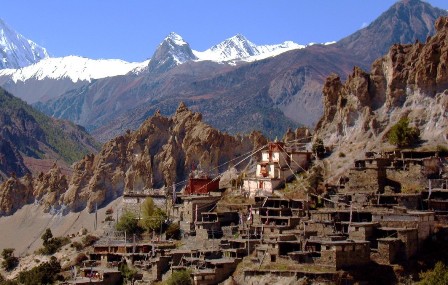 The Tiji festival is a three-day ritual known as "The chasing of the Demons" and it is centered on the Tiji myth. Tiji tells the story of a deity named Dorje Jono who must battle against his demon father to save the Kingdom of Mustang from destruction. The demon father wreaks havoc on Mustang by creating a water shortage which, in this extremely arid land, is the most precious life-sustaining resource. Dorje Jono eventually defeats the demon and banishes him from the land.
Tiji is a celebration and reaffirmation of this myth. Throughout the festival the events and story of the myth are re-enacted. The festival is timed to coincide with the end of the dry season (late winter/spring) and ushers in the wetter monsoon season. Tiji comes from the words "ten che" meaning "the hope of Buddha Dharma prevailing in all worlds" and is a spring renewal festival that also celebrates the triumph of good over evil. In 1964 Michel Peissel was the first westerner to observe the Tiji festival. At this time, the Mustang region was still completely closed off to foreigners and he had to obtain special permission from the government of Nepal in order to enter the region. Despite his arrival on the last day of the celebration (he was unaware of the observance of Tiji) the experience left a lasting impression on him. "The scenes I witnessed were so extraordinary and so unexpected that I dared not believe my eyes and even today I have some trouble in believing in the reality of what I saw that day."
Best Season: March to October.
Trekking Grade: Moderate and Fairly Strenuous
Max Elevation: 4320 m
Total trekking days: 12 Days
Day 01: Arrive Kathmandu
Upon arrival in Kathmandu airport, please come right to the main arrival gate where our representative will be waiting with the company board or your name card.
Transfer to the hotel. Overnight at hotel in Kathmandu.
Day 02: Your full-day sightseeing includes visits to Bhaktapur Durbar Square, home of medieval art & architecture; Continue your tour to Kathmandu Durbar Square (Hanuman Dhoka), the old palace of the Royal Dynasty and hometown of living Goddess, Kumari. Final stop is at the Swayambhunath Stupa, the holiest shrine for the Buddhist and Hindus.
Overnight at hotel in Kathmandu.
Day 03: Drive Kathmandu to Pokhara (950m/200 kms) - 6 to 7 hours.
Early in the morning you will leave will for Pokhara in private transport with our trekking guide which is a nostalgic scenic journey. Along the journey you will witness some stunning scenery of snow capped Mountains, green hills, rivers for rafting, and villages. Pokhara is a beautiful tourist hub, with panoramic views of Annapurna, Machapuchare (shape of fish tail), Dhaulagiri in the west, Lamjung Himal and Manaslu in the east. The town of Pokhara is set on the banks of the Phewa Lake. It is smaller and much less hectic than Kathmandu providing the perfect starting point for one;s trek.
You will be introduced with rest of the trekking assistances.Overnight at hotel in Pokhara.
Day 04: Pokhara flight to Jomsom (2713m) then trek to Kagbeni (2800m) – 3 hours
Early morning transfer to Pokhara airport, fly to Jomsom. This is one of the world's exciting flights to see mountain closely through the tiny aircraft, Annapurna I 8091 meters, Dhaulagiri 8167 meters, fishtail 6997 meter and other numerous peaks. You begin your trek to Kagbeni following along the bank of Kali Gandaki River. En- route, you pass through arid part of Kali Gandaki River with beautiful Ekle Bhatti. Kagbeni people are influence with more Tibetan and also Kagbeni is gateway for Upper Mustang and Damodar Kunda trekking. After reaching at Kagbeni (2800m) there is oldest monastery so better to visit this monastery and look around Kagbeni village. Overnight at local lodges/tea houses.
Day 05: Kagbeni trekking to – Chele (3050m)- 5 to 6 hrs
The trail leads up toward the east bank of the Kaligandaki that climbs over many ridges as it heads north and reaches Tangbe Village. The town is labyrinth of narrow alleys amongst white washed houses, fields of buckwheat, barley, wheat and apple orchards. The Nilgiri peaks, which dominate the southern skyline of Kagbeni provide a spectacular backdrop and continues to loom massively at the foot of the valley. Beyond Tangbe we reach Chhusang Village and crosses the river, continue climbing north up the trail to a huge red chunk of conglomerate that has fallen from the cliff above. forming a tunnel through which the Kaligandaki follows. The trek now leaves the Kaligandaki valley and climbs steeply up a rocky gully to Chele at 3030m.
Day 06: Chele trekking to - Ghiling – (3806m) - 5 to 6 hrs
The climb continues along step, treeless, waterless terrain, along the side of the spectacular steep canyon to pass and cairn of rock at 3540m. Then the trail makes a long gradual descent to some chortens on a ridge, and then the trail descends further on a pleasant trail to Samar . The Annapurna , still dominated by Nilgiri, is visible far to the south. Climb above Samar to a ridge, then descend into a large gorge and the trail goes into another valley field, crosses a stream and climbs up to a ridge at 3800m. The route climbs sharply up and down over a series of high passes, before the final descend to Geiling.
Day 07: Ghiling trekking to Tsharang (Charang) – (3500m) - hrs
From Geling, the trail climbs gently to the interesting pass on our trek NYILA and descends below the blue, gray and red cliffs. After crossing a steel bridge of the Tangmar chu (river) we will arrive to a MANI (Prayer WALL) perhaps the longest and most spectacular stretch and main wall in Nepal . Climbing over another pass at 3600m the route makes a long gentle descent to Charang. The huge five – story white Dzong and red Gompa is an interesting visit to observe collections of statues and Thankas as well as many large paintings of seated Buddha’s.
Day 08: Tsharang (Charang) trekking to Lo - Manthang (3700m) 4 to5 hrs
The trail descends about 100 meters down from Charang, crosses the Charang- Chu and climbs steeply up a rocky trail to a cairn on a ridge and continues to climb. Finally, from a ridge at 3850m. There is a view of the walled city of LO. After a short descent, cross a stream then climb up into the plateau of Lo- Manthang.
Day 09: The Tiji Festival begins 1 day of Tiji: Early in the afternoon, horns resounded, announcing the two twelve-foot copper dunchens, with their elephantine blurting, followed by two double-reeled horns, all accompanied by drum and cymbals.
Next, an ancient and enormous tanka three stories high was unrolled down the entire south wall of the square. The thanka portrayed Padma Sambhava or (Guru Rimpoche) who brought this ceremony to Tibet in the 8th century." At mid-afternoon, in high wind and blowing dust, eleven lamas in maroon and gold, wearing high red hats, came from the palace and took their places along the wall beneath the thanka, with Tashi Tenzing on the elevated seat just in the center.
As the monks and lamas commence chanting, twelve more monks come from the palace in maroon and royal blue and glittering gold brocade, with cymbal-shaped hats decked with upright peacock plumes. Soon they withdraw, to be replaced by the masked dancers who" start the portrayal of the Tiji myth.
Dorje Jono repels the demon through the power of his magical dancing — he dances fifty-two separate dances, one of them in ten different bodies, each with a different head. As the dances end, Dorje Jono kills the demon, after which his people are relieved of their plague of misfortunes, water becomes plentiful once more, and the balance and harmony of existence are restored.
Day 10: Second day of TIji Festival: On the second day of Tiji, numbers of Loba have arrived from the outlying hamlets, and the small square is thronged with wild beautiful people, with all of the women and children, at least, in traditional dress.
The King of Mustang "wears a whole crown of tiny river pearls set off by dozens of large red coralline tones interspersed with matched ornaments of turquoise.
The costumes and masks, the twelve-foot horns, the gold cups of wheat, the butter cakes, the snow peaks and wind and dust and sun, the mehti, snow leopard, snow pigeons, saligrams, the dying glacier and the desert ruins, the drunks and rajas and foreigners, the dogs and yaks. Tantra!
Day 11: Third day of Tiji and end of Festival: On the third day, Tiji ends with the ceremonial destruction of the evil remains, represented by some long black yak hair and red torma cakes minced to a dark red gurry. The demons red remnants are set out on an old tiger skin, where-upon they are attacked by bow and arrow, slings, and the old guns. The poor devils remains are over- turned upon the ground, each time to a wild cannonade from the old muzzle-loaders and a wave of cheers and smoke.
Day 12: Lo-Manthang trekking to Ghami via Lo-Geker (3520m) – 6 to 7 hrs
We will make our return take via highland rouge crossing the alpine meadows and the trail climbs a ridge at 4070m and Chogo La (4325m), Visit Lo-Geker Gompa on the way, which is one of the oldest Gompas in Nepal.It is older than the famed Samye Gompa in Tibet,after visit the Ghar Gompa Monastery decent to Ghami a nice village surrounded by farm land with barley fields and white washed houses.
Day 13: Ghami trekking to Samar (3520m) – 5 to 6 hrs
Today we will follow the narrow winding path until you reach Ghiling crossing a small stream. On the way you can enjoy good view of the Nilgiri Mountain, deserted landscapes, Tibetan style villages, farming terraces and natural vegetation. After Ghiling the trail pasees chortens and Mani walls with prayer flags before arrive Samar, it is small village with nice terraces and peple are follow the Tibetan lifestyle and tradition here.
Day 14: Samar to Kagbeni (2,858m) - 6 to 7 hrs
We start descending and reach the Kali Gandaki valley where working can may be in an wind. We will mostly walk along the bank of Kali Ganadki River with the views of natural vegetation and apple orchards.
Day 15: Kagbeni to Jomsom (2700m) - 3 to 4 hrs
The last day of the trekking is easy day and flat walking in the river bank. Trail passes through Eklebhatti and continues to Jomsom in a windy, wind start early afternoon. Jomsom is the headquarters of Mustang District most of the facilities are here from internet to bank.
Day 16: Fly back to Pokhara
After breakfast we shall board the flight back to Pokhara. Rest day at leisure. Overnight at hotel in Pokhara.
Day 17: After breakfast, half day sightseeing around Pokhara valley. Refreshments at your hotel and then drive back to Kathmandu through the scenic journey again of terraces, streams, rivers, local settlements, high hills for about 7 hours. Overnight at hotel in Kathmandu.
Day 18: Depart Kathmandu After breakfast, transfer to the Kathmandu airport (prior to three hours of your departure time) to board flight for your onward destination.
MANASLU TREK
The area to the east of the Annapurna are the peaks of Manaslu group... Few trekkers trek to this area, which makes a visit here all the more unique and unspoiled. The area is bordered by River Budi Gandaki and to the west by River Marshyangdi. This area is marked by two cultural highlights. Gorkha, which is the ancestral seat of the reigning Shah dynasty and the temple of Manakamana.
Since the treks in the Manaslu region originate at around 1,000 meters and reach as high as 5250 meters. The trekkers will see a wild range of flora typical of the middle hills and alpine regions of Nepal. Plants to be seen around here are pine, rhododendron, wildlife include barking deer, pika and Himalayan marmots. Birds to be sighted in the region are Pheasant, raven and chough. The best time to trek here is between September and May. Camping Trekking is suggested in these area.
RNK 32 TSUM VALLEY TREK (17 Nights / 18 Days)
Best Season: Spring (September to December) autumn (March to May).
Trekking Grade: Moderate
RNK 33 MANASLU TREKKING (38 Nights / 39 Days)
Best Season: Spring (September to December) autumn (March to May).
Trekking Grade: Moderate and fairly strenuous
RNK 32 TSUM VALLEY TREK (17 Nights / 18 Days)
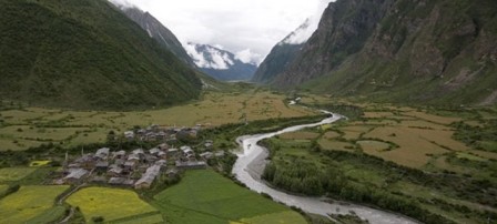 Tsum Valley is a newly explored trekking region as well as a famous pilgrimage site for the Buddhist. Tsum comes from the Tibetan word "Tsombo" which means vivid. This trekking route goes through the Budi Gandaki River through wild least visited countryside where the majority of the people are the Gurungs and few other mongoloid ethnic groups. The natural hot springs over there are added attractions which can be enjoyed after the tiring day treks.
Upper Tsum valley (part of the Inner Himalaya) open from Chhokangparo, where hospitality local people (Tibetan group "Tsombo") welcome you with traditional Tibetan Chiya (butter tea) and local meal. The lifestyle and cultural practices are highly influenced by Tibetan Buddhism and because of that we can encounter lost of monasteries, chortens and Mani walls in the trail. The longest Mani walls (over 250km) are at Dzong and Phurpe. The valley preserves steps of the great Buddhist Yogi Chyuchin Milarepa and story about Guru Padmasambhava circumbulation. The people here never slaughter animals, even as sacrifice to the gods. The Tsum Valley is surrounded by the Buddha Himal and Himal Chuli to the west, Ganesh Himal to the south, and Sringi Himal to the North.
Best Season: Spring (September to December) autumn (March to May).
Trekking Grade: Moderate
Max Elevation: 4060m
Total trekking days: 14 Days
Day 01: Arrive Kathmandu
Upon arrival in Kathmandu airport, please come right to the main arrival gate where our representative will be waiting with the company board or your name card.
Transfer to the hotel. Overnight at hotel in Kathmandu.
Day 02: Your full-day sightseeing includes visits to Bhaktapur Durbar Square, home of medieval art & architecture; Continue your tour to Kathmandu Durbar Square (Hanuman Dhoka), the old palace of the Royal Dynasty and hometown of living Goddess, Kumari. Final stop is at the Swayambhunath Stupa, the holiest shrine for the Buddhist and Hindus.
Overnight at hotel in Kathmandu.
Day 03: From Kathmandu drive to Arughat Bazaar by bus (7-8 hrs) and trek to Arkhet Bazar (2 hrs)
We take a 7- 8 hrs bus ride to Arughat bazaar in Gorkha district. The village of Arughat is in two parts, on opposite sides of the Budi Gandaki. From the stop we trek for two hours to Arkhet bazaar. We pass through Gurung and Magar villages and terraced fields along the way. Overnight at local lodge.
Day 04: Arkhet Bazar to Machha Khola (6 hrs)
The trail follows to Machha Khola. Machha Khola is a village situated above a stream with the same name. We stay Overnight at local lodge.
Day 05: Machha Khola to Yaru khola (6 hrs)
We trek to Yaru Khola. The village of Yaru Khola at 1,330m near the Budi Gandaki River. The river meanders serenely among gravel bars. Overnight at local lodge.
Day 06: Yaru khola to Lokpa (6-7 hrs)
We trek to Lokpa. Lokpa is the first village as you enter the Tsum Valley. The local people are farmers and grow potatoes, gucchi mushrooms and soya beans. Overnight at local lodge.
Day 07: Lokpa to Chumling (Lower Tsum) (4-5 hrs)
We trek to Chumling Tanjo. We can see the Baudha Himal (6672m) and Ganesh Himal. Chumling has three monasteries: Panago Gumba, Mani Dhungyur and Gurwa Gumba. Overnight at local lodge.
Day 08 Chumling to Chhokangparo (Upper Tsum) (7 hrs)
We trek to Chhokangparo. Upper Tsum valley opens from Chhokangparo, where we can see the hospitality of local Tibetan people. Overnight at local lodge.
Day 09: Chhokangparo to Nile/Chhule, visit Milarepa Piren Phu Cave on the way (4-5 hrs)
We trek to Nile/ Chulle. This is the last village heading north in the upper Tsum Valley. Nile is on the western, sun-side of the Shiar Khola, about 20 minutes walk across from Chhule.On the way we pass the Piren Phu cave is one of the most sacred caves in the Tsum valley. Milarepa, the famous Tibetan saint, was believed to have meditated here .Beautiful views can be had of the Shiar Khola, Rachen Gumba , the mountains and settlements. Overnight at local lodge.
Day 10: Nile/Chhule to Mu Gompa (3700 m), visit Dhephyudonma Gompa (4060 m) (4-5 hrs)
Dephyudonma gumba is one of the oldest monasteries in the Tsum Valley and is situated in the rugged mountains, a 2 hr walk from the village of Chhule and Nile. Overnight at local lodge.
Day 11: Mu Gompa to Rachen Gompa, visit Gonhgye Gompa (Nyigma-pa Buddhist sect) (5 hrs)
The trail ascends to Mu Gumba, the largest monastery in the region. Mu Gumba is located at the highest and farthest point in the Tsum Valley. Overnight at local lodge.
Day 12: Rachen Gompa to Dumje (6-7 hrs)
Rachen Gompa is one of the largest nunneries in the Tsum Valley, with 80 nuns currently studying. It was established in 1905AD. Dhumje is a small village with about eight houses and adjoining cattle shed. Overnight at local lodge.
Day 13: Dumje to Philim (cross Ripchet) (7-8 hrs)
We trek to Phillim and cross Ripchet. Through the way the most beautiful falls in the Lower Tsum Valley, Samba Tingding Chhupyang are seen. Phillim, at 1550m, is a large Gurung village .The trail that climbs through the village and heads up over the ridge leads to Ganesh Himal Base camp. Overnight at local lodge.
Day 14: Phillim to Tatopani (7-8 hrs)
We trek to Tatopani. There is a hot spring at Tatopani we can enjoy in the hot spring for recreation, we stay overnight camp.
Day 15: Tatopani to Lapubeshi (6-7 hrs)
We trek to Lapubeshi, a Gurung Village. We pass through terraced fields and tropical waterfalls. We camp at the village.
Day 16: Lapubeshi to Arughat Bazar (5-6 hrs)
As we make our way from Lapubeshi to Arughat Bazar, on the same trail. Overnight at local lodge.
Day 17: Drive to Kathmandu by bus (6-7 hrs)
We drive to Kathmandu. Spend the leisure time on your own shopping and recreation. Overnight at local lodge.
Day 18: Departure
Approximately 3 hours before your scheduled flight a representative will transfer you to the airport for your destination.
RNK 33 MANASLU TREKKING (38 Nights / 39 Days)
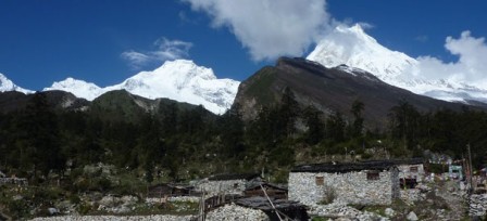 Manaslu is often referred as the Killer Mountain because of the high casualty rates while climbing yet it is one of the most beautiful mountains in the Himalayas. This peak boasts of being the eighth highest peak in the world. The trek begins from Gorkha district in western Nepal. After which the trail heads up the valley of the Buri Gandaki River through wild and unexplored country inhabited mainly by members of the Gurung ethnic group.
The trail goes around the Manaslu peak [8156m.] going through the Larkya pass at 5100 meter and finally emerges onto the Marshyangdi river valley along the main trail of Annapurna circuit. You will have two options as where to conclude your trek.
Best Season: Spring (September to December) autumn (March to May).
Trekking Grade: Moderate and fairly strenuous
Max Elevation: 5160m
Total trekking days: 35 Days
Best Season: Spring (September to December) autumn (March to May).
Trekking Grade: Moderate and fairly strenuous
Max Elevation: 5160m
Total trekking days: 35 Days
Day 02: Your full-day sightseeing includes visits to Bhaktapur Durbar Square, home of medieval art & architecture; Continue your tour to Kathmandu Durbar Square (Hanuman Dhoka), the old palace of the Royal Dynasty and hometown of living Goddess, Kumari. Final stop is at the Swayambhunath Stupa, the holiest shrine for the Buddhist and Hindus.
Overnight at hotel in Kathmandu.
Day 03: Drive from Kathmandu to Arughat Bazaar (535m) -8 to 9 Hours
Our Guide and Potter come to in your hotel at 6:00 am. Then we are heading to Arughat, by bus or Land cruiser (depending on group size) scenic drive. While passing ridge of Kathmandu Valley, you catch a glimpse of Annapurna, Manaslu, Ganesh Himal and Langtang Himal magnificent view and terraces and green hills. After Dhading Bisi or Gorkha Bazaar the road is tricky because of the grubby road. To get in Arughat through the Gorkha Bazaar or Dhading Besi depends on your time and choice. The village of Arughat is in two parts, on opposite sides of the Buri Gandaki. Arughat Bazaar is large, clean and prosperous with hotels and shops selling cloth, food and hardware. Stay Overnight at local lodge.Tea House or Tented camp.
Day 04: Trek Arughat to Soti Khola (720m) -6 to 7 Hours
After having breakfast, we trek to Soti Khola following banding Bdhigandaki river bank. Along the way we enjoy splendid views of Shringri Himal and local live hood. The trail goes through the Gurung and Magar villages, past fields and cascading waterfalls, till we reach Soti Khola. We set up camp on the banks of the Soti Khola (river) or stay in Tea house.
Day 05: Trek Soti Khola to Machha Khola (930m) -6 to 7 Hours
Today our trek from Soti Khola to Machha khola (Fish River) goes through the rice field and exploring people live hood. Machha khola is a village, which is situated above a stream with the same name of Budahigandaki. We camp for the night by a wide campsite or find some tea house.
Day 06: Trek Machha Khola to Thulo Dhunga (1,250m) -6 to7 Hours
The trail involves some steep ascents and descents to the Doban. The trail gives the glimpses of diversity of flora & fauna, and people with different religion and cultures. We ascend a well – crafted staircase over a ridge to Doban. Doban means confluence of the stream, where Shiar Khola comes from the east, and the Sarpu khola meet from the west. We set our camp here or stay Overnight at local lodge.tea house.
Day 07: Trek Thulo Dhunga to Philim (1,570 m) -5 to 6 Hours
After hot breakfast, journey leads us to ascend on a rugged rocky trail. Then we climb up and down ravines and notched trees. Several water falls on both side of the Budhi Gandaki River and hundred species of Birds in the forest makes our trip enjoyable. Liding, Machhakhola, Jagat and Philim provide the unique hospitality with culture and religion. During this trekking the narrow valley shaping by Budhi Gandaki provides the magnificent vistas of Ganesh Himal, Shringi Himal and Himal Chuli, as we continue up to the large Gurung village and fields of corn and millet. There are several good campsites and we set up camp surrounded by alder, blue pine and poplar trees or stay at the tea house.
Day 08: Trek Philim to Chumling (Lower Tsum) (2,361m)-6 to 7 Hours
The trail goes up through Philim and head up over a ridge that leads to Ganesh Himal Base camp and Chumling (Lower Tsum). We camp for the night at Chumling. Each individual can enjoy with songs of Bird and roaring sound of river on the trail. There are several good campsites at Chumling. Or stay Overnight at local lodge.local house.
Day 09: Trek Chumling to Chhekampar (Upper Tsum) (3,010 m) -5 to 6 Hours
After breakfast, we trek to Chhekampar. Upper Tsum valley (part of the inner Himalaya) opens from Chhekampar/Chhekamparo. This village situated on flat land and made up of two settlements Chhekam and Paro. From the valley, we have view of Ganesh Himal range in front to the south where it provides spectacular views of the Baudha and Himal Chuli peaks to the south-west. Some households in this village practice polyandry system. We stay overnight here.
Day 10: Trek Chhekampar to Chhule-Nile (3,361m), visit Milarepa Piren Phu Cave on the way -5 to 6 Hours
On the way we pass the Piren Phu cave. Piren Phu (pigeon cave) is one of the most sacred caves in the Tsum valley. It is located at the foot of a rugged cliff near the village of Burji. Milarepa, the famous Tibetan saint, was believed to have meditated here. There are two separate Gumbas attached to the rocky cave. Richly painted Buddhist murals, excellent artistic scripts carved on stones, long prayer flags and significant Buddhists paper scripts make this cave one of the most important socio-cultural asset in the valley. Beautiful views can be had of the Shiar Khola, Rachen Gumba, the mountains and settlements amidst vast agricultural land. This is the last village heading north of the upper Tsum Valley. Stay overnight.
Day 11: Trek Chhule-Nile to Mu Gompa (3,700 m), visit Dhephyudonma Gompa (4,060 m) -2 to 3 Hours
After breakfast, the trail gradually ascends to Mu Gumba (1895 AD), the largest monastery in the region and farthest point in the Tsum valley. The monastery houses religious books, including Kangyur, a life sized statue of Avalokiteshwara, and images of Guru Padmasambhava and Tara. Chhosyang Tal is about two to three hours uphill walk.Then we visit Dephyudonma Gumba is one of the oldest monasteries in the Tsum Valley and is situated in the rugged mountains, a 2 hr walk from the village of Chhule and Nile. The history of this monastery is directly associated with the dawn of Buddhism in the valley. The monastery is run by Lama Serap of Nile Ladrang from the Kangin sect. There are a few campsites and drinking water facilities.
Day 12: Extra day for excursion
This is day of leisure, after having late breakfast hike up Mu Gumba and reach the base of Pika Himal (4,865m).We are quite close to Tibet and get a good view of the Tibetan peaks as well as the beautiful Ganesh Himal range. We may visit to Rikang Gompa and Dheron Gompa this day. After the day's excursion we return to our camp at Mu Gumba.
Day 13: Trek Mu Gompa to Rachen Gompa (3,210 m) -4 to 5 Hours
We take the trail to Rachen Gumba, a nunnery. It is situated in the Shiar Khola Valley in the foothills of the mountains bordering Nepal and Tibet. Rachen Gumba was established in the year 1905 AD and is one of the largest nunneries in the Tsum valley. It is belong to the Ngak-pa sect, which does not allow animal slaughter. The nunnery houses one thousand clay, mud statues of Avalokiteshwara, a brightly colored, carved throne and pillar, and a large prayer wheel. The interior is richly painted with murals about Buddhism and its history. We stay Overnight at local lodge.camp or local house.
Day 14: Trek Rachen Gompa to Dumje (2,405m) -5 to 6 Hours
Today, we proceed towards Dumje, is small and scattered settlements with some houses and adjoining cattle sheds. Dumje is wide flat land, good for cultivation especially barely and potato. Where, patches of purple-hued amaranth interspersed with fields of brown barley, dozens of yaks grazing in grassy meadows, rustic stone houses hugging the trail, long stretches of hand-carved mani stones and stacked mani walls, ancient villages dotting the landscape, rock chortens perched high on ridges, snow-capped Himalayan peaks scratching the deep blue sky, high remote mountain passes threading into Tibet, maroon-robed Buddhist monks and nuns fingering prayer beads, and hard-working kind-hearted villagers warmly welcome you into this scenic and soaring valley where Tibetan culture is still celebrated today.
Day 15: Trek Dumje to Pewa (1,490 m) -6 ½ to 7 ½ Hours
After breakfast, we are heading to Philim and cross Ripchet. We pass one of the most beautiful waterfalls in the Lower Tsum Valley, Samba Tingding Chhupyang. This is the village which lies along the trial from Gumpa Laundang to Philim. The houses are completely built from stone and roofs are pine wood. The houses are associated in linear pattern along the trial. There are remarkable numbers of Mani walls, Chortens and gateway chortens. We make camp in Philim for overnight stay.
Day 16: Trek Pewa to Deng (1865m) - 6 to 7 Hours
The trekking leads today, on a high beautiful trail through a narrow dramatic gorge section with towering walls, past a thundering waterfall just above us and cross the suspension bridge, ascend gradually along a wide hillside. After trekking through dense forest the small village of Deng, lower Nubri region called Kutang, where the people are ethnically pure Tibetans. We have views of Lumbo Himal as well as Lapuchen and Dwijen Himals. We camp nearby village, and get fresh greens from owns the land. It starts to feel like a piece of old Tibet at last.
Day 17: Trek Dang to Ghap (2165m) - 5 to 6 Hours
Another five hours day for today, is like similar length of yesterdays. The trail goes through the valley with across the bridge switchback steeply up to the small, poor village of Lana, after more climbing through lovely woods of pine and we reach Bihi Phedi, views of Kutang Himal and start to see mani stones, sign of the tiny Tibetan footholds mark in the high Himalayan places. We ahead twice cross the large Buri Gandaki, many up and dawn as we walk through the gorge, all the time enjoying spectacular views. Eventually we reach Ghap, where we set up camp wonderful village.
Day 18: Trek Ghap to Lho (3180m) – 6 to 7 Hours
Today is a wonderful trekking day; through dense forest crossing Budhi Gandaki wooden bridge, ascent gently up to Tibetan-run lodge Namrung, views of mountains. Then the trail goes to extensive pastures land to the ancient Lihi village and flowing down the Lidanda Glaciers reach the picturesque Tibetan village of Sho at 3000. On the way to Lho, the spectacular views of Ngadi Chuli and Manaslu itself; is quite an impressive afternoon. We set up camp in Lho, sprawling village decorated with many prayer flags, in the yard of a small lodge and Gomba. Sunset and sunrise from the campsite are wonderful.
Day 19: Trek Lho to Sama Gaon (Ro) (3525m) - 4 to 5 Hours
After breakfast the trail leads us from new Gomba and then ascends to the idyllic Tibetan settlement of Shayla with amazing mountain panoramas. Then the treks through the classic alpine leads us Pung Gyan Gomba, through the fields to the 500 years old settlement Sama Gaon, or Ro and unique architecture wooden two Gombas also same time. Dzongka Dzong (fortress) at the border of Tibet, a few days walk from Sama Gaon, as late as the 1940's until it was taken over by Gorkhas in the late 19th century. Later, make shelter by Tibetan guerrillas, it was closed for the treks until 1992.Take the afternoon to hike up to the old Gomba settlement above town, and to wander the streets of the fascinating Sama Gaon village.
Day 20: Explore day in Sama Gaon for acclimatization
We have a rest day in Sama Gaon to explore the village and Gombas; a little piece of old Tibet. This is also an extra day in case anyone is having trouble acclimatizing...A great excursion is a hike towards Manalsu Base Camp where we'll have stunning views of the lake, glacier and valley. Another option is a hike up to Pung Gyen Gompa, at 3870 meters, explore around unique natural beauty.
Day 21: Trek Sama Gaun to Samdo (3850m) - 3 to 4 Hours
Another day of incredible mountain views, past the long mani wallsand Chorten at Kermo Kharka then descend to the Bhudi Gandaki and old herding settlement of Samdo inhabitants are Tibetan, and were ceded the land by the king of Jumla over 500 years ago. This is trading point of China and India in long time ago. Get out and take a walk around the village, where the inhabitants live an essentially Tibetan lifestyle, herding their yaks, sheep and goats, training their horses and planting barley. Camp tonight here.
Day 22: Trek Samdo to Dharamsala High Camp (Larkya Phedi) (4460m) - 3 to 4 Hours
The trail leads us to the old trade route towards Tibet, cross a bridge, and climb through the trade markets of Larkya bazaar. After about three hours of climbing past glaciers, with increasingly overwhelming panoramas, we come to the campsite at Dharamsala, the high camp for the Larkya La pass, where we have lunch surrounded breathtaking mountains scenery and blue sheep territory, grazing nearby on the barren hill-sides. You'll really feel the altitude and the cold here, so enjoy a more leisurely afternoon and keep warm. We'll have an early dinner in preparation for our pass crossing tomorrow...
Day 23: Trek Larkey Phadi to via Larkya La (5,160m)-4 to 5 Hours & to Bimphedi (3590m) - 4 to 5 Hours
After very morning breakfast, the trail goes to North side of the Larkya Glaciers where we have views of Cho Danda and then of Larkya Peak. Then walking about four hours we will get on the top of the Larkya La (4930m), view of wonderful panoramic mountains; Himlung Himal (7126meter), Cheo Himal (6820meters), Gyagi Kung, Kang Kuru (6981meters) and the Annapurna II (7937meters) equally stunning from both sides. The descent is steep, through moraines, towards Bhimphedi. After praing the God and yelling 'Ki ki so so lha gyalo' (may the Gods be victorious), get ready drop often slippery trail following the glacial moraine finally to the Bimphedi, where 'Three Sisters Hotel' , is the evening clouds gather and turn pink behind the surrounding peaks. It's all worthwhile now.
Day 24: Trek Bimphadi to Tilje (2300m) - 6 to 7 Hours
The trail descents along the fig tree and rhododendron fortes,through the rocky river-bed and sliding hill-sides to several small green villages. Eventually, after long but very scenic day, we reach the large village of Tilje, inhabitants of mix of Manangis (of Tibetan descent) and Chettris (Hindus), so have a unique architecture and culture, and eat mix foods - dal bhat, buckwheat dhido, tsampa and Tibetan salt-tea. We see ahead marks of Annapurna Circuit Trekking board.
Day 25: Trek Tilje to Danaqyu (2300m) - 4 to 5 Hours
It's an easy trekking day following the Dudh Khola through bamboo forests down to Dharapani, an atmospheric Tibetan village with prayer flags fluttering at the gompa in Thongje on the old Annapurna trail. Trekking south on the main Annapurna Circuit trail, and following up the Marsyangdi River reach the Bagarchhap village. And continue walk to Danpyu. Today we meet trekkrs trrafice for the Annapurna circuit trip. We are saty over night at Tea House.
Day 26: Trek Danaqyu to Koto (2600m) - 3 to 4 Hours
After breakfast the trail goes steep up to the Timang (2510m), even though recover of tiredness after wonderful Manaslu, Annapurna II scenery and others majestic mountains view. From here, the trek lead us through the pine forest to Thanchok and Koto, nearby Manang district headquarters Chame, we are rewarded by the views of Annapurna II, Manaslu and Lamjung Himal from Chame & two small hot springs by the town.
This is where the 'Remote Nar Phu' and the 'Lost Worlds of Manaslu & Nar Phu' treks meet.
Day 27: Trek Koto to Dharamsala (3230m) -6 to 7 Hours
Today we are heading different trail then Annapurna Circuit, as we have a long and somewhat difficult day before us. We past the check post, and cross the bridge leading to the Nar Phu valleys, and hike up through beautiful woods above the Phu Khola (river). The trail leads us through some beautiful forest and past several small shelters (caves) and a pilgrims 'dharmasala'. As we appear out a narrow canyon, the trail actually passes under a wide waterfall just before the Dharmasala, from which point the woods become thinner and the wider landscape. We camp at the Dharamsala, with lovely campsite.
Day 28: Trek Dharamsala to Kayang (3740m) -5 to 6 hours
After breakfast, the trail climb up the valley along a small scenic river, might be one of the loveliest walks in the Himalayas and brings us finally to high pastures plateau, winter settlement of Nar. The landscape is similar to the Sierra Nevada; white rocks, low shrub and juniper, scattered evergreens, delicate brick-red and orange leafed bushes, crumbling shelves of flat slate, white, sandy trails and knarled trees. Then the trail goes to through the Meta, Junam and Chako semi-permanent settlement, one where "khampas" from Tibet sometimes sheltered. Above here to the right looms a massive glacier, which falls bumpily down to the high pastures above us truly amazing scenery.Many more ups and downs take us to tonight's campsite at Kayang, where grass lies tied in bunches to dry on all the rooftops and prayer flags flutter in the breeze.
Day 29: Trek Kayang to Phu (4050m) -4 to 5 Hours
Today, the trail follow for a while along the river bank and really see some of the unique, colorful Chortens, Monastery and unique landscape for which Nar and Phu are justly famous. Then trekking through scenic canyon lands and gorges, and the "leaning tower of Pisa" monolith guards the steep trail up to the Phu gate, called Pupigyal Kwe, offers first view of the three villages of Phu, as well as an old "dzong" and the remains of two forts, all now in ruins, but impressively situated atop the flatlands before Phu. Overnight at local lodge.Tent. Trekking 4/5 hrs.
Day 30: Explore day in Phu & Acclimatization rest day
We walk around to explore Phu Village; unique culture, people day to days live hood and meet the locals with Dalai Lama’s some story and exploring up the wide valley systems above us. An incredibly interesting Phu village, a day is well spent sitting with the villagers as they spin their yak and sheep wool and chat, pound mustard seeds into a paste for oil, or involve themselves in the numerous activities that take up a day in Tibetan villages. For photographers, the light is spectacular, and the skies a deep blue and we may even see some blue sheep on the nearby hillsides, and century old Monastery and fort also remarkable. While wander village will probably involve an invitation into someone's home for some authentic Tibetan salt butter tea, or perhaps a small glass of local 'raksi'.
Day 31: Trek Phu to Junam (3550m) -4 to 5 Hours
After breakfast, we back through Phu gate, and then descend to the river and go back over our steps to Junam karka, a lovely spot as any for our campsite for the evening. In 2001 we camped with some Phu residents (all but one woman) on their way back up to Phu with huge loads of flat timber from the forests, and the evening was filled with Tibetan, Manangi songs in the smoky shelters and that unique Tibetan laughter. Stay Overnight at local lodge.tent.
Day 32: Trek Junam to Nar (4150m) -5 to 6 Hours
The trekking trail follow again another classic Himalayan trekking activist with trek down to old spanning deep bridge and then all the way back up again. It's a good thing the scenery is so stunning ... Below us sit Gyalbu Kumbu, built in 1650, and Satte gompa, both of empty and four old, colorful and traditional Gombas and the snow-peaks looming overhead. Finally we reach the Nar gates at the top of the hill, sights of wonderfully painted, bamboo-topped Chortens. The camp will set after 5/6 hours walking for Overnight at local lodge.Tent.
Day 33: Explore day in Nar & Acclimatization rest day
We walk around to Nar village, which is not far from the main Annapurna trail, but it feels centuries away, is rarely visited by trekkers and is about as picturesque as they come. The high Himalaya settlement ‘Nar’ is bit more social and lively than Phu, every family have at least one son or daughter in the Gomba, and many live at home or visit frequently, so there is the resonating sound of cymbals, chanting and drums echoing throughout the village. Some of people are printing prayer flags, doing some carpentry, collecting wood from the forest and carrying large loads with a head-strap back up to the house, harvesting the crops, tending the yaks, sheep and goats or spinning the prayer wheels in the center of town. It is a good day to try some local organic buckwheat pancakes or 'diro'.
Day 34: Trek Nar to Ngawal (3675m) -6 to 7 Hours
Today is our adventures day for Kang La Pass (5,315m) is not a difficult, but it can be a long and difficult day if there is snow on the pass or the altitude is taking its toll. The Kang La Pass offers absolutely spectacular view of Annapurna II, Gangapurna, Tilicho peak, the peaks surrounding Tilicho and the Marsyngdi Valley Hunde airport. The trail heading down easy and enjoyable views to Ngawal with an unusual grouping of chortens and prayer flags, and marks a meditation cave far up in the hills, on the upper Pisang route of the Annapurna circuit can be reached in as little as two hours from the pass.We're finished the camping section of the trek here, and head for a guest house for the night!
Day 35: Trek Ngawal to Chame (2670m) - 5 to 6 Hours
After breakfast the trail slowly climb down to through valley with pine and juniper forest to the Humde (Airport place, from where you can fly to Kathmandu or Pokhara twice in week). Again, we catch the main route of Annapurna Circuit trail, and then walk down the Chame (headquater of Manang Districts), we stay overnight here.
From here either you can fly to Kathmandu to Pokhara or countinue your trip Annapurna Circuit trekking or Tilicho Lake trip vai Mesokantola Pass and get in Jomsom in Mustang valley.
Day 36: Trek Chame to Tall (1680m) -5 to 6 Hours
After having breakfast, we will retrace down until Dharapani and then main Annapurna trail to Tall, takes about 5 to 6 hours. It's an easy trekking day following the Marsyngdi River down to Dharapani, an atmospheric Tibetan village with prayer flags fluttering at the gompa. Trekking south on the main Annapurna Circuit trail, and following down the Marsyangdi River crossing bridge twice to reach the small village of Karte. And continue decent along the cliff rocky trail before crossing the Marsyangdi River. Before us, we see the wide plain and waterfall at scenic Tal (lake), the last village of the Lower Manang region. We'll set up our campsite on the grassy lawn of the last tea-house in Tal or can stay overnight in the simple facilitate hotel. Take the afternoon to amble over to the waterfall at the other end of town, and wander through this little hamlet.
Day 37: Trek Tal to Syange (110m) - 4 to 5 hours walk and drive to Besi Sahar (825m) - 2 hours
Continuing walk down along the Masyangdi riverside, Tal Phedi and small teahouses at Sattale continue down through the lush forest and wild Mariana to the another suspension bridge nearby Chamje with a beautiful waterfall. From here, the road have been building, we descent through the woods, leads us to the lovely paved village of Jagat, afterwards we arrive at the small, somewhat wild-looking village of Syange, and hope our jeep is waiting for us. We'll have a bumpy drive to Besi Sahar where we set up our last campsite and get ready for our last night's party with the staff and porters in the evening!
Day 38: Drive Besi Sahar to Kathmandu -5 to 6 hours
In the morning we will back to Kathmandu with our scenic driving, so we'll try to head off early and stop for lunch en route back. It is a different world back in the Nepali hills, and the gentle light sends us on our way back to the bustle of Nepal's capital city Kathmandu. Overnight at local lodge.
Day 39: Depart from Kathmandu
After breakfast, transfer to the Kathmandu airport (prior to three hours of your departure time) to board flight for your onward destination.
Have a wonderful flight back home with the treasures of your nostalgic memories.
GANESH HIMAL REGION
RNK 34 GANESH HIMAL REGION TREKKING (14 Nights / 15 Days)
Best Season: Spring (September to December) autumn (March to May).
Trekking Grade: Moderate
RNK 34 GANESH HIMAL REGION TREKKING (14 Nights / 15 Days)
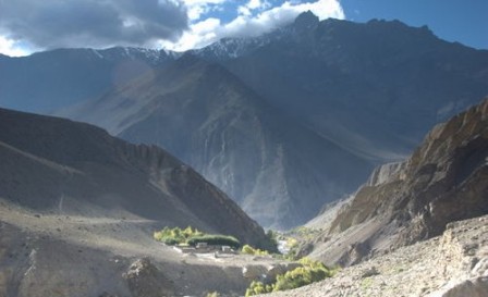 Ganesh Himal trekking area lies on the central eastern region of Nepal. This regions offers spectaculars views, untouched natural splendor, wild and friendly inhabitants.
The Ganesh Himal is named after the elephant.-headed God of good fortune. The Ganesh Himal can clearly be seen from Kathmandu valley. The Ganesh range peak ( Ganesh 1. Ganesh II, Ganesh III, and Ganesh IV) stand out like crystal. That is the great Himalayan change forming the skyline. This great Himalayan massif is contained between the valley of the Budhi Gandaki in the west and Bhotekoshi in the east, which becomes Trishuli Khola in the lower section.
There are three major groups of peaks between Kathmandu and Pokhara such as Ganesh Himal, Langtang and Manaslu including Annapurna range. This trek is ideal for those wanting to escape from the more popular regions of Annapurna and Everest. It is famous for unspoiled Tamang culture, spectacular views of mountains and colorful rhododendron forest. It also begins conveniently close to Kathmandu .
During the Ganesh Himal Trekking you can observe the different ways of life culture and able to contact with rural people in the small villages. On the way to Trekking period you will see the method of living those rural people in Nepal . Milestone and a kind of wooden machine for hustling rice. Millet and corn the significant glamour of the village. You will cross through the 4400m high sing-la pass offers an excellent view of the massif Ganesh Himal, Langtang Himal, Mt. Manaslu and Annapurna Himalayan ranges. No more tourists are the peculiarity of this region. It might be possible you can’t see any foreigners even any modern Nepalese other than local people
You will see 65 percent people are Tamang (semi Mongolian) and rests of them are others. Ganesh Himal trekking is knows as a Tamang cultural tour
Best Season: Spring (September to December) autumn (March to May).
Trekking Grade: Moderate
Max Elevation: 3800m
Total trekking days: 10 Days
Day 01: Arrive Kathmandu (1338 m)
Upon arrival in Kathmandu, meet & greet in the airport; transfer to Hotel. Overnight at Hotel in Kathmandu.
Day 02: Your full-day sightseeing includes visits to Bhaktapur Durbar Square, home of medieval art & architecture; Continue your tour to Kathmandu Durbar Square (Hanuman Dhoka), the old palace of the Royal Dynasty and hometown of living Goddess, Kumari. Final stop is at the Swayambhunath Stupa, the holiest shrine for the Buddhist and Hindus. Overnight at hotel in Kathmandu.
Day 03: Drive to Pairo Bensi (800m) 6 hrs.
It takes about 6 hrs scenic drive from Kathmandu to Pairo Bensi. Pairo Bensi is a small Village next to Trisuli River. Enjoy the first overnight in tent under the glooming stars and moreover near to river bank. Overnight tented camp.
Day 04: Trek to Kispang- (1900m) 5 hrs.
Wake up under the sky and get ready for the first walking day of your trek. It's up hill walk for about 3 hrs to the village called satdobato and then gradual uphill walk for another 2 hrs to our camping site call Kispang. Enjoy your walk through the mixed villages on this day. Overnight tented camp.
Day 05: Trek to Gonga- (2800m) 6-7 hrs.
It is steady uphill through rhododendron forest which is the national flower of Nepal all the way to Gonga, which is our camp site. You could see Langtang Lirung and Gosainkunda mountain ranges from here. Overnight at local lodge.tented camp. Overnight tented camp.
Day 06: Trek to Rupchet- (3635m) 5 hrs.
Another uphill walk for about 5 hrs through rhododendron forest takes you to Rupchet. Overnight at local lodge.tented camp, alpine area looking at the Langtang mountain range.
Day 07: Rest day in Rupchet for acclimatize- explore around Rupchet.
Day 08: Trek to Shing la pass (4100m) - Larkap- (approx. 3700m) 4 hrs.
Get your camera ready for the spectacular mountain views from Shing la pass which offers some over eight thousand meters mountains. From Rupchet we trek steep uphill walk for 2 hrs to Shing La pass from where you could have great Mountain View of Ganesh himal, Manaslu, Annapurna range, fishtail, Langtang range, Gosainkunda range, Tibetan range and more. After the pass it is downhill walk for one hour to Larkap. Overnight tented camp.
Day 09: Trek to Pangsang la - (3800m) - Somdan 3200m- 7 hrs.
It's up hill and ridge walk to Pangsang la and from here plan walk through rhododendron forest and enjoy full day of great Mountain View while you are walking from Larkap to Somdan. Overnight tented camp.
Day 10: Trek to Gatlang (2500m) 5 hrs.
First it’s flat walk and then after uphill walk though khupi bangyang pass (3600m) and then downhill walk to Gatlang. In Gatlang there is a small holy lake. Overnight tented camp.
Day 11: Trek to Sano Haku- (2300m) 6 hrs.
It’s about 1 hrs uphill through forest and gradual downhill all through villages to Sanu Haku. Mountain View could be seen as well. Overnight tented camp.
Day 12: Trek to Mailung- (1200m) 6 hrs.
Downhill walk through forest and fields takes us to Mailung, a small Tamang village at the river bank. Be in touch with local Tamang people with their typical life style and customs. Overnight tented camp.
Day 13: Trek to Pairo bensi- (800m) 4 hrs.
Gradual walk for about 4 hrs following the Trisuli River takes us to Peirobensi which is out last camp in mixed village of Pairobensi. Overnight tented camp.
Day 14: Drive back to Kathmandu for about 6 hrs. Overnight at hotel in Kathmandu.
Day 15: Depart from Kathmandu
After breakfast, transfer to the Kathmandu airport (prior to three hours of your departure time) to board flight for your onward destination.
Have a wonderful flight back home with the treasures of your nostalgic memories.
DOLPO REGION
Dolpo Trek in west Nepal is located in side the Shey-phoksundo National Park toward the north of Dhaulagiti range and the Tibetan plateau. Dolpo ramains a truly isolated cornner of Nepal . The national park is a preserve ecosystem of plants and wildlife that includes the rare blue sheep, gray wolf and snowleopoard, the view of the Kanjiroba peak, Phoksundo Lake and the Dhaulagiri massif are rewards of trekking to the Dolpo Region. The easiest way to Dolpo region is by air from Nepalgunj to juphal, which is a 4-hour walk from district-headdquarters of Dunai it is also possible to trek to Dunai from Dhorpatan that can me reached from Tansen or "Pokhara. A trek through Dolpo is an experience not easily forgotten.
The inner Dolpo region remained in isolation till 1990 and till then it was a restricted area with no entry, especially for the foreigners. This place shares border with Tibet and is still culturally Tibetan. This place gained immense popularity and arouse interest of the people around the globe after the a book on this place was written by Matheson 'called the Snow Leopard', and even David Snell grove's 'Himalayan Pilgrimage' and George Schaller's 'Stones of Silence' among many other travel accounts has revealed a bit about this place but a visit is worth. Legend has it that the ubiquitous Guru Rimpoche, who spread Tibetan Buddhism throughout the Himalayas, discovered this hidden land, a 'beryl' or refuge, over 1700 years ago, and it has been inhabited by Tibetan nomads, called drokpas, for over a thousand years.
Dolpo is now part of the Nepali region of Dolpa, but historically came from the Zhangzhung Bon-po Kingdom which dominated Western Tibet for over a thousand years, later defeated by the first Tibetan dynasty, Yarlung, between the sixth and eighth centuries. Afterwards, Dolpo was governed by the Kingdom of Lo (now Mustang, formerly part of Tibet) until the Gorkha Kingdom took it over during its Inner Dolpo is a restricted area, for which a fee is charged of US$ 500 for the first 10 days, and US$ 50 for each additional day. Besides, there is a maximum of the number of foreigners that can enter Inner Dolpo each year. Currently this maximum is put at 250 people. This makes a trek into Inner Dolpo a very special and exclusive experience.
The trekking brings us to Shey Gompa, which is often referred to as the spiritual heart of Inner Dolpo. It's a magical place, situated at the base of Crystal Mountain, which is visited by hundreds of pilgrims each year. They make a kora (circuit) of the Crystal Mountain, Dolpo's own version of Mount Kailash.
It is a very strenuous hike. We have to cross three high passes, Kang La/ Ngadra La of 5350 m, the Shey La of 5000 m and Jeng La of 5110 m. These crossings involve long climbs and long descend. Besides, we stay above 4000 meters for a long time, with very cold nights. But the unforgettable landscapes, the views from the passes and the contacts with a very special untouched culture make it all worth it.
Dolpo, celebrated as a sample of original Tibet, created by a Buddhist deity for his worshippers is also known as hidden valley. Dolpo is located inside the Shey Phoksundo National Park of mid-western Nepal, behind the North side of the Dhaulagiri massif towards the Tibetan highland. Dolpo has scattered fascinating villages and is still the land of mystery, serenity and peace. This route provides the pleasure of nature to trekkers who are more adventurous.
The Dolpo is famous for the deepest lake, Phoksundo, in the entire Himalayan Region. The view of Kanjiroba peak, Phoksumdo Lake, and the Dhaulagiri massif is one of the most rewarding moments of this trek. The Dolpo region has only been opened to foreigners since 1989. Recently opened for trekking, this route is especially nice for those who love to explore remote areas reminiscent of an ancestral way of life.
Dolpo Region Trek is remains a truly isolated corner of Nepal; time has stood still here for centuries as the inhabitants of Tibetan stock continue to live, cultivate and trade the way they have done since time immemorial. The ecosystem encompasses a wild and wonderful variety of plants and wildlife, including the blue sheep and snow leopard. This trek is most suitable for those who are exceptionally fit and prepared to face the full challenge of the Himalayan wilderness.
RNK 35 PHOKSUNDO LAKE TREK (10 Nights / 11 Days)
Best Season: Spring (September to December) autumn (March to May).
Trekking Grade: Moderate
RNK 36 LOWER DOLPO TREK (16 Nights / 17 Days)
Best Season: Spring (September to December) autumn (March to May).
Trekking Grade: Moderate and fairly strenuous
RNK 37 DOLPO CIRCUIT TREK (16 Nights / 17 Days)
Best Season: Spring (September to December) autumn (March to May).
Trekking Grade: Moderate and fairly strenuous
RNK 38 UPPER DOLPO - SHY GOMPA TREK (23 Nights / 24 Days)
Best Season: Spring (September to December) autumn (March to May).
Trekking Grade: Moderate and faily strenuous
RNK 35 PHOKSUNDO LAKE TREK (10 Nights / 11 Days)
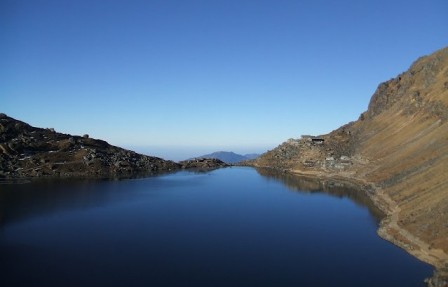 Dolpo is reminiscent of the image of Shangri-la in many respects. One has to see the landscape in all of its rugged natural beauty and experience the utter remoteness to appreciate this. The natural beauty and ancient culture of this place is rich almost beyond measure. The high and isolated valleys of northern Nepal's Dolpo region preserve some of the Himalayas last remnants of traditional Tibetan culture. According to legend, the Guru Rinpoche created Dolpo as a sanctuary for devout Buddhists. Cut off from the world by high mountains and snow-covered passes, Dolpo is the permanent home to about 5000 people whose lives cantered around Buddhism and traditional agriculture.
Our destination on this shorter trek is the awe-inspiring Phoksundo Lake.The distinctive people, architecture and unique lighting conditions make Dolpo a photographer's paradise. The Himalayan range can be seen in all its splendor and Phoksondo Lake with the Ringmo village provide some of the most beautiful Nepalese scenery. We follow the ancient Tibetan salt caravan route, across two high passes and through the wilderness in one of Nepals most remote areas. The route is Juphal- Phoksumdo Lake - Shey Gompa - Saldang La pass -Sibu - Tarakot.
In the Dolpo region the hot, humid monsoon, created by the sea winds blowing from the Gulf of Bengal, is tempered by the Dhaulaghiri range and trekking is therefore possible during the summer, a period during which flora explodes in all its splendor: orchids, edelweiss, campanulas, forget-me-nots . The centre of attraction is the lovely Lake Phoksundo, famous for its ever-changing color of its water. Here are steps on to the edge of the Trans-Himalayan plateau that extends from Tibet down into Nepal.
Best Season: Spring (September to December) autumn (March to May).
Trekking Grade: Moderate
Max Elevation: 3733m
Total trekking days: 06 Days
Day 01: Arrive Kathmandu (1338 m)
Upon arrival in Kathmandu, meet & greet in the airport; transfer to Hotel. Overnight at Hotel in Kathmandu.
Day 02: Your full-day sightseeing includes visits to Bhaktapur Durbar Square, home of medieval art & architecture; Continue your tour to Kathmandu Durbar Square (Hanuman Dhoka), the old palace of the Royal Dynasty and hometown of living Goddess, Kumari. Final stop is at the Swayambhunath Stupa, the holiest shrine for the Buddhist and Hindus. Overnight at hotel in Kathmandu.
Day 03: Flight to Nepalgunj.
To get to Dolpa, generally we have to fly to Nepalgunj first. Nepalgunj is a steaming hot city in South Western Nepal, in the lowlands of Terai, close to the Indian border, which is just 8 km away. Culturally the area more resembles India than upland Nepal. Take a cycle rikshaw for a ride in town. The Bageshowri temple is one of Nepal's most important Hindu temples and is worth a visit as well.
Day 04: Flight to Juphal (2475 m), walk to Chhepka (2838 m) 6 hrs
It's just a 35 minutes flight to Juphal over steep mountain ridges with beautiful views of snowcapped mountains and we have spectacular landing. From Juphal walk down over a small path among fields with wheat and vegetables to the Thuli Bheri River, which you'll follow after reaching it. A big iron suspension bridge, the Dhim Bridge (99 m long) forms the entrance to the Shey Phoksundo National Park (SPNP). The path follows the Suli Khola River behind us we can see the Dhaulagiri range. You pass small villages along the way, like Kageni (2413 m) and Sangta (2520 m) In Sangta honey is cultivated from where we enter the forest and walk along side of river and beautiful emerald green. The path is surrounded by pine trees, like spruce, fir, juniper and cypress and passes small bamboo forests and walnut trees.. At the end of the day we reach Chhepka, a small village, surrounded by fields of millet and wheat.
Day 05: Trek to Chunuwar/Amchi Hospital (3110 m) 6 hrs
The path goes through beautiful pine forests, with some bushes, birches and other broadleaf trees mixed in as well. It's following the river all the time and most of it is Nepali flat: sometimes going up and sometimes going down, with a couple of steeper climbs and descents. At some parts the valley gets very narrow and the impressive steep rocks are towering high above you on both sides. After about four hours you pass the village of Rechi, where there is a camping spot. At other side there is teashop which we continue from the other side of the bridge. It's two hours more to Chunuwar. Close to Chunuwar you can find the Amchi Hospital. (An Amchi is a traditional Tibetan doctor with traditional method of treatment and medicine). We stay Overnight at local lodge.tented camp.
Day 06: Trek to Ringmo/Phoksundo Lake (3733 m) 3 hrs
It's a short hike to Ringmo and the Phoksundo Lake. It includes a long and sometimes steep climb of about 2 hours. Just before the top, you can see Nepal's highest waterfall, a spectacular waterfall of 167 meters high, the Phoksundo Waterfall (also called Suligad Waterfall). The path is going down till it gets close to the river, which follows until we reach Ringmo.
Ringmo is a charming village. People practice the Bonpo religion here. In Ringmo women make very nice woven products, like belts, bags, shawls and blankets. Ringmo lies at the shore of the holy Phoksundo Lake. the lake is surrounded by the mountain with emerald green .If you want, you can walk a part of the famous Demons Trail from the movie Himalaya (Caravan) of Eric Valli. It's a spectacular trail, going high above the lake. At some parts it gets very narrow due to landslides, where we need to be very careful.At the other shore, there is a beautiful Bonpo Monastery which we can visit. We stay Overnight at local lodge.camp.
Day 07: Trek to Chunuwar (3110 m) 2 hrs
As the Phoksundo Lake is such a beautiful place, an extra free morning here is recommended.
In the afternoon you leave back to Chunuwar. Leaving Ringmo, the path is rather flat at first, but soon climbs steeply up the hill. Soon you will see the river far below you. The climb takes about half an hour. At the top you have a beautiful last view of the Phoksundo Lake. And then it is going down, down and more down. Pretty steep at the beginning but later Nepali flat again till you reach Chunuwar.
Day 08: Trek to Sangta (2520 m) or Kageni (2413 m) 6-7 hrs
The path descends gradually, going almost entirely through beautiful pine forests, with some bushes, birches and other broad leaved trees mixed in. It's about 1 ½ hours to Rechi.After Rechi, the trail is Nepali flat, to Chhepka (3 ½ hrs) going up and down, with a couple of steeper climbs and descends, following the river all the time. You notice that you are descending; not only by the increasing temperature, but also by the difference in vegetation. You'll see bamboo again for example, and big walnut trees. From Chhepka it's an hour more to Sangta, and another hour to Kageni. After Sangta you leave the forest, and suddenly you walk through a bit dry landscape.
Day 09: Trek to Dunai, 3-4 hrs or Juphal (2475 m) 6-7 hrs
It's a pleasant walk in a rocky landscape till the check post of the Shey Phoksundo National Park (SPNP). After the check post you can choose to go left to Dunai or cross the big iron suspension bridge (the Dhim Bridge) and go west to Juphal. It's about 45 minutes to Dunai, the headquarters of Dolpa District. It's a large village, of about 2,500 people, more or less half Hindu and half Buddhist. Up the hill, there is a Buddhist monastery, the Dolpa Kendriya Gompa, which is worth a visit. It is situated at the slope at the other site of the river, overlooking Dunai. The monastery belongs to the Nyingmapa lineage, the oldest Buddhism linege and was built in 1998.A bit further away from Dunai, at the same slope, you can find the Dolpo Bon School and Hostel. Besides the normal teachings that children receive at common schools, the Bon School educates children in the Bonpo religion, Tibetan culture and Tibetan language. As the children come from different, far away villages, there is a hostel as well. Currently there are 26 children in the school, divided into 5 different classes.Besides the Hostel, there is a beautiful stupa with holds a century old footprint of an important lama.From the bridge, it's about 2½ - 3 hours to Juphal. The first part goes over a large path, passing through the small village of Kalagaonda. Then we leave the main road and walk over a small path. It's a pretty steep climb to reach Juphal. Juphal is a large village with a small bazaar where it is nice to spend some time looking around.
Day 10: Flight to Nepalgunj and Kathmandu
Early in the morning you fly to Nepalgunj. Especially the first part of the flight through the mountain valleys is spectacular. Later in the day, you fly back to Kathmandu. Overnight at local lodge.Kathmandu.
Day 11: Depart from Kathmandu
After breakfast, transfer to the Kathmandu airport (prior to three hours of your departure time) to board flight for your onward destination.
Have a wonderful flight back home with the treasures of your nostalgic memories.
RNK 36 LOWER DOLPO TREK (16 Nights / 17 Days)
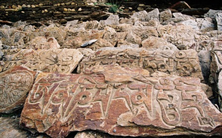 Best Season: Spring (September to December) autumn (March to May).
Trekking Grade: Moderate and fairly strenuous
Max Elevation: 5318m
Total trekking days: 12 Days
Day 01: Arrive Kathmandu (1338 m)
Upon arrival in Kathmandu, meet & greet in the airport; transfer to Hotel. Overnight at Hotel in Kathmandu.
Day 02: Your full-day sightseeing includes visits to Bhaktapur Durbar Square, home of medieval art & architecture; Continue your tour to Kathmandu Durbar Square (Hanuman Dhoka), the old palace of the Royal Dynasty and hometown of living Goddess, Kumari. Final stop is at the Swayambhunath Stupa, the holiest shrine for the Buddhist and Hindus.
Overnight at hotel in Kathmandu.
Day 03: Flight Kathmandu - Nepalganj
To get to dolpo region, generally you have to fly to Nepalgunj first. Nepalgunj is a steaming hot city in South Western Nepal, in the lowlands of Terai, close to the Indian border, which is just 8 km away. Culturally the area more resemble India than upland Nepal. Take a cycle rikshaw for a ride in town. You pass the hustle and bustle of the bazaar and see horse carts full of colorful people going to or coming from the Indian border. The Bageshowri temple is one of Nepal’s most important Hindu temples and is worth a visit as well. Overnight at local lodge.
Day 04: Flight Nepalgunj-Juphal (2475 m), walk to Dunai (2140 m) 2.5 hrs
It’s just a 35 minutes flight to Juphal over steep mountain ridges with beautiful views of snowcapped mountains. Juphal airport is just a gravel airstrip amidst the mountains, which guarantees a spectacular landing. Stepping out of the plane, you enter in a completely different world. From a hot city in the plains, you arrive in a small mountain village, situated in the midst of the Himalaya, breathing in crispy cold air. From Juphal you walk down over a small path among fields with wheat and vegetables to the Thuli Bheri River, which you’ll follow after reaching it. Overnight at local lodge.tented camp.
Day 05: Dunai (2140 m) to Lingdo (2391 m) 5 hrs
Leaving Dunai, you soon walk in a beautiful mountain landscape, which sometimes reminds to the European Alps. Rocky slopes are dotted with pine trees, mostly blue pine. At the horizon you see the snowcapped Kang Tokal (6294 m). The path goes slightly up and down, following the Thuli Bheri River, once and a while passing a couple of houses.
You cross the Buddhist village Byasgar (2427 m). After leaving Dunai, all the villages you’ll come across are inhabited by Buddhist people. The people who live in this region are Tarali’s, a Magar group.
After Byasgar, the landscape gets quickly more rough and rocky. The path is sometimes carved out of the rocks, and at a few points very narrow. There are plans to make a motor able road all the way to Dho Tarap. Walking here, it seems that this is a huge challenge, and it surely will take a couple of years. But, it might be a reason not to wait too long if you want to visit Dolpa… You reach Lingdo, a small village which has one guesthouse, with a campingsite. Plus a checkpost, so have your permit at hand. Overnight at local lodge.tented camp.
Day 06: Lingdo (2391 m) to Laina Odar (3370 m) 6 hrs
The path is gradually going up. Along the way you have a good view to some of the villages in this region, like Sarakot, which is situated high on a cliff. These are the last villages you will see till you reach Dho Tarap. You pass some mani walls (a wall with loose stones with Buddhist mantra’s carved on it) and chortens. According to Buddhist custom, you have to pass these Buddhist shrines on the left side, so clockwise. At the horizon you can see the beautiful snowcapped Kang Tokal. The landscape is impressive and sometimes very green. Sharp rocks are dotted with junipers and other pine trees. If you are lucky, you can see groups of large grey monkeys here.
The trail climbs high on a slope and goes high above the Thuli Bheri River, leading to a large suspension bridge (120 meter long), high above the river as well. You reached Laisicap (2772 m). On the other side of the bridge, there is a tent-hotel, where you could stop for a dal bhat or noodle soup or fill up your stock of snacks. Tent-hotels are big Tibetan tents, set up to serve food and drinks to travelers. Besides local restaurants, they serve as a shop as well, and you can buy a variety of items here, like biscuits, juice, Lhasa beer, shampoo, etc.
After Laisicap it’s a long and strenuous climb of about 3 hours to Laina Odar (3370 m). The path partly goes through forests and you are surrounded by steep cliffs full of pine trees, some of which are huge. You find yourself high above the river. Close to Laina Odar, the path goes alongside the river again. Overnight at local lodge/tented camp.
Day 07: Laina Odar (3370 m) to Nawarpani (3475 m) 4 hrs
After leaving Laina Odar, the trail goes up to a small pass, which takes about 45 minutes climbing to reach it. After the pass, it’s a fairly easy walk with a few small climbs. It’s a beautiful walk again, sometimes going through pine forests, with a wonderful smell. About 4 hours after leaving Laina Odar, you reach Nawarpani (3475 m), where you find another tent-hotel. You can camp here. If you are feeling well and in good shape, you could continue and walk to Sisaul (3750 m) today. Overnight at local lodge/tented camp.
Day 08: Nawarpani (3475 m) to Sisaul (3750 m) 3.5 hrs
After Nawarpani the landscape quickly gets more barren. There are only few trees. You mostly walk in the river valley with high rocks towering above you on both sides. In this barren landscape the bluesheep lives. If you look out for them you have a big chance to see big groups high on the slopes. Besides, if you are really very lucky, you might even spot a snowleopard…
It’s a fairly easy walk, gradually going up. At some parts the path is beautifully carved out of the rock, so that you find yourself walking in a kind of three sided tunnel. The path climbs steeply for about half an hour to a small pass with a nice chorten (stupa). From the pass, it’s 30 minutes till Sisaul (3750 m). Overnight at local lodge/tented camp.
Day 09: Sisaul (3750 m) to Dho Tarap (4080 m) 4 hrs
Leaving Sisaul, the trail climbs to another small pass. Shortly after the pass, the valley suddenly widens. The landscape has changed completely. It’s very dry and small bushes have taken the place of the trees from before. Gradually you will notice these bushes disappearing almost completely as well. The trail stays besides the river. At the horizon a small collection of houses is appearing in between the mountains: Dho Tarap. Getting nearer to Dho Tarap, you cross many mani walls and small chortens. It makes you realize how important Buddhism is for the people of Dolpa. Buddhism is interwoven in each and every aspect of people’s life here. Behind Dho, you can see the gompa (Buddhist monastery) of Dho, situated on a hill.
The people of Dho are direct descendents of Tibetans, which you can notice easily by their faces and their dress. The women wear dark dresses with colorful aprons made from yak wool. Many women wear bracelets of big shells and some have beautiful silver and turquoise headgear. Most men have long hair, some wear a red ribbon in their hair, in the style of Tibetan Khampas. Their typical dress is a long coat, from which they let one sleeve hanging down. The people in Dho are very friendly. A Tashi Delek (good day, like the Nepali Namasté), is always welcomed with a big smile. Overnight at local lodge/tented camp.
Day 10: Dho Tarap (3944 m) to Numala Base Camp (4440 m) 3 ½ hrs
As it is only a 3 ½ hours walk to Numala Base Camp, so you can use the morning to explore Dho and surroundings. Leaving Dho, you pass a beautiful gate chorten. After more or less half an hour, you arrive at the Crystal Mountain School, which is educating children from Dho and surroundings. It is sponsored by a French NGO. If you want, you can visit the school, the teachers are very pleased to show you around. From the school, it’s about half an hour to Tokyu (4209 m), a spread out village, which is said to be the highest permanent settlement in the world. The gompa is at the end of the village, and is worth a visit. It has a beautiful statue of Maitreya, the Future Buddha. From the gompa, it is a gradual climb of about 1 ½ hour over grassy land to Numala Base Camp (4440 m). It’s in the middle of nowhere, but close to the river and you find a small house for cooking here.
Day 11: Numala Base Camp (4440 m) to Danigar (4631 m) via Numa La (Pass) (5318 m) 6 hrs
A tough day lies ahead of you. It’s a good idea to start early (between 5 and 6 am), to arrive early at the pass. In the morning the weather generally is best which makes the crossing of the pass easier and safer. Besides you have more chance to have a good view of the mountain ranges from the pass, as later in the day clouds tend to cover the peaks.
It’s a long and strenuous climb of about 3 hours to Numa La (la means pass) at 5318 m. The altitude makes you go slow and you get out of breath quickly. But it’s definitely worth it. On a clear day you have a stunning view from the pass on countless snowcapped mountains. Daulagiri (8167 m) is towering above them to the right. Besides, you can see the Annapurna and Manaslu Range, the Shey Shikar (6139 m), Kanjirowa (6883 m) and many, many others. In spring there can be snow on the pass, which makes the crossing a bit harder. After the pass you go down steeply for about an hour. Then the path becomes pretty level and later climbs slowly but steadily again for about an hour. As the river is going down quickly, you find yourself soon high above the river. After a couple of turns, you arrive at a meadow, which is the campsite for today, Danigar (4631 m). It’s an amazing spot close to the river (Panklanga Khola). To the south the beautiful snowcapped Norbung Kang (6085 m) is towering high above the campsite. On the other side of the river there are high pastures, which are often used by yaks to graze. Overnight at local lodge.tented camp.
Day 12: Danigar (4631m) to Yak Kharka (3982m) via Baga La (5190 m) 6 hrs
Another pass to cross today, so another tough, but beautiful day lies ahead of you. Again, an early start is best. The path continues on the slope on the other side of the Panklanga Khola and climbs pretty steep, going “zig zag” over the slope. Soon you are high above the river. A good 2 hours after leaving camp you reach the high camp, which is already close to the pass. From here you have an excellent view on the Norbung Kang and the Baga La range. Pretty soon after the high camp you can observe the last stretch of the path to the pass, climbing very gradually in a half circle over the slope to Baga La (5190 m). From the pass you have a splendid view on many snowcapped mountains like Kanjirowa and Shey Shikhar. In spring there can be snow on this pass as well.
After the pass, the path descends pretty steep at the beginning. This part can be icy which makes it slippery, so watch your step! You walk in a stunning scenery of huge rocks in all kind of colors with at the horizon mountains covered with snow. And then, suddenly, more or less 1 ½ hour after leaving the pass, you will see green bushes and a bit later even trees. In the distance you can observe green meadows far below you. A beautiful sight after those days without any trees. Besides, you will see a couple of beautiful waterfalls along the way. It’s rather flat and easy walking, very gradually going down, till you reach Yak Kharka (3982 m), another beautiful place to camp. You have a great view of the imposing Kanjirowa Himal (6612 m). Besides, in spring the meadows are full with flowers. Overnight at local lodge.tented camp.
Day 13: Yak Kharka (3982 m) to Ringmo/Phoksundo Lake (3733 m) 2 .5 hrs
It’s a short hike today, and if you have the energy, you can even walk this part at the same day as crossing the Baga La. Pretty soon after leaving Yak Kharka, the path starts to climb high on the slope, and the river (Maduwa Khola) is soon far below you. The path is going up and down and stays level sometimes: that is what they call Nepali flat. The path is beautifully carved out of the rocks and leads to a small pass. After the pass, the path goes into a pine forest. If you detour from the path soon after entering the forest and go to the left to the edge of the ridge, you can see a nice waterfall. You walk through some beautiful pine forests and meadows and it’s nice to hear the birds singing. Leaving the forest, you cross a small bridge from which you climb in a couple of minutes to Ringmo.
Day 14: Phoksundo Lake (3733 m) to Chhepka (2838 m) via Rechi (2940 m) 7 hrs
You can walk the following stretch in two short days, or one long day. Walking time to Rechi is about 3.5 hours and from Rechi to Chhepka is 3 .5hours as well. The walk to Rechi goes almost entirely through beautiful pine forests, with some bushes, birches and other broad leaved trees mixed in. Leaving Ringmo, the path is rather flat at first, but soon climbs steeply up the hill. Soon you will see the river far below you. Overnight at local lodge.tented camp.
Day 15: Chhepka (2838 m) to Juphal (2475 m) 6 hrs
Today it is most of the times descending, with some small climbs in between. The first part is going through the forest again, with below you the wild flowing river. After the village of Shyanta you leave the forest, and suddenly you walk through a bit dry landscape. In front of you, you can see a part of the Dhaulagiri range. You pass villages like Sangta (2520 m) and Kageni (2413 m) and reach the check post of the Shey Phoksundo National Park (SPNP) again. After crossing a big iron suspension bridge (the Dhim Bridge, 99 m long) you go left (west) to Juphal (if you would go right (east), you’ll arrive in Dunai again (45 minutes walking)
From the bridge, it’s about 3 hours to Juphal. The first part goes over a large path, passing through the small village of Kalagaonda. Then you leave the main road and walk over a small path, through fields of barley and wheat, with walnut, peach and apricot trees. It’s a pretty steep climb to reach Juphal. Overnight at local lodge.tented camp.
Day 16: Flight Juphal-Nepalgunj-Kathmandu
Early in the morning you fly to Nepalgunj. Especially the first part of the flight through the mountain valleys is spectacular. Later in the day, you fly back to Kathmandu. Overnight at local lodge.Kathmandu.
Day 17: Depart from Kathmandu
After breakfast, transfer to the Kathmandu airport (prior to three hours of your departure time) to board flight for your onward destination.
Have a wonderful flight back home with the treasures of your nostalgic memories.
RNK 37 DOLPO CIRCUIT TREK (16 Nights / 17 Days)
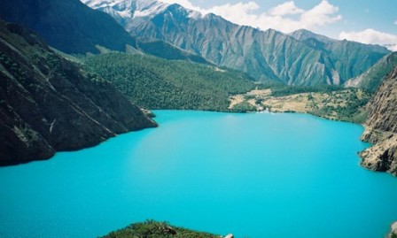 Trek to the Dolpa Circuit is an experience we'll never forget. It gives us the opportunity to experience life in the remote highlands. We walk through a variety of landscapes, ranging from green pastures, reminding to the European Alps, to barren rocks, reminding to the Tibetan plateau. The Phoksundo Lake is of an incomparable beauty, with its deep blue and emerald colors, surrounded by steep bold rocks.
We pass some small authentic villages, inhabited by straight descendents of the Tibetans. Buddhism en Bonpo are very important for the people living in these villages and interwoven in everyday life. Bonpo religion is the oldest spiritual traditional of Tibet. It is very much related with Buddhism, but has more shamanistic and animistic influences, which gives a mythical appeal to Dolpa.
Due to its remote location, Dolpa is still an "off the beaten track destination". Especially in spring and summer we see very few other tourists.
The Dolpa Circuit is a quite strenuous trekking, with some steep climbs. We have to cross two passes, Numa La of 5318 m and Baga La of 5190 m. This crossing involves long climbs and long descends. But the scenery on the way, the views from the passes and the encounters we will have with the Dolpa people will make it all worth it.
Best Season: Spring (September to December) autumn (March to May).
Trekking Grade: Moderate and fairly strenuous
Max Elevation: 5190m
Total trekking days: 12 Days
Day 01: Arrive Kathmandu
Upon arrival in Kathmandu airport, please come right to the main arrival gate where our representative will be waiting with the company board or your name card.
Transfer to the hotel. Overnight at hotel in Kathmandu.
Day 01: Arrive Kathmandu
Upon arrival in Kathmandu airport, please come right to the main arrival gate where our representative will be waiting with the company board or your name card.
Transfer to the hotel. Overnight at hotel in Kathmandu.
Day 03: Flight to-Nepalgunj
Nepalgunj is a steaming hot city in South Western Nepal, in the lowlands of Terai, close to the Indian border, which are just 8 km away and also the gate way to Dolpo. Culturally the area more resembles India than upland Nepal. Take a cycle rikshaw for a ride in town. The Bageshowri temple is one of Nepal's most important Hindu temples and is worth a visit as well. We stay Overnight at local lodge.
Day 04: Flight to-Juphal (2475 m), walk to Dunai (2140 m) 2 ½ hrs
It's just a 35 minutes flight to Juphal over steep mountain ridges with beautiful views of snowcapped mountains. From Juphal we walk down over a small path among fields with wheat and vegetables to the Thuli Bheri River, which will follow after reaching it. About 45 minutes before Dunai we pass a beautiful gate chortens (stupa), which is the entrance to the VDC (Village Development Committee) Dunai where we can observe the beautiful Buddhist paintings of mandalas and important Buddhist figures.
Dunai is the headquarters of Dolpa District. It is situated at the slope at the other site of the river, overlooking Dunai. A bit further away from Dunai, at the same slope, we can find the Dolpo Bon School and Hostels, the Bon School educates children in the Bonpo religion, Tibetan culture and Tibetan language. We stay Overnight at local lodge.tented camp.
Day 05: Trek to Lingdo (2391 m) 5 hrs
Leaving Dunai, we soon walk in a beautiful mountain landscape, which sometimes reminds to the European Alps. Rocky slopes are dotted with pine trees, mostly blue pine. At the horizon we see the snowcapped Kang Tokal (6294 m). The path goes slightly up and down, following the Thuli Bheri River, We cross the Buddhist village Byasgar (2427 m). The people who live in this region are Tarali's, a Magar group.After Byasgar, the landscape gets quickly more rough and rocky. The path is sometimes carved out of the rocks, and at a few points very narrow. Walking through the huge challenging finally we reach to Lingdo, a small village where we stay Overnight at local lodge.tented camp.
Day 06: Trek to Laina Odar (3370 m) 6 hrs
The path is gradually going up. Along the way we have a good view to some of the villages in this region, like Sarankot, which is situated high on a cliff. These are the last villages we will see till we reach Dho Tarap. We pass some Mani walls and chortens. The landscape is impressive and sometimes very green. Sharp rocks are dotted with junipers and other pine trees. The trail climbs high on a slope and goes high above the Thuli Bheri River, leading to a large suspension bridge (120 meter long), high above the river as well. We reached Laisicap (2772 m). On the other side of the bridge After Laisicap it's a long and strenuous climb of about 3 hours to Laina Odar (3370 m). The path partly goes through forests and we are surrounded by steep cliffs full of pine trees, some of which are huge. Close to Laina Odar, the path goes alongside the river again. We stay Overnight at local lodge.tented camp.
Day 07: Trek to Nawarpani (3475 m) 4 hrs
The trail goes up to a small pass, which takes about 45 minutes climbing to reach it. After the pass, it's a fairly easy walk with a few small climbs. It's a beautiful walk sometimes going through pine forests, with a wonderful smell. About 4 hours after leaving Laina Odar, we reach Nawarpani (3475 m), where we stay Overnight at local lodge.tented camp.
Day 08: Trek to Sisaul (3750 m) 3½ hrs
The trail goes through the dry or more barren landscape passing by river valley with high rocks towering on our both side. In this barren landscape the blue sheep lives. If we look out for them we have a big chance to see big groups high on the slopes. It's a fairly easy walk, gradually going up. At some parts the path is beautifully carved out of the rock. The path climbs steeply for about half an hour to a small pass with a nice chorten (stupa). From the pass, it's 30 minutes till Sisaul (3750 m). we stay Overnight at local lodge.tented camp.
Day 09: Trek to Dho Tarap (4080 m) 4 hrs
The trail climbs to another small pass. Shortly after the pass, the valley suddenly widens. The trail stays besides the river. At the horizon a small collection of houses is appearing in between the mountains: Dho Tarap. Getting nearer to Dho Tarap, we cross many Mani walls and small chortens.A Dho Tarap is a traditional agricultural village, surrounded by fields. Yaks are used to plough the land. Barley, buckwheat and potatoes are among the few crops that can grow in this barren landscapeThe houses are made of stones found in the river valley and are in typical Tibetan style, with small windows and the flat roofs stocked with firewood.
Close to Dho are 2 monasteries which are worth a visit. Ribo Bhumpa Gompa, Gompa belongs to Nyingmapa Buddhism right on the hill behind Dho, and Shipchaur Gompa, which is in the village Shipchowk, 30 minutes walking from Dho. Shipchaur Gompa in Shipchowk belongs to Bonpo Buddhism. We stay Overnight at local lodge.tented camp.
Day10: Trek to Numala Base Camp (4440 m) 3 ½ hrs
As it is only a 3 ½ hours walk to Numala Base Camp, we pass a beautiful gate chorten. After more or less half an hour, we arrive at the Crystal Mountain School which is sponsored by a French NGO and worth to visit. From the school, it's about half an hour to Tokyu (4209 m), a spread out village, which is said to be the highest permanent settlement in the world. The Gompa is at the end of the village, and is worth a visit. It has a beautiful statue of Maitreya, the Future Buddha. From the Gompa, it is a gradual climb of about 1 ½ hours over grassy land to Numala Base Camp (4440 m). We stay Overnight at local lodge.tented camp.
Day 11: Trek to Danigar (4631 m) via Numa La (Pass) (5318 m) 6 hrs
Early morning trek to Numa la pass give us the spectacular view of the mountain ranges from the pass. It's a long and strenuous climb of about 3 hours to Numa La (la means pass) at 5318 m. The altitude makes we go slowly and we get out of breath quickly. We have a stunning view from the pass on countless snowcapped mountains. Dhaulagiri (8167 m) , Annapurna and Manaslu Range, the Shey Shikar (6139 m), Kanjirowa (6883 m) and many, many others. In spring there can be snow on the pass, which makes the crossing a bit harder. After the pass we go down steeply for about an hour. Then the path becomes pretty level and later climbs slowly but steadily again for about an hour. It's an amazing spot close to the river (Panklanga Khola). To the south the beautiful snowcapped Norbung Kang (6085 m) is towering high above the campsite. On the other side of the river there are high pastures, which are often used by yaks to graze. We stay Overnight at local lodge.tented camp.
Day 12: Trek to Yak Kharka (3982 m) via Baga La (5190 m) 6 hrs
An early start is best. The path continues on the slope on the other side of the Panklanga Khola and climbs pretty steep, going "zig zag" over the slope. Soon we are high above the river. A good 2 hours after leaving camp we reach the high camp, which is already close to the pass. From here we have an excellent view on the Norbung Kang and the Baga La range Baga La (5190 m). From the pass we have a splendid view on many snowcapped mountains like Kanjirowa and Shey Shikar. After the pass, the path descends pretty steep at the beginning. This part can be icy which makes it slippery, we walk in stunning scenery of huge rocks in all kind of colors with at the Horizon Mountains covered with snow. And then, suddenly, more or less 1 ½ hour after leaving the pass, we will see green bushes and a bit later even tree Besides, we will see a couple of beautiful waterfalls along the way. It's rather flat and easy walking, very gradually going down, till we reach Yak Kharka (3982 m), another beautiful place to camp. We have a great view of the imposing Kanjirowa Himal (6612 m). Besides, in spring the meadows are full with flowers.
Day 13: Trek to Ringmo/Phoksundo Lake (3733 m) 2 ½ hrs
The path is going up and down and stays level sometimes. The path is beautifully carved out of the rocks and leads to a small pass. After the pass, the path goes into a pine forest. Leaving the forest, we cross a small bridge from which we climb in a couple of minutes to Ringmo.
Ringmo is a charming village. Ringmo lies at the shore of the holy Phoksundo Lake. This lake is of an incomparable beauty. It has an enchanting deep blue color and is emerald green close to the shore .If we want; we can walk a part of the famous Demons Trail from the movie Himalaya (Caravan) of Eric Valli. This is a beautiful movie about the life of people in Dolpa, At the other shore, there is a beautiful Bonpo Monastery which we can visit. In the monastery we can observe a statue of Tonpa Shenrab Miwo, the founder of Bonpo religion, who lived thousands of years ago.
Phoksundo Lake is part of the Shey Phoksundo National Park. It's Nepal's largest National Park, established in 1984, with an area of 3,555 km². It aims to conserve the Trans-Himalayan ecosystem and the Tibetan type of flora and fauna. we can camp at the shores of Phoksundo Lake.
Day 14: Trek to Chhepka (2838 m) via Rechi (2940 m) 7 hrs
Walking time to Rechi is about 3 ½ hours and from Rechi to Chhepka is 3 ½ hours as well.The path is rather flat at first, but soon climbs steeply up the hill. The walk to Rechi goes almost entirely through beautiful pine forests, with some bushes, birches and other broad leaved trees mixed in. Soon after the top we'll come across Nepal's highest waterfall, a spectacular waterfall of 167 meters high, the Phoksundo Waterfall. More or less one hour after the viewpoint we reach the Amchi Hospital. It's about 1 ½ hour more to Rechi (2940 m). We walk through the forest, with birds singing. The river flows rapidly and is beautiful emerald green at some places. The village Rechi is at the other side of the river. It's a very small village and consists of just a couple of houses and a primary school.
The trail stays Nepali flat to Chhepka, following the river all the time. We notice that we are descending; not only by the increasing temperature, but also by the difference in vegetation. After about 3 to 3 ½ hours we reach Chhepka, a small village, surrounded by fields of millet and wheat.
Day 15: Trek to Juphal (2475 m) 6 hrs
Descending with some small climbs. We can see a part of the Dhaulagiri range. We pass villages like Sangta (2520 m) and Kageni (2413 m) and reach the checkpost of the Shey Phoksundo National Park (SPNP) again. After crossing a big iron suspension bridge (the Dhim Bridge, 99 m long) we go left (west) to Juphal .From the bridge, it's about 2½ - 3 hours to Juphal. The first part goes over a large path, passing through the small village of Kalagaonda. It's a pretty steep climb to reach Juphal. Just before arriving, we pass the Hindu village Dangiwada. Juphal is a large village with a small bazaar where it is nice to spend some time looking around.we stay Overnight at local lodge.local guest house.
Day 17: Depart Kathmandu
After breakfast, transfer to the Kathmandu airport (prior to three hours of your departure time) to board flight for your onward destination.
RNK 38 UPPER DOLPO - SHY GOMPA TREK (23 Nights / 24 Days)
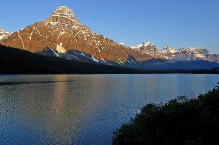 Best Season: Spring (September to December) autumn (March to May).
Trekking Grade: Moderate and faily strenuous
Max Elevation: 5375m
Total trekking days: 19 Days
Day 01: Arrive Kathmandu
Upon arrival in Kathmandu airport, please come right to the main arrival gate where our representative will be waiting with the company board or your name card.
Transfer to the hotel. Overnight at hotel in Kathmandu.
Day 02: Your full-day sightseeing includes visits to Bhaktapur Durbar Square, home of medieval art & architecture; Continue your tour to Kathmandu Durbar Square (Hanuman Dhoka), the old palace of the Royal Dynasty and hometown of living Goddess, Kumari. Final stop is at the Swayambhunath Stupa, the holiest shrine for the Buddhist and Hindus.
Overnight at hotel in Kathmandu.
Day 03: Flight Kathmandu-Nepalgunj.
To get to Dolpa, generally you have to fly to Nepalgunj first. Nepalgunj is a steaming hot city in South Western Nepal, in the lowlands of Terai, close to the Indian border, which is just 8 km away. Culturally the areas more resemble India than upland Nepal. Take a cycle rickshaw for a ride in town. You pass the hustle and bustle of the bazaar and see horse carts full of colorful people going to or coming from the Indian border. The Bageshowri temple is one of Nepal’s most important Hindu temples and is worth a visit as well. Overnigh at tented camp.
Day 04: Flight Nepalgunj-Juphal (2475 m), walk to Chhepka (2838 m) 6 hrs
It’s just a 35 minutes flight to Juphal over steep mountain ridges with beautiful views of snowcapped mountains. Juphal airport is just a gravel airstrip amidst the mountains, which guarantees a spectacular landing. Stepping out of the plane, you enter in a completely different world. From a hot city in the plains, you arrive in a small mountain village, situated in the midst of the Himalaya, breathing in crispy cold air. From Juphal you walk down over a small path among fields with wheat and vegetables to the Thuli Bheri River, which you’ll follow after reaching it. A big iron suspension bridge, the Dhim Bridge (99 m long) forms the entrance to the Shey Phoksundo National Park (SPNP). SPNP is Nepal’s largest National Park, established in 1984, with an area of 3,555 km². It aims to conserve the Trans-Himalayan ecosystem and the Tibetan type of flora and fauna. In 1998, and area of 1,349 km² surrounding the park was declared as buffer zone, which is jointly managed by the park and local communities. (You have to pay 1000 NPR entrance fee, except persons from SAARC countries, who pay 100 NPR). Next to the entrance is the small village of Suligad, where you could stop for a tea.
The path follows the Suli Khola River now. Behind you, you can see a part of the Dhaulagiri Range. You pass small villages along the way, like Kageni (2413 m) and Sangta (2520 m), where you could stop for a tea, lunch or stay for the night. In Sangta honey is cultivated. It’s a great place for a tea with honey! While sipping your tea, you can see the bees going in and out the beehives, made from tree trunks. Just before Sangta you enter the forest. It’s a beautiful walk, alongside the wild flowing river, which at some parts is beautiful emerald green. The path is surrounded by pine trees, like spruce, fir, juniper and cypress and passes small bamboo forests and walnut trees. At the other side of the river, the high rocky slope goes up steeply and is dotted with pine trees as well. At the end of the day you reach Chhepka, a small village, surrounded by fields of millet and wheat. Overnigh at tented camp.
Day 05: Chhepka (2838 m) to Chunuwar/Amchi Hospital (3110 m) 6 hrs
The path goes through beautiful pine forests, with some bushes, birches and other broadleaf trees mixed in as well. It’s following the river all the time and most of it is Nepali flat: sometimes going up and sometimes going down, with a couple of steeper climbs and descents. At some parts the valley gets very narrow and the impressive steep rocks are towering high above you on both sides. On the way you encounter local people with their mules or dzopas (crossbreed between yak and cow) loaded with things to sell. After about four hours you pass the village of Rechi, where there is a camping spot. At the other side of the bridge, there is a small teashop as well. The path continues at the other side of the bridge. It’s two hours more to Chunuwar. Close to Chunuwar you can find the Amchi Hospital. This is a very interesting place and worth a visit. In fact it is more a clinic, which is well frequented by local people. An Amchi is a doctor who is educated in traditional Tibetan medicine, and always is a lama (monk) as well. Tibetan medicine has a tradition of thousands of years and uses techniques as pulse analysis and urine analysis for diagnosis. For treatment, medicines made of herbs and minerals are used, together with physical therapies, like Tibetan acupuncture. In the Amchi Hospital you can see a collection of herbs and minerals used to cure people. Most Dolpa people prefer to visit the Amchi over a regular doctor when they are ill. A donation is highly welcomed to keep this tradition living. Overnigh at tented camp.
Day 06: Trek to Ringmo/Phoksundo Lake (3733 m) 3 hrs
it’s a short hike today to Ringmo and the Phoksundo Lake. It includes a long and sometimes steep climb of about 2 hours. Just before the top, you can see Nepal’s highest waterfall, a spectacular waterfall of 167 meters high, the Phoksundo Waterfall (also called Suligad Waterfall). From the pass you have your first view of the Phoksundo Lake. The path is going down till it gets close to the river, which you follow until you reach Ringmo. Ringmo is a charming village. People practice the Bonpo religion here. Bonpo is related to Buddhism, but it is a lot older than Buddhism and goes back thousands of years. The religion was founded more than 18,000 years ago by Buddha Tonpa Shenrab Miwo. It is believed that Dolpa used to be the centre of the Bon kingdom, called Zhang Zhung, a big and powerful kingdom in present Western and Northwestern Tibet and surroundings, as in Dolpa you can still find a big concentration of Bonpo practioners. In the 7th Century Zhang Zhung was defeated by the Buddhist kingdom of Tibet, and Bonpo disappeared almost completely. However many Bon traditions were absorbed into Tibetan culture. Overnigh at tented camp.
Day 07: Ringmo/Phoksundo Lake (3733 m), free day
It is essential to have an extra day in Ringmo, as your body needs time to acclimatize to the higher altitude. As the Phoksundo Lake is such a beautiful place, it’s a perfect place for a free day. Overnigh at tented camp.
Day 08: Ringmo/Phoksundo Lake (3733 m) to Chunemba (3639 m) 5 hrs
Today you enter the restricted area of Inner Dolpo. You follow the famous Demons Trail from the movie Himalaya (Caravan) of Eric Valli, a beautiful movie about the life of people in Dolpa who bring their yaks over difficult passes bearing salt from Tibet to trade with grain from the lowlands. In the movie, this trail is used during the salt caravan and one of the yaks falls in the lake here. It’s a spectacular trail, going high above the lake. At some parts it gets very narrow due to landslides. The trail climbs to a ridge, from which you have a spectacular view on the lake, Ringmo, the dark green pine forests and the snowcapped mountain Norbung Kang (6085 m) to the south. It’s now a gradual descend to the lake’s northern shore, which is a good place for lunch. After this the trail climbs through a wide valley, crossing some streams. You have a splendid and nearby view to the flanks and tops of the snowcapped Kanjirowa Himal (6612 m).You arrive at an alpine area with junipers, called Chuneba or Lakeside camp, which is a good place to camp. Overnigh at tented camp.
Day 09: Chunemba (3639 m) to Snowfields Camp (4400 m) 7 hrs
The Phoksundo Valley gets quite narrow now, with high rock walls on both sides. You have to cross a couple of streams. After about half an hour, you leave the main valley and enter a narrow gorge. It’s a long, pretty steep climb through the steep sided valley. The campsite is at Snowfields Camp, a name given by Peter Mathiesson in his famous book the Snowleopard. It’s at the foot of the pass that will bring you into the heart of Inner Dolpo tomorrow.
Day 10: Trek to Shey Gompa (4310 m) via Kang La (5375 m) 6 hrs
It’s a long and strenuous climb of about 2½ hours over a dusty path to Kang La (5350 m), locally also called Ngadra La. Prayer flags and cairns mark the pass. At the north side of the pass, there is snow most of the times, which makes the descend a bit difficult. The descend is pretty steep the first 45 minutes, but after this, it is going gradually for about 3 hours, till you reach Shey Gompa. Getting nearer, you pass red and white Chortens and mani walls. Shey Gompa is a very small village, with a couple of houses, and of course the gompa (monastery). The 11th century gompa is located beneath the Crystal Peak on a small grassy plain, at the confluence of two rivers. It is said to be constructed by a Tibetan Buddhist, who arrived here on the back of a flying snowlion. It’s a magical place, and Shey Gompa is often called the spiritual heart of Dolpa. Every year hundreds of pilgrims come to visit the gompa and to make a kora (clockwise circuit) of the Crystal Peak. People living here are direct descendents of Tibetans, which you can notice easily by their faces and their dress. The women wear dark dresses with colorful aprons made from yak wool. Men wear a long coat, from which they let one sleeve hanging down. Overnigh at tented camp.
Day 11: Rest day Shey Gompa (4310 m)
During this day, you can go to Tsakang Gompa (4575 m), a monastery from the Buddhist Kagyupa sect. This gompa appears in the movie Himalaya as well. It is spectacularly located high on a red rocky slope. The trail to Tsakang Gompa partly follows the same trail as pilgrims follow to make a Kora of the Crystal Peak.
You will probably see flocks of blue sheep in these areas. Many blue sheep live here, as the abbot of Shey Gompa imposed a ban on hunting them. Besides, in these regions you have the best chance of seeing the snow leopard. Overnigh at tented camp.
Day 12: Shey Gompa (4350 m) to Namgung (4430 m) via Shey La (5000 m) 6 hrs
Another pass to cross today, the Shey La, also called Gelu La, of 5000 m. The climb to the pass goes through a narrow valley. From the pass you have a good view to the north of the arid Tibetan Plateau, which is stretching out seemingly endlessly before you. To the east you can see Mustang. After the pass, it’s a long descend to the pastures of Namgung. Scattered in the landscape, you will see some fields, many times with a big Tibetan tent, as the fields are too far from the village to go there and go back each day.
The people in Namgung are very friendly and open. A friendly Tashi Delek (Tibetan greeting) will always be welcomed with a big smile. Overnigh at tented camp.
Day 13: Namgung (4400 m) to Saldang (4060 m) 3 hrs
It’s a short hiking day today. The path goes high above the Namgung Khola (River) and then descends steeply to the village of Saldang. Saldang is the largest settlement of Inner-Dolpo. It’s a spread out, traditional agricultural village, surrounded by fields. Barley, buckwheat and potatoes are among the few crops that can grow in this barren landscape. Besides, people live from what the yak gives them (cheese, meat, wool) and from trade. Saldang is close to the Tibetan border and some of the salt trade caravans pass through Saldang. The trading of salt for grain and rice is a century old tradition that still prevails in Inner-Dolpo. The people from Saldang are semi-nomadic.
In the warm months they trek in the highlands with their herds of yaks and sheep. The ones who are better off let the pure nomadic people of Dolpa, the Drokpa, do this work. Sometimes you can see a camp of the Drokpa in these areas. Overnigh at tented camp.
Day 14: Saldang (4060 m) to Sibu (4200 m) 5 hrs
It’s a fairly easy walk to Sibu, following the Namgung Khola southwards and passing little villages, like Namdo, along the way. The villages are surrounded by terraced fields of barley. The path goes alongside many Mani walls, chortens and some gompa’s, which makes you realize how important Buddhism is for the people of Inner Dolpo. Buddhism is interwoven in each and every aspect of people’s life here.Overnigh at tented camp.
Day 15: Sibu (4200 m) to Lagmo Che (4570 m) 4 hrs
The trail starts with an easy stretch, following the river. The last village you pass is Raka. After this, you enter a large, inhabited valley. Look out for bluesheep here. Besides, you may even come across a snow leopard… After 2 hours of trekking, the path turns away from the river and climbs steeply to a meadow of about 4570 m, which is often used by yaks to graze. This is Lagmo Che, the base camp for climbing to the Jeng La. Overnigh at tented camp.
Day 16: Lagmo Che (4570 m) to Tokyu (4209 m) via Jeng La (5110 m) 7 hrs
it’s a steep climb of about 2 hours to reach the next pass: Jeng La at 5110 m. From the pass you have a spectacular view to the Dhaulagiri (8167 m) and many other snowcapped mountains. After the pass you descend into the Tarap Valley. You arrive at the village Tokyu (4209), a spread out village, which is the first human settlement after Raka. Tokyu is said to be the highest permanent settlement in the world. The Gompa is worth a visit and has a beautiful statue of Maitreya, the Future Buddha. Overnigh at tented camp.
Day 17: Tokyo (4209 m) to Dho Tarap (4080 m) 2 hrs
it’s not far to Dho Tarap. On the way, you pass the Cristal Mountain School, which is educating children from Dho and surroundings. It is sponsored by a French NGO. If you want, you can visit the school, the teachers are very pleased to show you around. From the school it’s about half an hour to Dho. At the entrance you pass a beautiful gate chorten. Also the people of Dho are direct descendents of Tibetans. Besides the typical dark dresses with colorful aprons, most Dho women wear bracelets of big shells and some have beautiful silver and turquoise headgear. Most men have long hair, with a red ribbon in their hair, in the style of Tibetan Khampas. Besides they wear the long coat, from which one sleeve is hanging down. The people in Dho are very friendly and it is easy to make contact. With the Cristal Mountain School so close by, especially younger ones do speak a bit English.
Dho Tarap is a traditional agricultural village, surrounded by fields. Yaks are used to plough the land. As in the other villages you came across, barley, buckwheat and potatoes are among the few crops that can grow here. But nowadays, small greenhouses enable the people to grow some green vegetables as well. Besides, people live from what the yak gives them and from trade. The houses are made of stones found in the river valley and are in typical Tibetan style, with small windows and the flat roofs stocked with firewood. Overnigh at tented camp.
Day 18: Dho Tarap (4080 m) to Sisaul (3750 m) 4 hrs
A short day today again, so you have all the time to explore Dho in the morning.
Leaving Dho Tarap, you come along many mani walls and small Chortens. The path is going down, following the Tarap Khola. Gradually you can see the landscape changing. Some bushes are appearing, it’s getting a bit greener. Just before arriving at Sisaul, you have to climb to a small pass. After the pass, the valley gets narrow. It’s a short descend to Sisaul, which has a good campsite next to a tent-hotel. You can choose to camp here, or on one of the spots a bit further down. Overnigh at tented camp.
Day 19: Sisaul (3750 m) to Laina Odar (3370 m) 7-8 hrs
soon after leaving Sisaul, you climb to a small pass with a nice chorten. After the pass you will see the first trees again. You mostly walk in the river valley with high rocks towering above you on both sides. The landscape is still pretty barren and this is your last chance to see the blue sheep or snow leopard. It’s a fairly easy walk of about 3 to 3½ hours from Sisaul to Nawarpani. The path gradually goes down. At some parts the path is beautifully carved out of the rock, so that you find yourself walking in a kind of three sided tunnel.
After Nawarpani, the landscape gets quickly greener and the path is sometimes going through pine forests, with a wonderful smell. It’s a fairly easy walk over a pretty large path, which sometimes goes very high above the river. You reach Laina Odar where there is tent-hotel, located at the riverside. Overnigh at tented camp.
Day 20: Laina Odar (3370 m) to Lingdo (2391 m) 5 hrs
From Laina Odar the trail goes down pretty steep to Laisicap (2772 m). The path goes partly through forests and you are surrounded by steep cliffs full of pine trees, mostly spruce, fir, juniper and cypress, some of which are huge. Sometimes the river is far below you. The walk to Laisicap takes about 3 hours. At Laisicap you cross Thuli Bheri river over a large suspension bridge of 120 meter, high above the river. The trail goes down pretty steep for about 45 minutes. After this, it’s a fairly easy walk, gradually going down, with some flat parts as well. The landscape is impressive and sometimes very green. The sharp rocks are dotted with junipers and other pine trees. If you are lucky, you can see groups of large grey monkeys here. Behind you, you can see the beautiful snowcapped Kang Tokal (6294 m).
Getting closer to Lingdo, you can see some other villages in the distance, like Sarakot, which is situated high on a cliff.
These are the first villages you see after Dho Tarap. You pass some mani walls and Chortens. Lingdo is a small village with one guesthouse with a camping site. The people who live in this region are Trail’s, a Magar group (who are Buddhist as well). Overnigh at tented camp.
Day 21: Lingdo (2391 m) to Dunai (2140 m) 5 hrs
it’s an easy walk today. The first part goes through rough landscape. The path is sometimes carved out of the rocks, and at a few points very narrow. There are plans to make a motor able road all the way to Dho Tarap. Walking here, it seems that this is a huge challenge, and it surely will take a couple of years. But, may be a reason not to wait too long if you want to visit Dolpa. After about 2 ½ hours your reach the small village of Bazar (2427 m). After Bazar, the landscape gets greener and sometimes reminds to the European Alps. Rocky slopes are dotted with pine trees, mostly blue pine. At the horizon you see the snowcapped Kang Tokal (6294 m). The path goes slightly up and down, following the Thuli Bheri River, once and a while passing a couple of houses. Dunai is the headquarters of Dolpa District. It’s a large village, of about 2.500 people, more or less half Hindu and half Buddhist. Up the hill, there is a Buddhist monastery, the Dolpa Kendriya Gompa, which is worth a visit. It is situated at the slope at the other site of the river, overlooking Dunai.
The monastery belongs to the Nyingmapa lineage, the oldest Buddhism linege and was built in 1998. There is only one monk/lama. If he is there, he will be happy to open the monastery for you and show you around. Inside the Gompa you can observe a beautiful statue of Sakyamuni Buddha (Gautama Buddha), the Kengyur (the holy scriptures of Buddhism) and big thankas (Buddhist paintings on cotton). There is a small daily puja (prayer ceremony) from 6-7 am and from 6-7 pm. Overnigh at tented camp.
Day 22: Dunai (2140 m) to Juphal (2475 m) 3½ hrs
It’s a short walk to Juphal. After about 45 minutes you reach a beautiful gate chorten (stupa), which is the entrance to the VDC (Village Development Committee) Dunai. Inside the chorten you can observe some beautiful Buddhist paintings of mandala’s and important Buddhist figures. You pass the big iron suspension bridge, which you crossed on the first day to get into the Shey Phoksundo National Park. From the bridge, it’s about 2½ – 3 hours to Juphal. The first part goes over a large path, passing through the small village of Kalagaonda. Then you leave the main road and walk over a small path, through fields of barley and wheat, with walnut, peach and apricot trees. It’s a pretty steep climb to reach Juphal. Just before arriving, you pass the Hindu village Dangiwada. Juphal is a large village with a small bazaar where it is nice to spend some time looking around. Overnigh at tented camp.
Day 23: Flight Juphal-Nepalgunj-Kathmandu
Early in the morning you fly to Nepalgunj. Especially the first part of the flight through the mountain valleys is spectacular. Later in the day, you fly back to Kathmandu. Overnight at local lodge.Kathmandu.
Day 24: Depart Kathmandu
After breakfast, transfer to the Kathmandu airport (prior to three hours of your departure time) to board flight for your onward destination.
WESTERN REGION TREK
Rara Lake trek through the distant wilderness of western Nepal offers a splendid occurrence of scenery and a visit to Rara Lake, Nepal's largest Lake at 3062 meters. Launching the trek from the mountain airstrip of Jumla after flying from Kathmandu via Nepalgunj, the trail passes through green countryside which provides unusual glimpse of a culture and scenery quite different from that found elsewhere in Nepal and which ultimately terminates to the Rara Lake National Park. This beautiful high altitude lake is encircled by alpine paddocks and forests of pine, juniper and spruce, whilst in the background you may be able to view the magnificent snow-capped peaks of the Himalayas. The entire route is 'off the beaten track' which involves the crossing of Ghurchi Lagna pass at 3450m on the trek to Rara Lake and a small number of edges at around 3000 meters when hiking on the trek back.
Any physically fit person can do this temperate trek anytime in Autumn and Spring.Highly Professional and well trained staffs of Destination Himalaya will support you if you get any trouble during the trek.
RNK 39 RARA LAKE TREK (15 Nights / 16 Days)
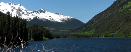 Best Season: Spring (September to December) autumn (March to May).
Trekking Grade: Moderate
Max Elevation: 3710m
Total trekking days: 11 Days
Day 01: Arrive Kathmandu
Upon arrival in Kathmandu airport, please come right to the main arrival gate where our representative will be waiting with the company board or your name card.
Transfer to the hotel. Overnight at hotel in Kathmandu.
Day 02: Your full-day sightseeing includes visits to Bhaktapur Durbar Square, home of medieval art & architecture; Continue your tour to Kathmandu Durbar Square (Hanuman Dhoka), the old palace of the Royal Dynasty and hometown of living Goddess, Kumari. Final stop is at the Swayambhunath Stupa, the holiest shrine for the Buddhist and Hindus. Overnight at hotel in Kathmandu.
Day 03: Flight Kathmandu-Nepalganj
To get to this region, generally you have to fly to Nepalgunj first. Nepalgunj is a steaming hot city in South Western Nepal, in the lowlands of Terai, close to the Indian border, which is just 8 km away. Culturally the area more resembles India than upland Nepal. Take a cycle rikshaw for a ride in town. You pass the hustle and bustle of the bazaar and see horse carts full of colorful people going to or coming from the Indian border. The Bageshowri temple is one of Nepal’s most important Hindu temples and is worth a visit as well. Overnight at local lodge.
Day 04: Fly Nepalgunj to Jumla & trek to Chala Chaur (2900m)
We take a thirty-minute scenic flight from Nepalgunj to Jumla. On reaching Jumla, we interact with the trekking crew and begin our trekking after lunch. We traverse northwards out of the Jumla Valley. Soon after trekking for an hour, we encounter a small village of Micha bearing a small walled enclosure and a number of Buddhist stupas. These stupas were erected at around late 15th century, in the memory of important dignitaries of the region. The trail further leads to rock-strewn path and at last ends at Chala Chaur. Overnight at local lodge/tented camp.
Day 05: Cross a Pass
We leave Chala Chaur and follow a trail moving along path of steep stones. While ascending, we cross through birch, pine forests and grassy pass at approx 3500m. From this point Kanjiroba becomes visible in the east with its twin peaks towering over the adjacent area. Further on, we descend as the trail opens into lush forests.
After trekking for a couple of hours, we finally stop at a suitable campsite in the meadows nearby some shepherd's huts. Overnight at local lodge/tented camp.
Day 06: Trek via Sinja (2440m) to Botan (2600m)
We walk along the Jaljala Khola through pine forests of and terraced farmland. En route the trail passes the 300 year old Kanaksundari Temple. The temple holds immense religious significance for Hindus. The route further bends along the main river. Crossing a thick plank bridge, we finally descend to reach Sinja village. Sinja village rests upon a small alluvial plain on the west bank of the clear Lah Gad River, also called the Sinja Khola. Sinja was once the ancient capital of the Malla kings. There are stones lying along the trail that foretell the history of Malla dynasty. After lunch, we head to Botan. On the way, we pass through a spectacular gorge and finally reach the village of Botan. Overnight at local lodge/tented camp.
Day 07: Trek to Rara Park border
Leaving Sinja Khola, we follow the trail along Ghatta Khola amid the unparallel beauty of nature. The sinuous route winds up into terraced farmland and beautiful valley. Soon we find ourselves within the territory of Rara Lake National Park. We come across primitive flour mills and police post on the way. Rara Lake National Park houses unique and rich ecosystem. We can spend half an hour exploring the beauty of the park or simply doing whatever we feel like. We spend the night in Gorosingha. Overnight at local lodge/tented camp.
Day 08: Trek to Rara Lake (3062m)
We walk away from Gorosingha and ascend to the Ghurchi Mara ridge (3710m) for one and half hour. The trail is not as strenuous as it looks. On reaching the crest of the ridge, we get to experience an excellent panorama to the north, flaunting irresistible beauty and charm. As the trail descends, Rara Lake becomes visible on the northeast. The trail further passes through bamboo and birch forests before crossing the Khatyar Khola.
We then follow the river upstream to Rara Lake, where we savor the most fascinating trekking experience amid the beauty of nature. Overnight at local lodge/tented camp.
Day 09-10: Rest days at Rara
We now have 2 days set aside to explore the area, including the old village of Rara. We can also climb up to the wooden observation tower behind the post office for fine views of the lake and surrounding hills. We can even visit the National Park Headquarters. Swimming is allowed in the lake and it is piercingly refreshing. Overnight at local lodge/tented camp.
Day 11: Trek via Jhyari (2630m) to River camp
We depart from Rara Lake and continue skirting along the target destination. On crossing a ridge, we enter the village of Jhyari. Strolling by the Jhyari Khola, the trail further follows terraced farmlands. As we approach Dhauligar Khola valley, we find a suitable camp site near the river bank. We also get to witness an exotic charisma of nature and outstanding panorama of snow-capped mountain peaks. Overnight at local lodge/tented camp.
Day 12: Across Ghurchi Lagna pass (3450m) to Chautha (2770m)
As Dhauligar Khola blurs out of our trekking route, we pass through farmland and then enter the village of Pina. Pina has a police post and some hotels. We continue climbing to the Ghurchi Lagna Pass and come across several small Chortens, alpine-like pastures, walnut groves and a narrow valley. Finally, the steep slope guides us into the village of Chautha where we conclude the trek of the day. Overnight at local lodge/tented camp.
Day 13: Trek to Tharamara (3280m)
From Chautha, the trail follows the northern bank of the Sinja Khola past the hotel and health clinic under the massive overhanging rock at Kabra. Silaji found in this area is the source of the important medicinal mineral which is believed to cure almost anything. The route then passes through the villages of Bumra and Nyawre, before climbing to the pasture at Tharamara. Overnight at local lodge/tented camp.
Day 14: Trek to Jumla
Following the trail gently sloping upwards, we march towards Jumla. We meet tall birch trees on our way to the Khali Lagna and Danphe Lekh. From atop the ridge, we can have the most spectacular views of the mountain ridges to the south and Jumla below. Further on, we descend steeply to the first night's campsite. Utmost caution is required while trekking along this trail. We then follow the same route back to Jumla. After reaching Jumla, we can spend our afternoon exploring the busy market town or simply pursuing whatever we feel like. Overnight at local lodge/tented camp.
Day 15: Fly to Nepaljung – Kathmandu
We take a flight from Jumla to Nepalgunj. On reaching Nepalgunj, we return to Kathmandu on the next available flight. Overnight at local lodge.
Day 16: Depart Kathmandu
After breakfast, transfer to the Kathmandu airport (prior to three hours of your departure time) to board flight for your onward destination.
- RNK 01 EVEREST PANORAMA TREKKING (09 Nights / 10 Days)
- RNK 02 AMADABLAM BASE CAMP TREK (11 nights / 12 Days)
- RNK 03 GOKYO VALLEY AND GOKYO RI TREK (13 Nights / 14 Days)
- RNK 04 EVEREST BASE CAMP & KALA PATHAR TREKKING (14 Nights / 15 Days)
- RNK 05 GOKYO RENJO LA PASS (15 Nights / 16 Days)
- RNK 06 GOKYO CHO LA PASS TREKKING (18 Nights / 19 Days)
- RNK 07 EVEREST HIGH PASS TREKKING (20 Nights / 21 Days)
- RNK 08 EVEREST TRANSVERSE TREK (THREE PASSES) (20 Nights / 21 Days)
- RNK 09 ARUN VALLEY (21 Nights / 22 Days)
- RNK 10 GHANDRUK TREK (8 Nights/9 Days)
- RNK 11 PANCHASE HILL TREKKING (09 Nights / 10 Days)
- RNK 12 THE ROYAL TREK (08 Nights / 09 Days)
- RNK 13 GHOREPANI POONHILL TREK (10 Nights / 11 Days)
- RNK 14 THE SIKLES TREKKING (11 Nights / 12 Days)
- RNK 15 JOMSOM MUKTINATH TREK (14 Nights / 15 Days)
- RNK 16 ANNAPURNA DHAULAGIRI TREK (14 Nights / 15 Days)
- RNK 17 ANNAPURNA SANCTUARY TREK (14 Nights / 15 Days)
- RNK 18 TILICHO PASS TREKKING (15 Nights / 16 Days)
- RNK 19 ANNAPURNA BASE CAMP TREKKING (16 Nights / 17 Days)
- RNK 20 ANNAPURNA CIRCUIT TREK (22 Nights/23 Days)
- RNK 21 HELAMBU VALLEY TREK (09 Nights / 10 Days)
- RNK 22 LANGTANG VALLEY TREK (10 Nights / 11 Days)
- RNK 23 GOSAIKUNDA TREK (10 Nights / 11 Days)
- RNK 24 LANGTANG - HELAMBU - GANJALA TREKS (15 Nights / 16 Days)
- RNK 25 LANGTANG HELAMBU GOSAINKUNDA TREKKING (18 Nights / 19 Days)
- RNK 26 LANGTANG GANJALA PASS TREK (21 Nights / 22 Days)
- RNK 27 MAKALU BASE CAMP TREKKING (21 Nights / 22 Days)
- RNK 28 KANCHENJUNGHA TREKKING (24 Nights / 25 Days)
- RNK 29 DHAULAGIRI CIRCUIT TREKKING (20 Nights / 21 Days)
- RNK 30 UPPER MUSTANG TREK (15 Nights / 16 Days)
- RNK 31 MUSTANG TIJI FESTIVAL TREKKING (17 Nights / 18 Days)
- RNK 32 TSUM VALLEY TREK (17 Nights / 18 Days)
- RNK 33 MANASLU TREKKING (38 Nights / 39 Days)
- RNK 34 GANESH HIMAL REGION TREKKING (14 Nights / 15 Days)
- RNK 35 PHOKSUNDO LAKE TREK (10 Nights / 11 Days)
- RNK 36 LOWER DOLPO TREK (16 Nights / 17 Days)
- RNK 37 DOLPO CIRCUIT TREK (16 Nights / 17 Days)
- RNK 38 UPPER DOLPO - SHY GOMPA TREK (23 Nights / 24 Days)
- RNK 39 RARA LAKE TREK (15 Nights / 16 Days)
Contact Address
- Maitighar,Kathmandu Nepal
- Tel:+977-1-4259563 / 4259573
- Email: Hgsale@infoclub.com.np, Ramya@gmail.com
Extra Links
We are associated with


We Accept

Connect With us:
2015 © Ramya Travel and tours ALL Rights Reserved.
Develop & Designed By: Pathway Technology